STS081-749-14
| NASA Photo ID | STS081-749-14 |
| Focal Length | 250mm |
| Date taken | 1997.01.__ |
| Time taken | GMT |
Resolutions offered for this image:
4072 x 4072 pixels 639 x 639 pixels 5700 x 5900 pixels 483 x 500 pixels 633 x 632 pixels
4072 x 4072 pixels 639 x 639 pixels 5700 x 5900 pixels 483 x 500 pixels 633 x 632 pixels


Cloud masks available for this image:
Spacecraft nadir point:
Photo center point: 40.0° S, 148.0° E
Photo center point by machine learning:
Photo center point: 40.0° S, 148.0° E
Photo center point by machine learning:
Nadir to Photo Center:
Spacecraft Altitude: nautical miles (0km)
Country or Geographic Name: | AUSTRALIA-T |
Features: | FLINDERS ISLAND |
| Features Found Using Machine Learning: | |
Cloud Cover Percentage: | 0 (no clouds present) |
Sun Elevation Angle: | ° |
Sun Azimuth: | ° |
Camera: | Hasselblad |
Focal Length: | 250mm |
Camera Tilt: | |
Format: | 5046: Kodak, natural color positive, Lumiere 100/5046, ASA 100, standard base |
Film Exposure: | Normal |
| Additional Information | |
| Width | Height | Annotated | Cropped | Purpose | Links |
|---|---|---|---|---|---|
| 4072 pixels | 4072 pixels | No | No | Earth From Space collection | Download Image |
| 639 pixels | 639 pixels | No | No | Earth From Space collection | Download Image |
| 5700 pixels | 5900 pixels | No | No | Download Image | |
| 483 pixels | 500 pixels | No | No | Download Image | |
| 633 pixels | 632 pixels | No | No | Download Image |
Download Packaged File
Download a Google Earth KML for this Image
View photo footprint information
Download a GeoTIFF for this photo
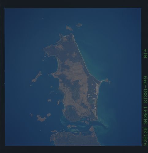
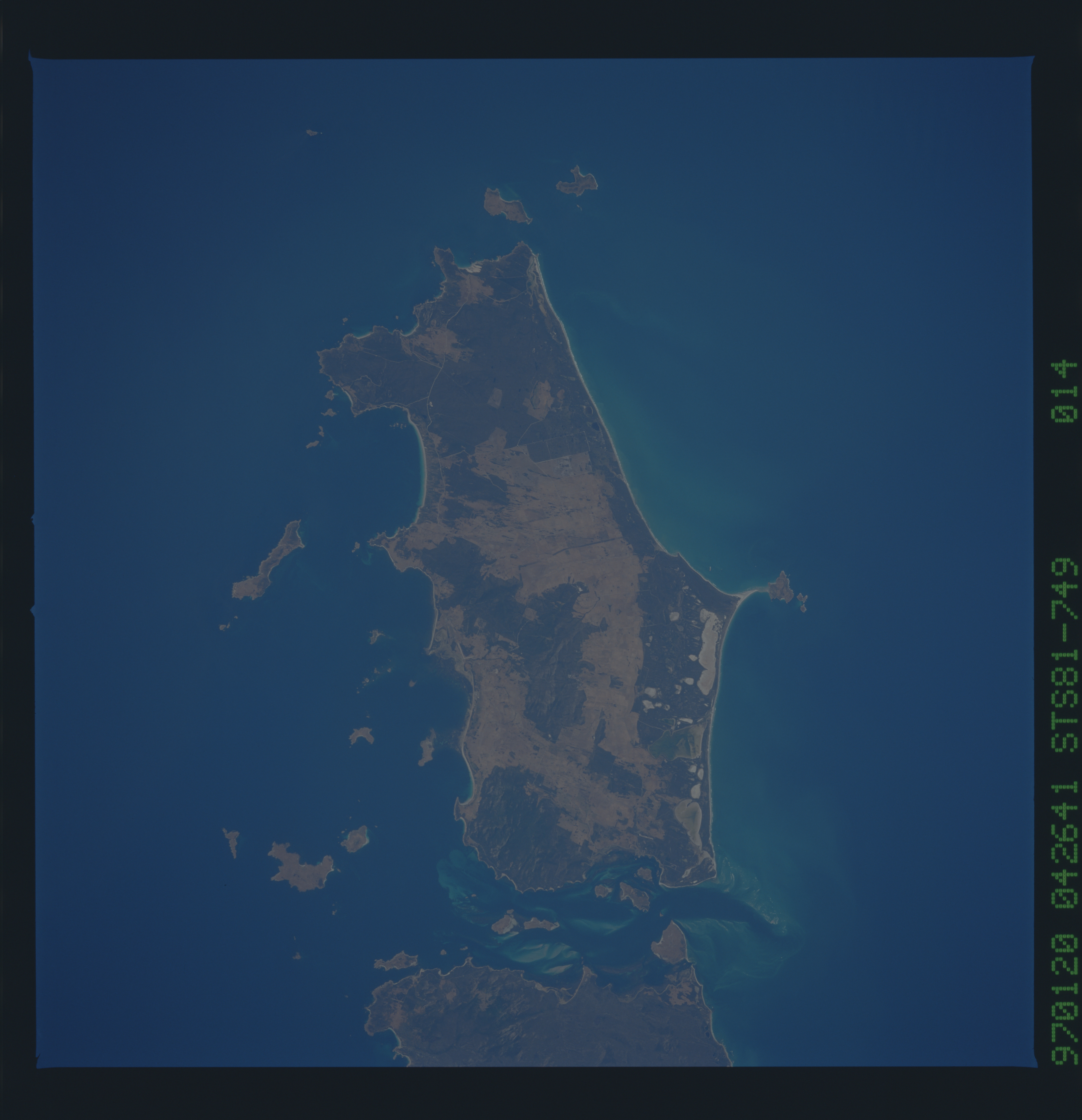
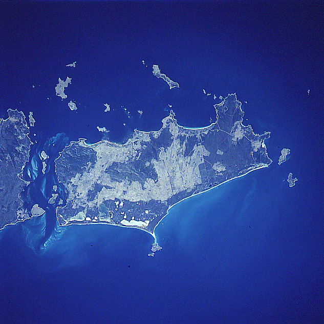
Image Caption: STS081-749-014 Flinders Island, Tasmania, Australia January 1997
Flinders Island (approximately 40 miles long - 64 km and 29 miles - 47 km wide) is the largest island in the Furneaux Group. The islands extend northward from the northeast end of Tasmania into the Bass Strait. Except for the east coast, at least half of the island is made up of low mountains, primarily granite ridgelines and peaks. Strzelecki National Park, located at the southwest end of the island (dark, vegetated area), has the highest point on the island (Mt. Strzelecki is 2480 feet - 756 meters above sea level). The dark swath of land that borders the sandy beaches along the east coast shows a series of fresh and saline lagoons and swamps (varying colors and shapes) with old beach ridges further inland. The island's major sources of revenue are generated by agriculture (beef and dairy cattle as well as sheep ranching), fishing, and a growing tourist industry. The lighter-colored areas show where the agricultural lands are distributed throughout the island. Darker landscapes are indicative of mountainous features and naturally vegetated terrain.
Flinders Island (approximately 40 miles long - 64 km and 29 miles - 47 km wide) is the largest island in the Furneaux Group. The islands extend northward from the northeast end of Tasmania into the Bass Strait. Except for the east coast, at least half of the island is made up of low mountains, primarily granite ridgelines and peaks. Strzelecki National Park, located at the southwest end of the island (dark, vegetated area), has the highest point on the island (Mt. Strzelecki is 2480 feet - 756 meters above sea level). The dark swath of land that borders the sandy beaches along the east coast shows a series of fresh and saline lagoons and swamps (varying colors and shapes) with old beach ridges further inland. The island's major sources of revenue are generated by agriculture (beef and dairy cattle as well as sheep ranching), fishing, and a growing tourist industry. The lighter-colored areas show where the agricultural lands are distributed throughout the island. Darker landscapes are indicative of mountainous features and naturally vegetated terrain.
