STS080-748-80
| NASA Photo ID | STS080-748-80 |
| Focal Length | 250mm |
| Date taken | 1996.11.28 |
| Time taken | 05:12:47 GMT |
Resolutions offered for this image:
4091 x 4073 pixels 640 x 637 pixels 5700 x 5900 pixels 483 x 500 pixels 639 x 637 pixels
4091 x 4073 pixels 640 x 637 pixels 5700 x 5900 pixels 483 x 500 pixels 639 x 637 pixels
Cloud masks available for this image:
Spacecraft nadir point: 24.6° N, 105.0° E
Photo center point: 24.5° N, 102.5° E
Photo center point by machine learning:
Photo center point: 24.5° N, 102.5° E
Photo center point by machine learning:
Nadir to Photo Center: West
Spacecraft Altitude: 189 nautical miles (350km)
Camera: | Hasselblad |
Focal Length: | 250mm |
Camera Tilt: | 39 degrees |
Format: | 5046: Kodak, natural color positive, Lumiere 100/5046, ASA 100, standard base |
Film Exposure: | Normal |
| Additional Information | |
| Width | Height | Annotated | Cropped | Purpose | Links |
|---|---|---|---|---|---|
| 4091 pixels | 4073 pixels | No | No | Earth From Space collection | Download Image |
| 640 pixels | 637 pixels | No | No | Earth From Space collection | Download Image |
| 5700 pixels | 5900 pixels | No | No | Download Image | |
| 483 pixels | 500 pixels | No | No | Download Image | |
| 639 pixels | 637 pixels | No | No | Download Image |
Download Packaged File
Download a Google Earth KML for this Image
View photo footprint information
Download a GeoTIFF for this photo
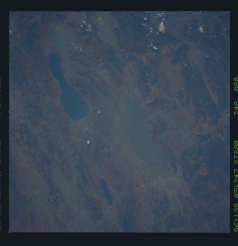
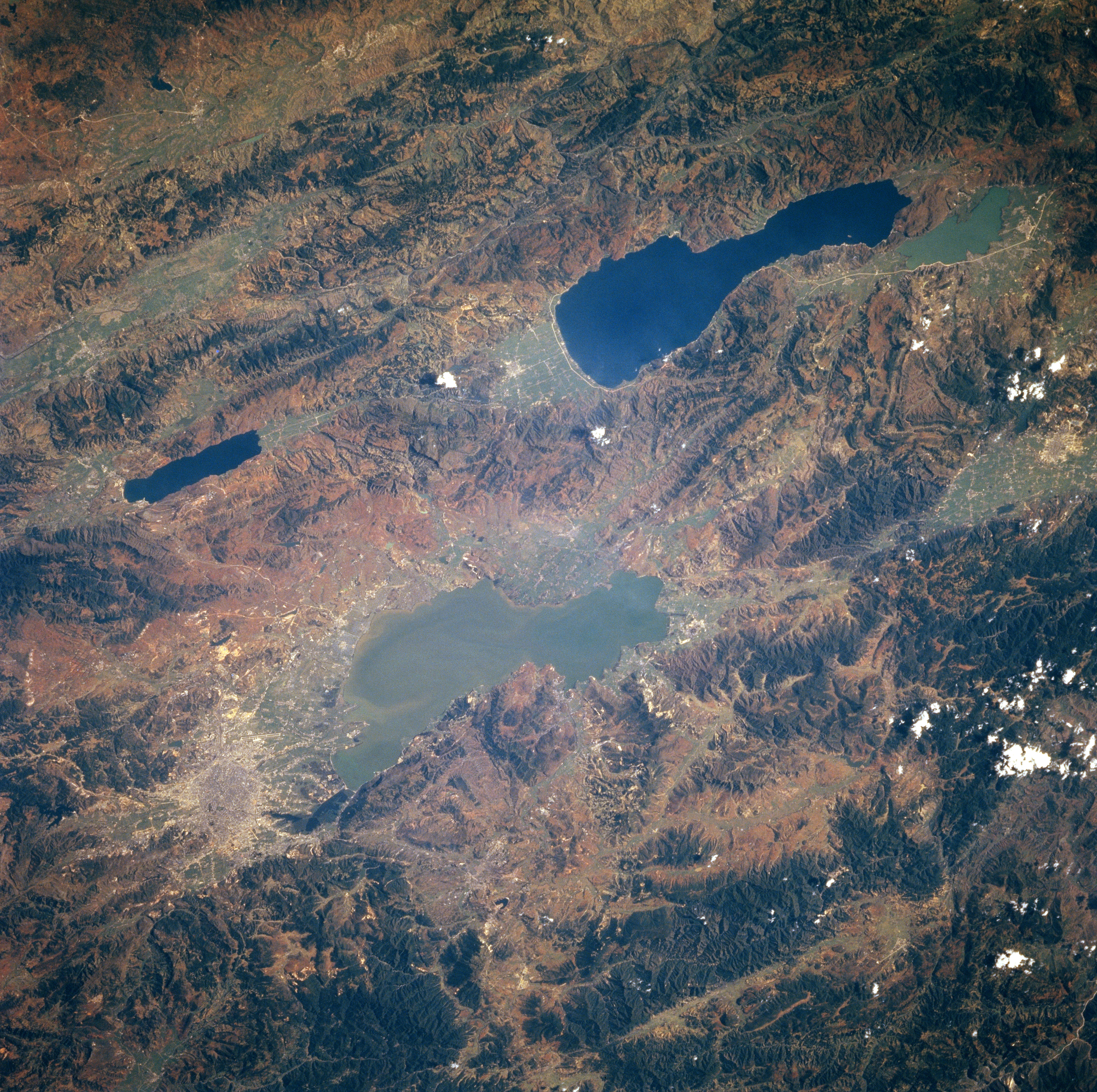
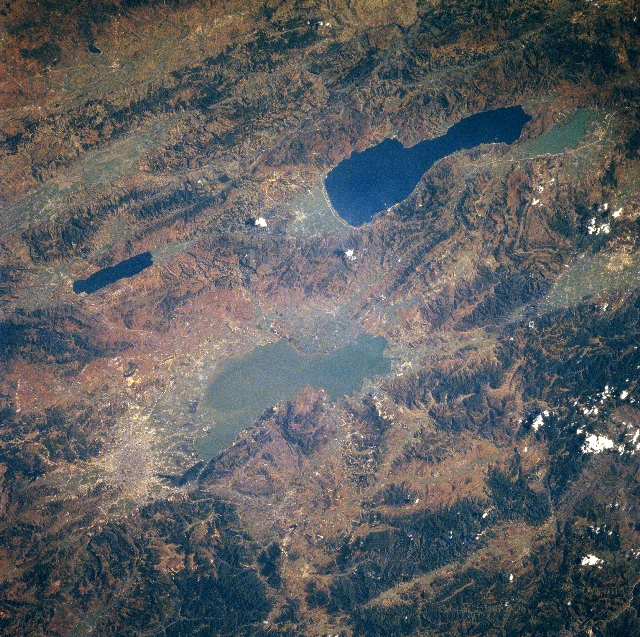
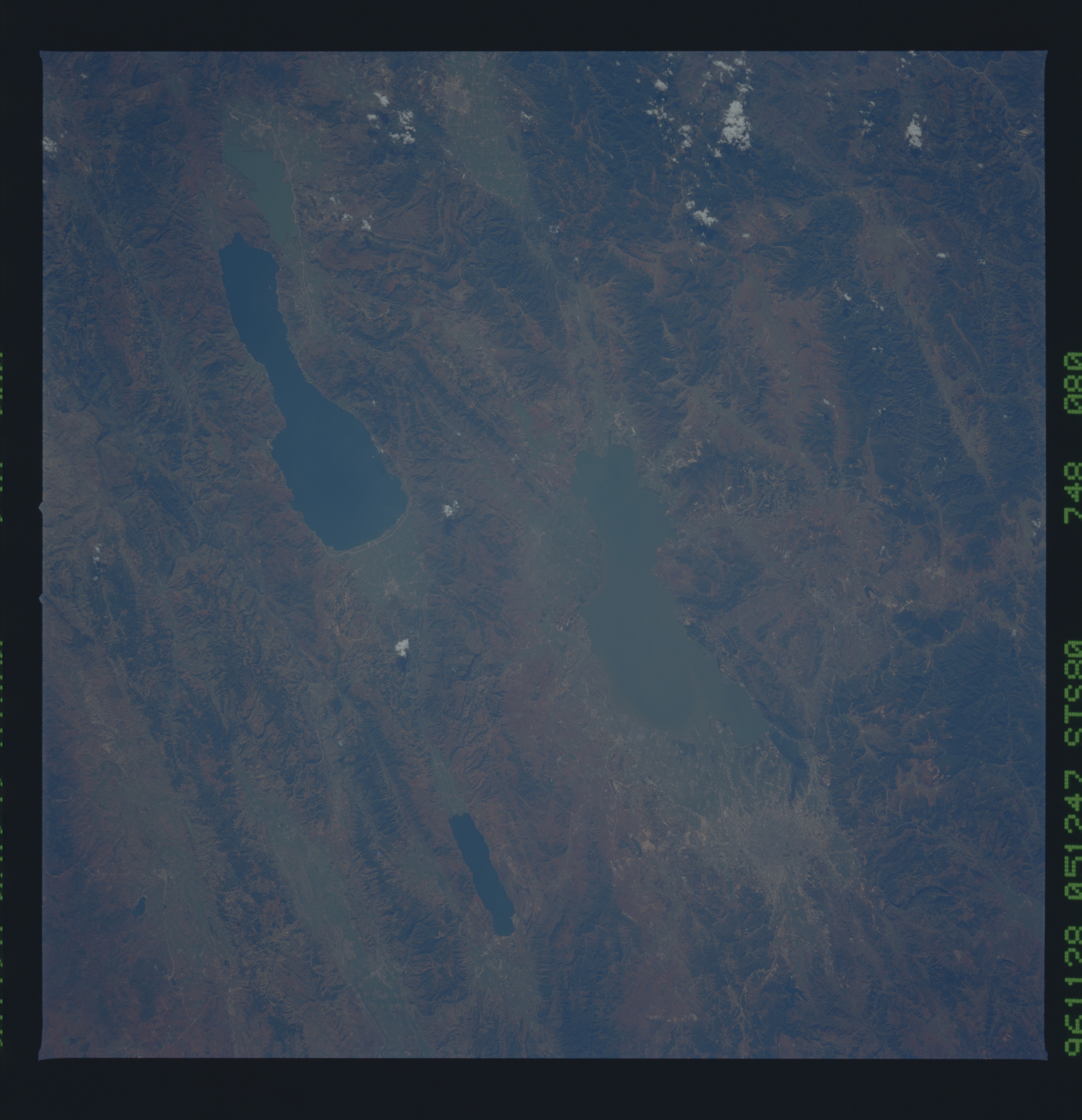
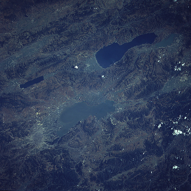
Image Caption: STS080-748-080 Lake Dian Area, China November 1996
The darker, north-south oriented landforms are vegetated mountain ridges, where the maximum elevations exceed 8000 feet (2440 meters) above sea level. The lighter-colored landscape shows the location of the valleys that are interspersed throughout this region of east central Yunnan Province. Four lakes, (two lakes are light in color, while two lakes are dark in color) that are aligned north to south, are located in geologically faulted valleys. The largest lake (light-colored feature slightly below center of image) is Lake Dian. Lake Dian is approximately 25 miles (40 km) in length and covers roughly 116 square miles (300 sq km) in surface area. The capital of Yunnan Province, Kunming (population of the metropolitan area is estimated to 3.5 million people) is visible at the north end of Lake Dian (near bottom left). The capital city sits on a plateau that is about 6300 feet (1920 m) above sea level. Extensive areas of karst topography, immediately east of the four lakes, have created unique landforms that are a favorite tourist attraction.
The darker, north-south oriented landforms are vegetated mountain ridges, where the maximum elevations exceed 8000 feet (2440 meters) above sea level. The lighter-colored landscape shows the location of the valleys that are interspersed throughout this region of east central Yunnan Province. Four lakes, (two lakes are light in color, while two lakes are dark in color) that are aligned north to south, are located in geologically faulted valleys. The largest lake (light-colored feature slightly below center of image) is Lake Dian. Lake Dian is approximately 25 miles (40 km) in length and covers roughly 116 square miles (300 sq km) in surface area. The capital of Yunnan Province, Kunming (population of the metropolitan area is estimated to 3.5 million people) is visible at the north end of Lake Dian (near bottom left). The capital city sits on a plateau that is about 6300 feet (1920 m) above sea level. Extensive areas of karst topography, immediately east of the four lakes, have created unique landforms that are a favorite tourist attraction.
