STS080-702-95

| NASA Photo ID | STS080-702-95 |
| Focal Length | 250mm |
| Date taken | 1996.11.21 |
| Time taken | 17:32:52 GMT |
Resolutions offered for this image:
4066 x 4066 pixels 640 x 640 pixels 5700 x 5900 pixels 483 x 500 pixels
4066 x 4066 pixels 640 x 640 pixels 5700 x 5900 pixels 483 x 500 pixels
Cloud masks available for this image:
Spacecraft nadir point: 22.5° N, 100.1° W
Photo center point: 22.0° N, 101.0° W
Photo center point by machine learning:
Photo center point: 22.0° N, 101.0° W
Photo center point by machine learning:
Nadir to Photo Center: Southwest
Spacecraft Altitude: 189 nautical miles (350km)
Country or Geographic Name: | MEXICO |
Features: | SAN LUIS POTOSI, AGR. |
| Features Found Using Machine Learning: | |
Cloud Cover Percentage: | 0 (no clouds present) |
Sun Elevation Angle: | 46° |
Sun Azimuth: | 162° |
Camera: | Hasselblad |
Focal Length: | 250mm |
Camera Tilt: | 18 degrees |
Format: | 5046: Kodak, natural color positive, Lumiere 100/5046, ASA 100, standard base |
Film Exposure: | Out of Focus |
| Additional Information | |
| Width | Height | Annotated | Cropped | Purpose | Links |
|---|---|---|---|---|---|
| 4066 pixels | 4066 pixels | No | No | Earth From Space collection | Download Image |
| 640 pixels | 640 pixels | No | No | Earth From Space collection | Download Image |
| 5700 pixels | 5900 pixels | No | No | Download Image | |
| 483 pixels | 500 pixels | No | No | Download Image |
Download Packaged File
Download a Google Earth KML for this Image
View photo footprint information
Download a GeoTIFF for this photo
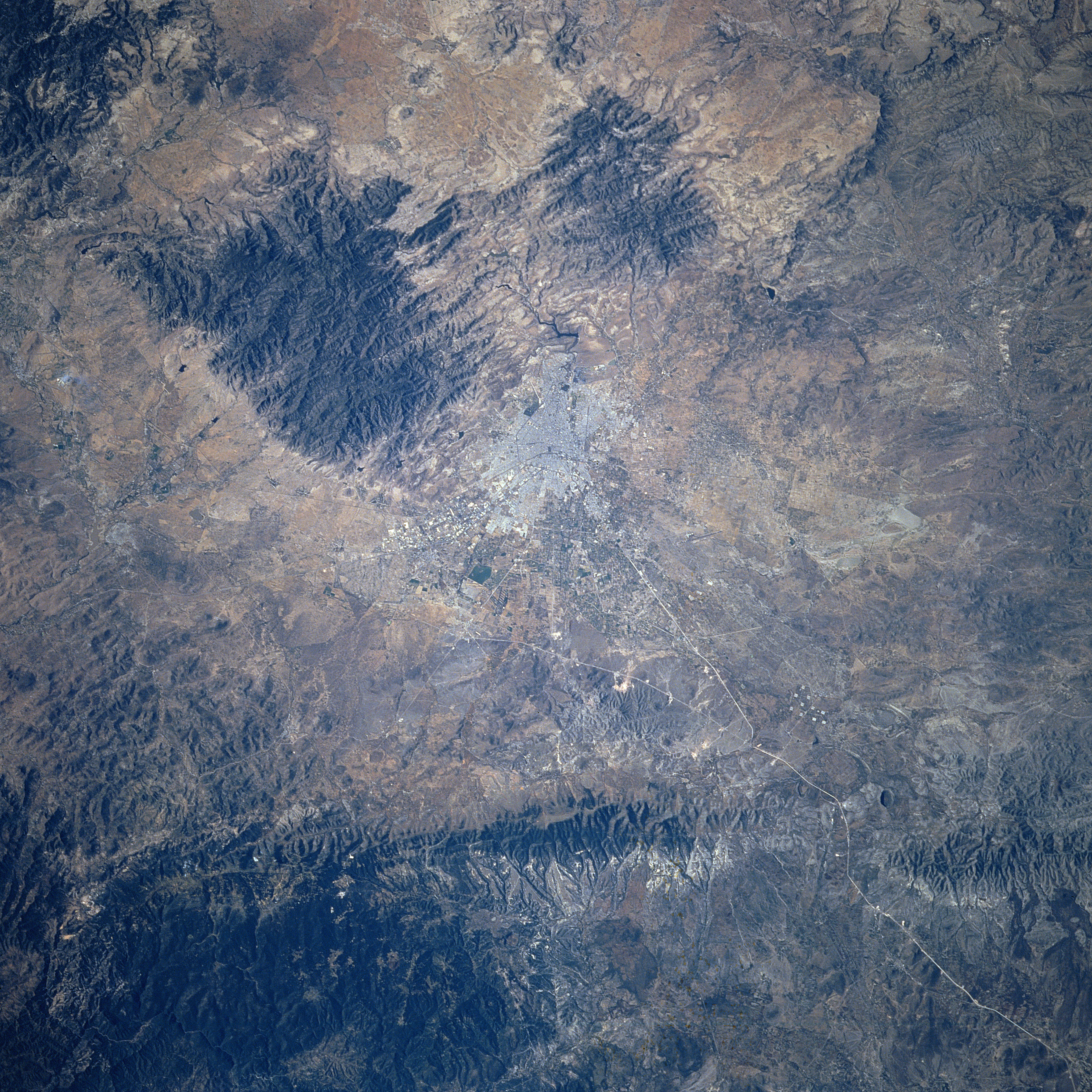
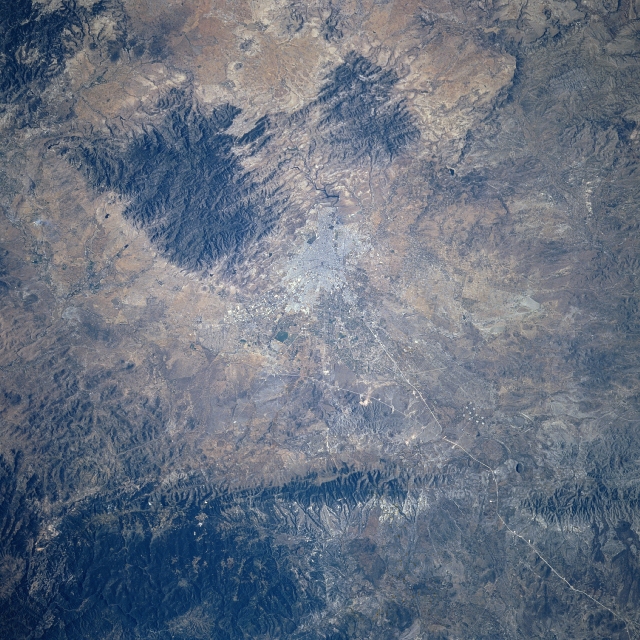
Image Caption: STS080-702-095 San Luis Potosi, Mexico November 1996
The concentration of highly reflective surfaces (near the center of the image) is the city of San Luis Potosi. In addition to being located on the arid to semi-arid Mexican Plateau that averages 6500 feet - 1980 meters above sea level, San Luis Potosi is flanked by several mountain ranges (darker, eroded features), particularly west, south, and even east of the developing urban area. San Luis Potosi is favorably located to function as an important ground transportation hub for central Mexico (the thin, light colored lines appear to be recently constructed highways). For example consider that the so-called NAFTA (North American Free Trade Agreement) Highway, basically a north-south artery, passes through the city. There is also an east-west highway linkage that connects the Gulf of Mexico coast with the west coast of Mexico that also passes through the city. San Luis Potosi is an important stop for one of Mexico's principal railroad lines (railroad right of way is very difficult to trace across the computer image).
The concentration of highly reflective surfaces (near the center of the image) is the city of San Luis Potosi. In addition to being located on the arid to semi-arid Mexican Plateau that averages 6500 feet - 1980 meters above sea level, San Luis Potosi is flanked by several mountain ranges (darker, eroded features), particularly west, south, and even east of the developing urban area. San Luis Potosi is favorably located to function as an important ground transportation hub for central Mexico (the thin, light colored lines appear to be recently constructed highways). For example consider that the so-called NAFTA (North American Free Trade Agreement) Highway, basically a north-south artery, passes through the city. There is also an east-west highway linkage that connects the Gulf of Mexico coast with the west coast of Mexico that also passes through the city. San Luis Potosi is an important stop for one of Mexico's principal railroad lines (railroad right of way is very difficult to trace across the computer image).
