STS079-781-100
| NASA Photo ID | STS079-781-100 |
| Focal Length | 250mm |
| Date taken | 1996.__.__ |
| Time taken | GMT |
Resolutions offered for this image:
4061 x 4091 pixels 635 x 640 pixels 5700 x 5900 pixels 483 x 500 pixels
4061 x 4091 pixels 635 x 640 pixels 5700 x 5900 pixels 483 x 500 pixels

Cloud masks available for this image:
Spacecraft nadir point:
Photo center point: 46.0° N, 77.5° E
Photo center point by machine learning:
Photo center point: 46.0° N, 77.5° E
Photo center point by machine learning:
Nadir to Photo Center:
Spacecraft Altitude: nautical miles (0km)
Country or Geographic Name: | KAZAKHSTAN |
Features: | KARATAL RIVER, L. BALKHASH |
| Features Found Using Machine Learning: | |
Cloud Cover Percentage: | 0 (no clouds present) |
Sun Elevation Angle: | ° |
Sun Azimuth: | ° |
Camera: | Hasselblad |
Focal Length: | 250mm |
Camera Tilt: | Low Oblique |
Format: | 5046: Kodak, natural color positive, Lumiere 100/5046, ASA 100, standard base |
Film Exposure: | Out of Focus |
| Additional Information | |
| Width | Height | Annotated | Cropped | Purpose | Links |
|---|---|---|---|---|---|
| 4061 pixels | 4091 pixels | No | No | Earth From Space collection | Download Image |
| 635 pixels | 640 pixels | No | No | Earth From Space collection | Download Image |
| 5700 pixels | 5900 pixels | No | No | Download Image | |
| 483 pixels | 500 pixels | No | No | Download Image |
Download Packaged File
Download a Google Earth KML for this Image
View photo footprint information
Download a GeoTIFF for this photo
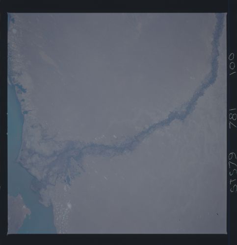
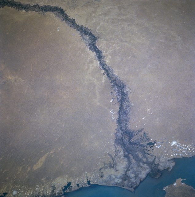
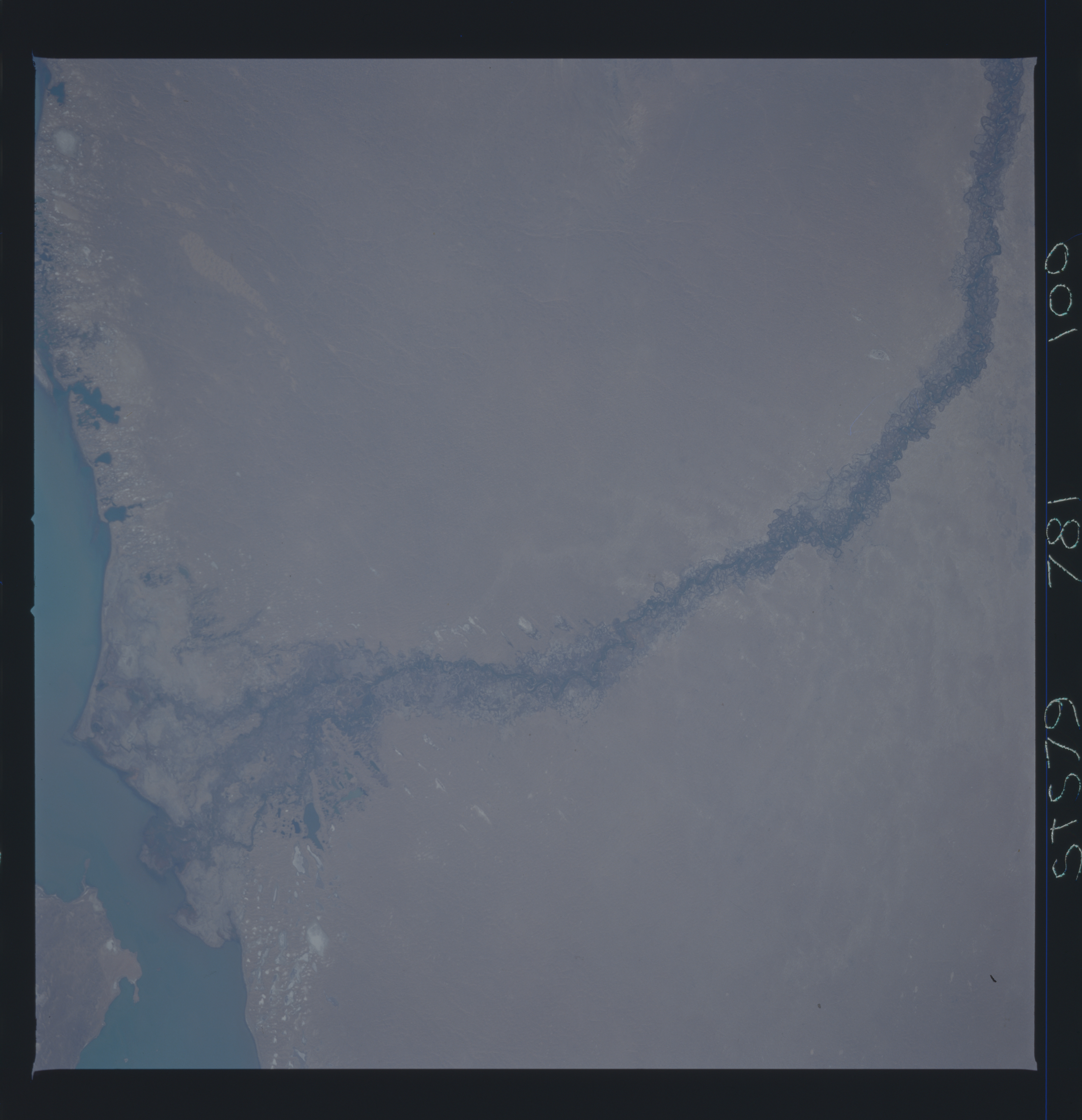
Image Caption: STS079-781-100 Qaratal River, Kazakhstan September 1996
Entering the scene in the upper left portion of the image, the Qaratal River (sometimes referred to as the Karatal River) can be seen traversing the scene south to north, emptying into Lake Balkhash at the bottom center of this south-looking view. The Qaratal River rises in the Dzungarsk-Alatau Mountains near the border of Kazakhstan and China (not visible on image). The river flows generally northwestward turning generally northward when it reaches the Saryesik-Atyrau Desert, a large sand desert south of Lake Balkhash. Irrigation in the river valley is visible (darker areas within the floodplain of the river). Because of the irrigation, little water reaches Lake Balkhash.
Entering the scene in the upper left portion of the image, the Qaratal River (sometimes referred to as the Karatal River) can be seen traversing the scene south to north, emptying into Lake Balkhash at the bottom center of this south-looking view. The Qaratal River rises in the Dzungarsk-Alatau Mountains near the border of Kazakhstan and China (not visible on image). The river flows generally northwestward turning generally northward when it reaches the Saryesik-Atyrau Desert, a large sand desert south of Lake Balkhash. Irrigation in the river valley is visible (darker areas within the floodplain of the river). Because of the irrigation, little water reaches Lake Balkhash.
