STS078-760-4
| NASA Photo ID | STS078-760-4 |
| Focal Length | 250mm |
| Date taken | 1996.06.28 |
| Time taken | 14:39:07 GMT |
Resolutions offered for this image:
4036 x 4036 pixels 639 x 639 pixels 5700 x 5900 pixels 483 x 500 pixels 514 x 509 pixels 479 x 479 pixels
4036 x 4036 pixels 639 x 639 pixels 5700 x 5900 pixels 483 x 500 pixels 514 x 509 pixels 479 x 479 pixels


Cloud masks available for this image:
Spacecraft nadir point: 38.7° N, 79.5° W
Photo center point: 37.5° N, 80.0° W
Photo center point by machine learning:
Photo center point: 37.5° N, 80.0° W
Photo center point by machine learning:
Nadir to Photo Center: South
Spacecraft Altitude: 143 nautical miles (265km)
Country or Geographic Name: | USA-VIRGINIA |
Features: | ROANOKE, ALLEGHENY MTS. |
| Features Found Using Machine Learning: | |
Cloud Cover Percentage: | 0 (no clouds present) |
Sun Elevation Angle: | 52° |
Sun Azimuth: | 102° |
Camera: | Hasselblad |
Focal Length: | 250mm |
Camera Tilt: | 29 degrees |
Format: | 2443: Kodak Aerochrome 2443, color IR, thin base, EA-5 process thru June 1999, E-6 process afterward |
Film Exposure: | Normal |
| Additional Information | |
| Width | Height | Annotated | Cropped | Purpose | Links |
|---|---|---|---|---|---|
| 4036 pixels | 4036 pixels | No | No | Earth From Space collection | Download Image |
| 639 pixels | 639 pixels | No | No | Earth From Space collection | Download Image |
| 5700 pixels | 5900 pixels | No | No | Download Image | |
| 483 pixels | 500 pixels | No | No | Download Image | |
| 514 pixels | 509 pixels | No | No | Download Image | |
| 479 pixels | 479 pixels | Download Image |
Download Packaged File
Download a Google Earth KML for this Image
View photo footprint information
Download a GeoTIFF for this photo
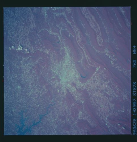
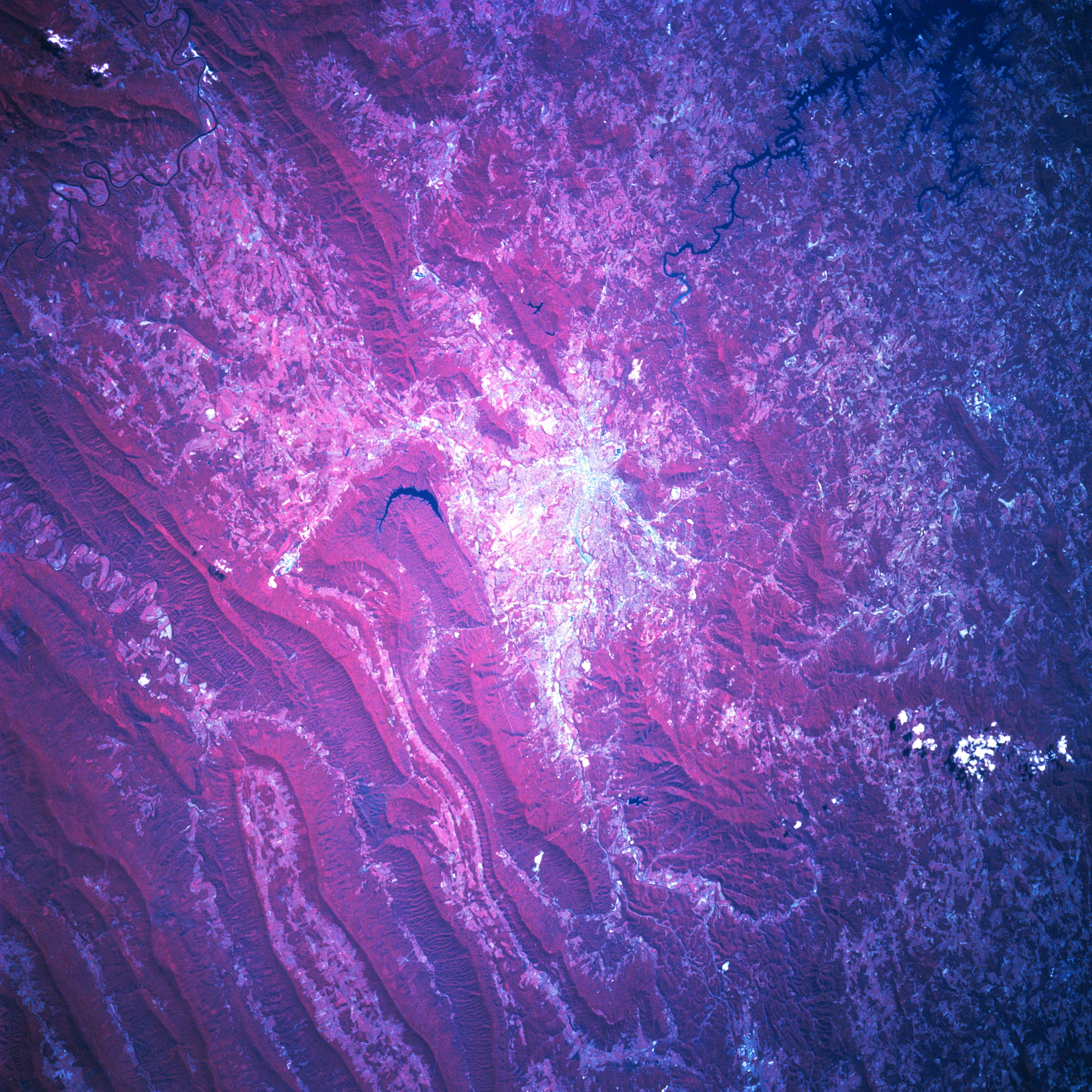
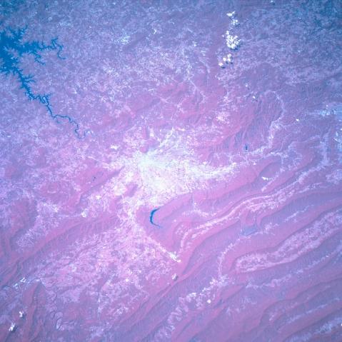
Image Caption: STS078-760-004 Roanoke Area, Virginia, USA June 1996 Situated among outlying hills and the more massive folded, parallel ridge and valleys of the Appalachian Mountains, the physical setting of the city of Roanoke (highly reflective area center of the picture) is captured in this south looking color infrared shot. The dense green foliage of the mountainous terrain is shown as a deep reddish color. Most of the lower and flatter valleys are used for some form of agriculture. A single, dark, crescent-shaped reservoir within a small, elevated valley is just northwest of Roanoke. The Roanoke River meanders southeasterly from the city towards Smith Mountain Lake.
