STS078-754-89
| NASA Photo ID | STS078-754-89 |
| Focal Length | 250mm |
| Date taken | 1996.06.27 |
| Time taken | 14:33:20 GMT |
Resolutions offered for this image:
4096 x 4080 pixels 640 x 637 pixels 5700 x 5900 pixels 483 x 500 pixels 643 x 660 pixels 478 x 480 pixels
4096 x 4080 pixels 640 x 637 pixels 5700 x 5900 pixels 483 x 500 pixels 643 x 660 pixels 478 x 480 pixels

Cloud masks available for this image:
Spacecraft nadir point: 32.7° N, 119.1° W
Photo center point: 34.0° N, 120.0° W
Photo center point by machine learning:
Photo center point: 34.0° N, 120.0° W
Photo center point by machine learning:
Nadir to Photo Center: Northwest
Spacecraft Altitude: 142 nautical miles (263km)
Country or Geographic Name: | USA-CALIFORNIA |
Features: | SANTA ROSA ISLAND, IS. |
| Features Found Using Machine Learning: | |
Cloud Cover Percentage: | 5 (1-10)% |
Sun Elevation Angle: | 19° |
Sun Azimuth: | 74° |
Camera: | Hasselblad |
Focal Length: | 250mm |
Camera Tilt: | 34 degrees |
Format: | 5046: Kodak, natural color positive, Lumiere 100/5046, ASA 100, standard base |
Film Exposure: | Normal |
| Additional Information | |
| Width | Height | Annotated | Cropped | Purpose | Links |
|---|---|---|---|---|---|
| 4096 pixels | 4080 pixels | No | No | Earth From Space collection | Download Image |
| 640 pixels | 637 pixels | No | No | Earth From Space collection | Download Image |
| 5700 pixels | 5900 pixels | No | No | Download Image | |
| 483 pixels | 500 pixels | No | No | Download Image | |
| 643 pixels | 660 pixels | No | No | Download Image | |
| 478 pixels | 480 pixels | Download Image |
Download Packaged File
Download a Google Earth KML for this Image
View photo footprint information
Download a GeoTIFF for this photo
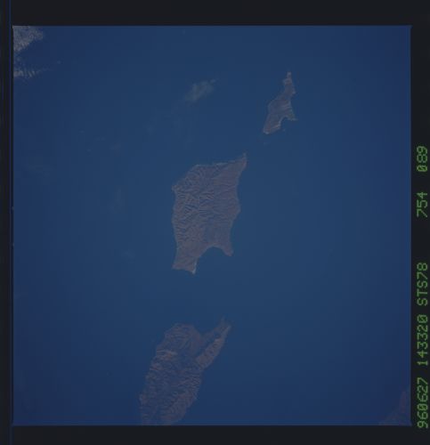
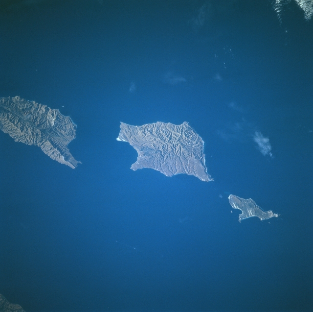
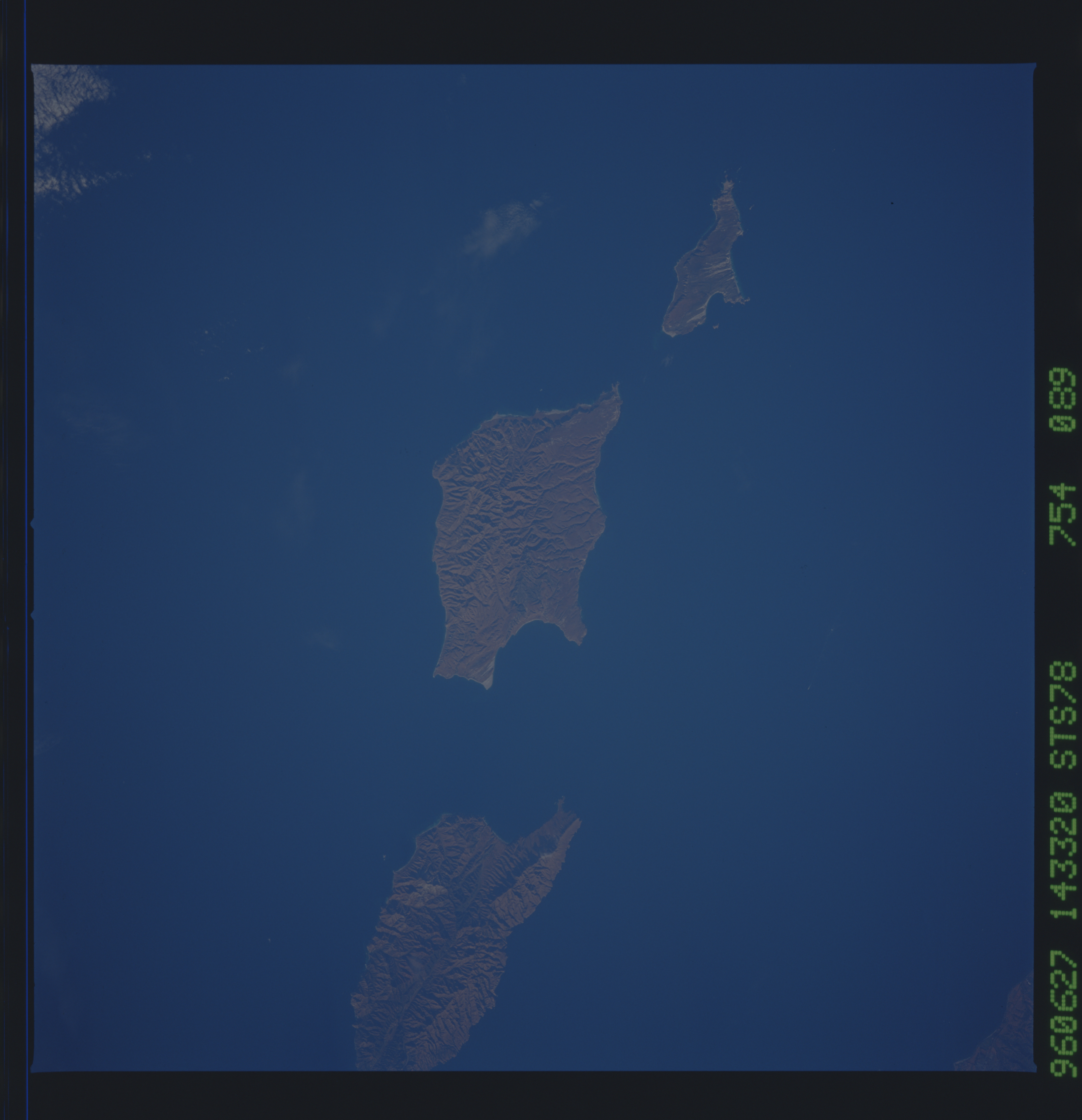
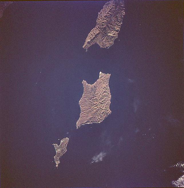
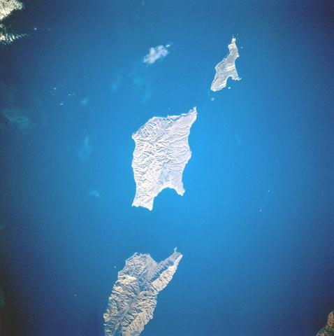
Image Caption: STS078-754-089 Santa Barbara Islands, California June, 1996
The islands (top to bottom) of Santa Cruz, Santa Rose, and San Miguel can be seen in this near-vertical view. The islands, the exposed tops of low mountains, are the westward extension of the Santa Monica Mountains of southern California and are separated from the mainland by the Santa Barbara Channel. The islands, uninhabited by humans, are home to large populations of sea lions, nesting seabirds, and other unusual animal and plant life.
The islands (top to bottom) of Santa Cruz, Santa Rose, and San Miguel can be seen in this near-vertical view. The islands, the exposed tops of low mountains, are the westward extension of the Santa Monica Mountains of southern California and are separated from the mainland by the Santa Barbara Channel. The islands, uninhabited by humans, are home to large populations of sea lions, nesting seabirds, and other unusual animal and plant life.
