STS078-740-87
| NASA Photo ID | STS078-740-87 |
| Focal Length | 250mm |
| Date taken | 1996.07.04 |
| Time taken | 05:14:52 GMT |
Resolutions offered for this image:
3998 x 4029 pixels 635 x 639 pixels 5700 x 5900 pixels 483 x 500 pixels 1290 x 1253 pixels
3998 x 4029 pixels 635 x 639 pixels 5700 x 5900 pixels 483 x 500 pixels 1290 x 1253 pixels

Cloud masks available for this image:
Spacecraft nadir point: 33.1° N, 44.2° E
Photo center point: 33.5° N, 44.5° E
Photo center point by machine learning:
Photo center point: 33.5° N, 44.5° E
Photo center point by machine learning:
Nadir to Photo Center: Northeast
Spacecraft Altitude: 139 nautical miles (257km)
Camera: | Hasselblad |
Focal Length: | 250mm |
Camera Tilt: | 12 degrees |
Format: | 5046: Kodak, natural color positive, Lumiere 100/5046, ASA 100, standard base |
Film Exposure: | Normal |
| Additional Information | |
| Width | Height | Annotated | Cropped | Purpose | Links |
|---|---|---|---|---|---|
| 3998 pixels | 4029 pixels | No | No | Earth From Space collection | Download Image |
| 635 pixels | 639 pixels | No | No | Earth From Space collection | Download Image |
| 5700 pixels | 5900 pixels | No | No | Download Image | |
| 483 pixels | 500 pixels | No | No | Download Image | |
| 1290 pixels | 1253 pixels | No | No | Download Image |
Download Packaged File
Download a Google Earth KML for this Image
View photo footprint information
Download a GeoTIFF for this photo
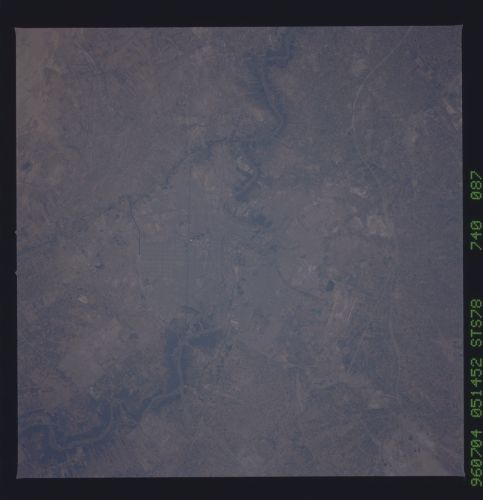
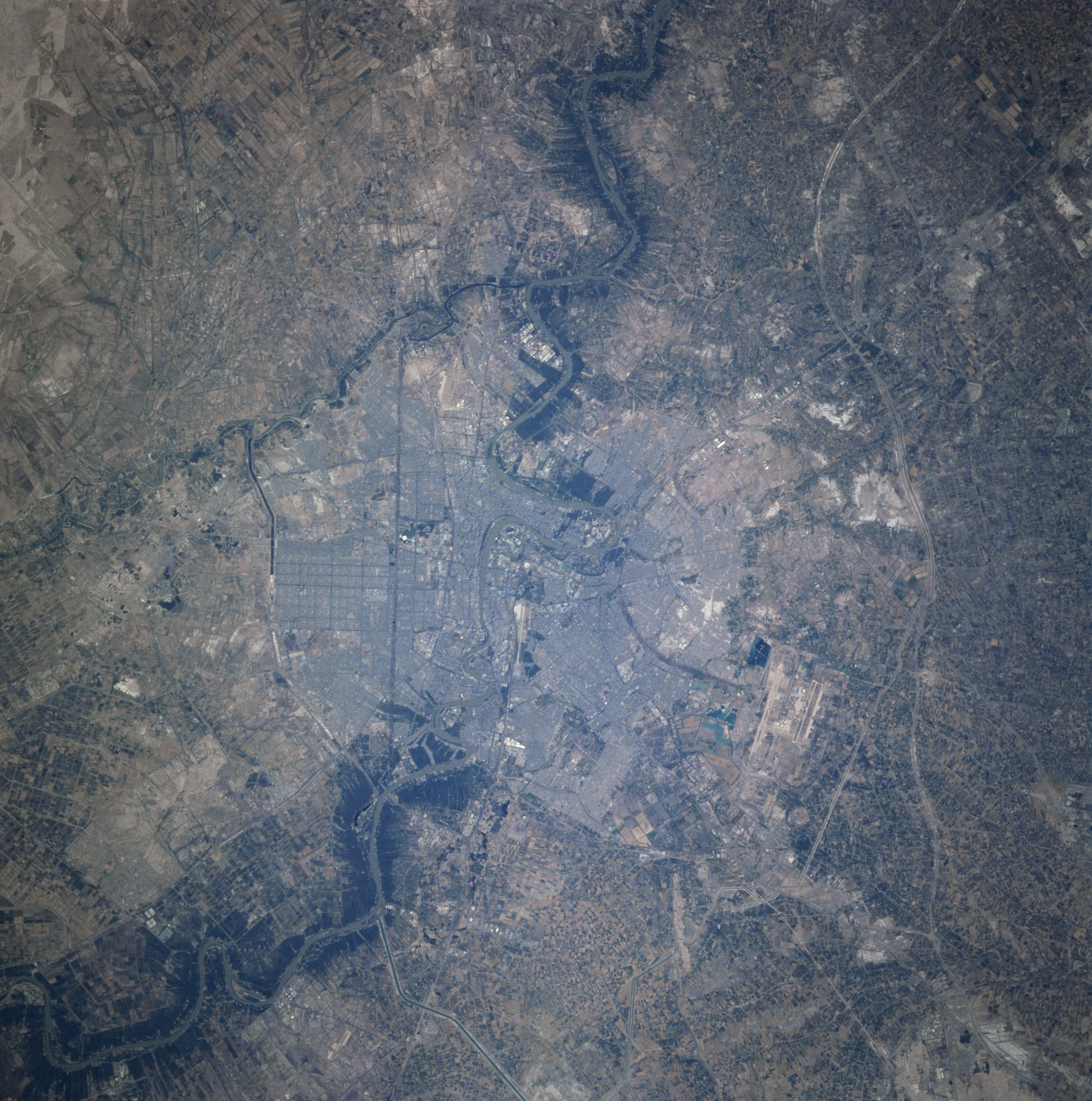
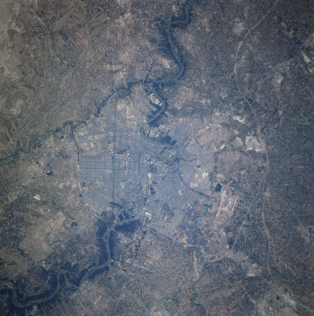
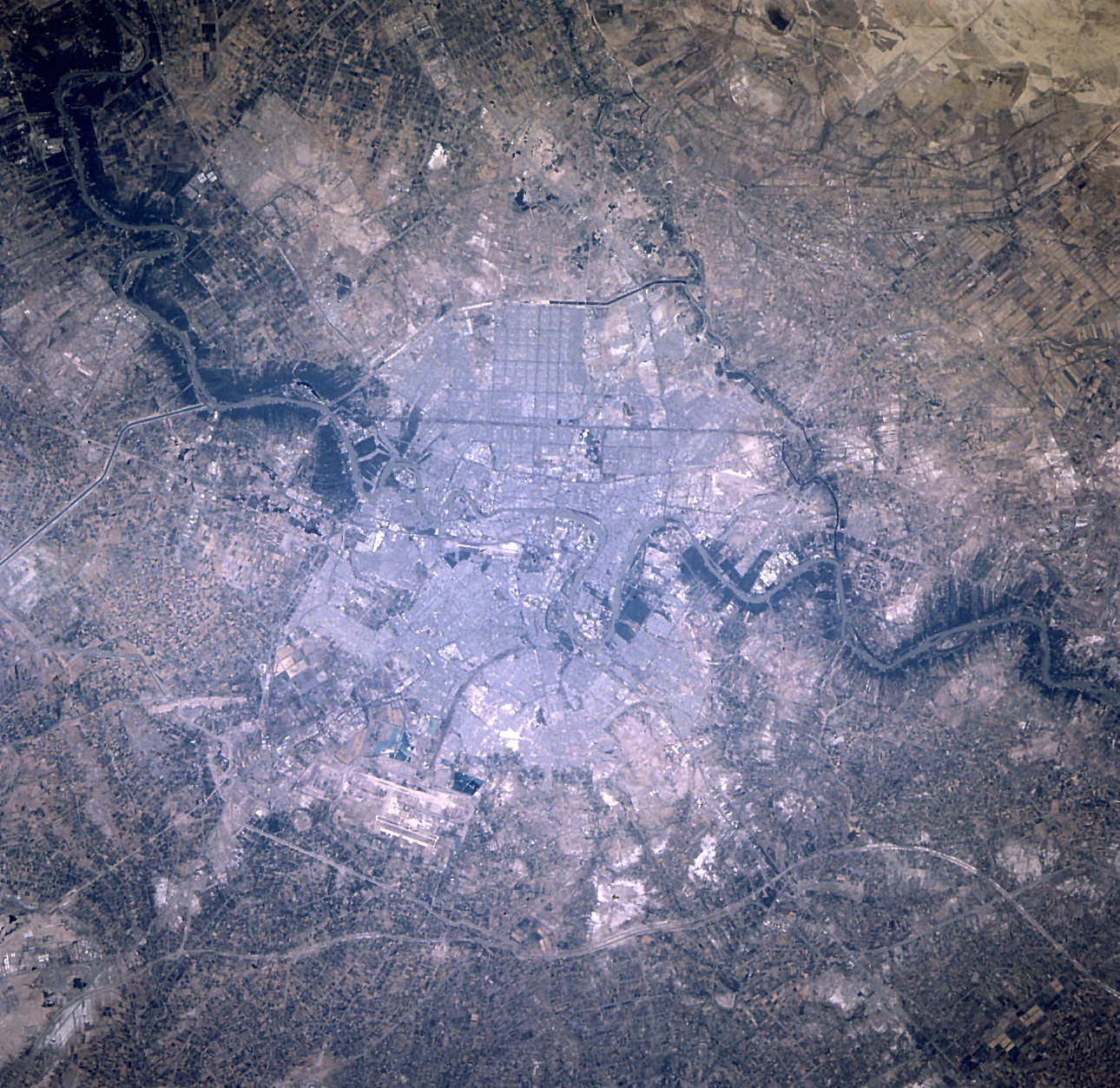
Image Caption: STS078-740-087 Baghdad, Iraq June 1996
The capital city of Iraq, Baghdad, located in a broad plain with a population of nearly 4 million, can be seen in this near-nadir view. The Tigris River is visible entering the scene from the upper left (north) traversing south through the city, and exiting the scene at the right center of the image (south). Canals are discernible throughout the view traversing through and around the city. Even after the Gulf War of early 1991, Baghdad remains the major commercial and industrial center of the country. The runways of the Baghdad International Airport are visible midway between the center and the bottom of the image (west of the city center).
The capital city of Iraq, Baghdad, located in a broad plain with a population of nearly 4 million, can be seen in this near-nadir view. The Tigris River is visible entering the scene from the upper left (north) traversing south through the city, and exiting the scene at the right center of the image (south). Canals are discernible throughout the view traversing through and around the city. Even after the Gulf War of early 1991, Baghdad remains the major commercial and industrial center of the country. The runways of the Baghdad International Airport are visible midway between the center and the bottom of the image (west of the city center).
