STS078-740-72
| NASA Photo ID | STS078-740-72 |
| Focal Length | 250mm |
| Date taken | 1996.07.04 |
| Time taken | 05:11:41 GMT |
Resolutions offered for this image:
4050 x 4050 pixels 640 x 640 pixels 5700 x 5900 pixels 483 x 500 pixels
4050 x 4050 pixels 640 x 640 pixels 5700 x 5900 pixels 483 x 500 pixels


Cloud masks available for this image:
Spacecraft nadir point: 37.1° N, 30.2° E
Photo center point: 38.0° N, 30.0° E
Photo center point by machine learning:
Photo center point: 38.0° N, 30.0° E
Photo center point by machine learning:
Nadir to Photo Center: North
Spacecraft Altitude: 139 nautical miles (257km)
Country or Geographic Name: | TURKEY |
Features: | ACI, BURDUR, & SALDA LAKES |
| Features Found Using Machine Learning: | |
Cloud Cover Percentage: | 0 (no clouds present) |
Sun Elevation Angle: | 27° |
Sun Azimuth: | 80° |
Camera: | Hasselblad |
Focal Length: | 250mm |
Camera Tilt: | 22 degrees |
Format: | 5046: Kodak, natural color positive, Lumiere 100/5046, ASA 100, standard base |
Film Exposure: | Normal |
| Additional Information | |
| Width | Height | Annotated | Cropped | Purpose | Links |
|---|---|---|---|---|---|
| 4050 pixels | 4050 pixels | No | No | Earth From Space collection | Download Image |
| 640 pixels | 640 pixels | No | No | Earth From Space collection | Download Image |
| 5700 pixels | 5900 pixels | No | No | Download Image | |
| 483 pixels | 500 pixels | No | No | Download Image |
Download Packaged File
Download a Google Earth KML for this Image
View photo footprint information
Download a GeoTIFF for this photo
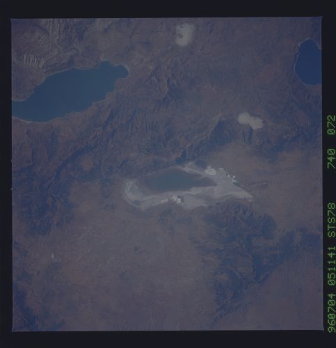
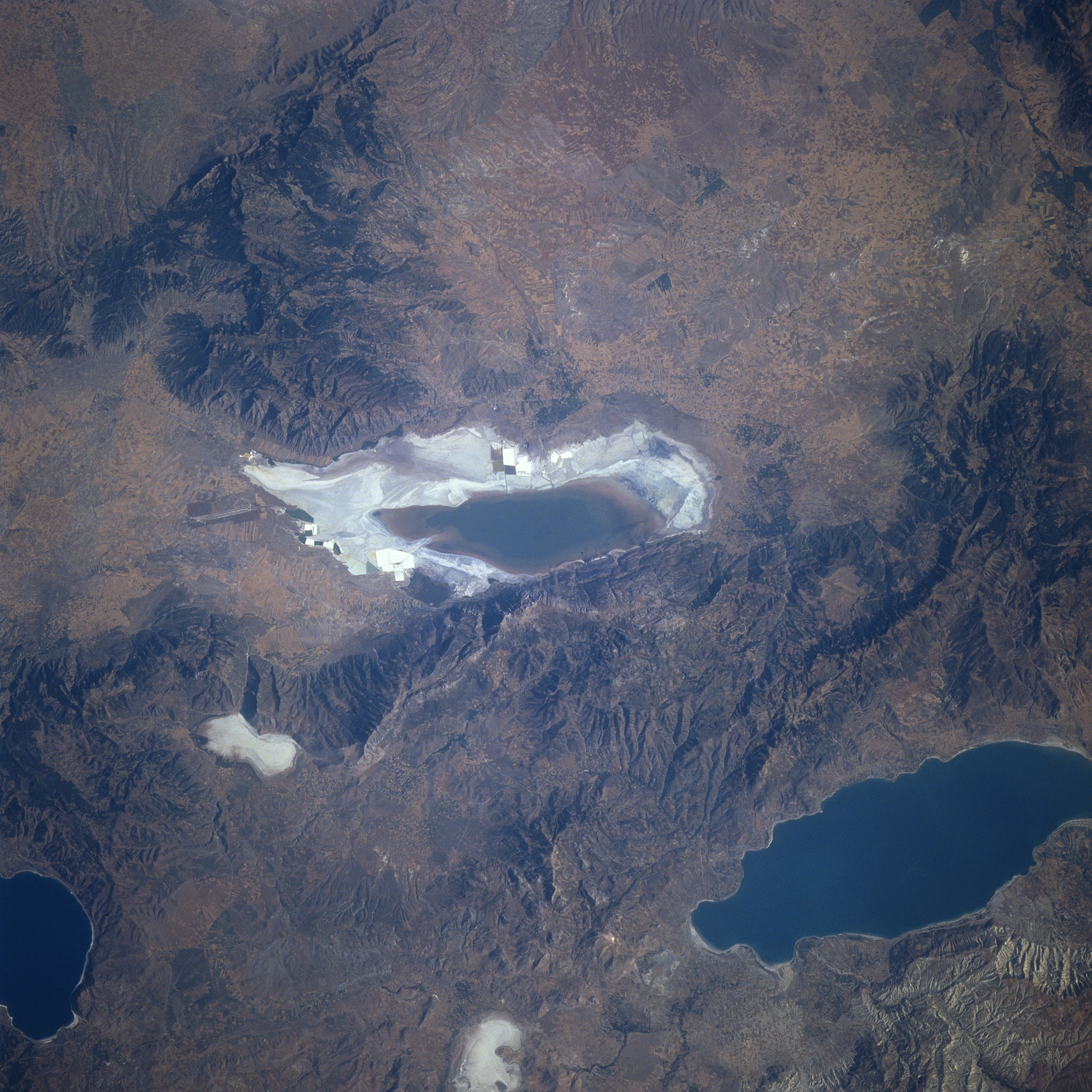
Image Caption: STS078-740-072 Aci and Budur Lakes, Turkey June 1996
The rugged, semi-arid terrain of southwestern Turkey is visible in this northwest-looking view. Aci Lake's (center of the image) old shorelines are visible as the lake is in the process of evaporating. Lake Burdur is discernible toward the bottom right of the image. Near the bottom center of the image is the evaporated Yarash Lake. Salda Lake is visible near the bottom left of the image. Numerous faults traverse this area of Turkey, which makes this region prone to earthquakes. Wheat is grown in the valleys and plains of the region.
The rugged, semi-arid terrain of southwestern Turkey is visible in this northwest-looking view. Aci Lake's (center of the image) old shorelines are visible as the lake is in the process of evaporating. Lake Burdur is discernible toward the bottom right of the image. Near the bottom center of the image is the evaporated Yarash Lake. Salda Lake is visible near the bottom left of the image. Numerous faults traverse this area of Turkey, which makes this region prone to earthquakes. Wheat is grown in the valleys and plains of the region.
