STS078-732-49
| NASA Photo ID | STS078-732-49 |
| Focal Length | 250mm |
| Date taken | 1996.06.24 |
| Time taken | 10:26:37 GMT |
Resolutions offered for this image:
4037 x 4037 pixels 639 x 639 pixels 5700 x 5900 pixels 483 x 500 pixels
4037 x 4037 pixels 639 x 639 pixels 5700 x 5900 pixels 483 x 500 pixels

Cloud masks available for this image:
Spacecraft nadir point: 37.7° N, 23.6° E
Photo center point: 38.0° N, 23.0° E
Photo center point by machine learning:
Photo center point: 38.0° N, 23.0° E
Photo center point by machine learning:
Nadir to Photo Center: Northwest
Spacecraft Altitude: 145 nautical miles (269km)
Country or Geographic Name: | GREECE |
Features: | B. OF ALKIONIDHON, MTS. |
| Features Found Using Machine Learning: | |
Cloud Cover Percentage: | 0 (no clouds present) |
Sun Elevation Angle: | 76° |
Sun Azimuth: | 179° |
Camera: | Hasselblad |
Focal Length: | 250mm |
Camera Tilt: | 16 degrees |
Format: | 5046: Kodak, natural color positive, Lumiere 100/5046, ASA 100, standard base |
Film Exposure: | Normal |
| Additional Information | |
| Width | Height | Annotated | Cropped | Purpose | Links |
|---|---|---|---|---|---|
| 4037 pixels | 4037 pixels | No | No | Earth From Space collection | Download Image |
| 639 pixels | 639 pixels | No | No | Earth From Space collection | Download Image |
| 5700 pixels | 5900 pixels | No | No | Download Image | |
| 483 pixels | 500 pixels | No | No | Download Image |
Download Packaged File
Download a Google Earth KML for this Image
View photo footprint information
Download a GeoTIFF for this photo
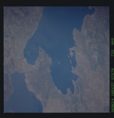
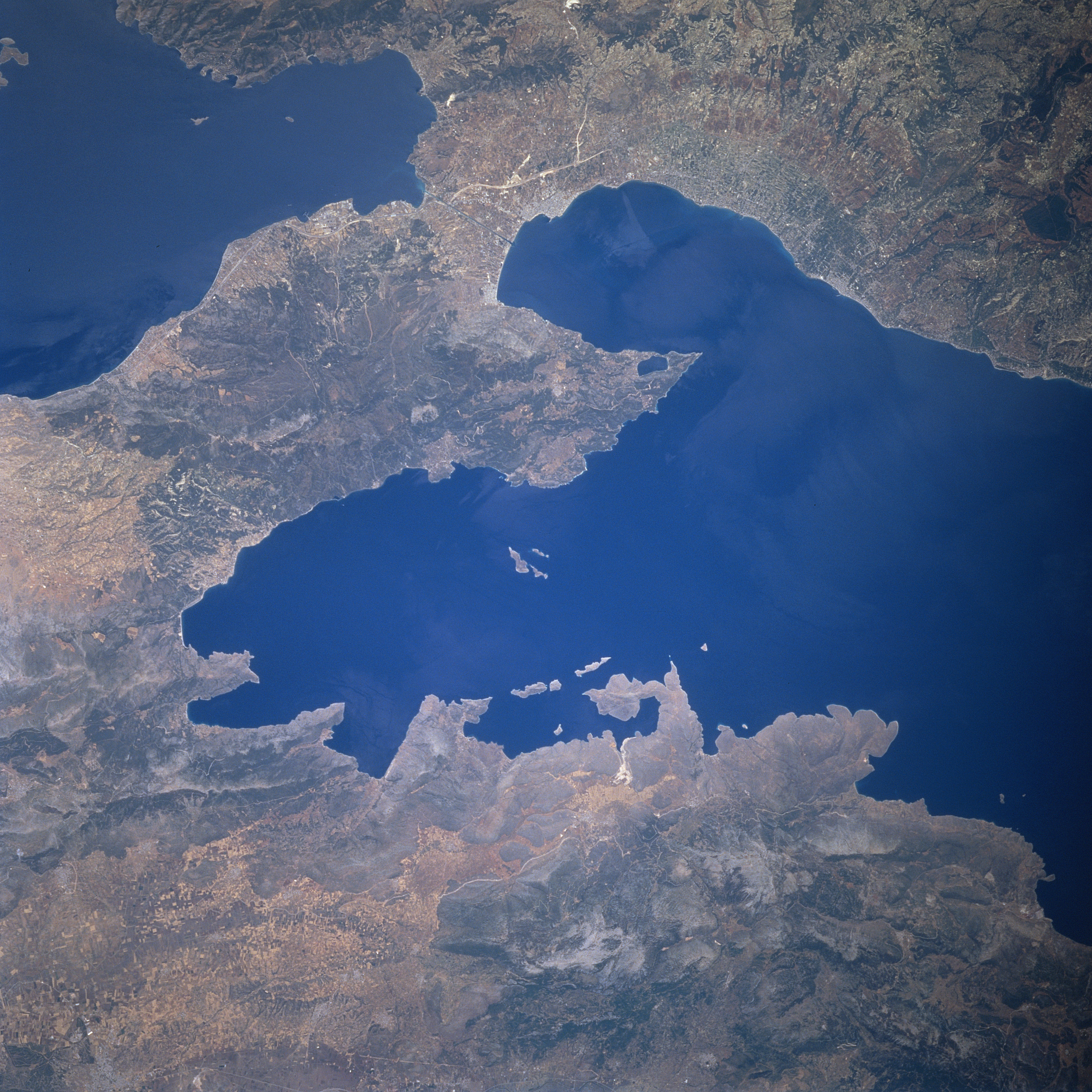
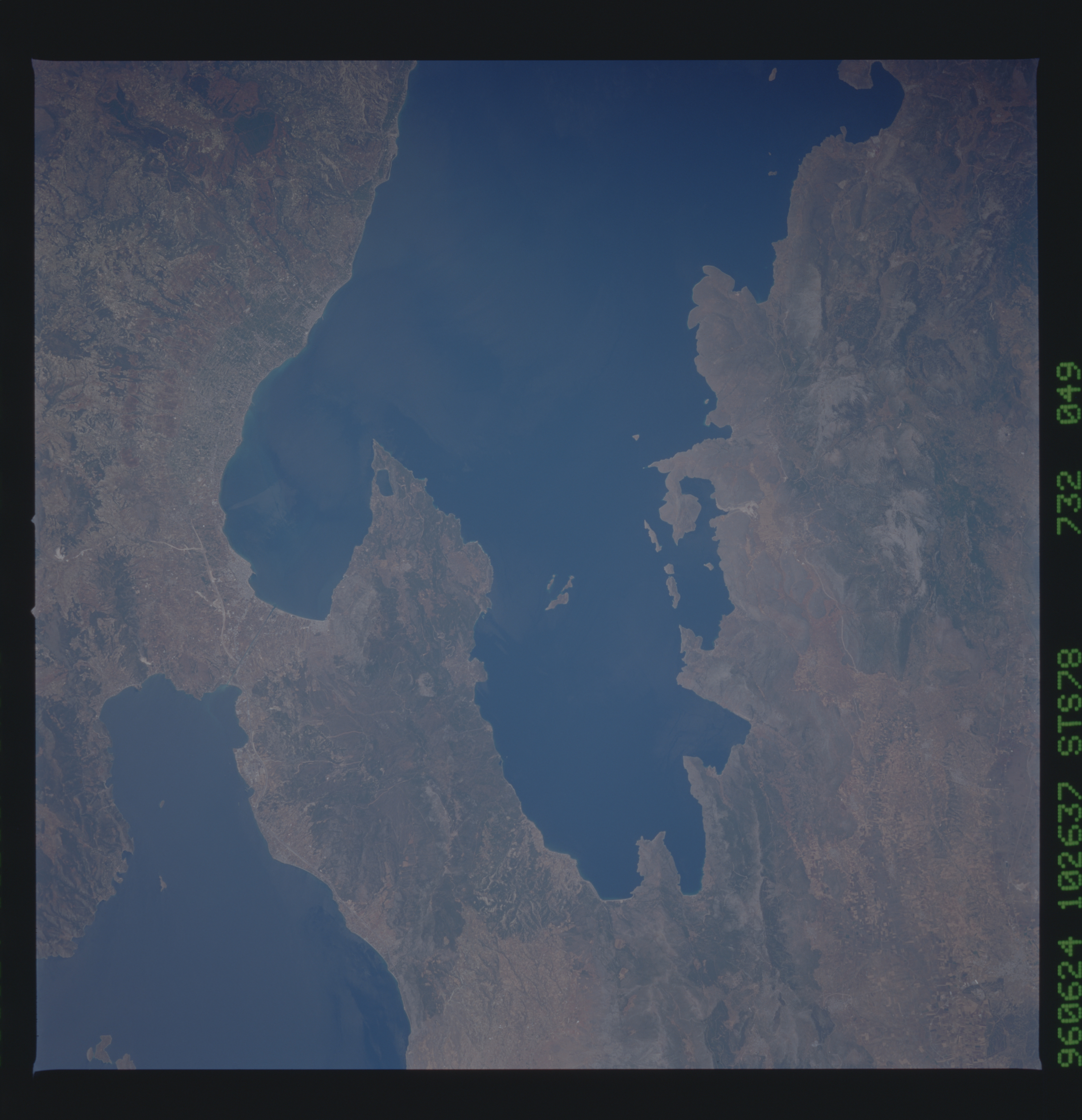
Image Caption: STS078-732-049 Isthmus of Corinth, Greece June 1996
The historical Isthmus of Corinth can be seen in this southwest-looking view. The Isthmus of Corinth is 20 miles (32 km) long and 4 to 8 miles (6 to 13 km) wide, and connects central Greece (bottom left and bottom center of the image) with the Peloponnesus (upper right of the image). The isthmus lies between the Saronic Gulf (upper left) and the Gulf of Corinth (center and right center). The Corinth Canal (not discernible on the image), 4 miles (6 km) long, crosses the isthmus and connects the Adriatic and Aegean Seas. The Gulf of Corinth, an inlet to the Ionian Sea, is 80 miles (130 km) long and from 3 to 20 (5 to 32 km) wide. The gulf separates the Greek mainland from the Peloponnesus. The city of Corinth is located at the southeastern end of the Gulf of Corinth. Corinth is a port and major transportation center trading in olives, tobacco, raisins, and wine. The city was destroyed by an earthquake in 1928 and rebuilt.
The historical Isthmus of Corinth can be seen in this southwest-looking view. The Isthmus of Corinth is 20 miles (32 km) long and 4 to 8 miles (6 to 13 km) wide, and connects central Greece (bottom left and bottom center of the image) with the Peloponnesus (upper right of the image). The isthmus lies between the Saronic Gulf (upper left) and the Gulf of Corinth (center and right center). The Corinth Canal (not discernible on the image), 4 miles (6 km) long, crosses the isthmus and connects the Adriatic and Aegean Seas. The Gulf of Corinth, an inlet to the Ionian Sea, is 80 miles (130 km) long and from 3 to 20 (5 to 32 km) wide. The gulf separates the Greek mainland from the Peloponnesus. The city of Corinth is located at the southeastern end of the Gulf of Corinth. Corinth is a port and major transportation center trading in olives, tobacco, raisins, and wine. The city was destroyed by an earthquake in 1928 and rebuilt.
