STS077-728-57
| NASA Photo ID | STS077-728-57 |
| Focal Length | 100mm |
| Date taken | 1996.05.23 |
| Time taken | 18:49:50 GMT |
Resolutions offered for this image:
5285 x 5285 pixels 639 x 639 pixels 5700 x 5900 pixels 500 x 518 pixels 640 x 480 pixels
5285 x 5285 pixels 639 x 639 pixels 5700 x 5900 pixels 500 x 518 pixels 640 x 480 pixels
Cloud masks available for this image:
Spacecraft nadir point: 20.4° S, 72.4° W
Photo center point: 15.0° S, 74.5° W
Photo center point by machine learning:
Photo center point: 15.0° S, 74.5° W
Photo center point by machine learning:
Nadir to Photo Center: North
Spacecraft Altitude: 153 nautical miles (283km)
Country or Geographic Name: | PERU |
Features: | COASTAL PLAIN, ANDES MTS. |
| Features Found Using Machine Learning: | |
Cloud Cover Percentage: | 10 (1-10)% |
Sun Elevation Angle: | 39° |
Sun Azimuth: | 322° |
Camera: | Hasselblad |
Focal Length: | 100mm |
Camera Tilt: | Low Oblique |
Format: | 5046: Kodak, natural color positive, Lumiere 100/5046, ASA 100, standard base |
Film Exposure: | Normal |
| Additional Information | |
| Width | Height | Annotated | Cropped | Purpose | Links |
|---|---|---|---|---|---|
| 5285 pixels | 5285 pixels | No | No | Earth From Space collection | Download Image |
| 639 pixels | 639 pixels | No | No | Earth From Space collection | Download Image |
| 5700 pixels | 5900 pixels | No | No | Download Image | |
| 500 pixels | 518 pixels | No | No | Download Image | |
| 640 pixels | 480 pixels | No | No | Download Image |
Download Packaged File
Download a Google Earth KML for this Image
View photo footprint information
Download a GeoTIFF for this photo
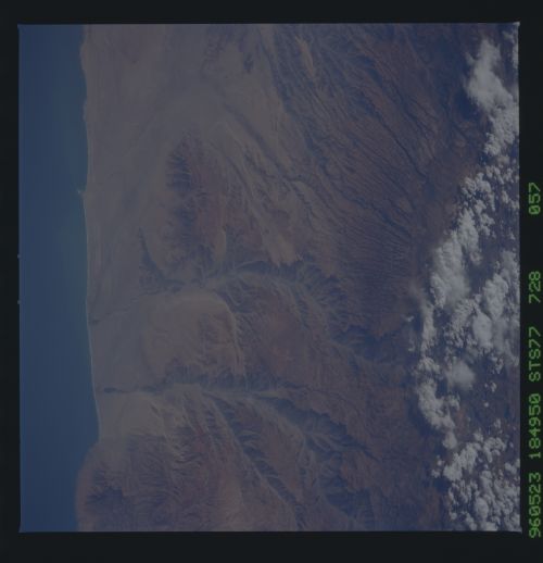
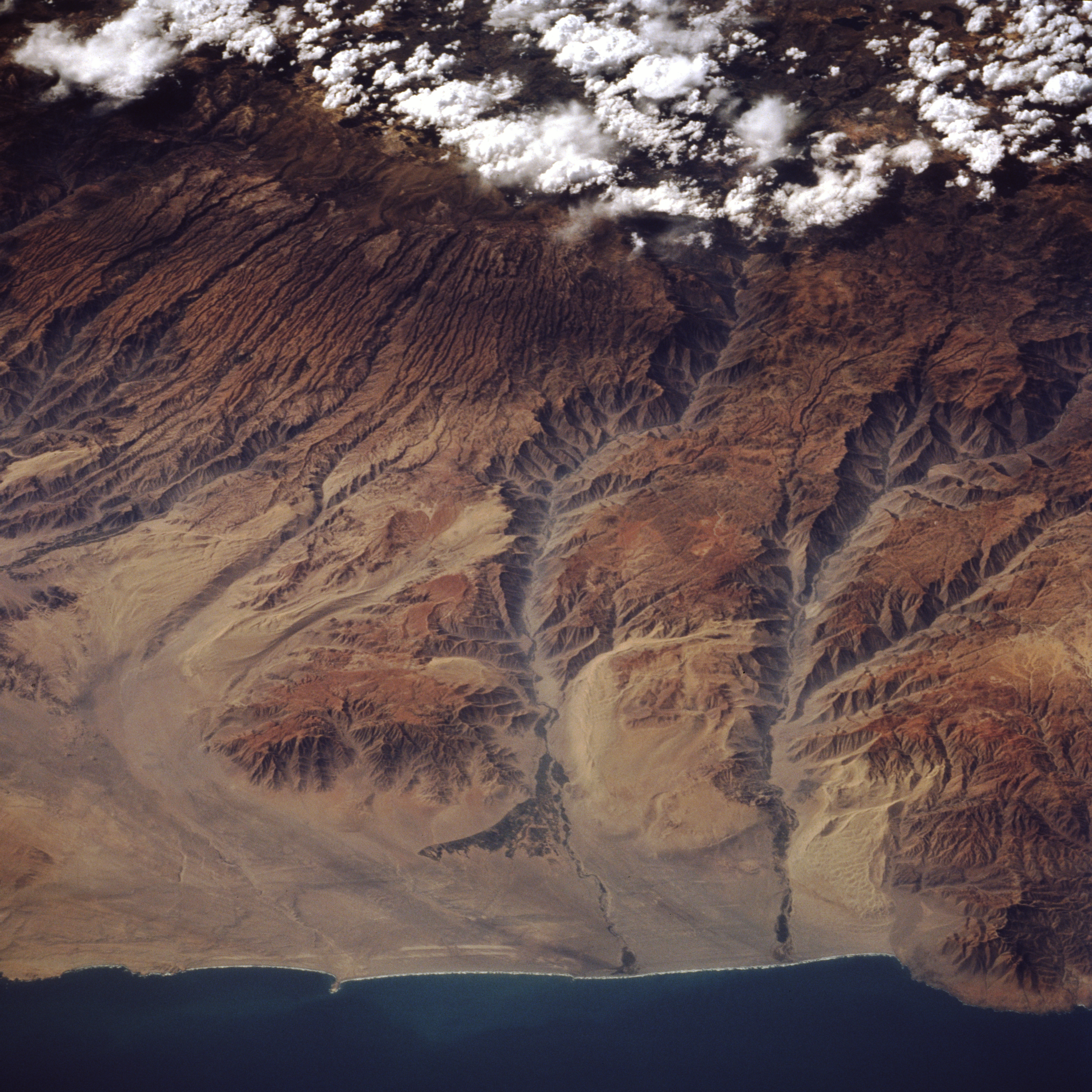
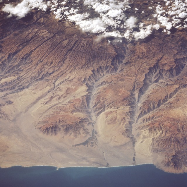
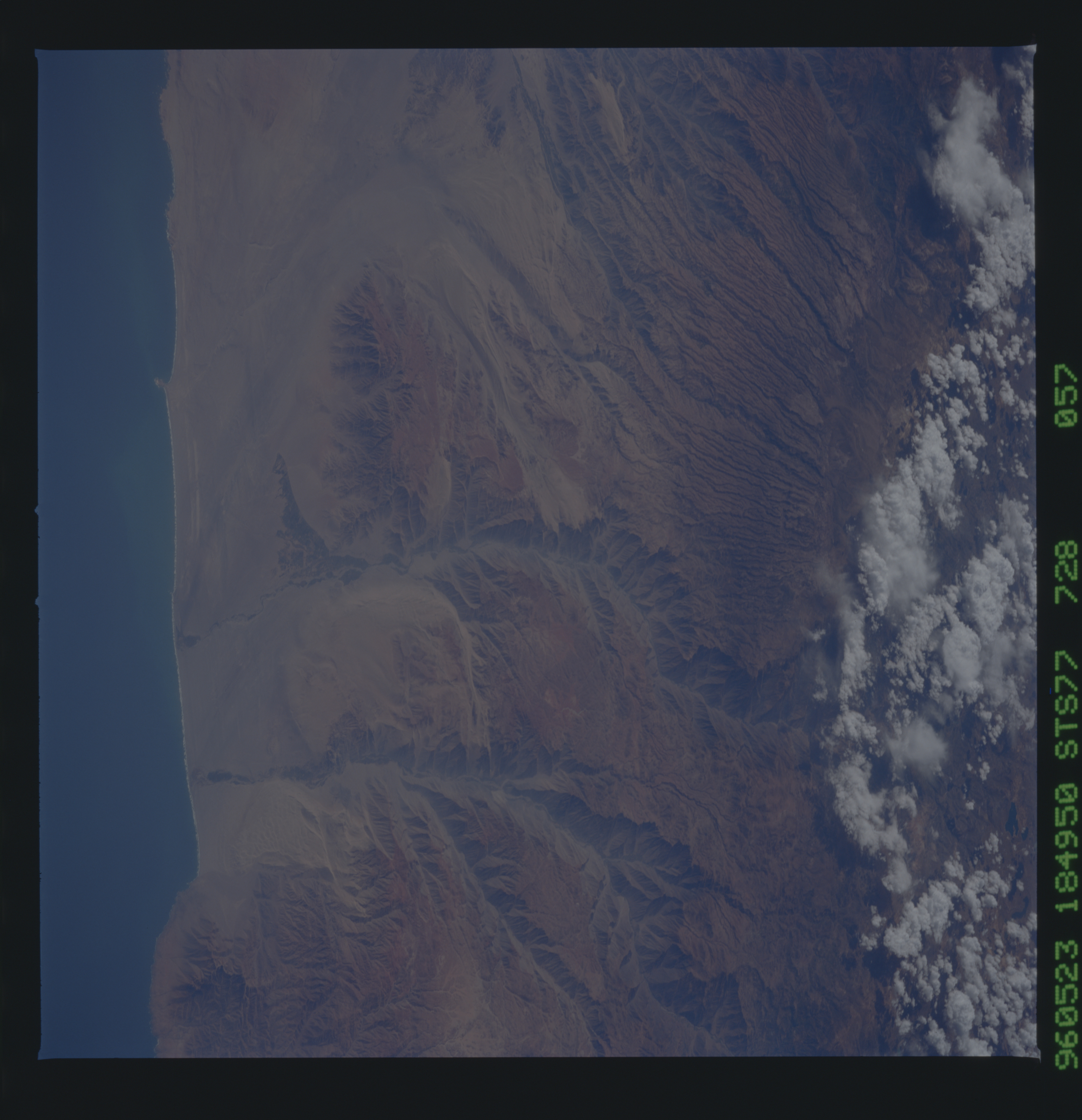
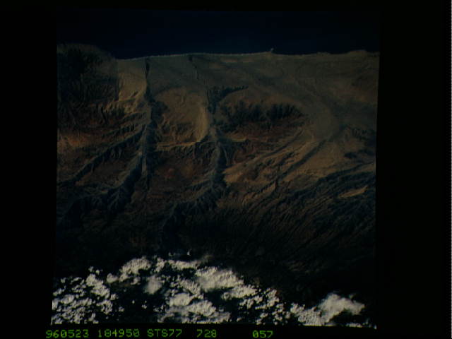
Image Caption: STS077-728-057 Yauca and Acari River Canyons, Peru May 1996
The dry, canyonlike terrain of the Peruvian coast is visible in this northeast-looking, low-oblique photograph. Clouds cover the western Andes Mountains, the longest mountain system in the world, which began to form 600 million years ago. Uplifted coastal plains deeply grooved the coastal areas, sculpturing deep canyons, some of which extend to the coast. A slow uplift continues to build the Andes, which are rising approximately 4 inches (10 centimeters) each century. Visible are many small canyons and two major ones--the Acari River Canyon (center of photograph) and the Yauca River Canyon to its south. Some irrigation is discernible in both river valleys and near the coast where the rivers empty into the Pacific Ocean. Point Chala appears at the bottom right of the photograph.
The dry, canyonlike terrain of the Peruvian coast is visible in this northeast-looking, low-oblique photograph. Clouds cover the western Andes Mountains, the longest mountain system in the world, which began to form 600 million years ago. Uplifted coastal plains deeply grooved the coastal areas, sculpturing deep canyons, some of which extend to the coast. A slow uplift continues to build the Andes, which are rising approximately 4 inches (10 centimeters) each century. Visible are many small canyons and two major ones--the Acari River Canyon (center of photograph) and the Yauca River Canyon to its south. Some irrigation is discernible in both river valleys and near the coast where the rivers empty into the Pacific Ocean. Point Chala appears at the bottom right of the photograph.
