STS077-711-11
| NASA Photo ID | STS077-711-11 |
| Focal Length | 100mm |
| Date taken | 1996.05.19 |
| Time taken | 20:07:35 GMT |
Resolutions offered for this image:
5285 x 5285 pixels 639 x 639 pixels 5700 x 5900 pixels 500 x 518 pixels 640 x 480 pixels
5285 x 5285 pixels 639 x 639 pixels 5700 x 5900 pixels 500 x 518 pixels 640 x 480 pixels

Cloud masks available for this image:
Spacecraft nadir point: 0.9° N, 89.9° W
Photo center point: 0.5° S, 91.0° W
Photo center point by machine learning:
Photo center point: 0.5° S, 91.0° W
Photo center point by machine learning:
Nadir to Photo Center: Southwest
Spacecraft Altitude: 153 nautical miles (283km)
Country or Geographic Name: | GALAPAGOS ISLANDS |
Features: | ISABELA, SAN SALVADOR, VOL |
| Features Found Using Machine Learning: | |
Cloud Cover Percentage: | 5 (1-10)% |
Sun Elevation Angle: | 53° |
Sun Azimuth: | 303° |
Camera: | Hasselblad |
Focal Length: | 100mm |
Camera Tilt: | 35 degrees |
Format: | 5046: Kodak, natural color positive, Lumiere 100/5046, ASA 100, standard base |
Film Exposure: | Normal |
| Additional Information | |
| Width | Height | Annotated | Cropped | Purpose | Links |
|---|---|---|---|---|---|
| 5285 pixels | 5285 pixels | No | No | Earth From Space collection | Download Image |
| 639 pixels | 639 pixels | No | No | Earth From Space collection | Download Image |
| 5700 pixels | 5900 pixels | No | No | Download Image | |
| 500 pixels | 518 pixels | No | No | Download Image | |
| 640 pixels | 480 pixels | No | No | Download Image |
Download Packaged File
Download a Google Earth KML for this Image
View photo footprint information
Download a GeoTIFF for this photo
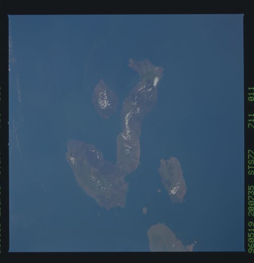
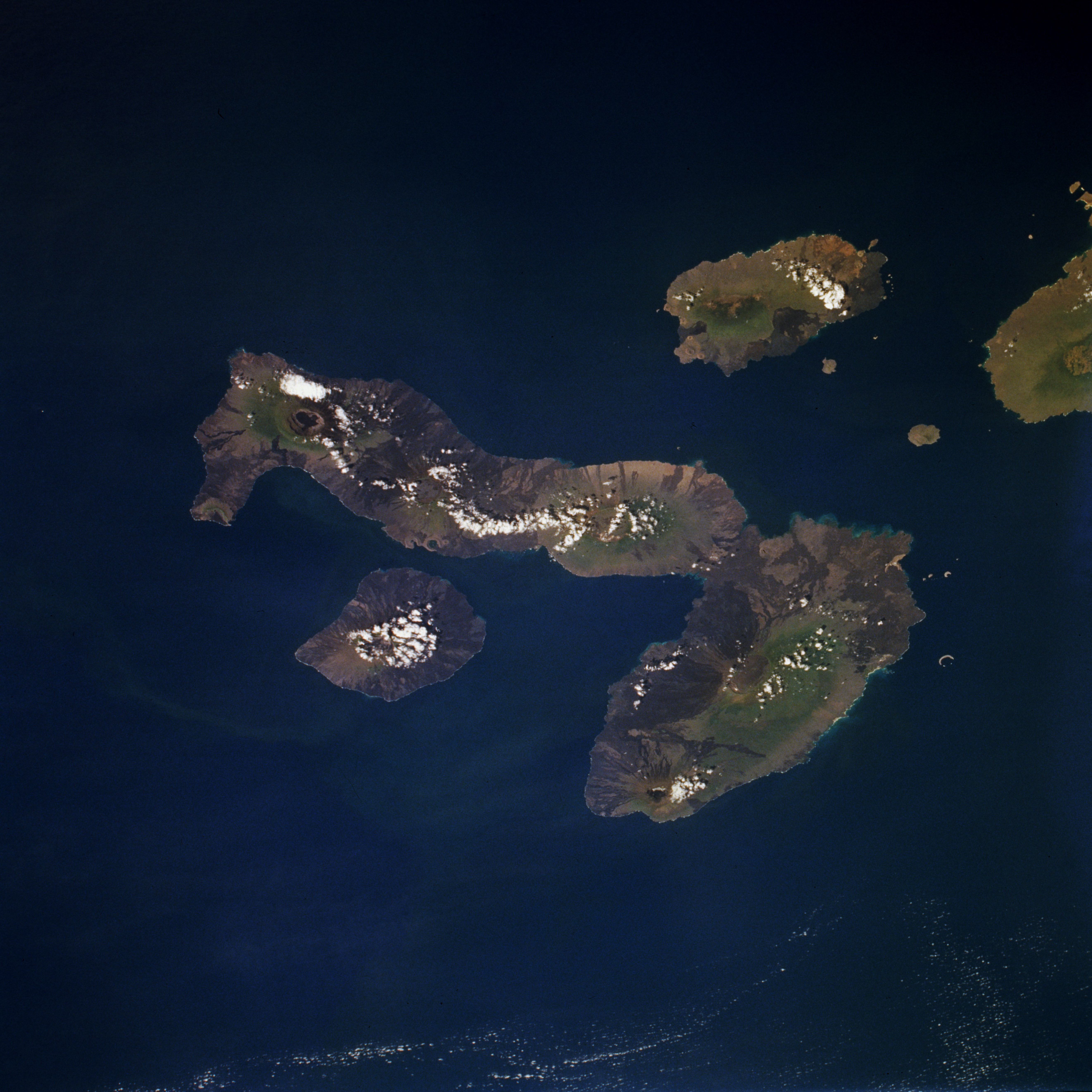
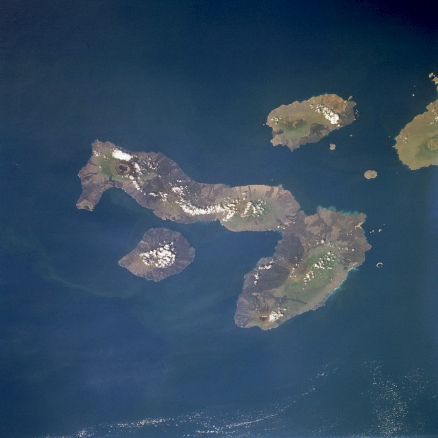
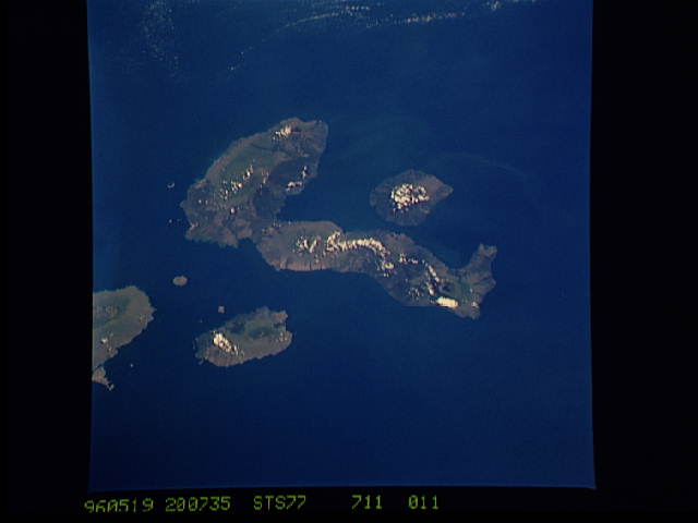
Image Caption: STS077-711-011 Galápagos Islands, Ecuador May 1996
Isabela, the largest of the Galápagos Islands; Fernandina; San Salvador; and a partial view of Santa Cruz, are apparent in this southwest-looking, low-oblique photograph. Located on the equator 600 miles (1000 kilometers) west of Ecuador, the rugged volcanic islands began forming 4 to 5 million years ago. Sea-horse-shaped Isabela Island covers 1771 square miles (4588 square kilometers) and has five active volcanoes. Fernandina Island, west-southwest of Isabela, covers 248 square miles (642 square kilometers) and has a single large active volcano with a very distinct caldera that is sometimes filled with water. East-northeast of Isabella lies San Salvador that covers 226 square miles (585 square kilometers). The islands, famous for their diversity of unique wildlife, were visited in 1835 by Charles Darwin, who gathered data that was later used in support of the theory of natural selection.
Isabela, the largest of the Galápagos Islands; Fernandina; San Salvador; and a partial view of Santa Cruz, are apparent in this southwest-looking, low-oblique photograph. Located on the equator 600 miles (1000 kilometers) west of Ecuador, the rugged volcanic islands began forming 4 to 5 million years ago. Sea-horse-shaped Isabela Island covers 1771 square miles (4588 square kilometers) and has five active volcanoes. Fernandina Island, west-southwest of Isabela, covers 248 square miles (642 square kilometers) and has a single large active volcano with a very distinct caldera that is sometimes filled with water. East-northeast of Isabella lies San Salvador that covers 226 square miles (585 square kilometers). The islands, famous for their diversity of unique wildlife, were visited in 1835 by Charles Darwin, who gathered data that was later used in support of the theory of natural selection.
