STS077-703-25
| NASA Photo ID | STS077-703-25 |
| Focal Length | 100mm |
| Date taken | 1996.05.23 |
| Time taken | 06:19:51 GMT |
Resolutions offered for this image:
5257 x 5257 pixels 640 x 640 pixels 5700 x 5900 pixels 500 x 518 pixels 640 x 480 pixels
5257 x 5257 pixels 640 x 640 pixels 5700 x 5900 pixels 500 x 518 pixels 640 x 480 pixels


Cloud masks available for this image:
Spacecraft nadir point: 39.0° N, 8.4° E
Photo center point: 39.5° N, 2.0° E
Photo center point by machine learning:
Photo center point: 39.5° N, 2.0° E
Photo center point by machine learning:
Nadir to Photo Center: West
Spacecraft Altitude: 153 nautical miles (283km)
Country or Geographic Name: | BALEARIC ISLANDS |
Features: | PAN-MENORCA, MALLORCA, COAST |
| Features Found Using Machine Learning: | |
Cloud Cover Percentage: | 5 (1-10)% |
Sun Elevation Angle: | 24° |
Sun Azimuth: | 82° |
Camera: | Hasselblad |
Focal Length: | 100mm |
Camera Tilt: | High Oblique |
Format: | 5046: Kodak, natural color positive, Lumiere 100/5046, ASA 100, standard base |
Film Exposure: | Normal |
| Additional Information | |
| Width | Height | Annotated | Cropped | Purpose | Links |
|---|---|---|---|---|---|
| 5257 pixels | 5257 pixels | No | No | Earth From Space collection | Download Image |
| 640 pixels | 640 pixels | No | No | Earth From Space collection | Download Image |
| 5700 pixels | 5900 pixels | No | No | Download Image | |
| 500 pixels | 518 pixels | No | No | Download Image | |
| 640 pixels | 480 pixels | No | No | Download Image |
Download Packaged File
Download a Google Earth KML for this Image
View photo footprint information
Download a GeoTIFF for this photo
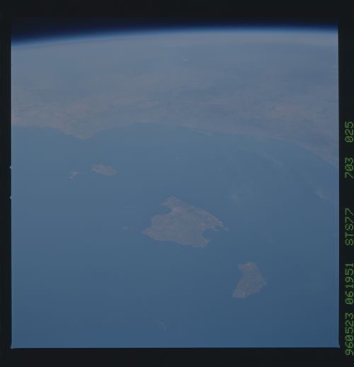
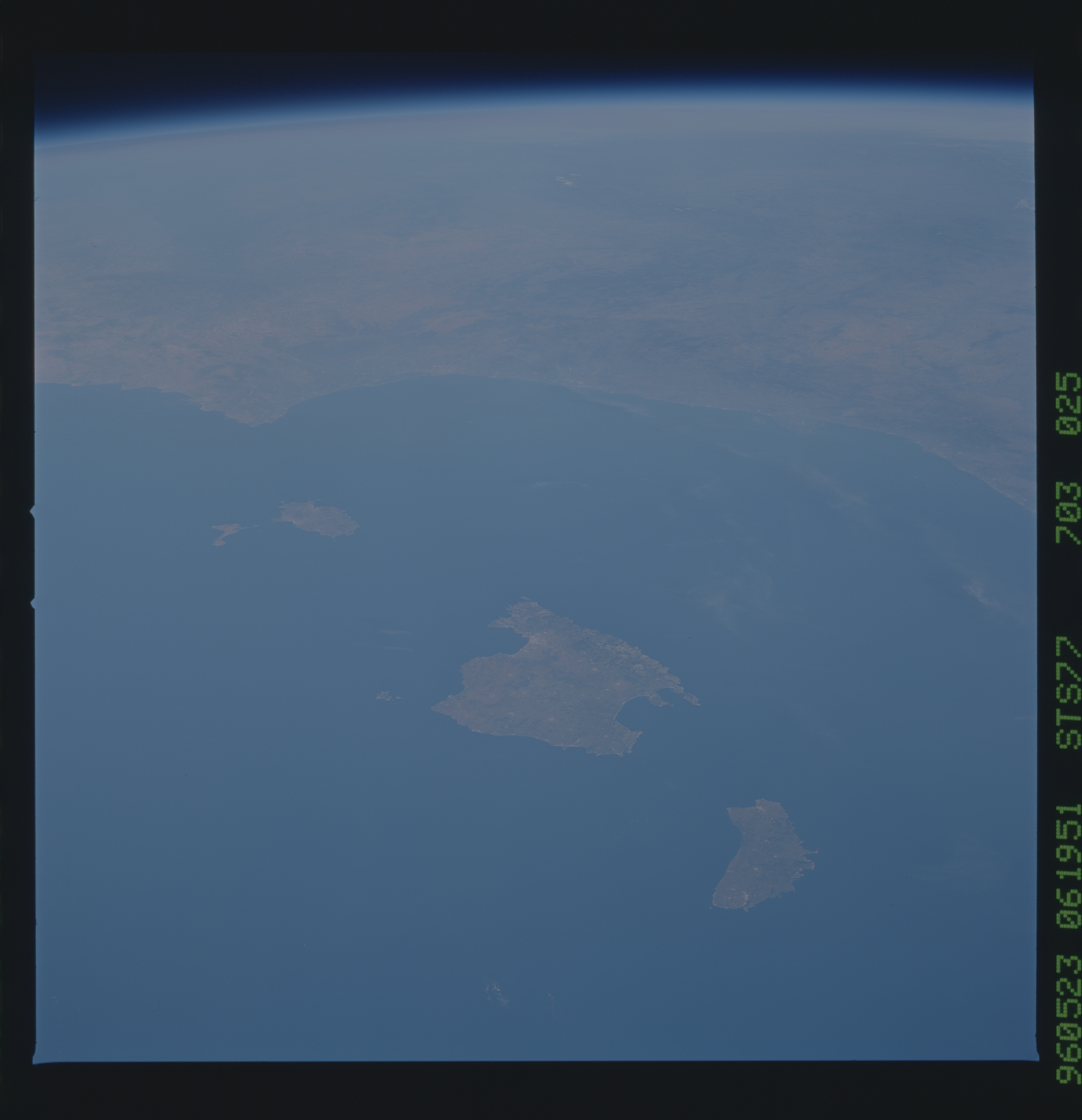
Image Caption: STS077-703-025 Balearic Islands, Spain May 1996
The Balearic Islands off the east coast of Spain in the western Mediterranean Sea are featured in this west-looking, low-oblique photograph. The islands, a major tourist area noted for its picturesque scenery and mild climate, also produce fruit, wine, grain, and olive oil. Cattle raising and fishing are also major industries. Majorca, famous for many prehistoric monuments, is the largest of the Balearic Islands. On the west and northwest sides of the island lie the Sierra de Alfabia Mountains, rising to an altitude of 4739 feet (1445 meters). The south and east portions of the island consist of gently rolling and very fertile terrain. The Gulf of Valencia and portions of eastern Spain are visible in the top quarter of the photograph.
The Balearic Islands off the east coast of Spain in the western Mediterranean Sea are featured in this west-looking, low-oblique photograph. The islands, a major tourist area noted for its picturesque scenery and mild climate, also produce fruit, wine, grain, and olive oil. Cattle raising and fishing are also major industries. Majorca, famous for many prehistoric monuments, is the largest of the Balearic Islands. On the west and northwest sides of the island lie the Sierra de Alfabia Mountains, rising to an altitude of 4739 feet (1445 meters). The south and east portions of the island consist of gently rolling and very fertile terrain. The Gulf of Valencia and portions of eastern Spain are visible in the top quarter of the photograph.
