STS075-771-47
| NASA Photo ID | STS075-771-47 |
| Focal Length | 40mm |
| Date taken | 1996.03.04 |
| Time taken | 13:58:28 GMT |

Cloud masks available for this image:
Spacecraft nadir point: 15.3° S, 44.3° E
Photo center point: 14.0° S, 40.5° E
Photo center point by machine learning:
Photo center point: 14.0° S, 40.5° E
Photo center point by machine learning:
Nadir to Photo Center: West
Spacecraft Altitude: 157 nautical miles (291km)
Country or Geographic Name: | MOZAMBIQUE |
Features: | PAN-COAST, T/S, VIEW TO W. |
| Features Found Using Machine Learning: | |
Cloud Cover Percentage: | 50 (26-50)% |
Sun Elevation Angle: | 20° |
Sun Azimuth: | 269° |
Camera: | Hasselblad |
Focal Length: | 40mm |
Camera Tilt: | High Oblique |
Format: | VELVI: Fuji, natural color positive, Velvia 50, CS 135-36, ASA 32, standard base |
Film Exposure: | Normal |
| Additional Information | |
| Width | Height | Annotated | Cropped | Purpose | Links |
|---|---|---|---|---|---|
| 5700 pixels | 5900 pixels | No | No | Download Image | |
| 500 pixels | 518 pixels | No | No | Download Image | |
| 640 pixels | 480 pixels | No | No | Download Image |
Download Packaged File
Download a Google Earth KML for this Image
View photo footprint information
Download a GeoTIFF for this photo
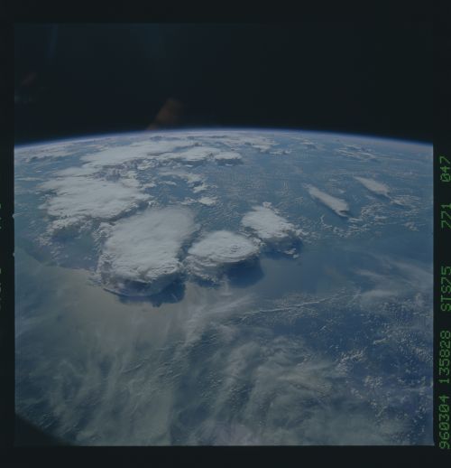
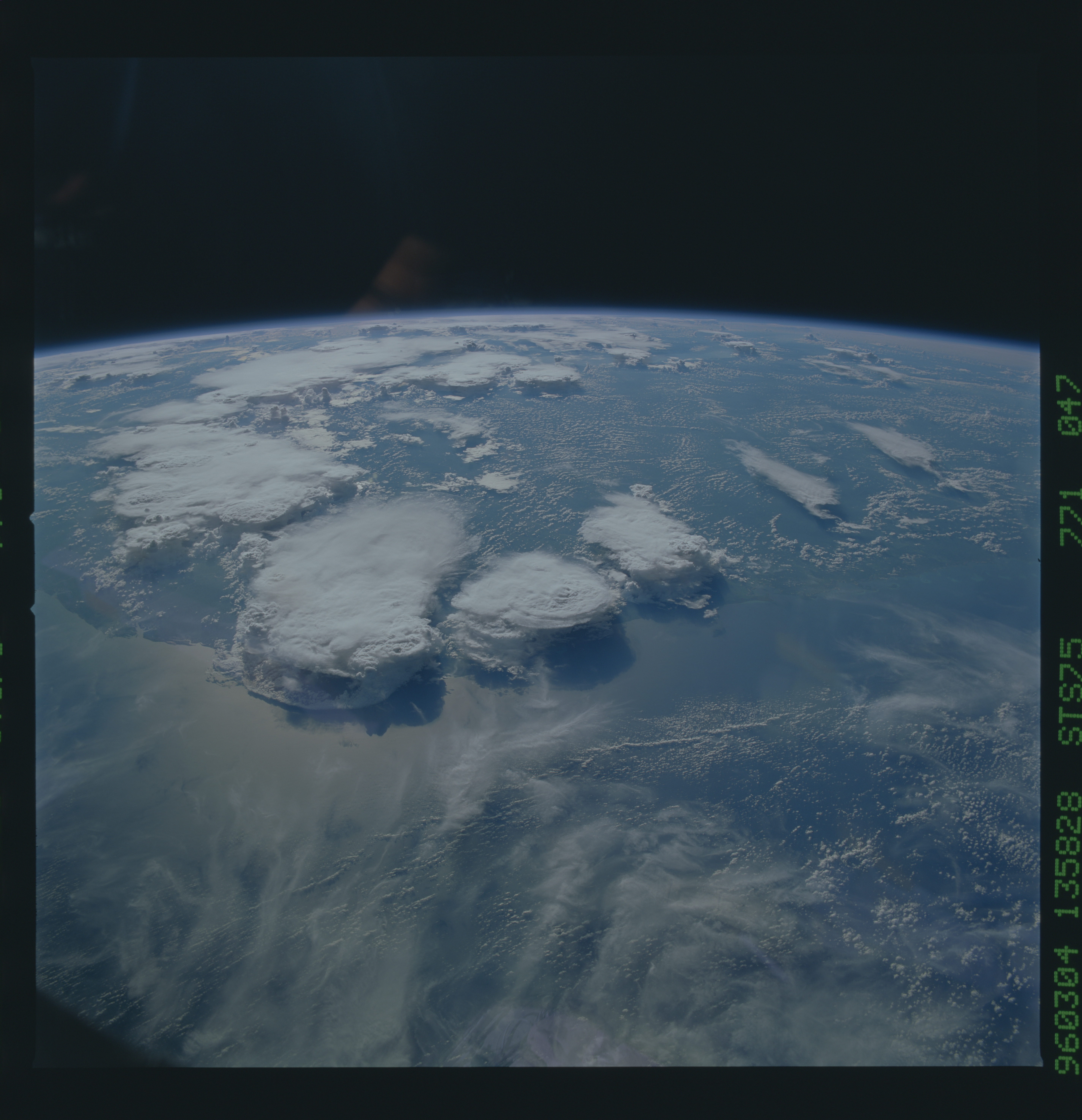
Image Caption: Thunderstorms and associated arc clouds
over Mozambique, Africa (nadir 15.2S 44.2E, sun azm 269 deg). These
two "text book" weather images show several thunderstorms in each
phase of development: in the north (right) two in the early stage
appear, in the middle are two mature-stage storms, and one in the
collapsing phase appears left, with arc clouds. These are a
stereoscopic pair.
