STS075-728-95
| NASA Photo ID | STS075-728-95 |
| Focal Length | 250mm |
| Date taken | 1996.02.29 |
| Time taken | 17:55:36 GMT |
Resolutions offered for this image:
3936 x 3904 pixels 639 x 634 pixels 5700 x 5900 pixels 500 x 518 pixels 640 x 480 pixels
3936 x 3904 pixels 639 x 634 pixels 5700 x 5900 pixels 500 x 518 pixels 640 x 480 pixels
Cloud masks available for this image:
Spacecraft nadir point: 26.5° N, 78.4° W
Photo center point: 25.5° N, 80.0° W
Photo center point by machine learning:
Photo center point: 25.5° N, 80.0° W
Photo center point by machine learning:
Nadir to Photo Center: Southwest
Spacecraft Altitude: 155 nautical miles (287km)
Country or Geographic Name: | USA-FLORIDA |
Features: | FLORIDA KEYS, REEFS, MIAMI |
| Features Found Using Machine Learning: | |
Cloud Cover Percentage: | 15 (11-25)% |
Sun Elevation Angle: | 55° |
Sun Azimuth: | 193° |
Camera: | Hasselblad |
Focal Length: | 250mm |
Camera Tilt: | 36 degrees |
Format: | 5046: Kodak, natural color positive, Lumiere 100/5046, ASA 100, standard base |
Film Exposure: | Normal |
| Additional Information | |
| Width | Height | Annotated | Cropped | Purpose | Links |
|---|---|---|---|---|---|
| 3936 pixels | 3904 pixels | No | No | Earth From Space collection | Download Image |
| 639 pixels | 634 pixels | No | No | Earth From Space collection | Download Image |
| 5700 pixels | 5900 pixels | No | No | Download Image | |
| 500 pixels | 518 pixels | No | No | Download Image | |
| 640 pixels | 480 pixels | No | No | Download Image |
Download Packaged File
Download a Google Earth KML for this Image
View photo footprint information
Download a GeoTIFF for this photo
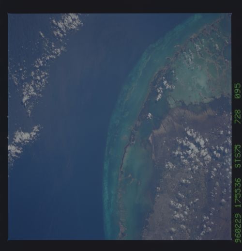
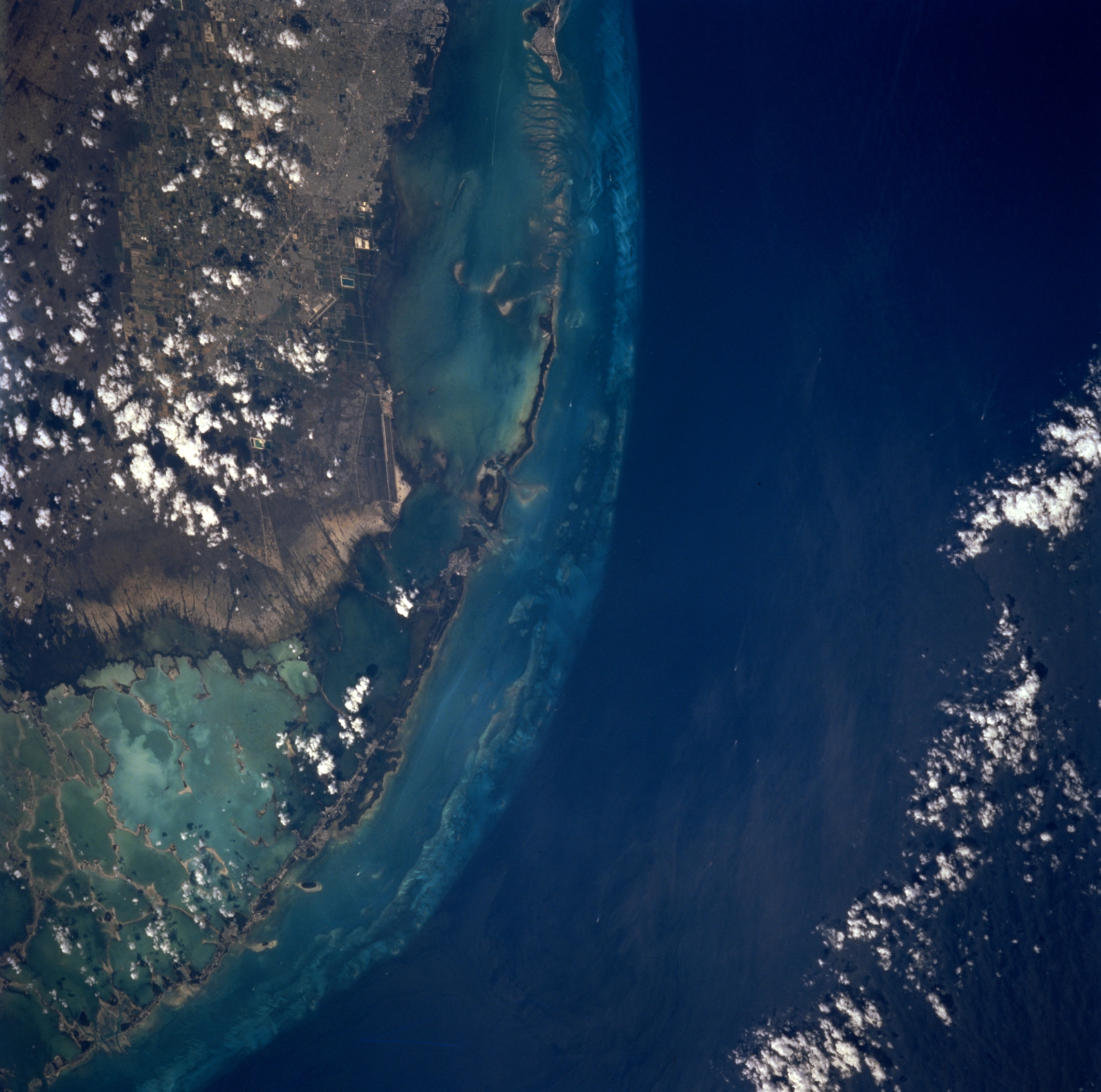
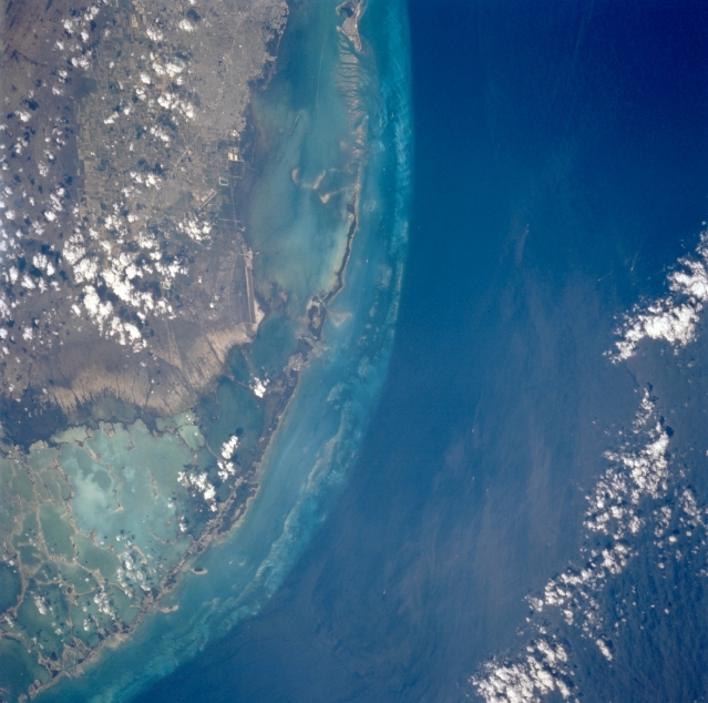
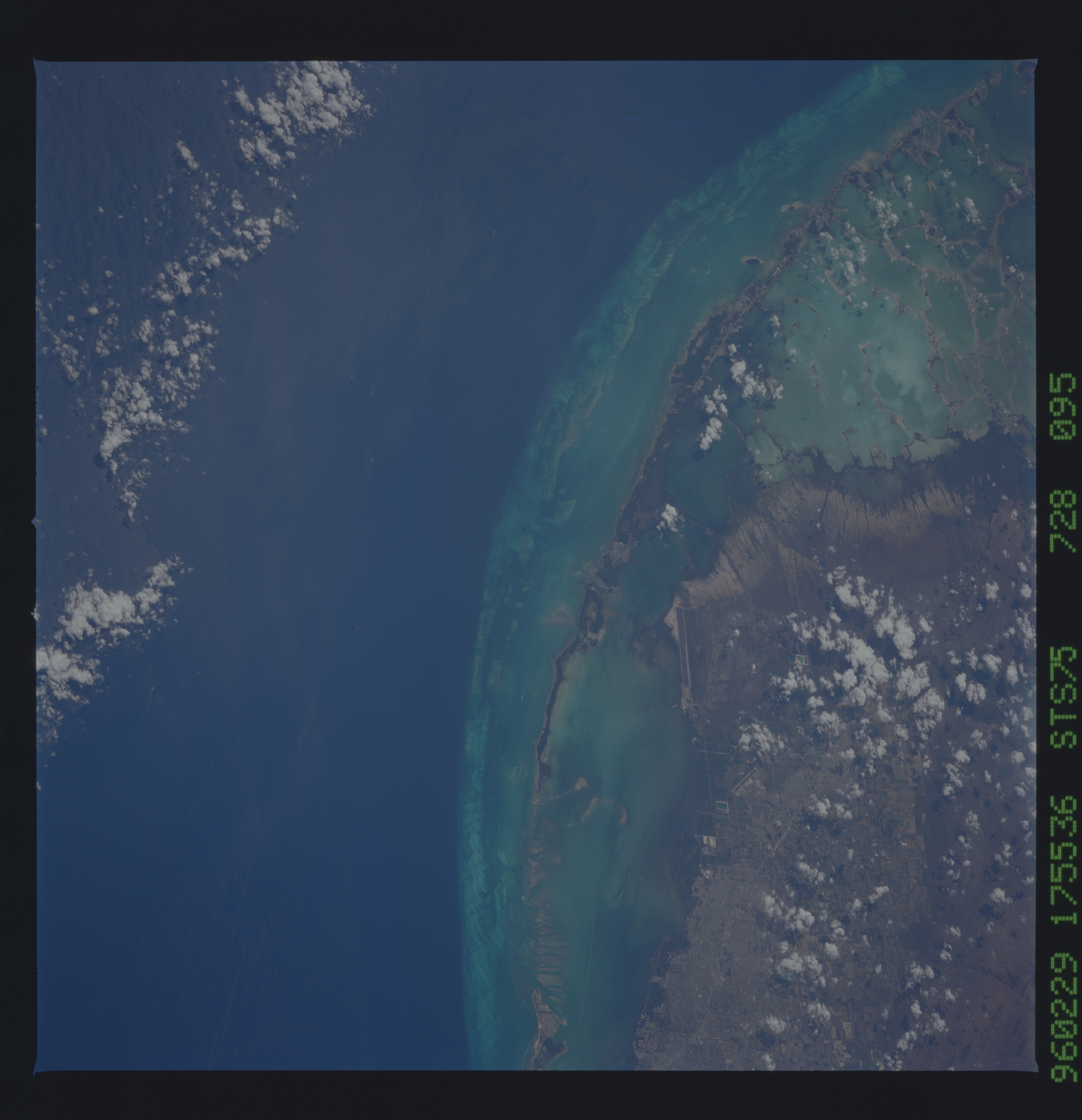
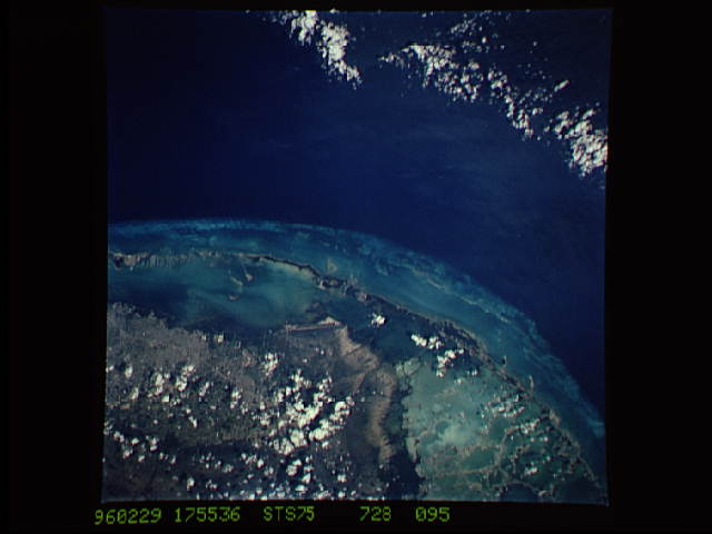
Image Caption: STS075-728-095 Northern Florida Keys, U.S.A. March 1996
The different shades of color represent different depths of water--the dark blues show the deeper water of the north-flowing Gulf Stream in the Straits of Florida, approximately 900 feet (275 meters) deep; the lighter waters adjacent to the Florida Keys average 10 feet (3 meters) in depth; and the highly reflective aquas denote very shallow [3 feet (1 meter)] Florida Bay with a multitude of vegetated islands (lower left). Visible are a small section of the southeastern portion of The Everglades and the mangrove swamp north of Florida Bay; the coral reefs and limestone islands that make up the southwest-arcing Florida Keys; most of shallow Biscayne Bay (upper center); and the vague outline of the southern extent of greater Miami (upper left).
The different shades of color represent different depths of water--the dark blues show the deeper water of the north-flowing Gulf Stream in the Straits of Florida, approximately 900 feet (275 meters) deep; the lighter waters adjacent to the Florida Keys average 10 feet (3 meters) in depth; and the highly reflective aquas denote very shallow [3 feet (1 meter)] Florida Bay with a multitude of vegetated islands (lower left). Visible are a small section of the southeastern portion of The Everglades and the mangrove swamp north of Florida Bay; the coral reefs and limestone islands that make up the southwest-arcing Florida Keys; most of shallow Biscayne Bay (upper center); and the vague outline of the southern extent of greater Miami (upper left).
