STS075-723-16
| NASA Photo ID | STS075-723-16 |
| Focal Length | 250mm |
| Date taken | 1996.__.__ |
| Time taken | GMT |
Resolutions offered for this image:
4000 x 4000 pixels 790 x 794 pixels 3904 x 3904 pixels 639 x 639 pixels 5700 x 5900 pixels 4000 x 4000 pixels 500 x 518 pixels 640 x 480 pixels
4000 x 4000 pixels 790 x 794 pixels 3904 x 3904 pixels 639 x 639 pixels 5700 x 5900 pixels 4000 x 4000 pixels 500 x 518 pixels 640 x 480 pixels


Cloud masks available for this image:
Spacecraft nadir point:
Photo center point: 30.0° N, 95.5° W
Photo center point by machine learning:
Photo center point: 30.0° N, 95.5° W
Photo center point by machine learning:
Nadir to Photo Center: Northwest
Spacecraft Altitude: nautical miles (0km)
Country or Geographic Name: | USA-TEXAS |
Features: | HOUSTON, LAKE HOUSTON |
| Features Found Using Machine Learning: | |
Cloud Cover Percentage: | 0 (no clouds present) |
Sun Elevation Angle: | ° |
Sun Azimuth: | ° |
Camera: | Hasselblad |
Focal Length: | 250mm |
Camera Tilt: | Low Oblique |
Format: | 5046: Kodak, natural color positive, Lumiere 100/5046, ASA 100, standard base |
Film Exposure: | Normal |
| Additional Information | |
| Width | Height | Annotated | Cropped | Purpose | Links |
|---|---|---|---|---|---|
| 4000 pixels | 4000 pixels | Cities collection | Download Image | ||
| 790 pixels | 794 pixels | No | No | Cities collection | Download Image |
| 3904 pixels | 3904 pixels | No | No | Earth From Space collection | Download Image |
| 639 pixels | 639 pixels | No | No | Earth From Space collection | Download Image |
| 5700 pixels | 5900 pixels | No | No | Download Image | |
| 4000 pixels | 4000 pixels | No | No | Scientist Request | Download Image |
| 500 pixels | 518 pixels | No | No | Download Image | |
| 640 pixels | 480 pixels | No | No | Download Image |
Download Packaged File
Download a Google Earth KML for this Image
View photo footprint information
Download a GeoTIFF for this photo
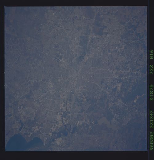
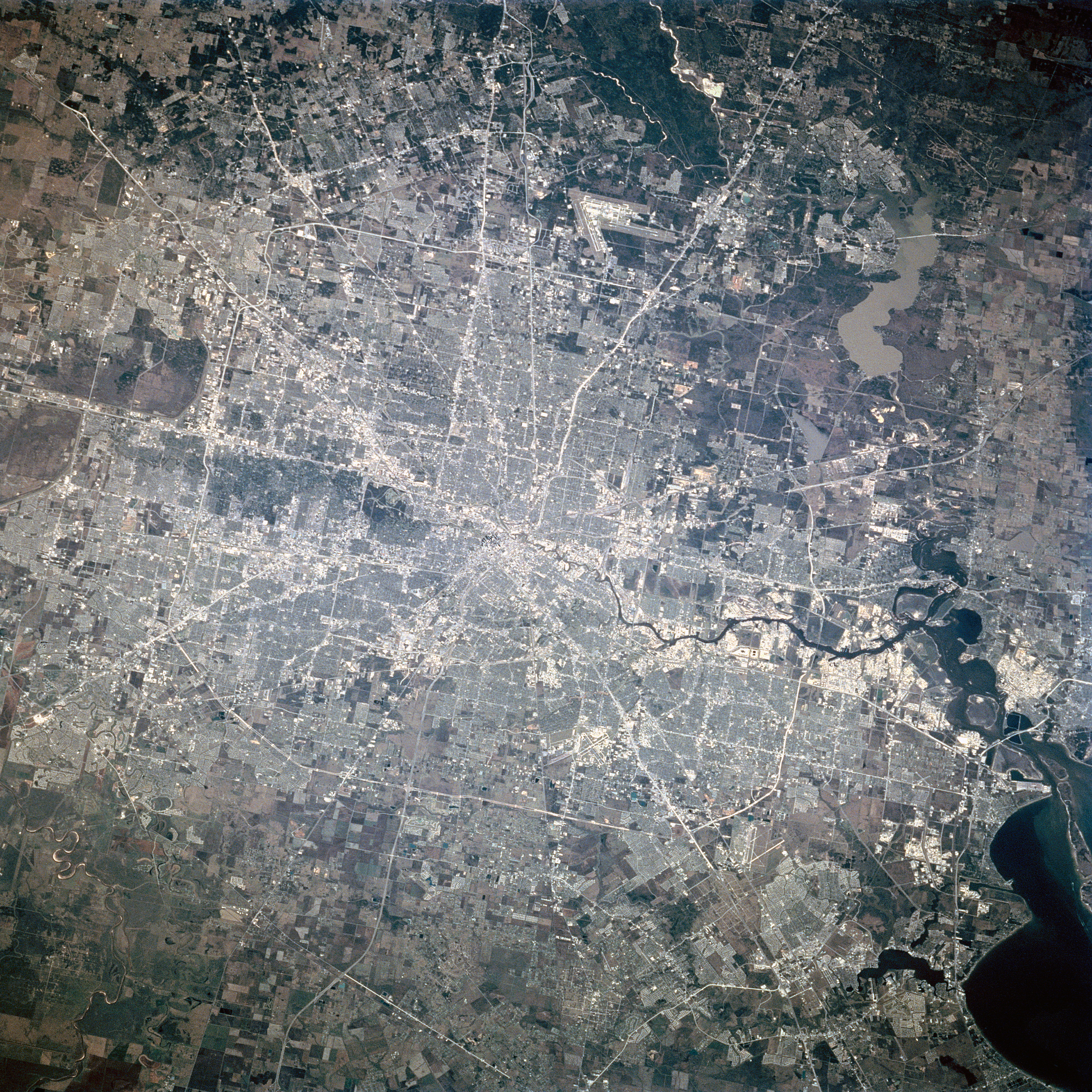
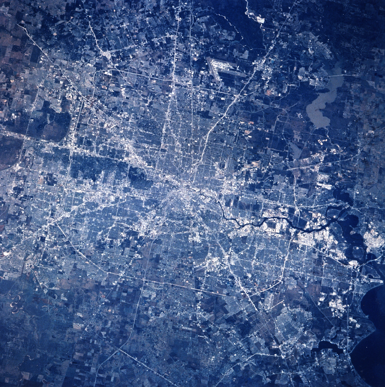
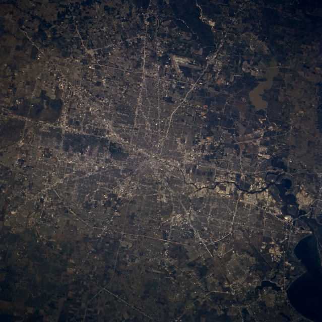
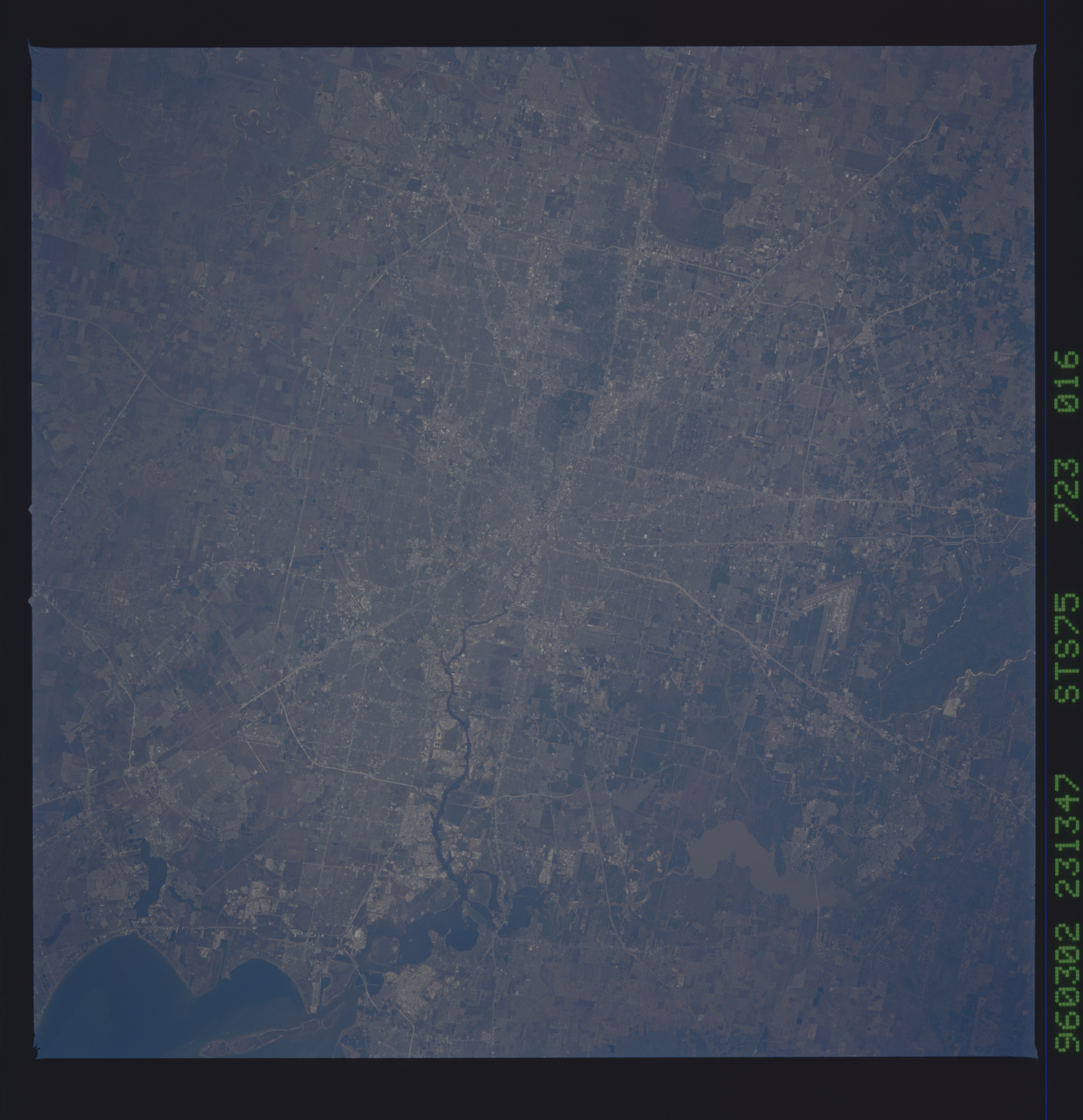
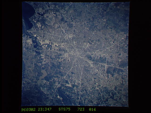
Image Caption: STS075-723-16 Houston, Texas, U.S.A. March 1996
Discernible in this north-looking, low-oblique photograph are numerous transportation arteries that radiate from metropolitan Houston, the fourth most populous city in the United States. Houston is a great financial, industrial, commercial, and medical hub and one of the world's major oil centers. Extending generally eastward from the city center is the snakelike Houston Ship Channel, along which is located one of the world's greatest concentrations of petrochemical and oil refinery industries. The Port of Houston is the third-busiest port in the United States. Metropolitan Houston, with numerous active faults crisscrossing the city, rests on the United States' third largest aquifer and the flat surface of the gulf coastal plain, a giant wedge of mud and sand deposited into the Gulf of Mexico during the last ice age by ancestral Texas rivers. Visible are the runways of George Bush Intercontinental Airport north of the city; sediment-laden Lake Houston to the east; and a small portion of Galveston Bay to the south.
Discernible in this north-looking, low-oblique photograph are numerous transportation arteries that radiate from metropolitan Houston, the fourth most populous city in the United States. Houston is a great financial, industrial, commercial, and medical hub and one of the world's major oil centers. Extending generally eastward from the city center is the snakelike Houston Ship Channel, along which is located one of the world's greatest concentrations of petrochemical and oil refinery industries. The Port of Houston is the third-busiest port in the United States. Metropolitan Houston, with numerous active faults crisscrossing the city, rests on the United States' third largest aquifer and the flat surface of the gulf coastal plain, a giant wedge of mud and sand deposited into the Gulf of Mexico during the last ice age by ancestral Texas rivers. Visible are the runways of George Bush Intercontinental Airport north of the city; sediment-laden Lake Houston to the east; and a small portion of Galveston Bay to the south.
