STS075-723-15
| NASA Photo ID | STS075-723-15 |
| Focal Length | 250mm |
| Date taken | 1996.__.__ |
| Time taken | GMT |
Resolutions offered for this image:
3936 x 3904 pixels 639 x 634 pixels 5700 x 5900 pixels 500 x 518 pixels 640 x 480 pixels
3936 x 3904 pixels 639 x 634 pixels 5700 x 5900 pixels 500 x 518 pixels 640 x 480 pixels

Cloud masks available for this image:
Spacecraft nadir point:
Photo center point: 28.0° N, 97.0° W
Photo center point by machine learning:
Photo center point: 28.0° N, 97.0° W
Photo center point by machine learning:
Nadir to Photo Center: Northwest
Spacecraft Altitude: nautical miles (0km)
Country or Geographic Name: | USA-TEXAS |
Features: | ROCKPORT, COPANO BAY, COAST |
| Features Found Using Machine Learning: | |
Cloud Cover Percentage: | 0 (no clouds present) |
Sun Elevation Angle: | ° |
Sun Azimuth: | ° |
Camera: | Hasselblad |
Focal Length: | 250mm |
Camera Tilt: | Low Oblique |
Format: | 5046: Kodak, natural color positive, Lumiere 100/5046, ASA 100, standard base |
Film Exposure: | Normal |
| Additional Information | |
| Width | Height | Annotated | Cropped | Purpose | Links |
|---|---|---|---|---|---|
| 3936 pixels | 3904 pixels | No | No | Earth From Space collection | Download Image |
| 639 pixels | 634 pixels | No | No | Earth From Space collection | Download Image |
| 5700 pixels | 5900 pixels | No | No | Download Image | |
| 500 pixels | 518 pixels | No | No | Download Image | |
| 640 pixels | 480 pixels | No | No | Download Image |
Download Packaged File
Download a Google Earth KML for this Image
View photo footprint information
Download a GeoTIFF for this photo
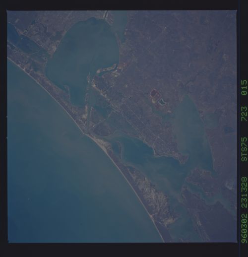
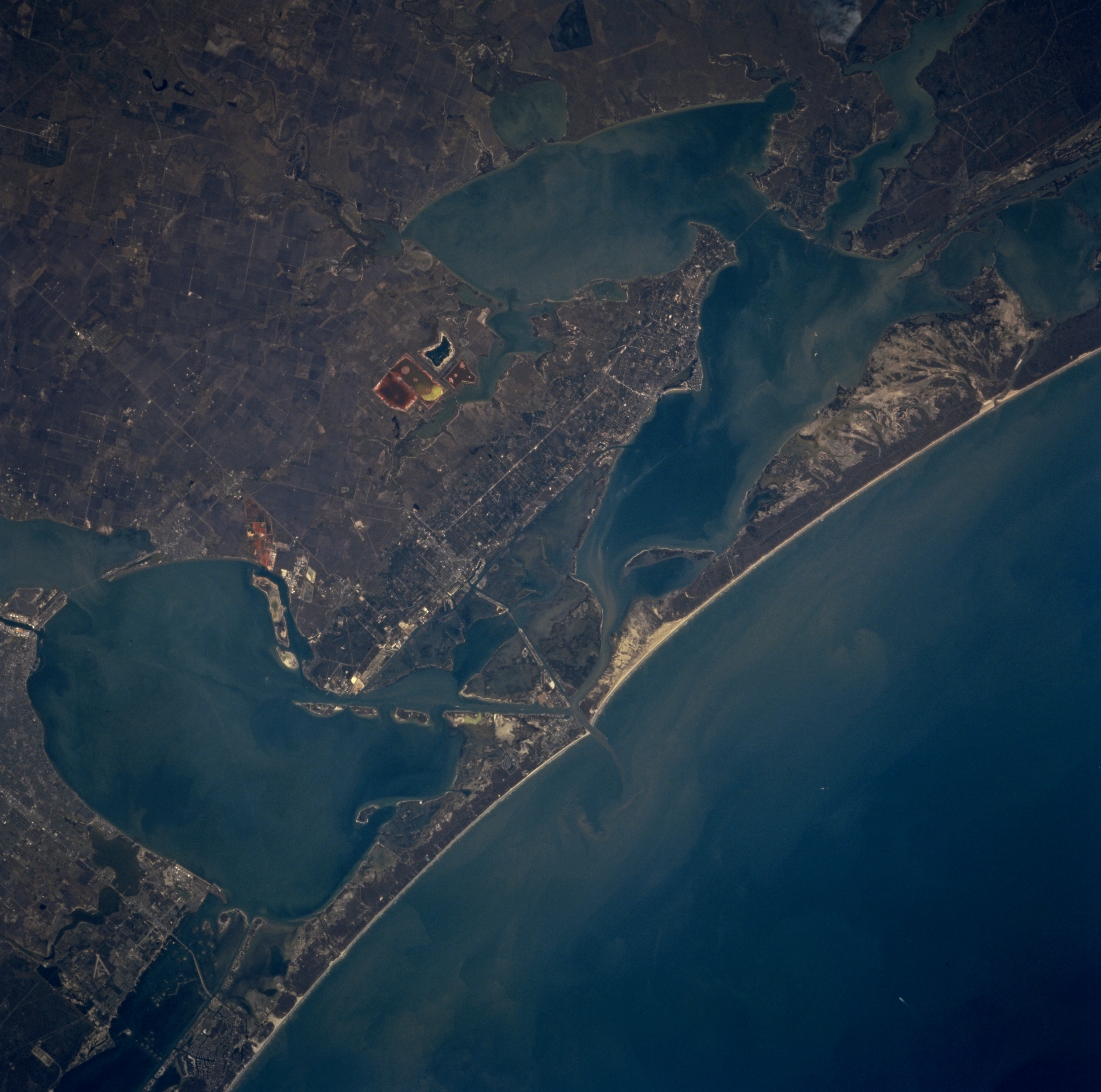
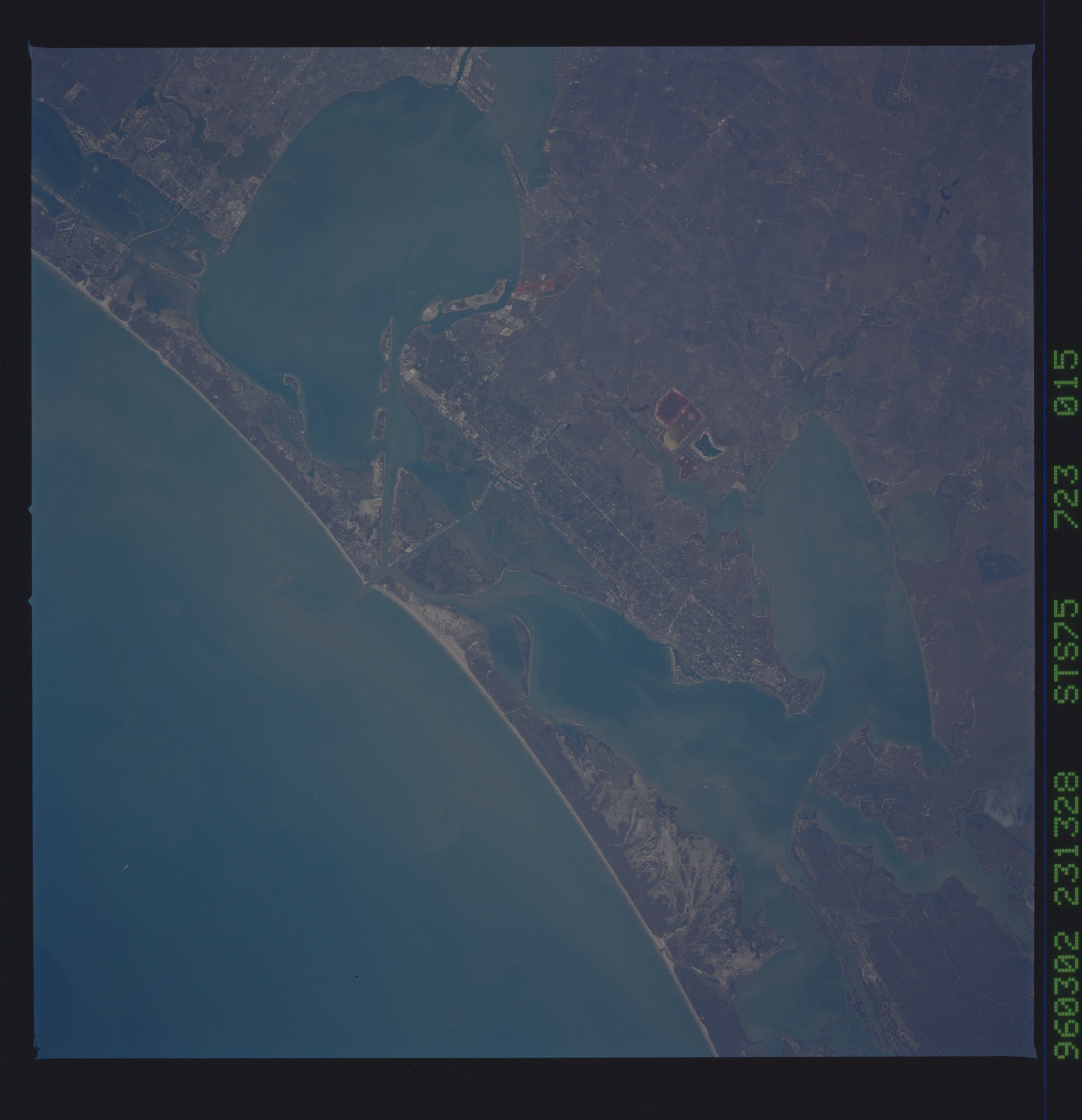
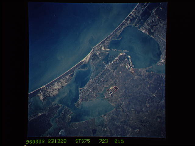
Image Caption: STS075-723-015 Corpus Christi, Aransas Pass, Aransas Bay, and Copano Bay, Texas, U.S.A. March 1996
The coastal area northeast of Corpus Christi is featured in this north-northwest-looking, low-oblique photograph. Apparent are many shallow, sediment-laden bays, some only 3 to 4 feet (1 meter) deep, that are former river mouths inundated by rising sea levels since the last ice age. The bays are rich in marine life and host large populations of winter birds that descend yearly on Aransas National Wildlife Refuge (upper right). The exquisite whopping cranes, which are gradually fighting their way back from extinction, winter at the refuge. Viewing in a northeast arc from Corpus Christi Bay (bottom left) are Copano Bay, Aransas Bay, and Saint Charles Bay. Discernible south to north are the barrier islands of Mustang, east of Corpus Christi; Saint Joseph; and extreme western Matagorda. The Gulf of Mexico is apparent.
The coastal area northeast of Corpus Christi is featured in this north-northwest-looking, low-oblique photograph. Apparent are many shallow, sediment-laden bays, some only 3 to 4 feet (1 meter) deep, that are former river mouths inundated by rising sea levels since the last ice age. The bays are rich in marine life and host large populations of winter birds that descend yearly on Aransas National Wildlife Refuge (upper right). The exquisite whopping cranes, which are gradually fighting their way back from extinction, winter at the refuge. Viewing in a northeast arc from Corpus Christi Bay (bottom left) are Copano Bay, Aransas Bay, and Saint Charles Bay. Discernible south to north are the barrier islands of Mustang, east of Corpus Christi; Saint Joseph; and extreme western Matagorda. The Gulf of Mexico is apparent.
