STS074-714-3
| NASA Photo ID | STS074-714-3 |
| Focal Length | 250mm |
| Date taken | 1995.11.12 |
| Time taken | 18:50:48 GMT |
Resolutions offered for this image:
3840 x 3936 pixels 624 x 639 pixels 5700 x 5900 pixels 500 x 518 pixels 640 x 480 pixels
3840 x 3936 pixels 624 x 639 pixels 5700 x 5900 pixels 500 x 518 pixels 640 x 480 pixels

Cloud masks available for this image:
Spacecraft nadir point: 51.8° N, 114.0° W
Photo center point: 51.0° N, 114.0° W
Photo center point by machine learning:
Photo center point: 51.0° N, 114.0° W
Photo center point by machine learning:
Nadir to Photo Center: South
Spacecraft Altitude: 169 nautical miles (313km)
Camera: | Hasselblad |
Focal Length: | 250mm |
Camera Tilt: | 16 degrees |
Format: | 5046: Kodak, natural color positive, Lumiere 100/5046, ASA 100, standard base |
Film Exposure: | Normal |
| Additional Information | |
| Width | Height | Annotated | Cropped | Purpose | Links |
|---|---|---|---|---|---|
| 3840 pixels | 3936 pixels | No | No | Earth From Space collection | Download Image |
| 624 pixels | 639 pixels | No | No | Earth From Space collection | Download Image |
| 5700 pixels | 5900 pixels | No | No | Download Image | |
| 500 pixels | 518 pixels | No | No | Download Image | |
| 640 pixels | 480 pixels | No | No | Download Image |
Download Packaged File
Download a Google Earth KML for this Image
View photo footprint information
Download a GeoTIFF for this photo
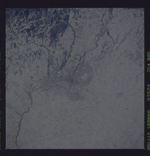
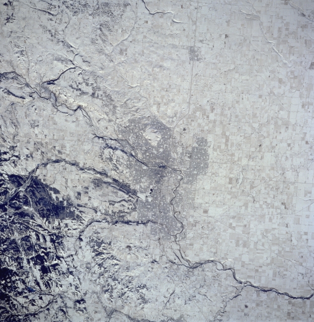
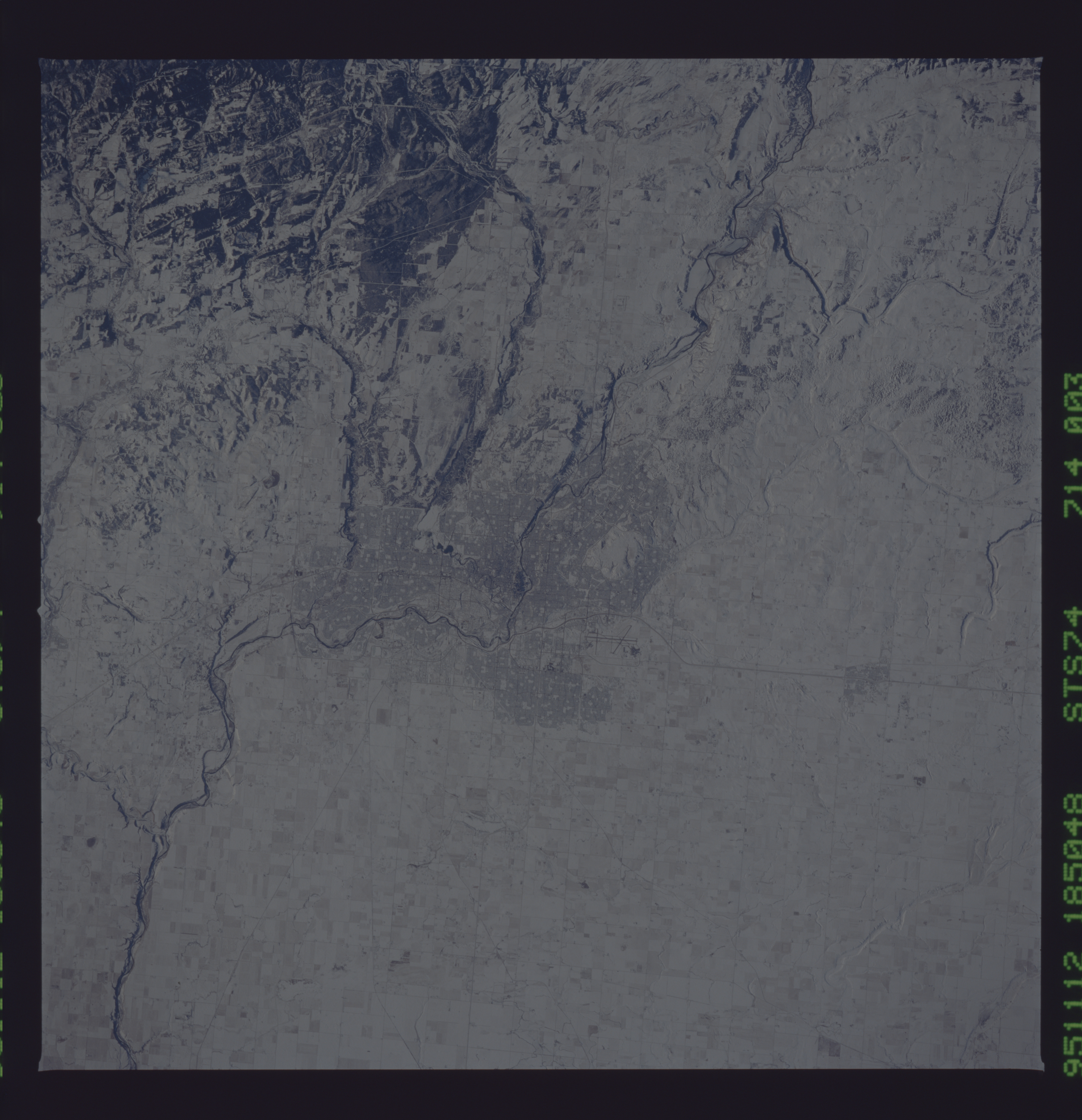
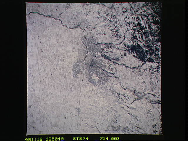
Image Caption: STS074-714-003 Calgary Area, Alberta, Canada November 1995
The snow covered landscape surrounding Calgary makes this image look like a black and white picture and helps to identify the Bow River, running diagonally from northwest to southeast through downtown Calgary. Two tributaries of the Bow River that originate in the foothills of the Canadian Rocky Mountains are accentuated as they flow out of the darker, hilly area southwest of the city. Highway 2 (thin, dark, linear feature) bypasses Calgary International Airport to its west, and north of the darker, central business district of Calgary. Then the highway heads north through the small community of Airdrie, on its way to the city of Edmonton (not in this scene).
The snow covered landscape surrounding Calgary makes this image look like a black and white picture and helps to identify the Bow River, running diagonally from northwest to southeast through downtown Calgary. Two tributaries of the Bow River that originate in the foothills of the Canadian Rocky Mountains are accentuated as they flow out of the darker, hilly area southwest of the city. Highway 2 (thin, dark, linear feature) bypasses Calgary International Airport to its west, and north of the darker, central business district of Calgary. Then the highway heads north through the small community of Airdrie, on its way to the city of Edmonton (not in this scene).
