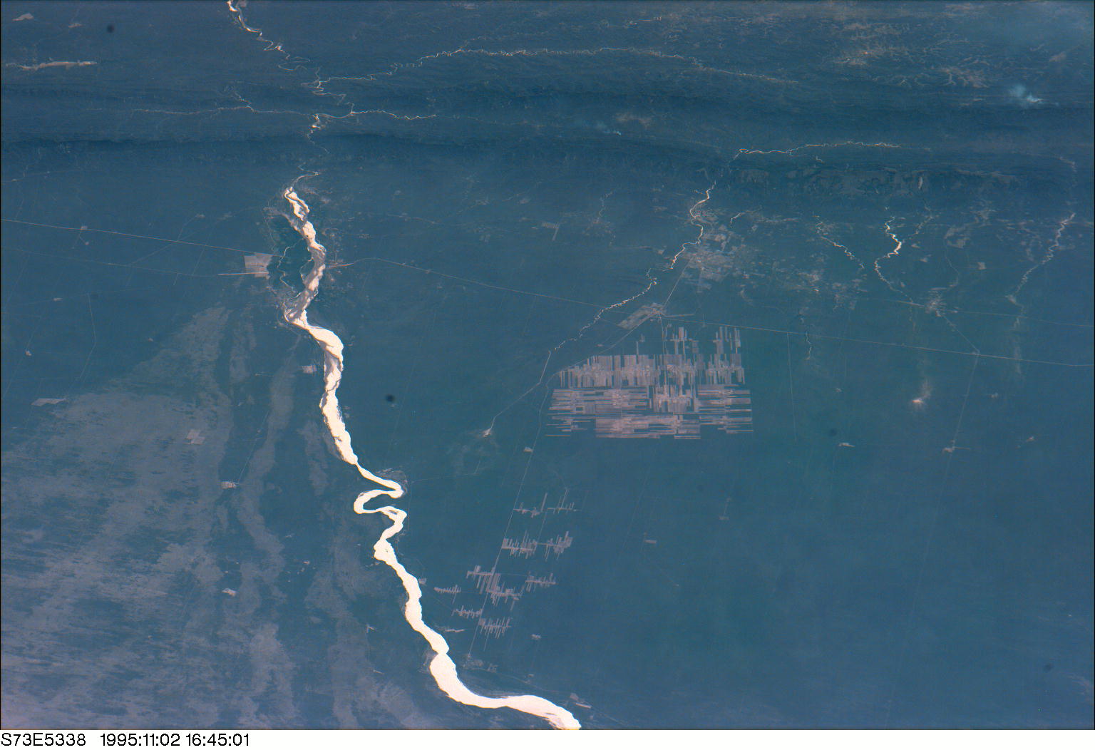
STS073-E-5338
| NASA Photo ID | STS073-E-5338 |
| Focal Length | mm |
| Date taken | 1995.11.02 |
| Time taken | 16:45:01 GMT |
Resolutions offered for this image:
1000 x 665 pixels 540 x 359 pixels 720 x 480 pixels 3060 x 2036 pixels 1536 x 1052 pixels 640 x 425 pixels
1000 x 665 pixels 540 x 359 pixels 720 x 480 pixels 3060 x 2036 pixels 1536 x 1052 pixels 640 x 425 pixels


Cloud masks available for this image:
Spacecraft nadir point: 25.1° S, 50.2° W
Photo center point: 20.0° S, 63.0° W
Photo center point by machine learning:
Photo center point: 20.0° S, 63.0° W
Photo center point by machine learning:
Nadir to Photo Center: West
Spacecraft Altitude: 145 nautical miles (269km)
Country or Geographic Name: | BOLIVIA |
Features: | RIO PARAPETI, AGR., MTS. |
| Features Found Using Machine Learning: | |
Cloud Cover Percentage: | 10 (1-10)% |
Sun Elevation Angle: | 64° |
Sun Azimuth: | 289° |
Camera: | Kodak DCS460 Electronic Still Camera |
Focal Length: | mm |
Camera Tilt: | High Oblique |
Format: | 3060E: 3060 x 2036 pixel CCD, RGBG array |
Film Exposure: | |
| Additional Information | |
| Width | Height | Annotated | Cropped | Purpose | Links |
|---|---|---|---|---|---|
| 1000 pixels | 665 pixels | No | Yes | Earth From Space collection | Download Image |
| 540 pixels | 359 pixels | No | Yes | Earth From Space collection | Download Image |
| 720 pixels | 480 pixels | Yes | No | NASA's Earth Observatory web site | Download Image |
| 3060 pixels | 2036 pixels | No | No | Download Image | |
| 1536 pixels | 1052 pixels | No | No | Download Image | |
| 640 pixels | 425 pixels | No | No | Download Image |
Download Packaged File
Download a Google Earth KML for this Image
View photo footprint information
Download a GeoTIFF for this photo
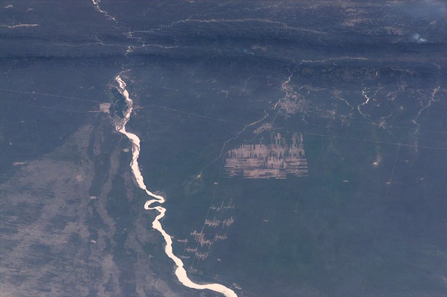
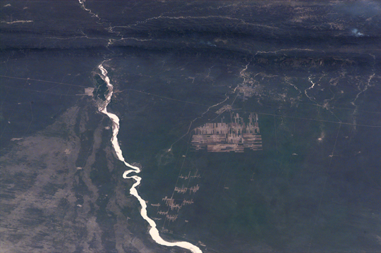
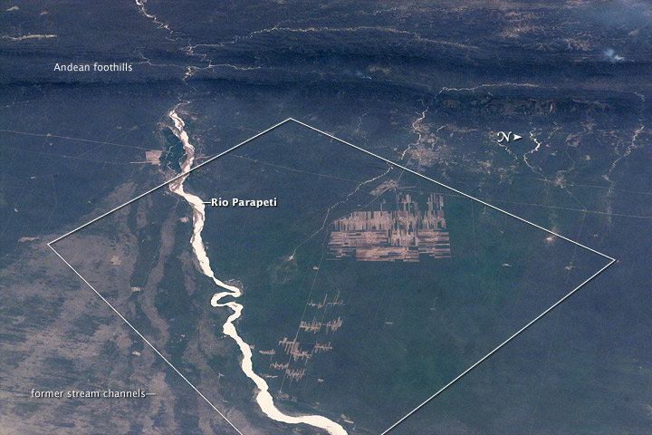
Image Caption: Progressive Forest Clearing, Bolivia
The eastern half of Bolivia is covered with tropical rainforest. In the 1990s, Bolivia initiated a large-scale effort to increase the rate of logging and create tracts of land for commercial agriculture (primarily soy and sugar cane, but also coca) on the Amazon Basin side of the Andean highlands. Today, the commercial fields are well-established and easily mapped from space as large, rectangular clearings in the forest. The agricultural developments are still growing today.
The clearings start off as small rectangles arranged perpendicular to an access road; early clearings take on a herring-bone pattern when viewed from above. The uncleared (dark forest) areas are gradually logged and cultivated, filling in the pattern to make a larger cleared area. This image, a wide panorama view looking toward the west and the Andean foothills, was taken from the Space Shuttle in November 1995. The clearing efforts were just getting underway, evidenced by the crosshatched and herring-bone pattern of clearing north of the river. On the south side of the river, old, abandoned river stream channels show up as lighter regions with lesser forest cover.
