STS073-753-17
| NASA Photo ID | STS073-753-17 |
| Focal Length | 250mm |
| Date taken | 1995.11.01 |
| Time taken | 06:22:17 GMT |
Resolutions offered for this image:
3904 x 3936 pixels 634 x 639 pixels 5700 x 5900 pixels 500 x 518 pixels 640 x 480 pixels
3904 x 3936 pixels 634 x 639 pixels 5700 x 5900 pixels 500 x 518 pixels 640 x 480 pixels


Cloud masks available for this image:
Spacecraft nadir point: 22.9° S, 112.7° E
Photo center point: 22.5° S, 114.5° E
Photo center point by machine learning:
Photo center point: 22.5° S, 114.5° E
Photo center point by machine learning:
Nadir to Photo Center: East
Spacecraft Altitude: 145 nautical miles (269km)
Country or Geographic Name: | AUSTRALIA-WA |
Features: | EXMOUTH GULF, SED., DESERT |
| Features Found Using Machine Learning: | |
Cloud Cover Percentage: | 5 (1-10)% |
Sun Elevation Angle: | 58° |
Sun Azimuth: | 280° |
Camera: | Hasselblad |
Focal Length: | 250mm |
Camera Tilt: | 37 degrees |
Format: | 5046: Kodak, natural color positive, Lumiere 100/5046, ASA 100, standard base |
Film Exposure: | Normal |
| Additional Information | |
| Width | Height | Annotated | Cropped | Purpose | Links |
|---|---|---|---|---|---|
| 3904 pixels | 3936 pixels | No | No | Earth From Space collection | Download Image |
| 634 pixels | 639 pixels | No | No | Earth From Space collection | Download Image |
| 5700 pixels | 5900 pixels | No | No | Download Image | |
| 500 pixels | 518 pixels | No | No | Download Image | |
| 640 pixels | 480 pixels | No | No | Download Image |
Download Packaged File
Download a Google Earth KML for this Image
View photo footprint information
Download a GeoTIFF for this photo
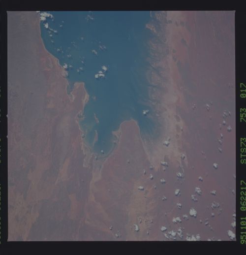
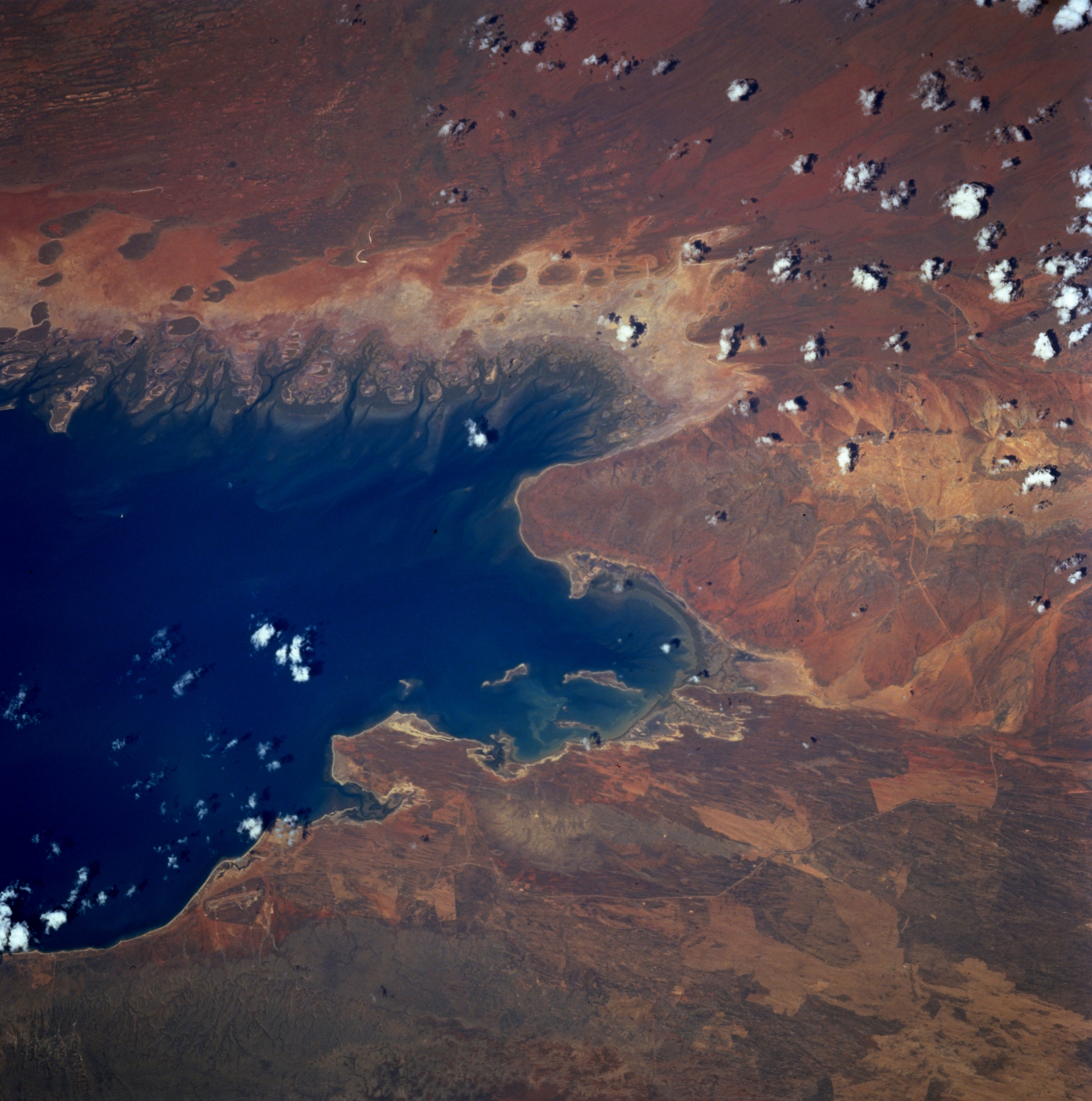
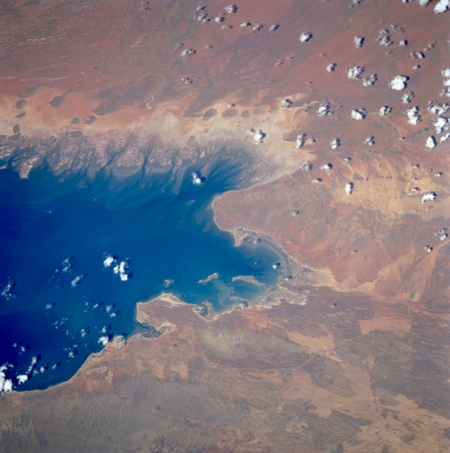
Image Caption: STS073-753-017 Exmouth Gulf, Western Australia, Australia October 1995
The southern half of Exmouth Gulf, located along the northwest coast of Western Australia, is dominated by a wide coastal tidal flat that floods during heavy rains. The darker terrain immediately along the southeast to east coast of Exmouth Gulf (and the water's edge) shows an area where mangrove trees are located. The darker, generally oval-shaped features inland (east of) from the swath of mangrove are elevated above the coastal plain. Centipede Hill forms part of the large peninsula that projects northward (center of image) from the southern end of Exmouth Gulf. The irregular shaped, lighter colored areas near the bottom of the image appear to be fire scars, usually caused by a lightening strike in this grassy environment. Refer to STS073-753-018, which covers the same general area, except this picture covers a little more terrain further north.
The southern half of Exmouth Gulf, located along the northwest coast of Western Australia, is dominated by a wide coastal tidal flat that floods during heavy rains. The darker terrain immediately along the southeast to east coast of Exmouth Gulf (and the water's edge) shows an area where mangrove trees are located. The darker, generally oval-shaped features inland (east of) from the swath of mangrove are elevated above the coastal plain. Centipede Hill forms part of the large peninsula that projects northward (center of image) from the southern end of Exmouth Gulf. The irregular shaped, lighter colored areas near the bottom of the image appear to be fire scars, usually caused by a lightening strike in this grassy environment. Refer to STS073-753-018, which covers the same general area, except this picture covers a little more terrain further north.
