STS073-750-32
| NASA Photo ID | STS073-750-32 |
| Focal Length | 250mm |
| Date taken | 1995.10.25 |
| Time taken | 16:59:13 GMT |
Resolutions offered for this image:
3936 x 3904 pixels 639 x 634 pixels 5700 x 5900 pixels 500 x 518 pixels 640 x 480 pixels 960 x 949 pixels
3936 x 3904 pixels 639 x 634 pixels 5700 x 5900 pixels 500 x 518 pixels 640 x 480 pixels 960 x 949 pixels

Cloud masks available for this image:
Spacecraft nadir point: 32.5° N, 78.8° W
Photo center point: 33.0° N, 80.0° W
Photo center point by machine learning:
Photo center point: 33.0° N, 80.0° W
Photo center point by machine learning:
Nadir to Photo Center: West
Spacecraft Altitude: 145 nautical miles (269km)
Country or Geographic Name: | USA-SOUTH CAROLINA |
Features: | CHARLESTON, RIVERS, MARSH |
| Features Found Using Machine Learning: | |
Cloud Cover Percentage: | 20 (11-25)% |
Sun Elevation Angle: | 46° |
Sun Azimuth: | 180° |
Camera: | Hasselblad |
Focal Length: | 250mm |
Camera Tilt: | 28 degrees |
Format: | 2443: Kodak Aerochrome 2443, color IR, thin base, EA-5 process thru June 1999, E-6 process afterward |
Film Exposure: | Normal |
| Additional Information | |
| Width | Height | Annotated | Cropped | Purpose | Links |
|---|---|---|---|---|---|
| 3936 pixels | 3904 pixels | No | No | Earth From Space collection | Download Image |
| 639 pixels | 634 pixels | No | No | Earth From Space collection | Download Image |
| 5700 pixels | 5900 pixels | No | No | Download Image | |
| 500 pixels | 518 pixels | No | No | Download Image | |
| 640 pixels | 480 pixels | No | No | Download Image | |
| 960 pixels | 949 pixels | Yes | No | Download Image |
Download Packaged File
Download a Google Earth KML for this Image
View photo footprint information
Download a GeoTIFF for this photo
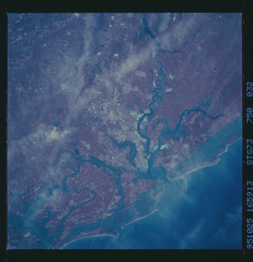
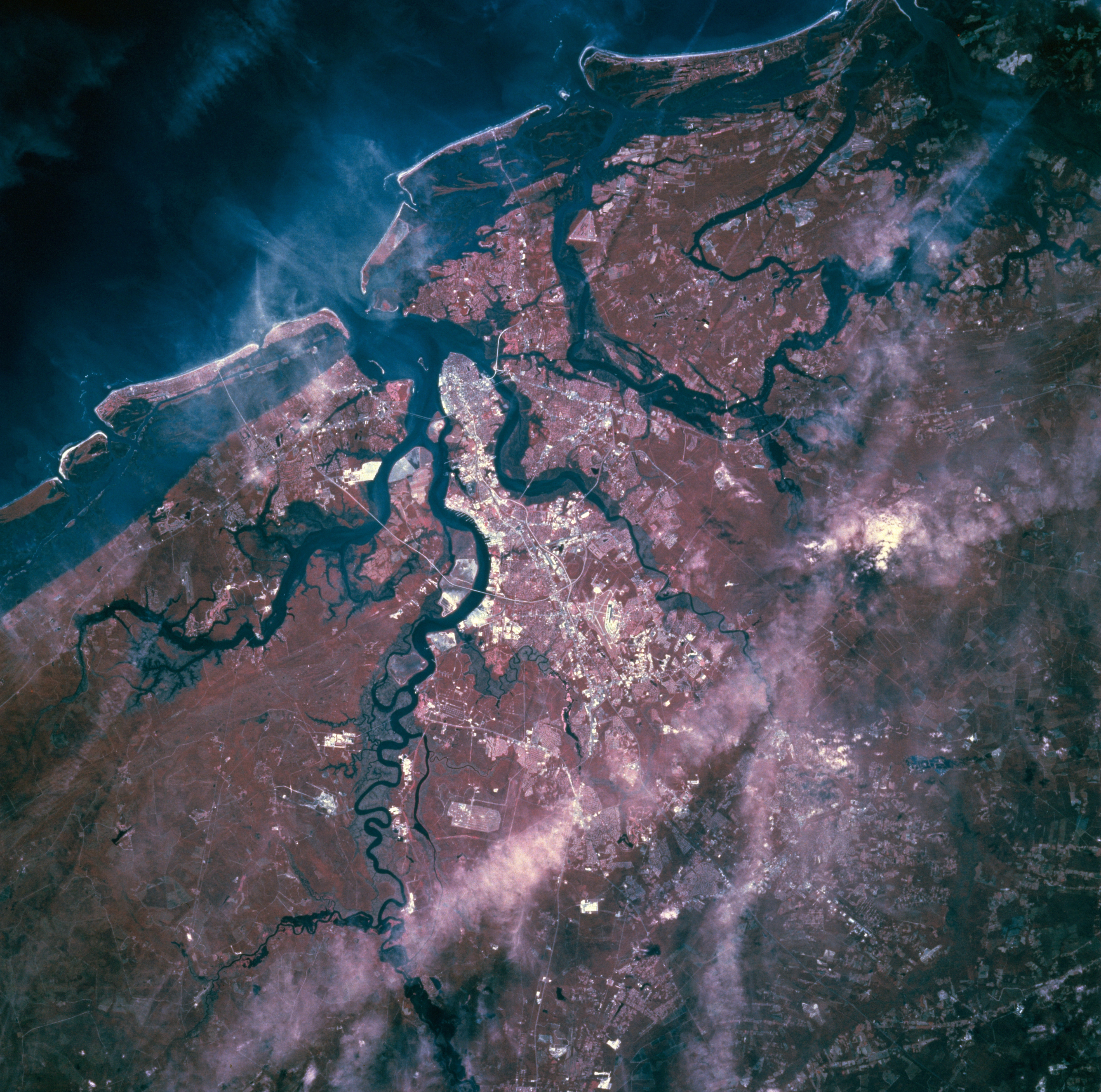
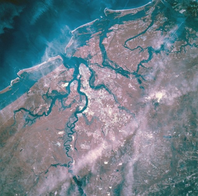
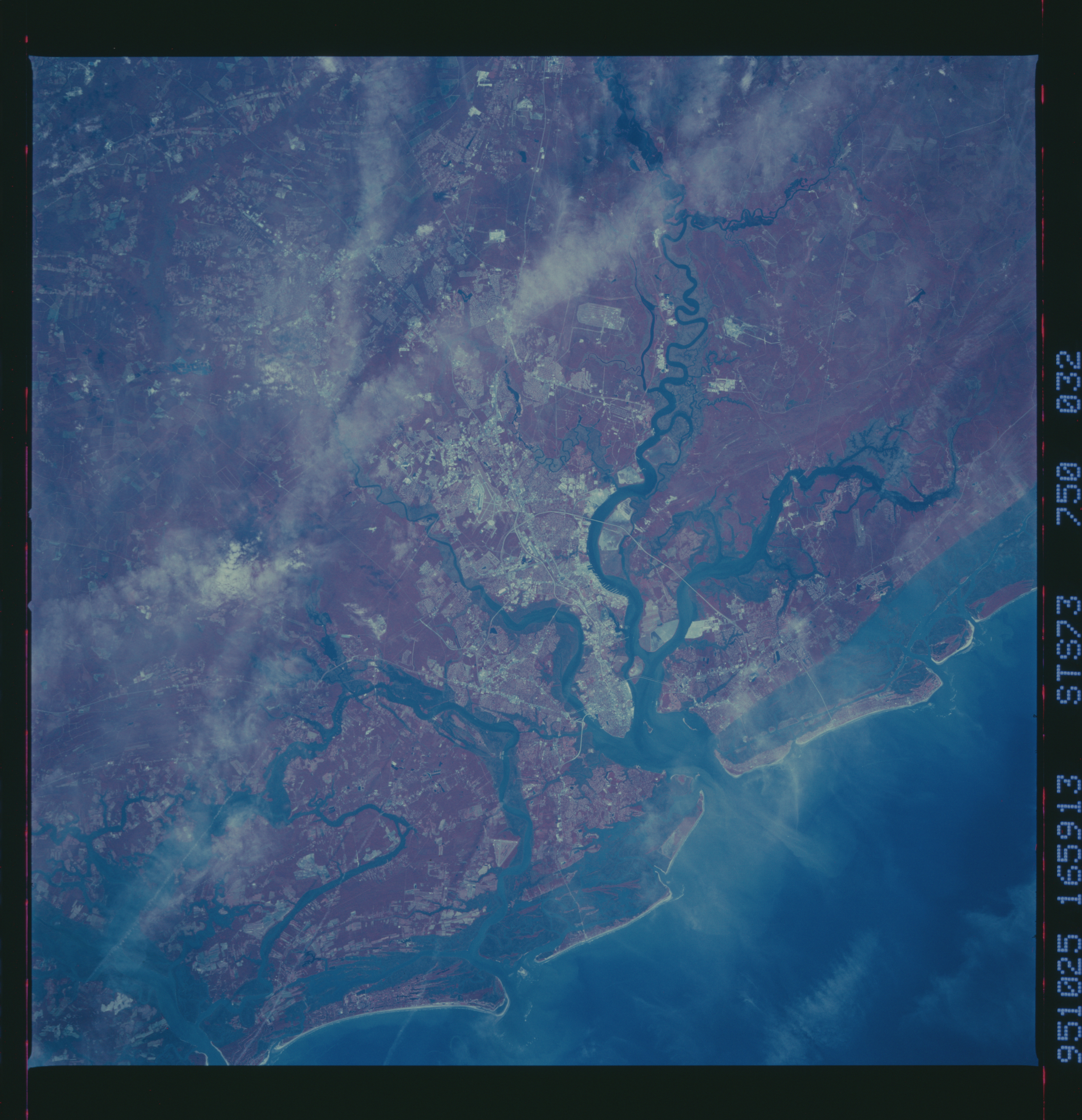
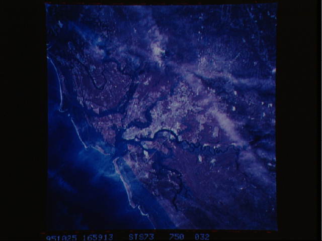
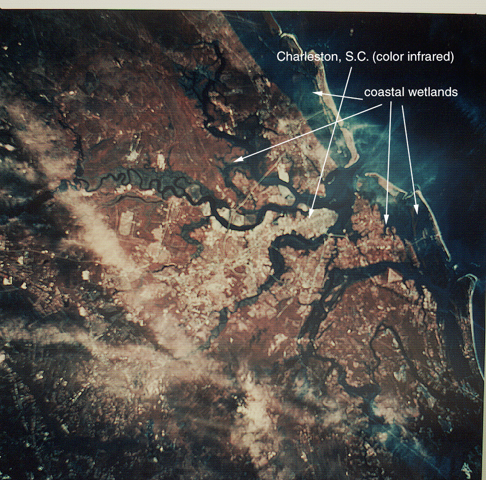
Image Caption: STS073-750-032 Charleston, South Carolina, U.S.A. October 1995
Easy differentiation between land and water forms surrounding Charleston is provided by color infrared film. Some cloud formations obscure the landscapes and waterscapes; however, the darker rivers, bays, estuaries, and Atlantic Ocean stand out in contrast to both vegetated and nonvegetated land areas. The red hues depict gradations of green vegetation, and the whitish surfaces are highways, bridges, rooftops, and commercial areas. Only two rivers are apparent--the Ashley River that forms the northwest side of the peninsula that makes up downtown Charleston and the Cooper River that creates the eastern boundary of the same peninsula that protrudes southeast into Charleston Harbor--the other waterways are part of the interconnected and complex coastal wetlands. The dense vegetation east of Cooper River is Francis Marion National Forest.
Easy differentiation between land and water forms surrounding Charleston is provided by color infrared film. Some cloud formations obscure the landscapes and waterscapes; however, the darker rivers, bays, estuaries, and Atlantic Ocean stand out in contrast to both vegetated and nonvegetated land areas. The red hues depict gradations of green vegetation, and the whitish surfaces are highways, bridges, rooftops, and commercial areas. Only two rivers are apparent--the Ashley River that forms the northwest side of the peninsula that makes up downtown Charleston and the Cooper River that creates the eastern boundary of the same peninsula that protrudes southeast into Charleston Harbor--the other waterways are part of the interconnected and complex coastal wetlands. The dense vegetation east of Cooper River is Francis Marion National Forest.
