STS073-745-55
| NASA Photo ID | STS073-745-55 |
| Focal Length | 250mm |
| Date taken | 1995.11.02 |
| Time taken | 19:25:08 GMT |
Resolutions offered for this image:
3895 x 3867 pixels 640 x 635 pixels 5700 x 5900 pixels 500 x 518 pixels 640 x 480 pixels 4030 x 4000 pixels 639 x 635 pixels
3895 x 3867 pixels 640 x 635 pixels 5700 x 5900 pixels 500 x 518 pixels 640 x 480 pixels 4030 x 4000 pixels 639 x 635 pixels

Cloud masks available for this image:
Spacecraft nadir point: 20.9° N, 154.3° W
Photo center point: 21.0° N, 157.5° W
Photo center point by machine learning:
Photo center point: 21.0° N, 157.5° W
Photo center point by machine learning:
Nadir to Photo Center: West
Spacecraft Altitude: 142 nautical miles (263km)
Camera: | Hasselblad |
Focal Length: | 250mm |
Camera Tilt: | 54 degrees |
Format: | 2443: Kodak Aerochrome 2443, color IR, thin base, EA-5 process thru June 1999, E-6 process afterward |
Film Exposure: | Normal |
| Additional Information | |
| Width | Height | Annotated | Cropped | Purpose | Links |
|---|---|---|---|---|---|
| 3895 pixels | 3867 pixels | No | No | Earth From Space collection | Download Image |
| 640 pixels | 635 pixels | No | No | Earth From Space collection | Download Image |
| 5700 pixels | 5900 pixels | No | No | Download Image | |
| 500 pixels | 518 pixels | No | No | Download Image | |
| 640 pixels | 480 pixels | No | No | Download Image | |
| 4030 pixels | 4000 pixels | Download Image | |||
| 639 pixels | 635 pixels | Download Image |
Download Packaged File
Download a Google Earth KML for this Image
View photo footprint information
Download a GeoTIFF for this photo
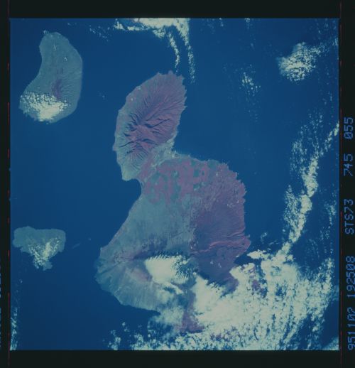
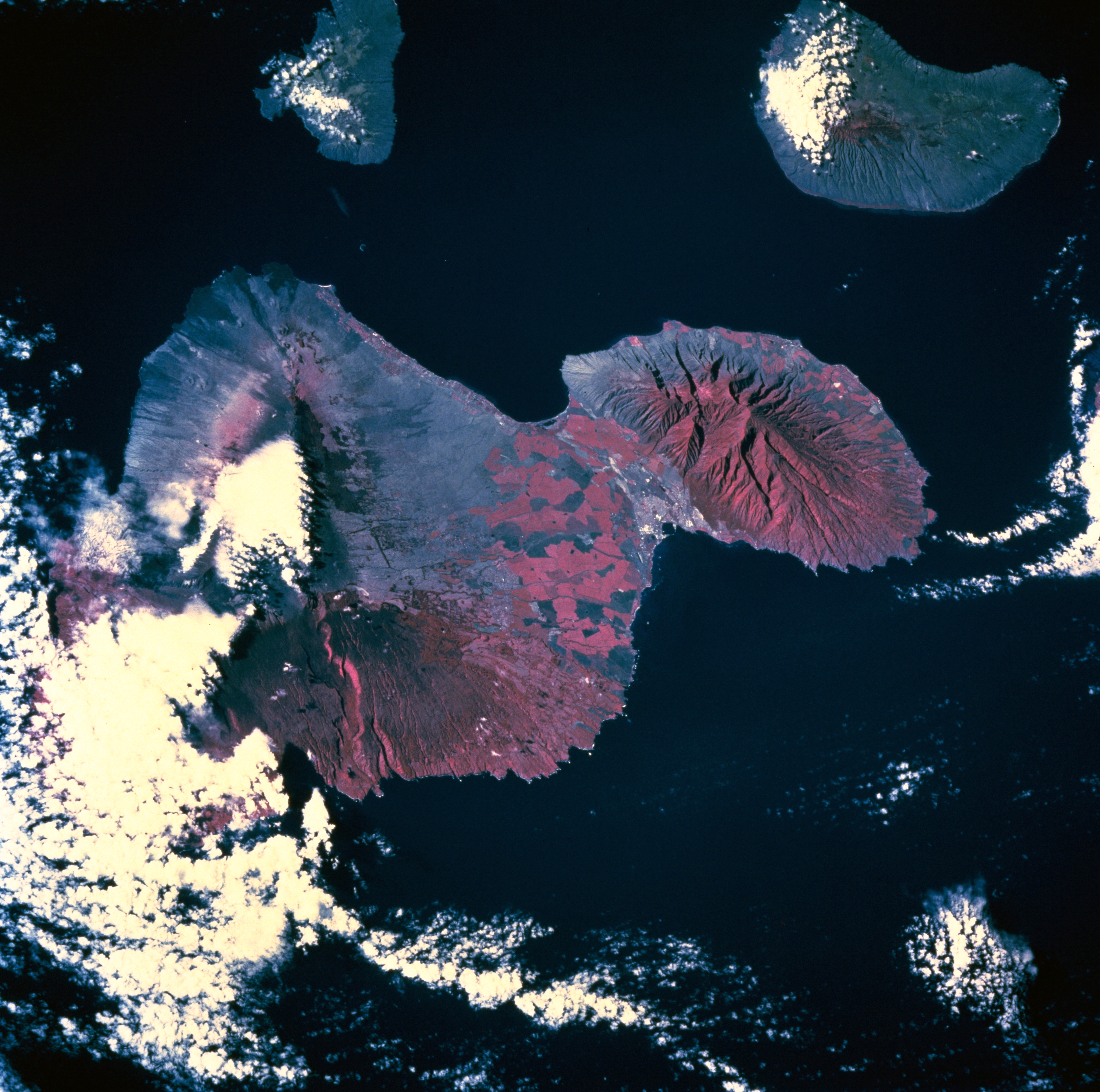
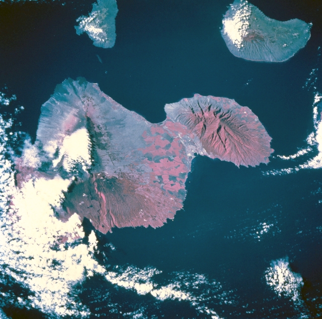
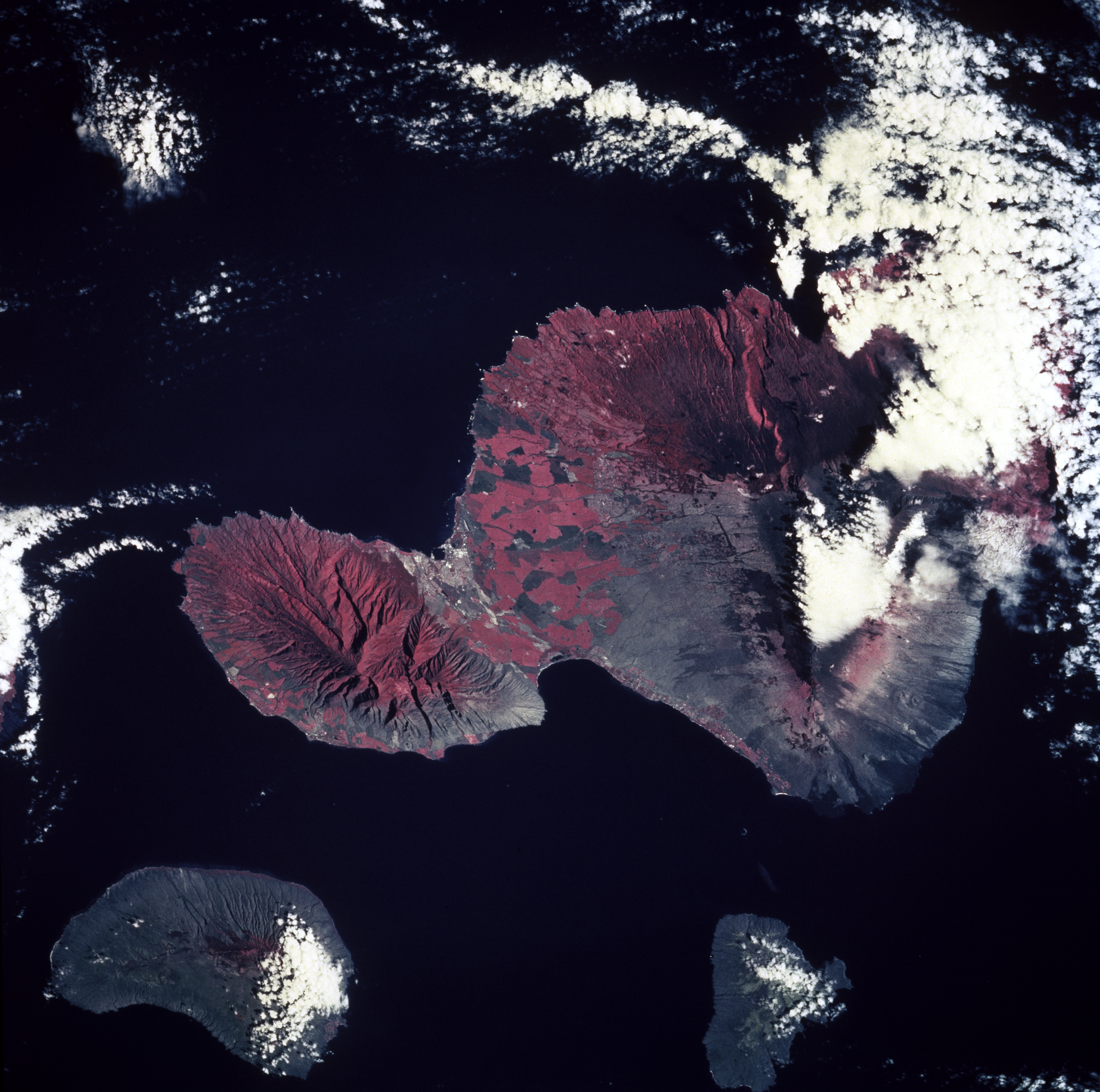
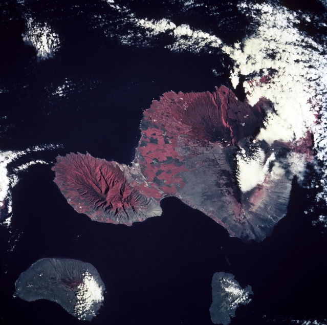
Image Caption: STS073-745-055 Maui, Hawaii, U.S.A. October 1995
This low-oblique, westward-looking photograph of southeastern Maui features two volcanic nodes at either end of the island--Puukukui [5788 feet (1764 meters)], the major landform in western Maui, and Red Hill [10 012 feet (3052 meters)], near the center of the eastern part of the island. Infrared film (with reds representing vegetation) accentuates the drainage pattern on the slopes of these large volcanoes; e.g., the deep canyon that extends eastward from Red Hill to the ocean. Apparent is a rain shadow effect (less vegetation and less red) on the drier side of Maui. Large cultivated field patterns appear between the two volcanoes. The rapidly developing urban and tourist centers of Wailuku and Kahului are visible along the north coast of the island near the base of Puukukui. The smaller islands of Kahoolawe and Lanai, to the southwest and west, respectively, are also captured in this photograph.
This low-oblique, westward-looking photograph of southeastern Maui features two volcanic nodes at either end of the island--Puukukui [5788 feet (1764 meters)], the major landform in western Maui, and Red Hill [10 012 feet (3052 meters)], near the center of the eastern part of the island. Infrared film (with reds representing vegetation) accentuates the drainage pattern on the slopes of these large volcanoes; e.g., the deep canyon that extends eastward from Red Hill to the ocean. Apparent is a rain shadow effect (less vegetation and less red) on the drier side of Maui. Large cultivated field patterns appear between the two volcanoes. The rapidly developing urban and tourist centers of Wailuku and Kahului are visible along the north coast of the island near the base of Puukukui. The smaller islands of Kahoolawe and Lanai, to the southwest and west, respectively, are also captured in this photograph.
