STS073-744-53
| NASA Photo ID | STS073-744-53 |
| Focal Length | 250mm |
| Date taken | 1995.10.27 |
| Time taken | 18:20:00 GMT |
Resolutions offered for this image:
3936 x 3872 pixels 639 x 629 pixels 5700 x 5900 pixels 500 x 518 pixels 640 x 480 pixels
3936 x 3872 pixels 639 x 629 pixels 5700 x 5900 pixels 500 x 518 pixels 640 x 480 pixels

Cloud masks available for this image:
Spacecraft nadir point: 33.3° N, 117.2° W
Photo center point: 34.0° N, 117.0° W
Photo center point by machine learning:
Photo center point: 34.0° N, 117.0° W
Photo center point by machine learning:
Nadir to Photo Center: North
Spacecraft Altitude: 144 nautical miles (267km)
Country or Geographic Name: | USA-CALIFORNIA |
Features: | SAN BERNARDINO MTS., TAIL |
| Features Found Using Machine Learning: | |
Cloud Cover Percentage: | 0 (no clouds present) |
Sun Elevation Angle: | 41° |
Sun Azimuth: | 156° |
Camera: | Hasselblad |
Focal Length: | 250mm |
Camera Tilt: | 17 degrees |
Format: | 2443: Kodak Aerochrome 2443, color IR, thin base, EA-5 process thru June 1999, E-6 process afterward |
Film Exposure: | Normal |
| Additional Information | |
| Width | Height | Annotated | Cropped | Purpose | Links |
|---|---|---|---|---|---|
| 3936 pixels | 3872 pixels | No | No | Earth From Space collection | Download Image |
| 639 pixels | 629 pixels | No | No | Earth From Space collection | Download Image |
| 5700 pixels | 5900 pixels | No | No | Download Image | |
| 500 pixels | 518 pixels | No | No | Download Image | |
| 640 pixels | 480 pixels | No | No | Download Image |
Download Packaged File
Download a Google Earth KML for this Image
View photo footprint information
Download a GeoTIFF for this photo
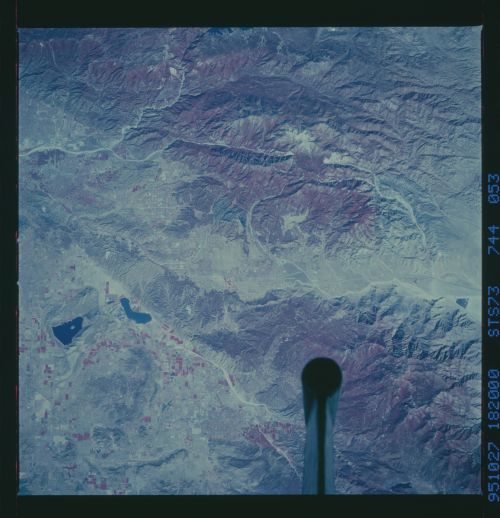
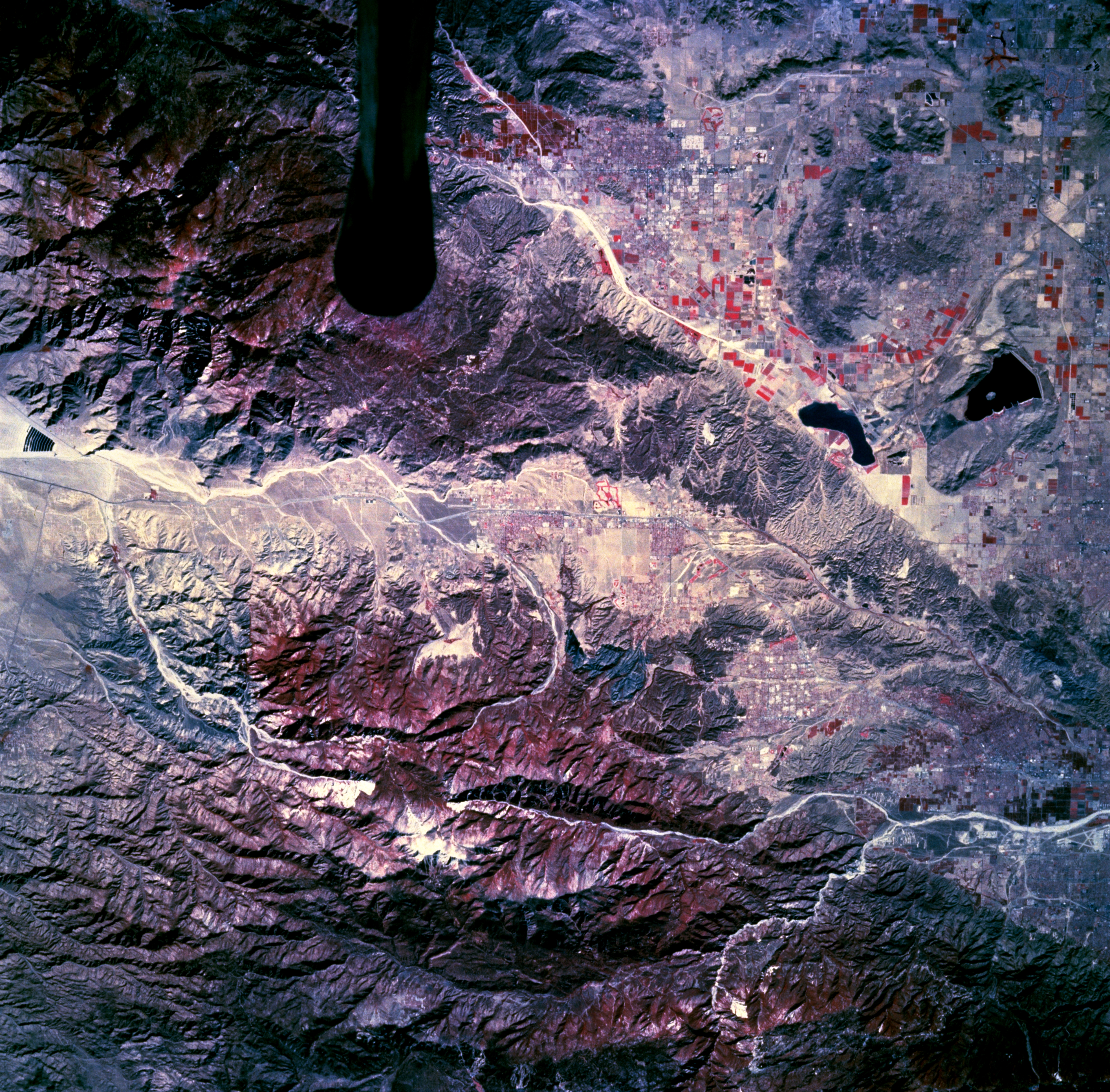
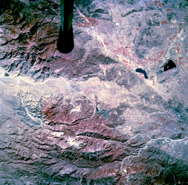
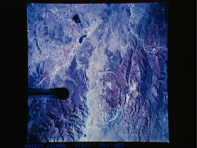
Image Caption: STS073-744-053 San Bernardino Mountains, California, U.S.A. October 1995
Rugged mountains and urban development are featured in this photograph southeast of San Bernardino. The mountain vegetation (red) along the northern edge is part of the San Bernardino Mountains and San Bernardino National Forest. Discernible are several natural and manmade features--Lake Perris, the westernmost reservoir with a small island near its center; several prominent canyons aligned in a general east-west orientation; a short section of the Santa Ana River, a highly reflective winding narrow river valley to the northwest; and cultivated field patterns near the two reservoirs. The symmetrical dark feature is the tip of the Shuttle tail.
Rugged mountains and urban development are featured in this photograph southeast of San Bernardino. The mountain vegetation (red) along the northern edge is part of the San Bernardino Mountains and San Bernardino National Forest. Discernible are several natural and manmade features--Lake Perris, the westernmost reservoir with a small island near its center; several prominent canyons aligned in a general east-west orientation; a short section of the Santa Ana River, a highly reflective winding narrow river valley to the northwest; and cultivated field patterns near the two reservoirs. The symmetrical dark feature is the tip of the Shuttle tail.
