STS073-742-47
| NASA Photo ID | STS073-742-47 |
| Focal Length | 250mm |
| Date taken | 1995.10.26 |
| Time taken | 15:18:39 GMT |
Resolutions offered for this image:
3936 x 3904 pixels 639 x 634 pixels 5700 x 5900 pixels 500 x 518 pixels 640 x 480 pixels
3936 x 3904 pixels 639 x 634 pixels 5700 x 5900 pixels 500 x 518 pixels 640 x 480 pixels
Cloud masks available for this image:
Spacecraft nadir point: 39.0° N, 93.4° W
Photo center point: 39.0° N, 94.5° W
Photo center point by machine learning:
Photo center point: 39.0° N, 94.5° W
Photo center point by machine learning:
Nadir to Photo Center: West
Spacecraft Altitude: 143 nautical miles (265km)
Country or Geographic Name: | USA-MISSOURI |
Features: | MO R., KANSAS CITY, AGRICULTURE |
| Features Found Using Machine Learning: | |
Cloud Cover Percentage: | 0 (no clouds present) |
Sun Elevation Angle: | 27° |
Sun Azimuth: | 136° |
Camera: | Hasselblad |
Focal Length: | 250mm |
Camera Tilt: | 25 degrees |
Format: | 2443: Kodak Aerochrome 2443, color IR, thin base, EA-5 process thru June 1999, E-6 process afterward |
Film Exposure: | Normal |
| Additional Information | |
| Width | Height | Annotated | Cropped | Purpose | Links |
|---|---|---|---|---|---|
| 3936 pixels | 3904 pixels | No | No | Earth From Space collection | Download Image |
| 639 pixels | 634 pixels | No | No | Earth From Space collection | Download Image |
| 5700 pixels | 5900 pixels | No | No | Download Image | |
| 500 pixels | 518 pixels | No | No | Download Image | |
| 640 pixels | 480 pixels | No | No | Download Image |
Download Packaged File
Download a Google Earth KML for this Image
View photo footprint information
Download a GeoTIFF for this photo
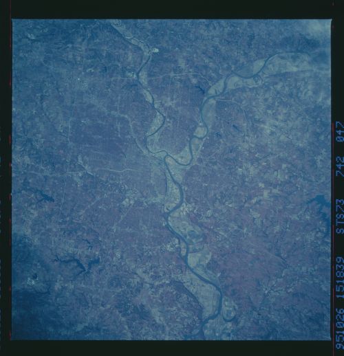
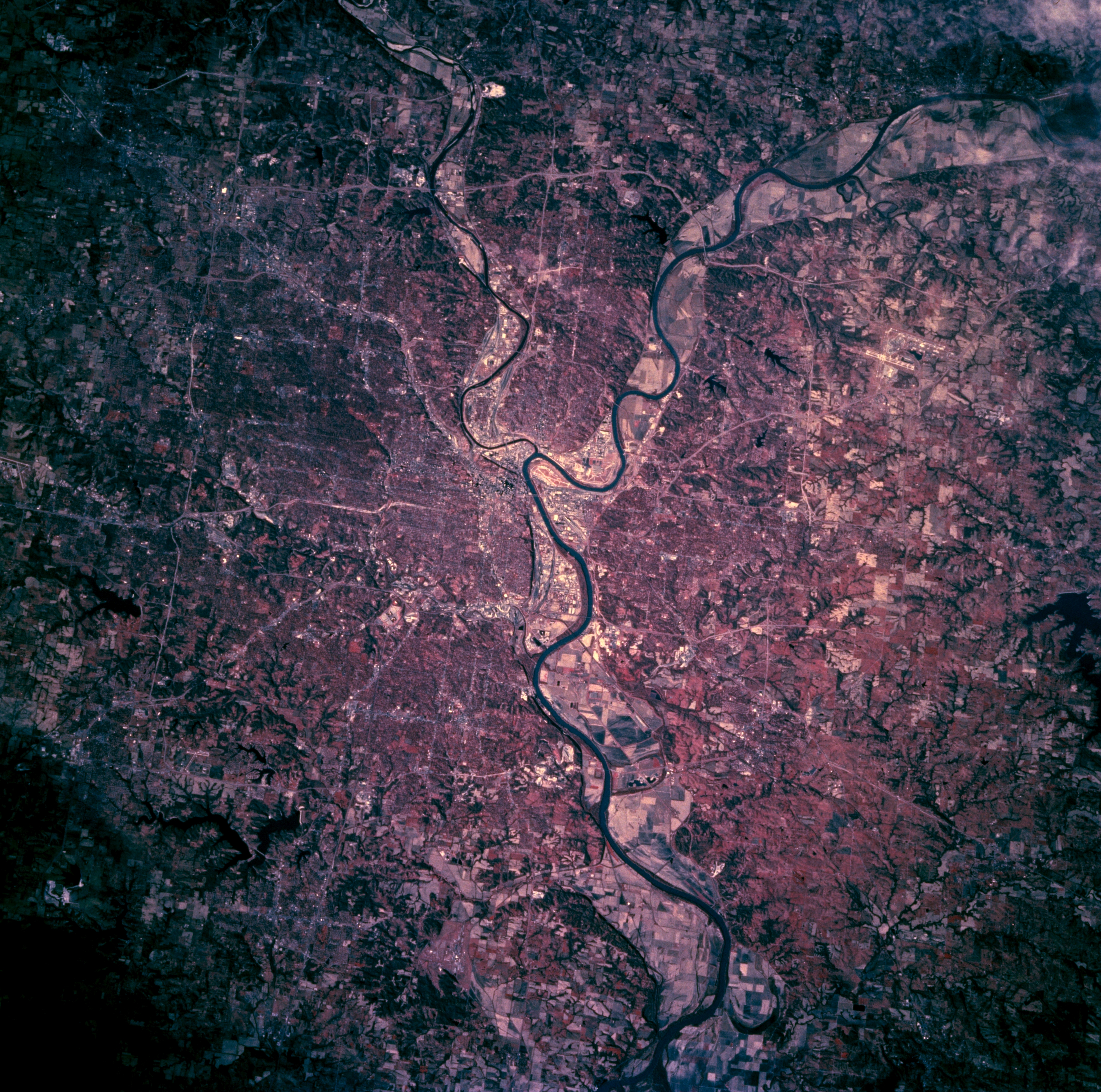
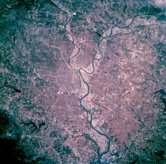
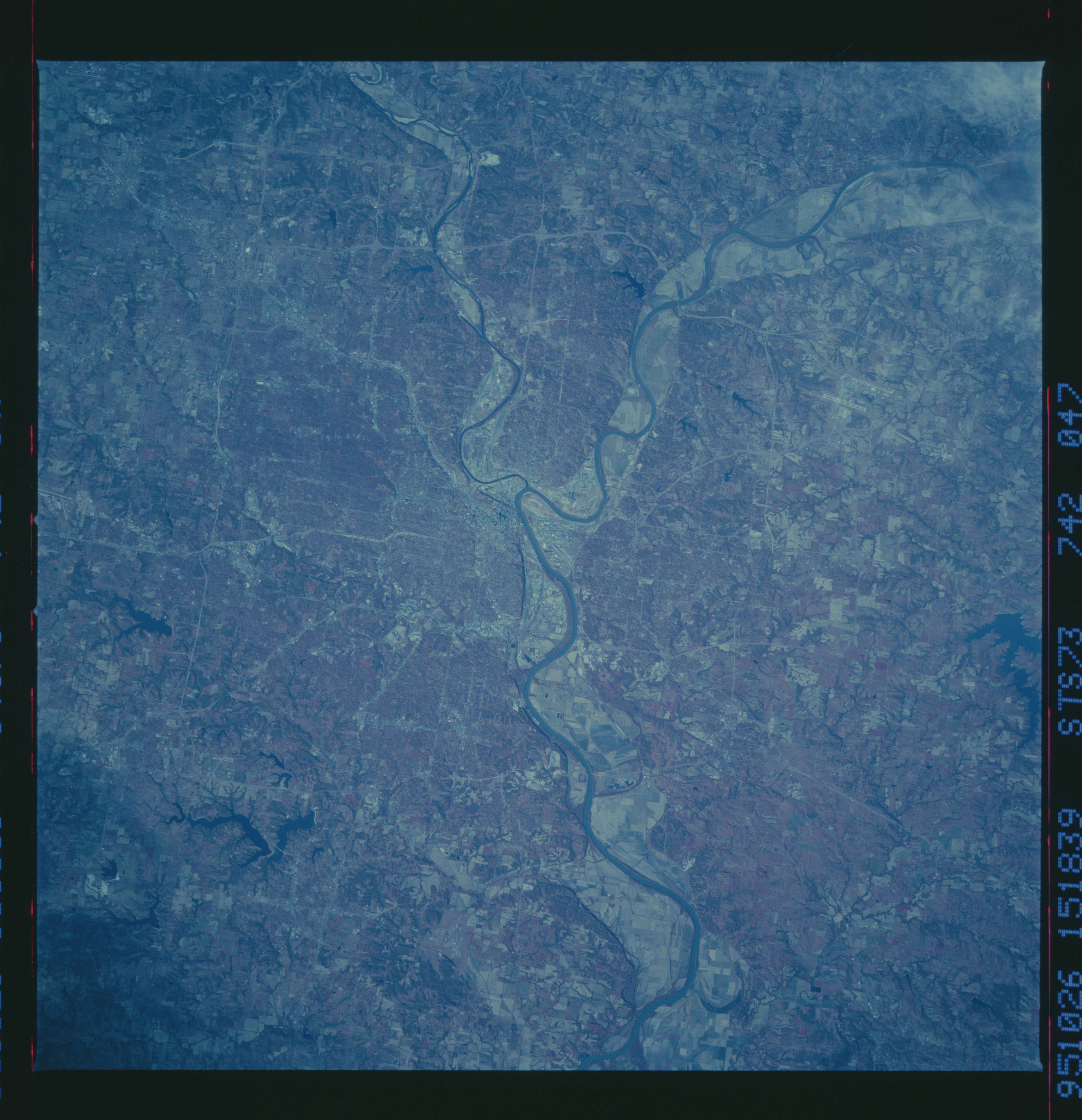
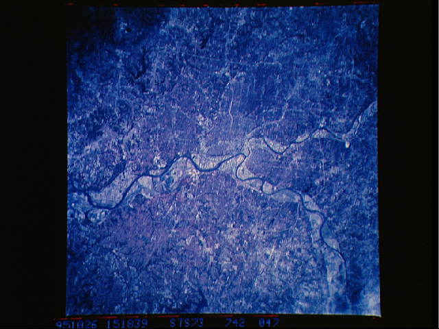
Image Caption: STS073-742-047 Kansas City, Missouri, U.S.A. October 1995
Kansas City, the second largest city in the state, is featured in this west-looking, low-oblique, color infrared photograph. The Missouri and Kansas Rivers travel eastward from the northwest and west, respectively. Kansas City is a major commercial, industrial, and transportation center in a rich agriculture and livestock producing area. The vivid reds identify many trees throughout the city. Agricultural field patterns are again discernible in the river floodplain following the devastating floods of 1993.
Kansas City, the second largest city in the state, is featured in this west-looking, low-oblique, color infrared photograph. The Missouri and Kansas Rivers travel eastward from the northwest and west, respectively. Kansas City is a major commercial, industrial, and transportation center in a rich agriculture and livestock producing area. The vivid reds identify many trees throughout the city. Agricultural field patterns are again discernible in the river floodplain following the devastating floods of 1993.
