STS073-741-66
| NASA Photo ID | STS073-741-66 |
| Focal Length | 250mm |
| Date taken | 1995.10.24 |
| Time taken | 13:53:12 GMT |
Resolutions offered for this image:
794 x 781 pixels 3936 x 3936 pixels 639 x 639 pixels 5700 x 5900 pixels 500 x 518 pixels 640 x 480 pixels
794 x 781 pixels 3936 x 3936 pixels 639 x 639 pixels 5700 x 5900 pixels 500 x 518 pixels 640 x 480 pixels
Cloud masks available for this image:
Spacecraft nadir point: 38.5° N, 74.3° W
Photo center point: 40.0° N, 75.0° W
Photo center point by machine learning:
Photo center point: 40.0° N, 75.0° W
Photo center point by machine learning:
Nadir to Photo Center: North
Spacecraft Altitude: 144 nautical miles (267km)
Country or Geographic Name: | USA-NEW JERSEY |
Features: | DE R., AGR., PHILADELPHIA |
| Features Found Using Machine Learning: | |
Cloud Cover Percentage: | 15 (11-25)% |
Sun Elevation Angle: | 26° |
Sun Azimuth: | 133° |
Camera: | Hasselblad |
Focal Length: | 250mm |
Camera Tilt: | 35 degrees |
Format: | 2443: Kodak Aerochrome 2443, color IR, thin base, EA-5 process thru June 1999, E-6 process afterward |
Film Exposure: | Normal |
| Additional Information | |
| Width | Height | Annotated | Cropped | Purpose | Links |
|---|---|---|---|---|---|
| 794 pixels | 781 pixels | No | No | Cities collection | Download Image |
| 3936 pixels | 3936 pixels | No | No | Earth From Space collection | Download Image |
| 639 pixels | 639 pixels | No | No | Earth From Space collection | Download Image |
| 5700 pixels | 5900 pixels | No | No | Download Image | |
| 500 pixels | 518 pixels | No | No | Download Image | |
| 640 pixels | 480 pixels | No | No | Download Image |
Download Packaged File
Download a Google Earth KML for this Image
View photo footprint information
Download a GeoTIFF for this photo
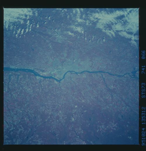
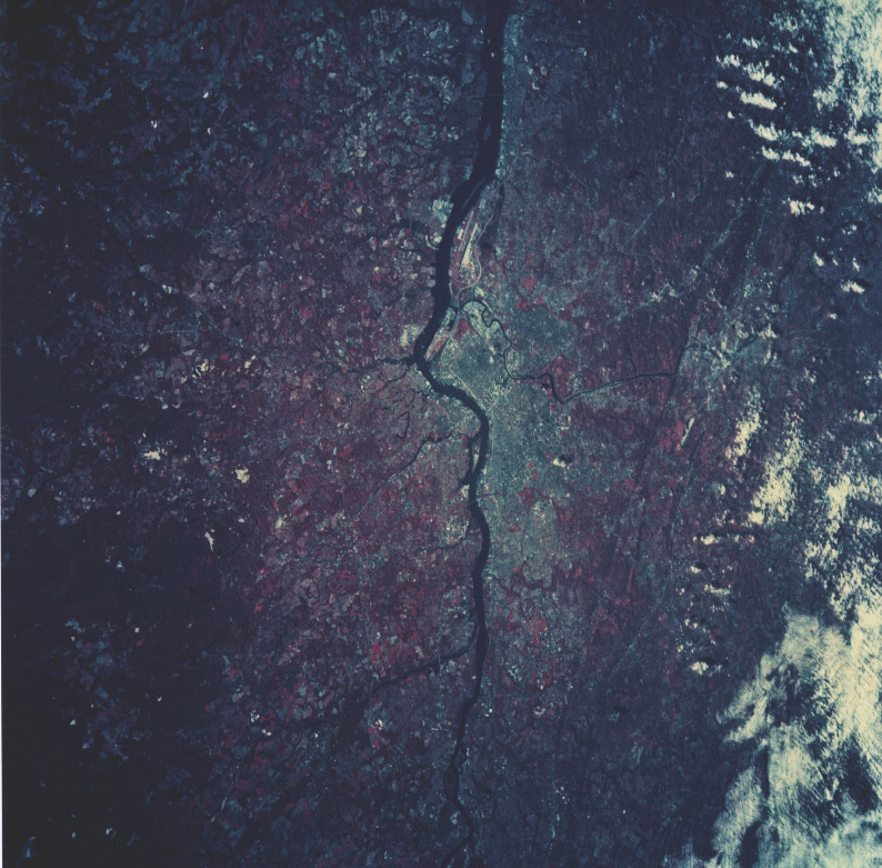
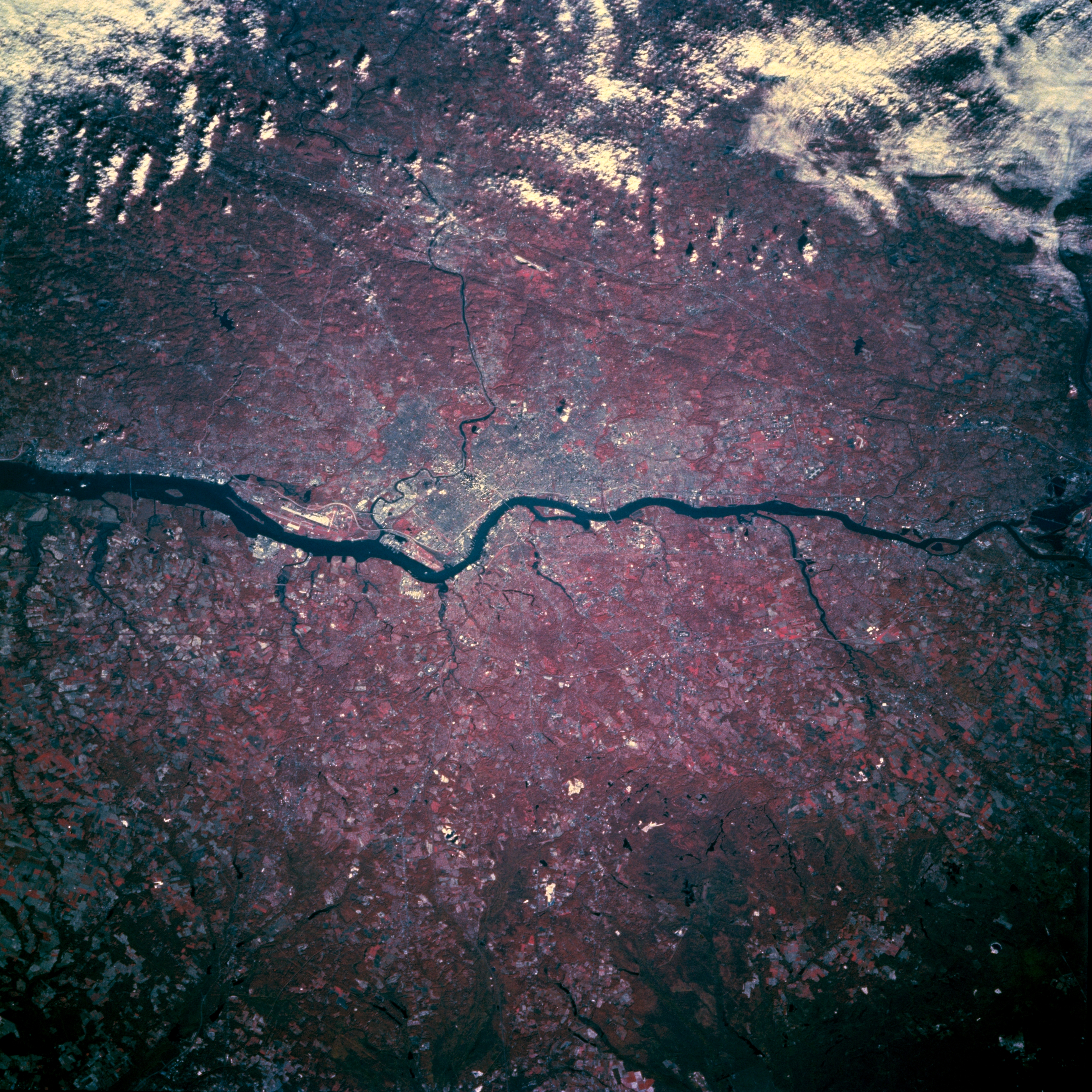
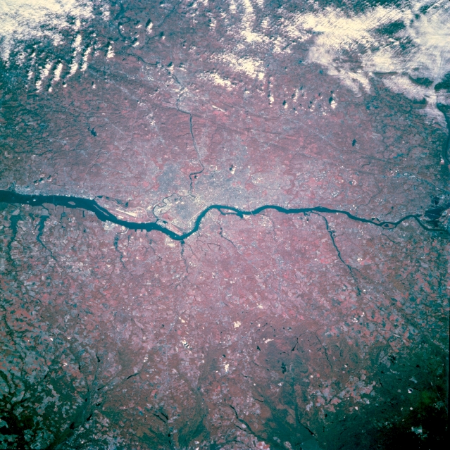
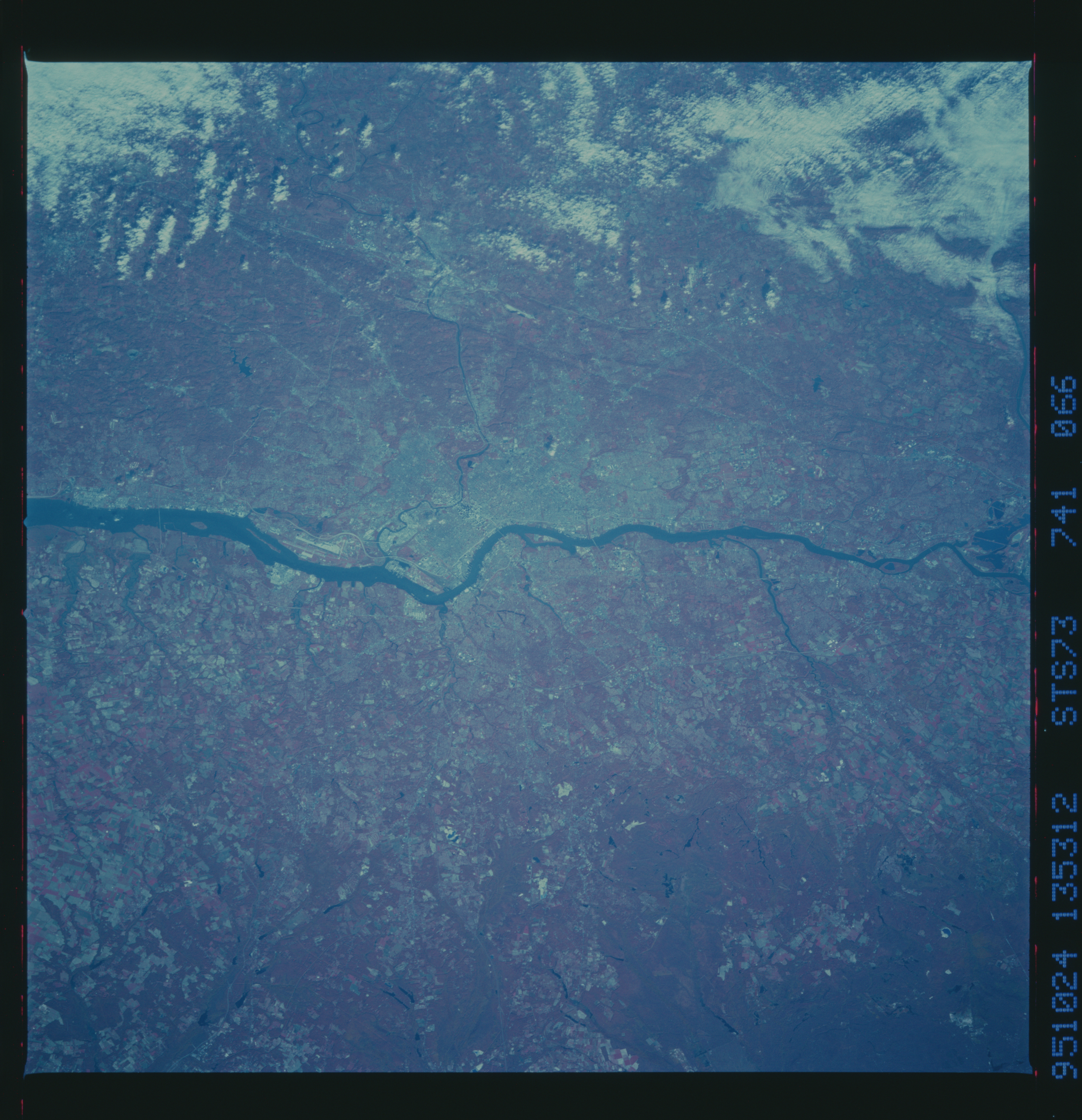
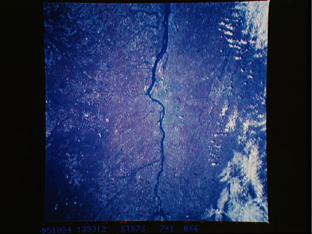
Image Caption: STS073-741-066 Greater Philadelphia Area, Pennsylvania October 1995
The physical setting of the metropolitan area of greater Philadelphia and its environs (center of the image) is visible in this northeast-looking color infrared view. Camden, New Jersey, a much smaller industrial city located on the east bank of the Delaware River, is opposite the central business district of Philadelphia. The Schuylkill River, a tributary of the Delaware River, is the thin, dark line that skirts the southern edge of downtown Philadelphia and heads northwest towards Reading, Pennsylvania. The runway (linear, white-looking feature immediately south of Philadelphia on the west side of the Delaware River) of the Philadelphia International Airport is visible. The deeper red colors both in Pennsylvania and New Jersey show the extent of the forested lands.
The physical setting of the metropolitan area of greater Philadelphia and its environs (center of the image) is visible in this northeast-looking color infrared view. Camden, New Jersey, a much smaller industrial city located on the east bank of the Delaware River, is opposite the central business district of Philadelphia. The Schuylkill River, a tributary of the Delaware River, is the thin, dark line that skirts the southern edge of downtown Philadelphia and heads northwest towards Reading, Pennsylvania. The runway (linear, white-looking feature immediately south of Philadelphia on the west side of the Delaware River) of the Philadelphia International Airport is visible. The deeper red colors both in Pennsylvania and New Jersey show the extent of the forested lands.
