STS073-741-65
| NASA Photo ID | STS073-741-65 |
| Focal Length | 250mm |
| Date taken | 1995.10.24 |
| Time taken | 13:53:07 GMT |
Resolutions offered for this image:
3928 x 3904 pixels 639 x 636 pixels 5700 x 5900 pixels 500 x 518 pixels 640 x 480 pixels
3928 x 3904 pixels 639 x 636 pixels 5700 x 5900 pixels 500 x 518 pixels 640 x 480 pixels

Cloud masks available for this image:
Spacecraft nadir point: 38.5° N, 74.7° W
Photo center point: 39.5° N, 75.5° W
Photo center point by machine learning:
Photo center point: 39.5° N, 75.5° W
Photo center point by machine learning:
Nadir to Photo Center: Northwest
Spacecraft Altitude: 144 nautical miles (267km)
Country or Geographic Name: | USA-MARYLAND |
Features: | DE RIVER, AGR., WILMINGTON |
| Features Found Using Machine Learning: | |
Cloud Cover Percentage: | 15 (11-25)% |
Sun Elevation Angle: | 26° |
Sun Azimuth: | 133° |
Camera: | Hasselblad |
Focal Length: | 250mm |
Camera Tilt: | 28 degrees |
Format: | 2443: Kodak Aerochrome 2443, color IR, thin base, EA-5 process thru June 1999, E-6 process afterward |
Film Exposure: | Normal |
| Additional Information | |
| Width | Height | Annotated | Cropped | Purpose | Links |
|---|---|---|---|---|---|
| 3928 pixels | 3904 pixels | No | No | Earth From Space collection | Download Image |
| 639 pixels | 636 pixels | No | No | Earth From Space collection | Download Image |
| 5700 pixels | 5900 pixels | No | No | Download Image | |
| 500 pixels | 518 pixels | No | No | Download Image | |
| 640 pixels | 480 pixels | No | No | Download Image |
Download Packaged File
Download a Google Earth KML for this Image
View photo footprint information
Download a GeoTIFF for this photo
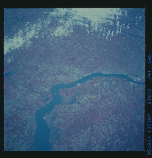
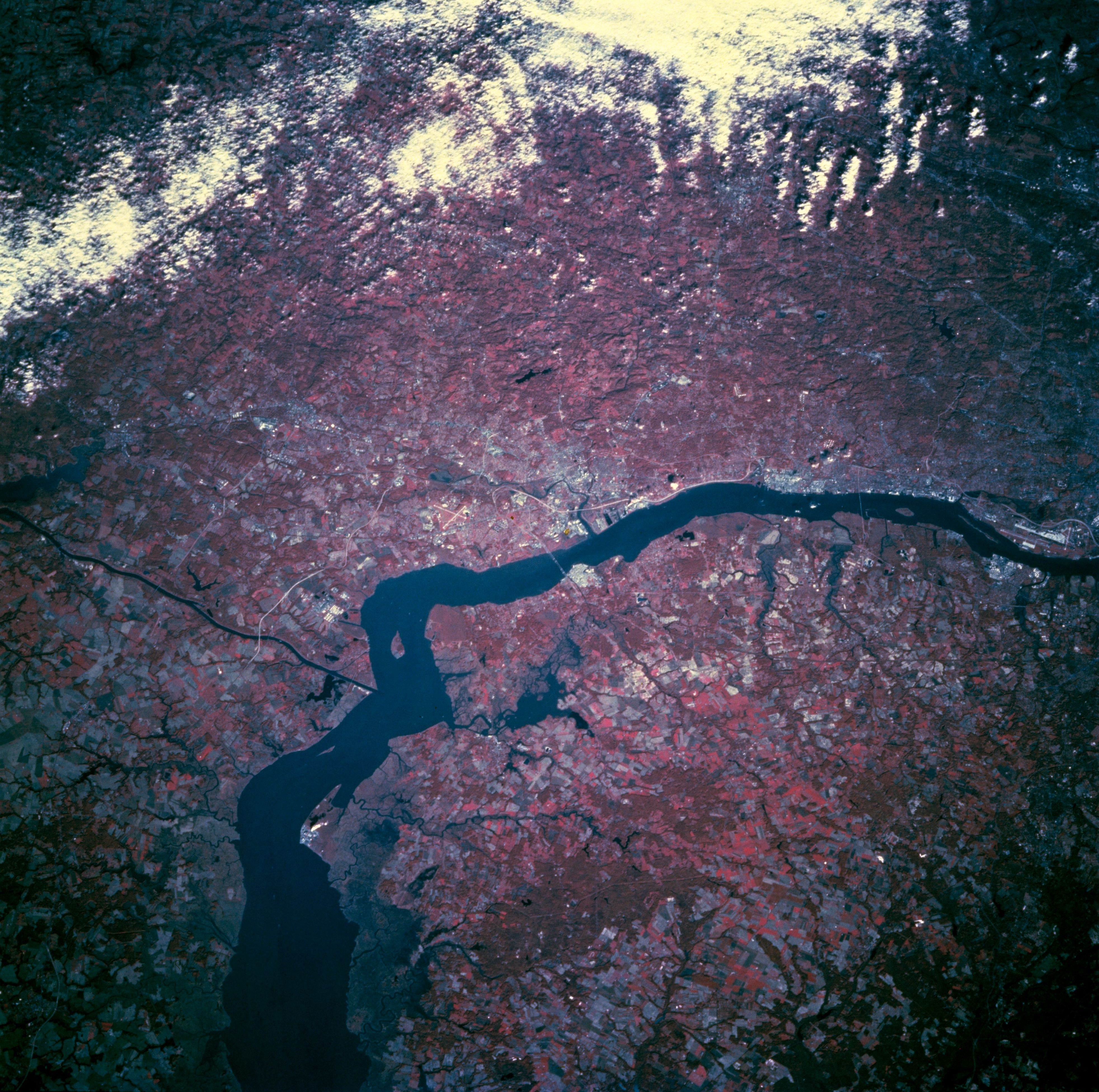
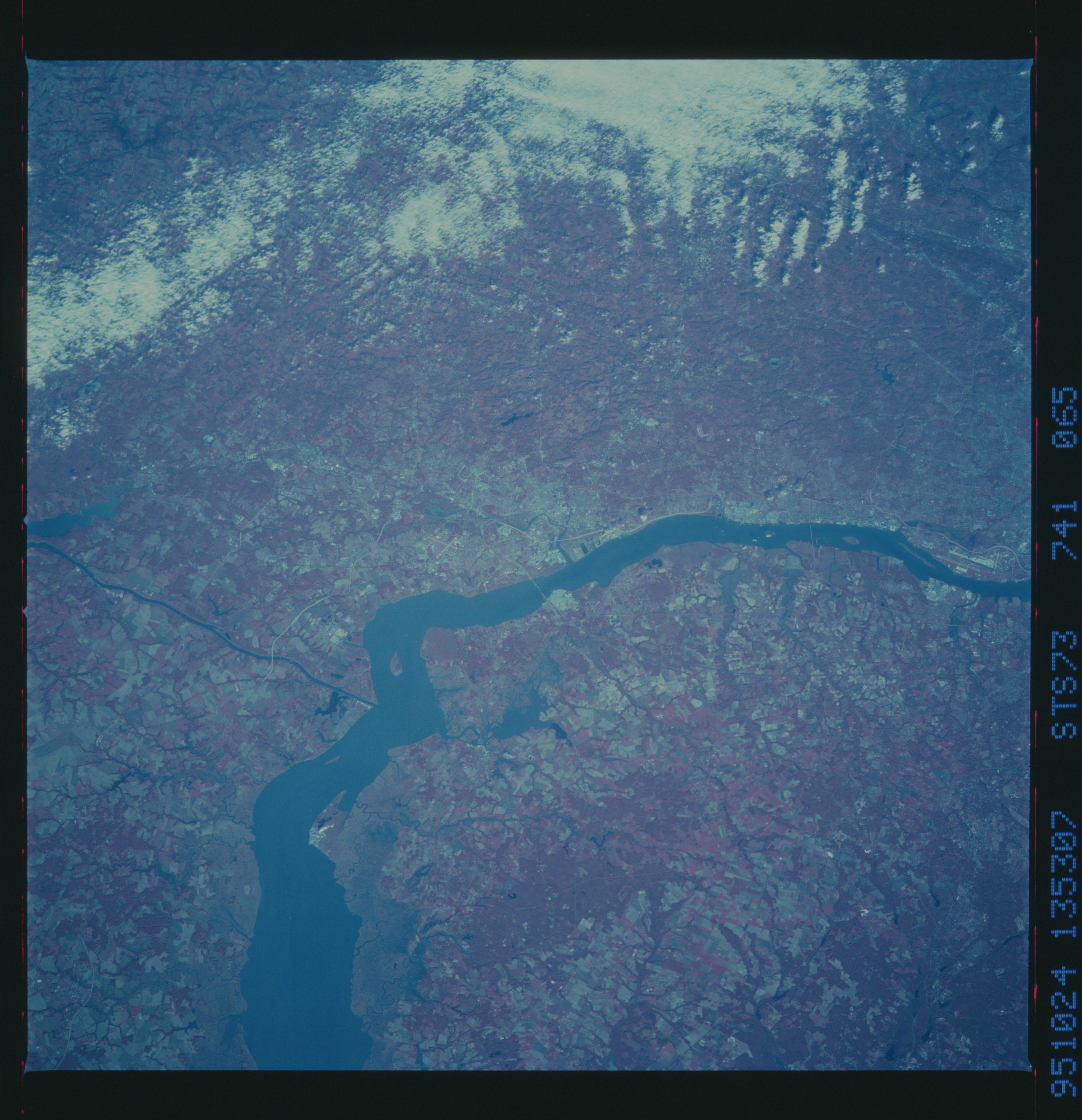
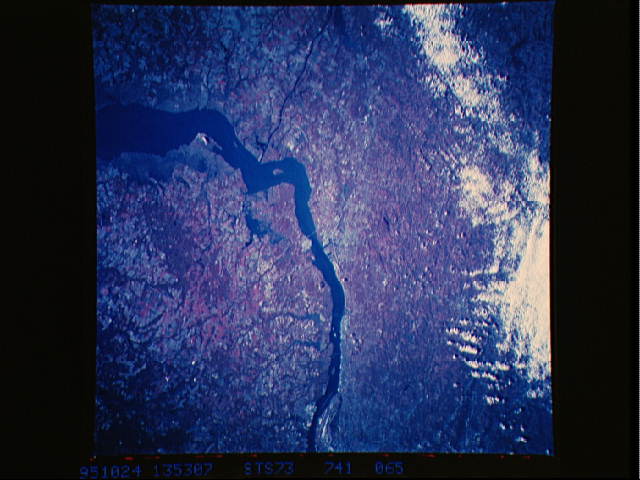
Image Caption: STS073-741-065 Wilmington Area, Delaware, U.S.A. October 1995
Wilmington, the largest city in Delaware, is on the northwest side of the Delaware River, just north of the bridge in the center of the picture (view to northwest). The Interstate Highway 295 bridge (Delaware Memorial Bridge) connects the Wilmington area with the New Jersey Turnpike on the east side of the Delaware River. Sections of Interstate Highway 95 (linear, light colored feature) also helps to identify the location of Wilmington. The thin, dark, east-west oriented feature (left center) is the Chesapeake and Delaware Canal, which connects the northern end of Chesapeake Bay with the Delaware River. Areas of deep red on this image are forested and lighter reds correspond to lands used for agriculture. The darker landscapes (lower left) along the Delaware River shoreline are marshy wetlands. The linear, light-colored feature (far right center) is the runway at Philadelphia International Airport.
Wilmington, the largest city in Delaware, is on the northwest side of the Delaware River, just north of the bridge in the center of the picture (view to northwest). The Interstate Highway 295 bridge (Delaware Memorial Bridge) connects the Wilmington area with the New Jersey Turnpike on the east side of the Delaware River. Sections of Interstate Highway 95 (linear, light colored feature) also helps to identify the location of Wilmington. The thin, dark, east-west oriented feature (left center) is the Chesapeake and Delaware Canal, which connects the northern end of Chesapeake Bay with the Delaware River. Areas of deep red on this image are forested and lighter reds correspond to lands used for agriculture. The darker landscapes (lower left) along the Delaware River shoreline are marshy wetlands. The linear, light-colored feature (far right center) is the runway at Philadelphia International Airport.
