STS073-716-84

| NASA Photo ID | STS073-716-84 |
| Focal Length | 250mm |
| Date taken | 1995.10.27 |
| Time taken | 15:15:51 GMT |
Resolutions offered for this image:
3904 x 3904 pixels 639 x 639 pixels 5700 x 5900 pixels 500 x 518 pixels 640 x 480 pixels
3904 x 3904 pixels 639 x 639 pixels 5700 x 5900 pixels 500 x 518 pixels 640 x 480 pixels


Cloud masks available for this image:
Spacecraft nadir point: 38.4° N, 93.4° W
Photo center point: 39.0° N, 94.5° W
Photo center point by machine learning:
Photo center point: 39.0° N, 94.5° W
Photo center point by machine learning:
Nadir to Photo Center: Northwest
Spacecraft Altitude: 143 nautical miles (265km)
Country or Geographic Name: | USA-MISSOURI |
Features: | KANSAS CITY, AGRICULTURE |
| Features Found Using Machine Learning: | |
Cloud Cover Percentage: | 0 (no clouds present) |
Sun Elevation Angle: | 27° |
Sun Azimuth: | 135° |
Camera: | Hasselblad |
Focal Length: | 250mm |
Camera Tilt: | 28 degrees |
Format: | 5046: Kodak, natural color positive, Lumiere 100/5046, ASA 100, standard base |
Film Exposure: | Normal |
| Additional Information | |
| Width | Height | Annotated | Cropped | Purpose | Links |
|---|---|---|---|---|---|
| 3904 pixels | 3904 pixels | No | No | Earth From Space collection | Download Image |
| 639 pixels | 639 pixels | No | No | Earth From Space collection | Download Image |
| 5700 pixels | 5900 pixels | No | No | Download Image | |
| 500 pixels | 518 pixels | No | No | Download Image | |
| 640 pixels | 480 pixels | No | No | Download Image |
Download Packaged File
Download a Google Earth KML for this Image
View photo footprint information
Download a GeoTIFF for this photo
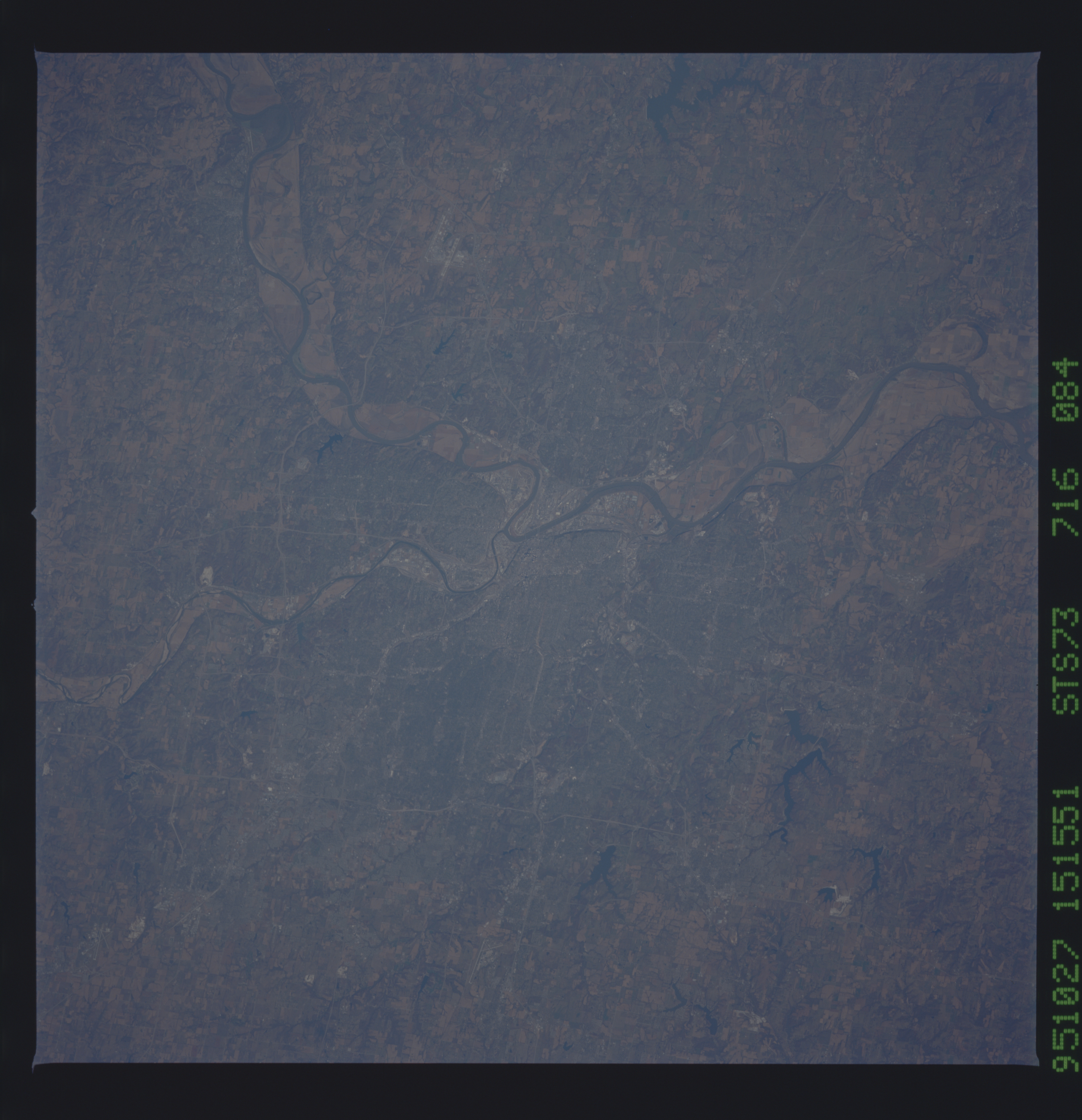
Image Caption: STS073-716-084 Missouri River and Kansas City, Missouri, U.S.A. October 1995
Metropolitan Kansas City and the confluence of the Missouri and Kansas Rivers near the downtown area are featured in this south-looking, low-oblique photograph. Kansas City, the starting point for many expeditions by settlers to the western United States in the 1800s, is today a major commercial, industrial, and transportation center in a rich agricultural and livestock producing region. Visible clockwise from the Smithville Reservoir north of the city are Independence, the home of former U.S. President Harry S. Truman, and Lake Jacomo.
Metropolitan Kansas City and the confluence of the Missouri and Kansas Rivers near the downtown area are featured in this south-looking, low-oblique photograph. Kansas City, the starting point for many expeditions by settlers to the western United States in the 1800s, is today a major commercial, industrial, and transportation center in a rich agricultural and livestock producing region. Visible clockwise from the Smithville Reservoir north of the city are Independence, the home of former U.S. President Harry S. Truman, and Lake Jacomo.
