STS073-708-24
| NASA Photo ID | STS073-708-24 |
| Focal Length | 250mm |
| Date taken | 1995.10.25 |
| Time taken | 18:31:33 GMT |
Resolutions offered for this image:
3872 x 3904 pixels 634 x 639 pixels 5700 x 5900 pixels 500 x 518 pixels 640 x 480 pixels
3872 x 3904 pixels 634 x 639 pixels 5700 x 5900 pixels 500 x 518 pixels 640 x 480 pixels

Cloud masks available for this image:
Spacecraft nadir point: 27.9° N, 91.5° W
Photo center point: 30.5° N, 90.0° W
Photo center point by machine learning:
Photo center point: 30.5° N, 90.0° W
Photo center point by machine learning:
Nadir to Photo Center: Northeast
Spacecraft Altitude: 145 nautical miles (269km)
Country or Geographic Name: | USA-LOUISIANA |
Features: | NEW ORLEANS, RIVER, LAKES |
| Features Found Using Machine Learning: | |
Cloud Cover Percentage: | 10 (1-10)% |
Sun Elevation Angle: | 49° |
Sun Azimuth: | 195° |
Camera: | Hasselblad |
Focal Length: | 250mm |
Camera Tilt: | 51 degrees |
Format: | 5046: Kodak, natural color positive, Lumiere 100/5046, ASA 100, standard base |
Film Exposure: | Normal |
| Additional Information | |
| Width | Height | Annotated | Cropped | Purpose | Links |
|---|---|---|---|---|---|
| 3872 pixels | 3904 pixels | No | No | Earth From Space collection | Download Image |
| 634 pixels | 639 pixels | No | No | Earth From Space collection | Download Image |
| 5700 pixels | 5900 pixels | No | No | Download Image | |
| 500 pixels | 518 pixels | No | No | Download Image | |
| 640 pixels | 480 pixels | No | No | Download Image |
Download Packaged File
Download a Google Earth KML for this Image
View photo footprint information
Download a GeoTIFF for this photo
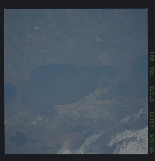
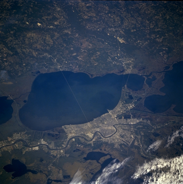
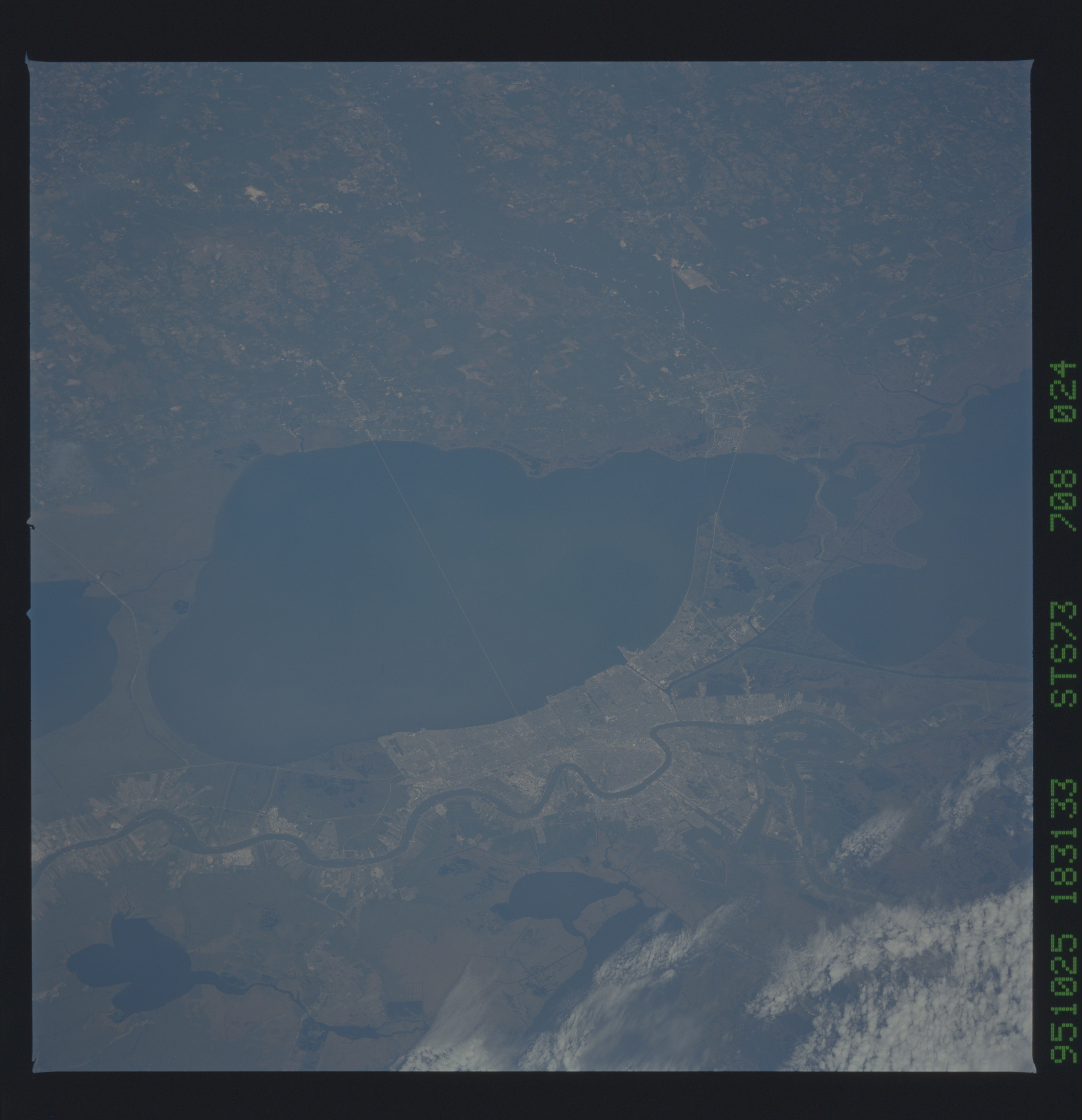
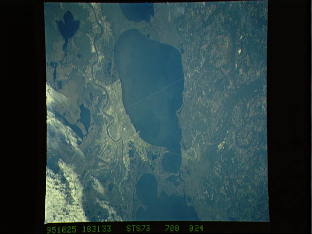
Image Caption: STS073-708-024 Southeast Louisiana, U.S.A. October 1995
The low-oblique, north-looking photograph features greater New Orleans and areas north of Lake Pontchartrain in southeastern Louisiana. Discernible are urban New Orleans and several of its suburbs; the 24-mile (39-kilometer) causeway that connects New Orleans with Covington and other communities on the north shore of Lake Pontchartrain; the meandering Mississippi River; dark, linear canals; and the short Interstate Highway 10 bridge that connects northeastern New Orleans with Slidell. Apparent are the dark Pearl River as it flows south, eventually emptying into Mississippi Sound, and parts of Lake Salvador and adjoining Lac des Allemands within the extensive marshlands south of New Orleans.
The low-oblique, north-looking photograph features greater New Orleans and areas north of Lake Pontchartrain in southeastern Louisiana. Discernible are urban New Orleans and several of its suburbs; the 24-mile (39-kilometer) causeway that connects New Orleans with Covington and other communities on the north shore of Lake Pontchartrain; the meandering Mississippi River; dark, linear canals; and the short Interstate Highway 10 bridge that connects northeastern New Orleans with Slidell. Apparent are the dark Pearl River as it flows south, eventually emptying into Mississippi Sound, and parts of Lake Salvador and adjoining Lac des Allemands within the extensive marshlands south of New Orleans.
