STS073-706-5
| NASA Photo ID | STS073-706-5 |
| Focal Length | 250mm |
| Date taken | 1995.10.22 |
| Time taken | 18:39:55 GMT |
Resolutions offered for this image:
3904 x 3904 pixels 639 x 639 pixels 5700 x 5900 pixels 500 x 518 pixels 640 x 480 pixels
3904 x 3904 pixels 639 x 639 pixels 5700 x 5900 pixels 500 x 518 pixels 640 x 480 pixels
Cloud masks available for this image:
Spacecraft nadir point: 32.1° N, 80.4° W
Photo center point: 32.5° N, 81.0° W
Photo center point by machine learning:
Photo center point: 32.5° N, 81.0° W
Photo center point by machine learning:
Nadir to Photo Center: Northwest
Spacecraft Altitude: 146 nautical miles (270km)
Country or Geographic Name: | USA-SOUTH CAROLINA |
Features: | HILTON HEAD I., BEAUFORT |
| Features Found Using Machine Learning: | |
Cloud Cover Percentage: | 0 (no clouds present) |
Sun Elevation Angle: | 41° |
Sun Azimuth: | 211° |
Camera: | Hasselblad |
Focal Length: | 250mm |
Camera Tilt: | 17 degrees |
Format: | 5046: Kodak, natural color positive, Lumiere 100/5046, ASA 100, standard base |
Film Exposure: | Normal |
| Additional Information | |
| Width | Height | Annotated | Cropped | Purpose | Links |
|---|---|---|---|---|---|
| 3904 pixels | 3904 pixels | No | No | Earth From Space collection | Download Image |
| 639 pixels | 639 pixels | No | No | Earth From Space collection | Download Image |
| 5700 pixels | 5900 pixels | No | No | Download Image | |
| 500 pixels | 518 pixels | No | No | Download Image | |
| 640 pixels | 480 pixels | No | No | Download Image |
Download Packaged File
Download a Google Earth KML for this Image
View photo footprint information
Download a GeoTIFF for this photo
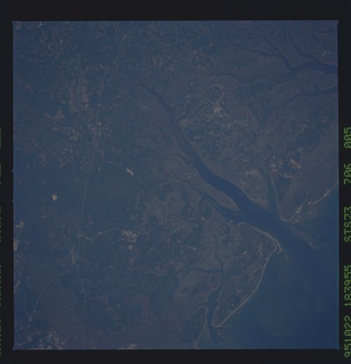
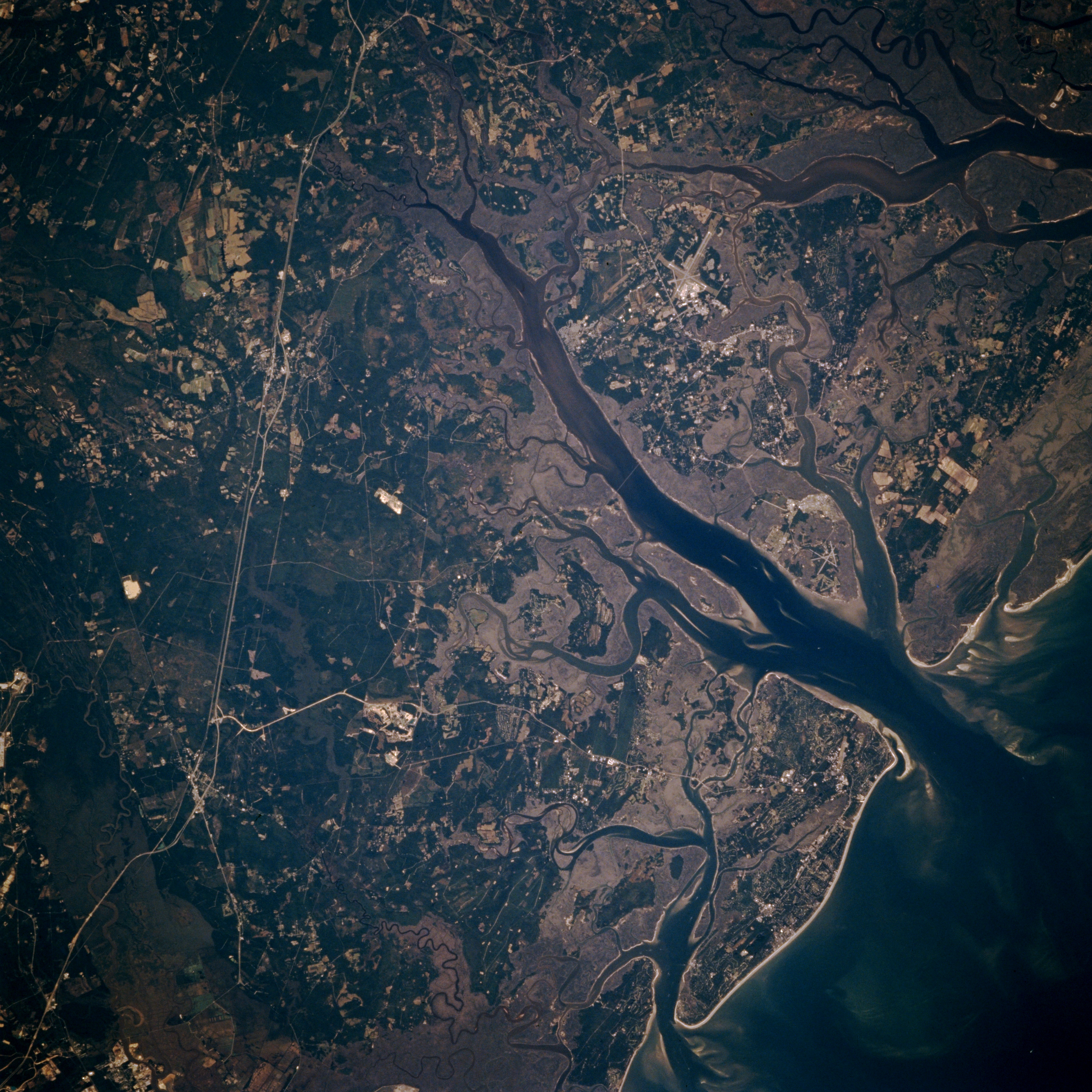
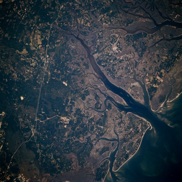
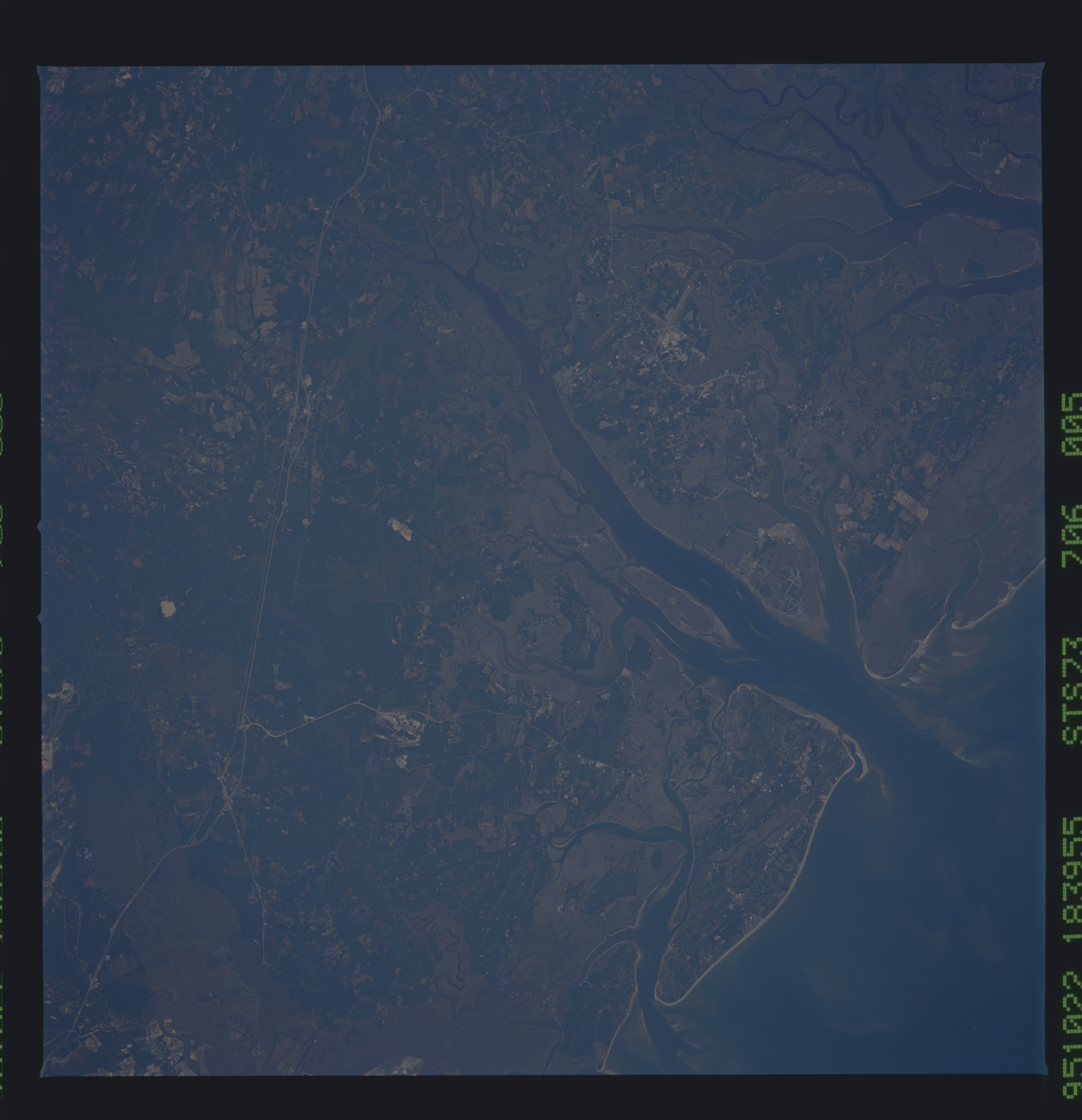
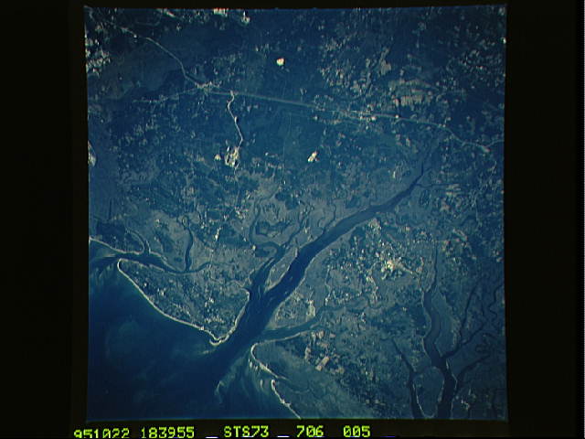
Image Caption: STS073-706-005 Hilton Head Island, South Carolina, U.S.A. October 1995
The low-lying, swampy wetlands; estuaries; and river mouths of coastal southern South Carolina are apparent in this north-looking photograph. Two islands are of particular note--Hilton Head Island, the larger island south of the Coosawhatchie River, noted for its recreational activities (lower right corner), and Parris Island, a U.S. Marine Corps Training Center along the north shore near the mouth of the Coosawhatchie River. The reflective intersecting runways of the U.S. Marine Corps Air Base lie near the small city of Beaufort (barely discernible). Visible are several tributaries of the Salkehatchie and Combahee Rivers immediately north of the air base (upper right corner); Interstate Highway 95 and sections of U.S. Highway 17, light, linear features that extend northward; and part of the extensive, vegetated Savannah River floodplain (lower left corner).
The low-lying, swampy wetlands; estuaries; and river mouths of coastal southern South Carolina are apparent in this north-looking photograph. Two islands are of particular note--Hilton Head Island, the larger island south of the Coosawhatchie River, noted for its recreational activities (lower right corner), and Parris Island, a U.S. Marine Corps Training Center along the north shore near the mouth of the Coosawhatchie River. The reflective intersecting runways of the U.S. Marine Corps Air Base lie near the small city of Beaufort (barely discernible). Visible are several tributaries of the Salkehatchie and Combahee Rivers immediately north of the air base (upper right corner); Interstate Highway 95 and sections of U.S. Highway 17, light, linear features that extend northward; and part of the extensive, vegetated Savannah River floodplain (lower left corner).
