STS071-748-49
| NASA Photo ID | STS071-748-49 |
| Focal Length | 100mm |
| Date taken | 1995.07.04 |
| Time taken | 22:16:39 GMT |
Resolutions offered for this image:
3904 x 3872 pixels 639 x 634 pixels 5700 x 5900 pixels 500 x 518 pixels 640 x 480 pixels
3904 x 3872 pixels 639 x 634 pixels 5700 x 5900 pixels 500 x 518 pixels 640 x 480 pixels

Cloud masks available for this image:
Spacecraft nadir point: 51.2° N, 109.9° W
Photo center point: 51.0° N, 105.0° W
Photo center point by machine learning:
Photo center point: 51.0° N, 105.0° W
Photo center point by machine learning:
Nadir to Photo Center: East
Spacecraft Altitude: 209 nautical miles (387km)
Country or Geographic Name: | CANADA-S |
Features: | LAST MOUNTAIN LAKE, AGR. |
| Features Found Using Machine Learning: | |
Cloud Cover Percentage: | 5 (1-10)% |
Sun Elevation Angle: | 46° |
Sun Azimuth: | 246° |
Camera: | Hasselblad |
Focal Length: | 100mm |
Camera Tilt: | 55 degrees |
Format: | VELVI: Fuji, natural color positive, Velvia 50, CS 135-36, ASA 32, standard base |
Film Exposure: | Normal |
| Additional Information | |
| Width | Height | Annotated | Cropped | Purpose | Links |
|---|---|---|---|---|---|
| 3904 pixels | 3872 pixels | No | No | Earth From Space collection | Download Image |
| 639 pixels | 634 pixels | No | No | Earth From Space collection | Download Image |
| 5700 pixels | 5900 pixels | No | No | Download Image | |
| 500 pixels | 518 pixels | No | No | Download Image | |
| 640 pixels | 480 pixels | No | No | Download Image |
Download Packaged File
Download a Google Earth KML for this Image
View photo footprint information
Download a GeoTIFF for this photo
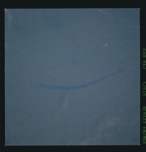
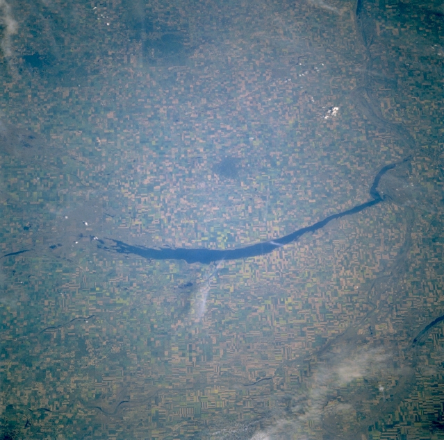
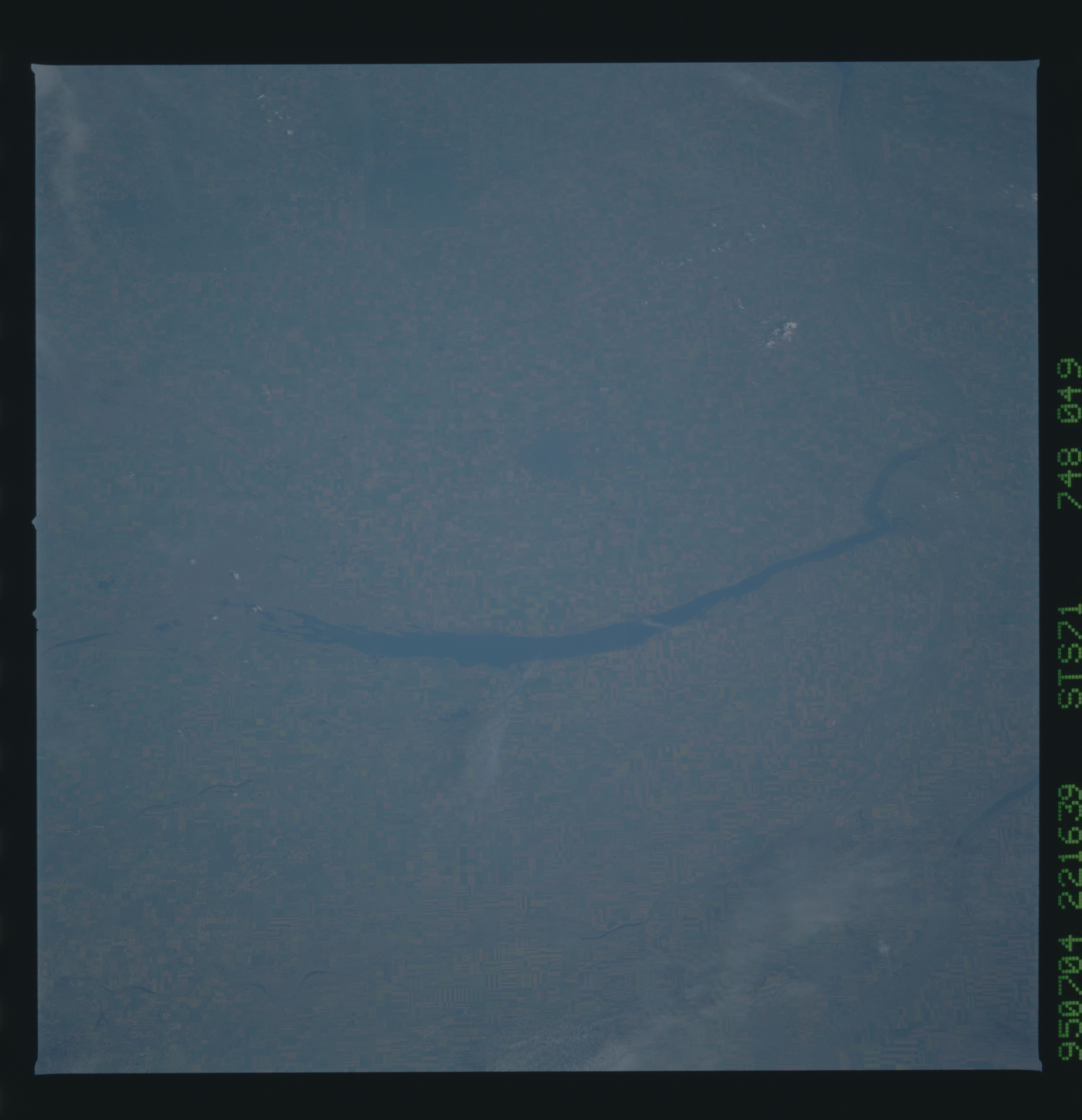
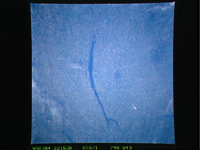
Image Caption: STS071-748-049 Last Mountain Lake, Saskatchewan, Canada July 1995
Last Mountain Lake (elongated, dark feature near center of image), Canada's first Migratory Bird Sanctuary, is located northwest of the provincial capital of Regina. This lake and adjacent basins provide a variety of habitats for natural and managed migratory birds. The large angular field patterns that cover the landscape show that this region of south central Saskatchewan is used extensively for agriculture, particularly for the production of wheat. Sections of the Arm River and the main channel of the Qu'Appelle River can be traced across the relatively flat terrain in the lower right quadrant of the picture. The dark, uniform looking areas are slightly elevated land where little or no large scale farming is taking place.
Last Mountain Lake (elongated, dark feature near center of image), Canada's first Migratory Bird Sanctuary, is located northwest of the provincial capital of Regina. This lake and adjacent basins provide a variety of habitats for natural and managed migratory birds. The large angular field patterns that cover the landscape show that this region of south central Saskatchewan is used extensively for agriculture, particularly for the production of wheat. Sections of the Arm River and the main channel of the Qu'Appelle River can be traced across the relatively flat terrain in the lower right quadrant of the picture. The dark, uniform looking areas are slightly elevated land where little or no large scale farming is taking place.
