STS070-717-11
| NASA Photo ID | STS070-717-11 |
| Focal Length | 250mm |
| Date taken | 1995.07.21 |
| Time taken | 18:13:38 GMT |
Cloud masks available for this image:
Spacecraft nadir point: 24.8° S, 68.7° W
Photo center point:
Photo center point by machine learning:
Photo center point:
Photo center point by machine learning:
Nadir to Photo Center:
Spacecraft Altitude: 155 nautical miles (287km)
Country or Geographic Name: | ARGENTINA |
Features: | ANDES MOUNTAINS, VOL. |
| Features Found Using Machine Learning: | |
Cloud Cover Percentage: | 0 (no clouds present) |
Sun Elevation Angle: | 40° |
Sun Azimuth: | 331° |
Camera: | Hasselblad |
Focal Length: | 250mm |
Camera Tilt: | Low Oblique |
Format: | 5046: Kodak, natural color positive, Lumiere 100/5046, ASA 100, standard base |
Film Exposure: | Normal |
| Additional Information | |
| Width | Height | Annotated | Cropped | Purpose | Links |
|---|---|---|---|---|---|
| 5700 pixels | 5900 pixels | No | No | Download Image | |
| 500 pixels | 518 pixels | No | No | Download Image | |
| 640 pixels | 480 pixels | No | No | Download Image |
Download Packaged File
Download a Google Earth KML for this Image
View photo footprint information
Download a GeoTIFF for this photo
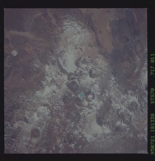
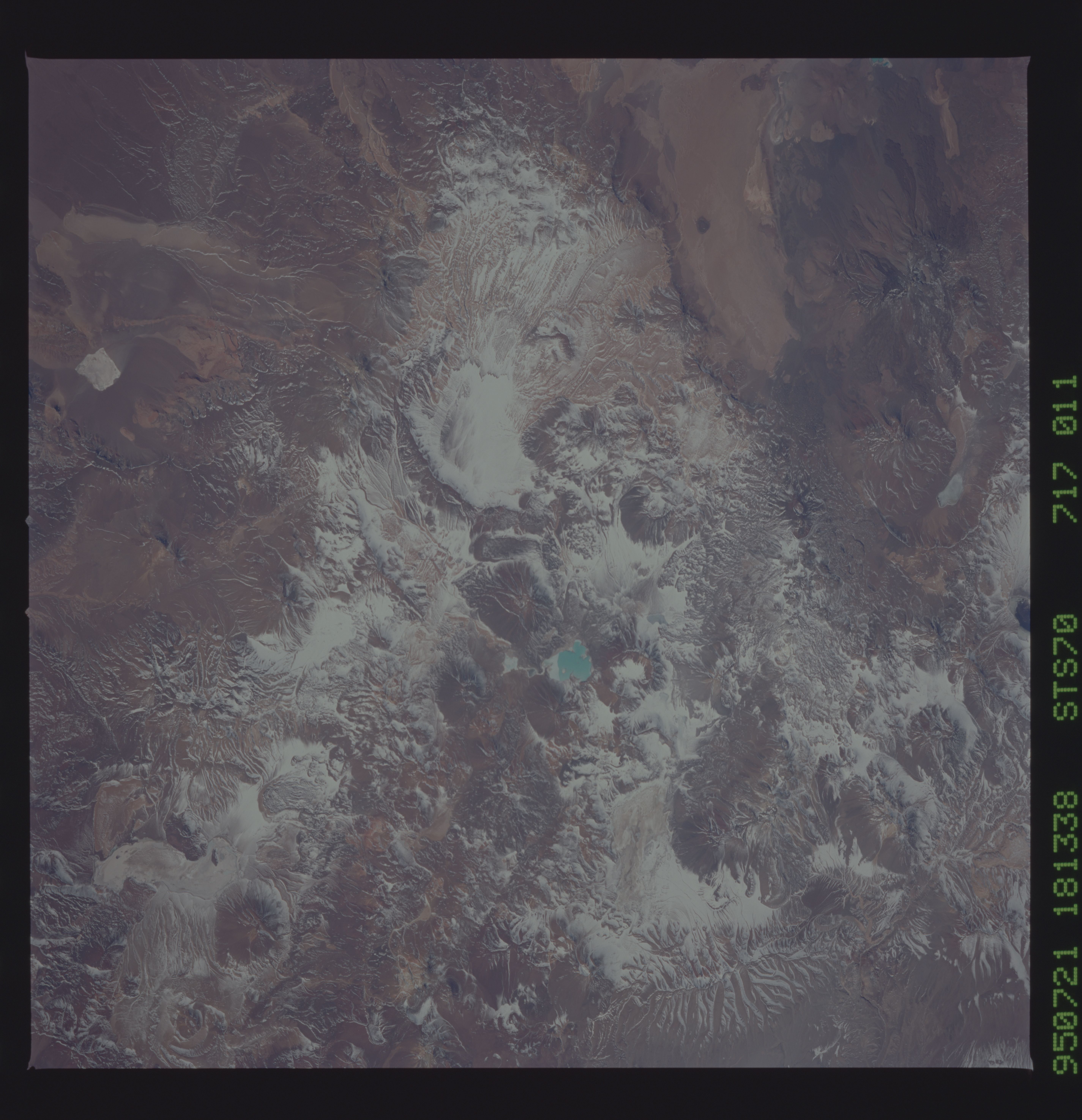
Image Caption: Central Andes Mountains (N Chile, NW Argentina) Under Winter Snow
Volcanic landscapes with a thin dusting of snow appear in this near-vertical view of the dry, high spine of the Andes Mountains at around 28 degrees South. Strong westerly winds (from left) have blown the snow off the highest volcanic peaks (center and bottom): many of these peaks rise higher than 20,000 feet.
A small, dry lake appears top right, the white color derived from salts. The border between Argentina and Chile winds from volcano to volcano and passes just left of the small blue lake (left center). Black lava flows can be detected bottom right. The larger area of brown-pink rocks (bottom right) is also an area of volcanic rocks, a type known as ash flow tuffs which are violently extruded, often in volumes measured in cubic kilometers.
