STS070-710-4
| NASA Photo ID | STS070-710-4 |
| Focal Length | 250mm |
| Date taken | 1995.07.17 |
| Time taken | 12:47:25 GMT |
Resolutions offered for this image:
3872 x 3904 pixels 634 x 639 pixels 5700 x 5900 pixels 500 x 518 pixels 640 x 480 pixels
3872 x 3904 pixels 634 x 639 pixels 5700 x 5900 pixels 500 x 518 pixels 640 x 480 pixels

Cloud masks available for this image:
Spacecraft nadir point: 27.1° N, 79.0° W
Photo center point: 26.5° N, 80.0° W
Photo center point by machine learning:
Photo center point: 26.5° N, 80.0° W
Photo center point by machine learning:
Nadir to Photo Center: Southwest
Spacecraft Altitude: 157 nautical miles (291km)
Country or Geographic Name: | USA-FLORIDA |
Features: | BOYNTON BEACH, WETLANDS |
| Features Found Using Machine Learning: | |
Cloud Cover Percentage: | 0 (no clouds present) |
Sun Elevation Angle: | 28° |
Sun Azimuth: | 79° |
Camera: | Hasselblad |
Focal Length: | 250mm |
Camera Tilt: | 24 degrees |
Format: | 5046: Kodak, natural color positive, Lumiere 100/5046, ASA 100, standard base |
Film Exposure: | Normal |
| Additional Information | |
| Width | Height | Annotated | Cropped | Purpose | Links |
|---|---|---|---|---|---|
| 3872 pixels | 3904 pixels | No | No | Earth From Space collection | Download Image |
| 634 pixels | 639 pixels | No | No | Earth From Space collection | Download Image |
| 5700 pixels | 5900 pixels | No | No | Download Image | |
| 500 pixels | 518 pixels | No | No | Download Image | |
| 640 pixels | 480 pixels | No | No | Download Image |
Download Packaged File
Download a Google Earth KML for this Image
View photo footprint information
Download a GeoTIFF for this photo
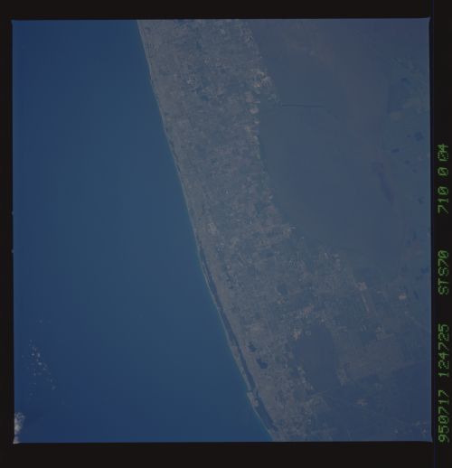
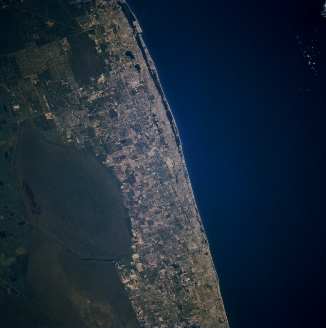
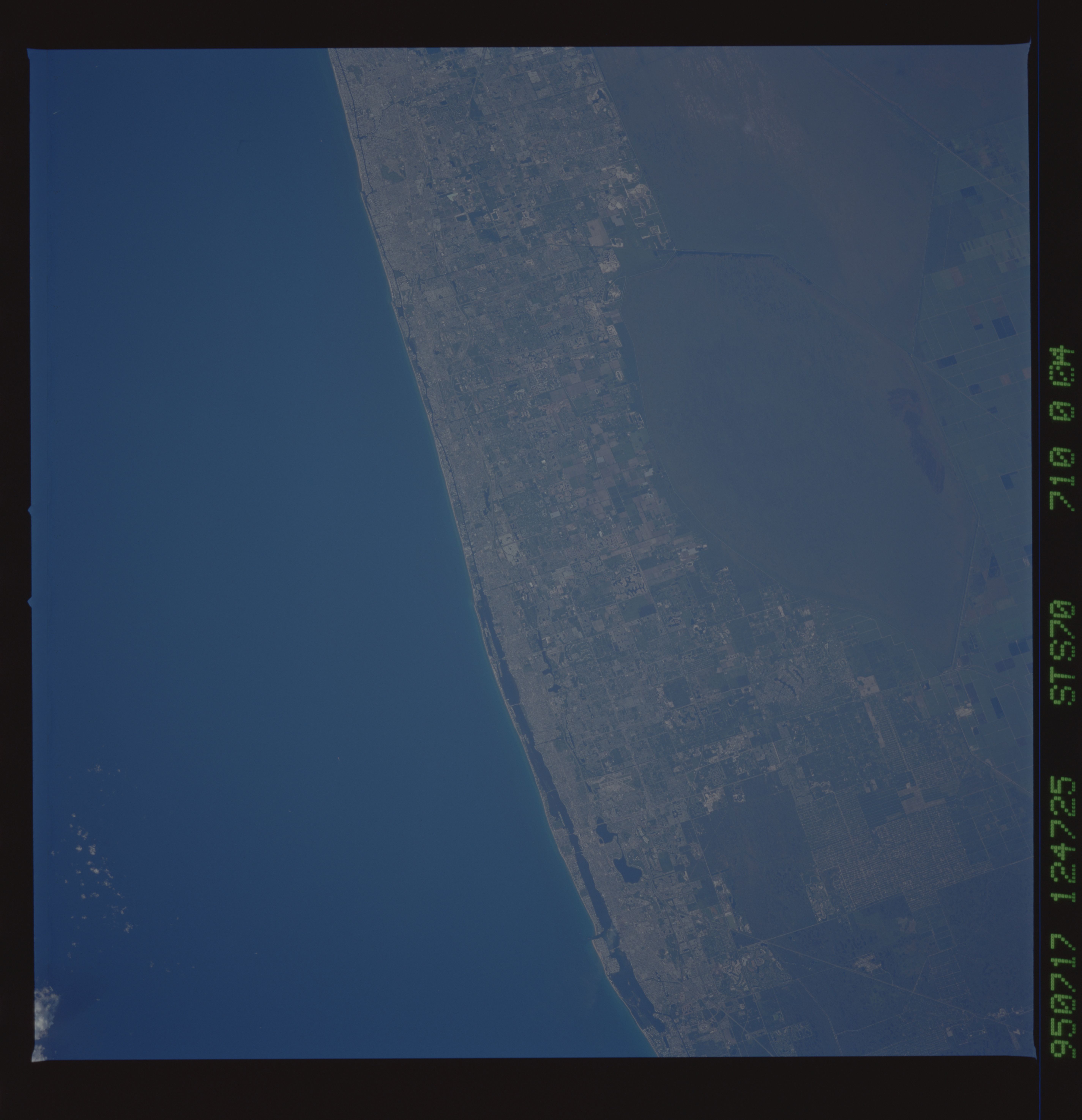
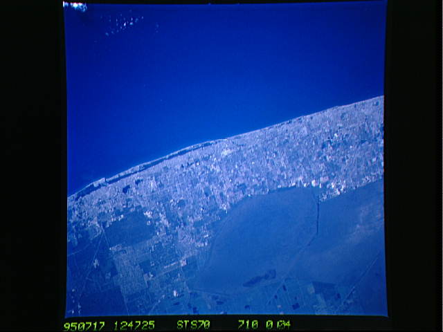
Image Caption: STS070-710-004 Southeast Coastal Florida, U.S.A. July 1995
The corridor of the densely populated east coast of Florida between North Palm Beach (top) and Pompano Beach (bottom) contrasts with the dark blue Atlantic Ocean and the dull, uniform Arthur R. Marshall-Loxahatchee National Wildlife Refuge to the west. From an aerial perspective, many smaller cities that constitute the coastal region of Florida appear to coalesce into one large, intensely developed urban area. Vast, cultivated field patterns are discernible south of Lake Okeechobee (left margin). The faint straight lines (lower left corner) are part of a canal system that connects Lake Okeechobee with the southeast coast of Florida.
The corridor of the densely populated east coast of Florida between North Palm Beach (top) and Pompano Beach (bottom) contrasts with the dark blue Atlantic Ocean and the dull, uniform Arthur R. Marshall-Loxahatchee National Wildlife Refuge to the west. From an aerial perspective, many smaller cities that constitute the coastal region of Florida appear to coalesce into one large, intensely developed urban area. Vast, cultivated field patterns are discernible south of Lake Okeechobee (left margin). The faint straight lines (lower left corner) are part of a canal system that connects Lake Okeechobee with the southeast coast of Florida.
