STS069-717-76
| NASA Photo ID | STS069-717-76 |
| Focal Length | 250mm |
| Date taken | 1995.09.17 |
| Time taken | 17:39:59 GMT |
Cloud masks available for this image:
Spacecraft nadir point: 21.6° S, 63.5° W
Photo center point: 23.0° S, 64.5° W
Photo center point by machine learning:
Photo center point: 23.0° S, 64.5° W
Photo center point by machine learning:
Nadir to Photo Center: Southwest
Spacecraft Altitude: 185 nautical miles (343km)
Camera: | Hasselblad |
Focal Length: | 250mm |
Camera Tilt: | 29 degrees |
Format: | 5046: Kodak, natural color positive, Lumiere 100/5046, ASA 100, standard base |
Film Exposure: | Normal |
| Additional Information | |
| Width | Height | Annotated | Cropped | Purpose | Links |
|---|---|---|---|---|---|
| 5700 pixels | 5900 pixels | No | No | Download Image | |
| 500 pixels | 518 pixels | No | No | Download Image | |
| 640 pixels | 480 pixels | No | No | Download Image |
Download Packaged File
Download a Google Earth KML for this Image
View photo footprint information
Download a GeoTIFF for this photo
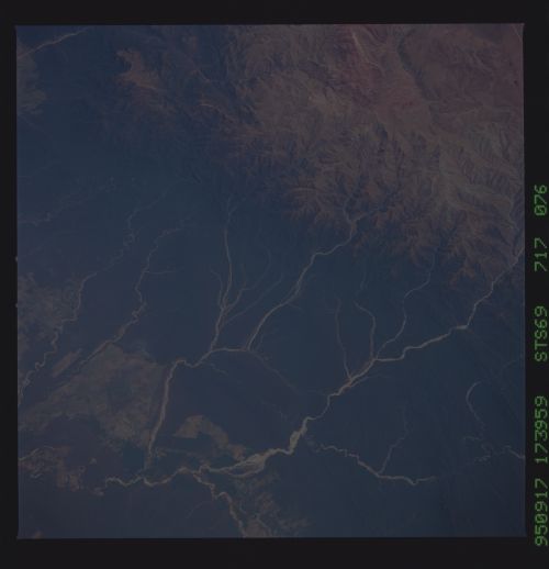
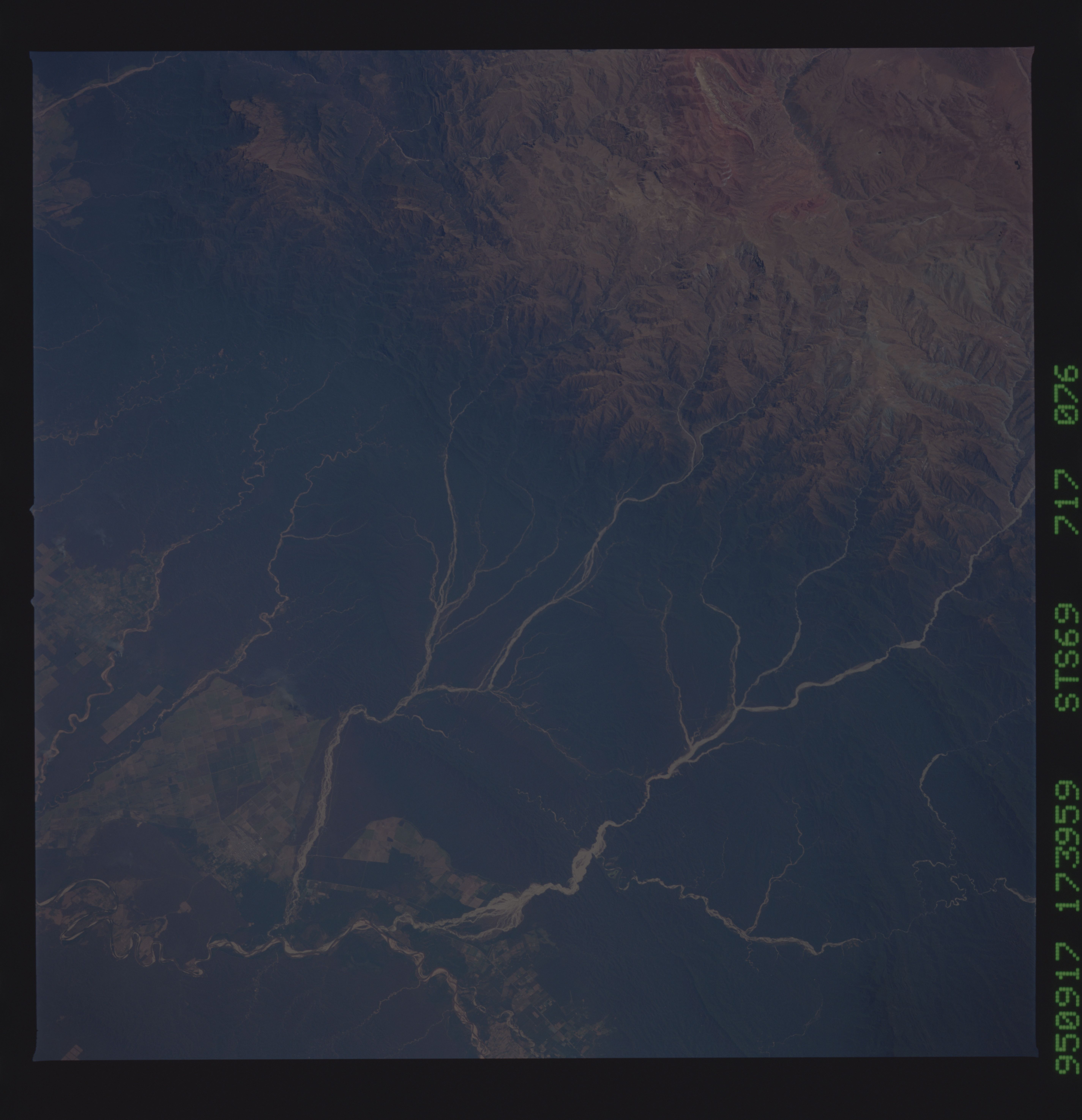
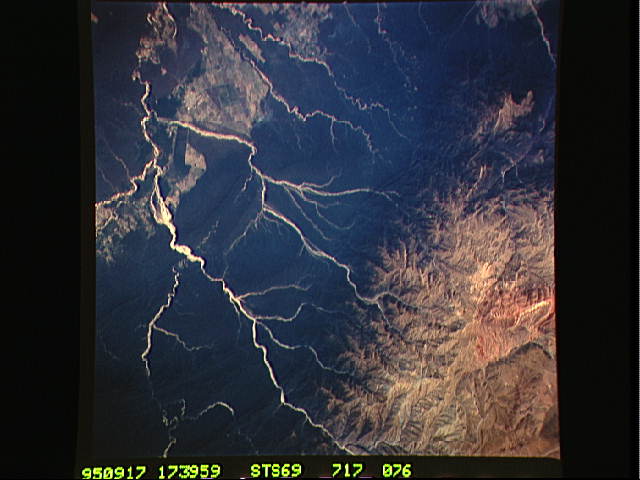
Image Caption: Upper Rio Bermejo drainage,
northwestern Argentina. The streams draining vegetated mountains have
meandering patterns incised into bedrock; these streams probably carry
mostly gravel bedload and run clear much of the time. Streams draining
unvegated, higher mountains tend to have straighter courses with
braided valley bottoms; these probably carry a substantial suspended
load of silt, and sand, as well as the bedload of sand
and gravel.
