STS069-713-91
| NASA Photo ID | STS069-713-91 |
| Focal Length | 100mm |
| Date taken | 1995.09.16 |
| Time taken | 07:58:44 GMT |
Resolutions offered for this image:
6805 x 6838 pixels 636 x 639 pixels 5700 x 5900 pixels 500 x 518 pixels 640 x 480 pixels 522 x 519 pixels
6805 x 6838 pixels 636 x 639 pixels 5700 x 5900 pixels 500 x 518 pixels 640 x 480 pixels 522 x 519 pixels


Cloud masks available for this image:
Spacecraft nadir point: 4.7° N, 38.5° E
Photo center point: 4.0° N, 36.0° E
Photo center point by machine learning:
Photo center point: 4.0° N, 36.0° E
Photo center point by machine learning:
Nadir to Photo Center: West
Spacecraft Altitude: 185 nautical miles (343km)
Country or Geographic Name: | KENYA |
Features: | LAKE RUDOLF, MTS., DES. |
| Features Found Using Machine Learning: | |
Cloud Cover Percentage: | 0 (no clouds present) |
Sun Elevation Angle: | 69° |
Sun Azimuth: | 94° |
Camera: | Hasselblad |
Focal Length: | 100mm |
Camera Tilt: | 40 degrees |
Format: | 5046: Kodak, natural color positive, Lumiere 100/5046, ASA 100, standard base |
Film Exposure: | Normal |
| Additional Information | |
| Width | Height | Annotated | Cropped | Purpose | Links |
|---|---|---|---|---|---|
| 6805 pixels | 6838 pixels | No | No | Earth From Space collection | Download Image |
| 636 pixels | 639 pixels | No | No | Earth From Space collection | Download Image |
| 5700 pixels | 5900 pixels | No | No | Download Image | |
| 500 pixels | 518 pixels | No | No | Download Image | |
| 640 pixels | 480 pixels | No | No | Download Image | |
| 522 pixels | 519 pixels | No | No | Download Image |
Download Packaged File
Download a Google Earth KML for this Image
View photo footprint information
Download a GeoTIFF for this photo
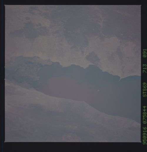
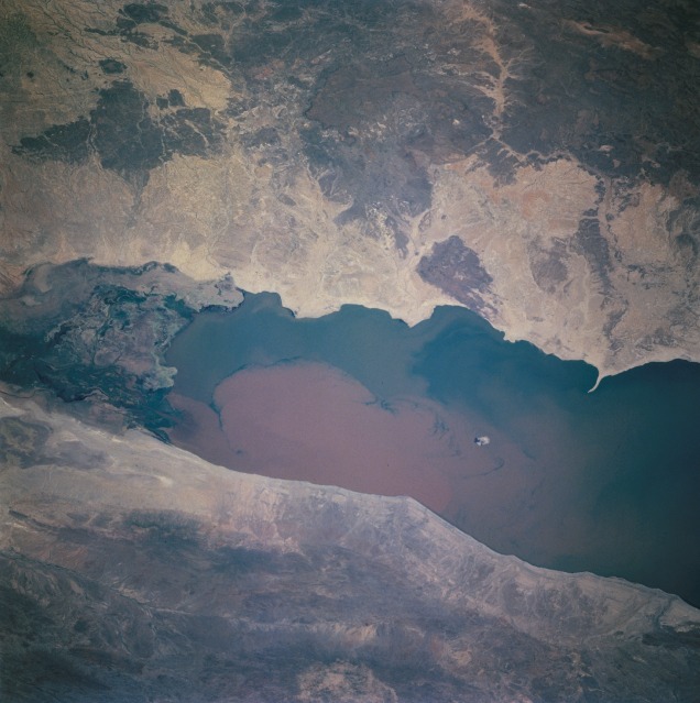
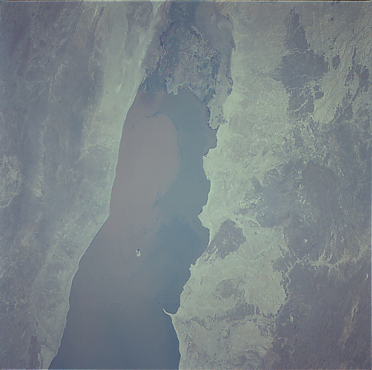
Image Caption: Omo Delta One of our long-term
environmental study sites is the Omo Delta at the north end of Lake
Turkana (Rudolph). The environmental interest in this instance is the
documentation of the delta's extension into the lake. This delta
extension, or aggradation, is felt to be the result of large-scale
soil erosion in the recently deforested areas of Ethiopia in the
watershed of the Omo River and lake level fluctuations.
Using digitized, rectified, classified, and mensurated Shuttle
photography, it has been determined that the Omo Delta has increased
in area by approximately 400% to about 1800 sq km since it was first
photographed during the Gemini program in 1965
These photos documents the long-term and increasing turbidity of Lake
Turkana and the continuing delta extension southward by both the
northwest and northeast distributaries of the Omo River.
