STS069-702-91
| NASA Photo ID | STS069-702-91 |
| Focal Length | 100mm |
| Date taken | 1995.09.08 |
| Time taken | 09:45:28 GMT |
Resolutions offered for this image:
4096 x 4096 pixels 640 x 640 pixels 5700 x 5900 pixels 500 x 518 pixels 640 x 480 pixels 523 x 517 pixels
4096 x 4096 pixels 640 x 640 pixels 5700 x 5900 pixels 500 x 518 pixels 640 x 480 pixels 523 x 517 pixels

Cloud masks available for this image:
Spacecraft nadir point: 21.1° N, 40.1° E
Photo center point: 21.5° N, 39.0° E
Photo center point by machine learning:
Photo center point: 21.5° N, 39.0° E
Photo center point by machine learning:
Nadir to Photo Center: West
Spacecraft Altitude: 200 nautical miles (370km)
Country or Geographic Name: | SAUDI ARABIA |
Features: | RED SEA COAST, JEDDA |
| Features Found Using Machine Learning: | |
Cloud Cover Percentage: | 5 (1-10)% |
Sun Elevation Angle: | 73° |
Sun Azimuth: | 205° |
Camera: | Hasselblad |
Focal Length: | 100mm |
Camera Tilt: | 19 degrees |
Format: | 5046: Kodak, natural color positive, Lumiere 100/5046, ASA 100, standard base |
Film Exposure: | Normal |
| Additional Information | |
| Width | Height | Annotated | Cropped | Purpose | Links |
|---|---|---|---|---|---|
| 4096 pixels | 4096 pixels | No | No | Earth From Space collection | Download Image |
| 640 pixels | 640 pixels | No | No | Earth From Space collection | Download Image |
| 5700 pixels | 5900 pixels | No | No | Download Image | |
| 500 pixels | 518 pixels | No | No | Download Image | |
| 640 pixels | 480 pixels | No | No | Download Image | |
| 523 pixels | 517 pixels | Download Image |
Download Packaged File
Download a Google Earth KML for this Image
View photo footprint information
Download a GeoTIFF for this photo
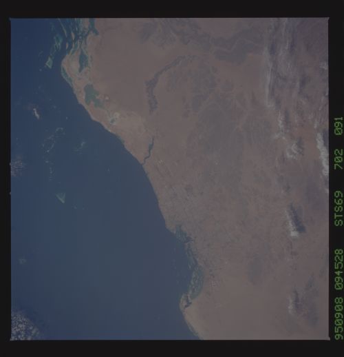
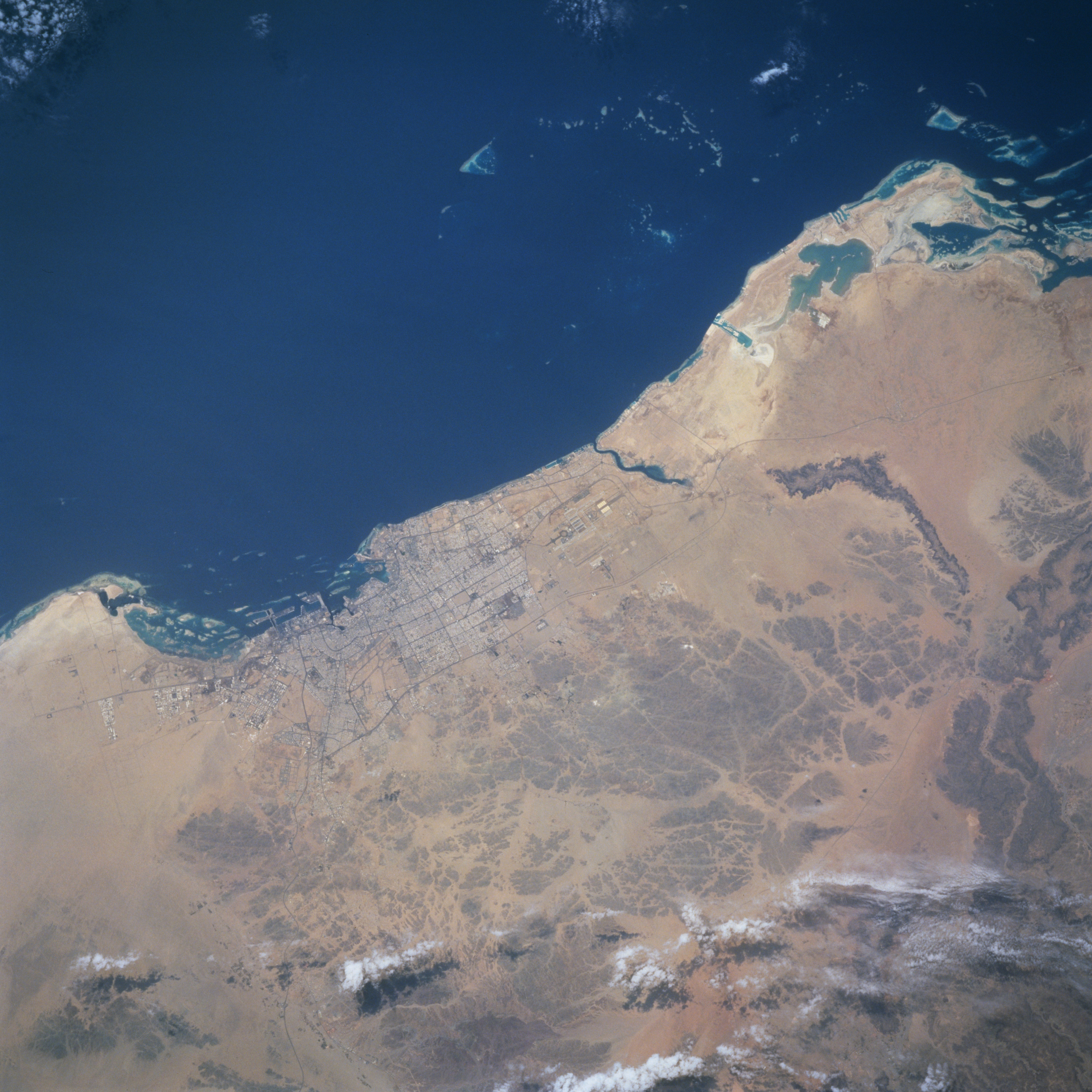
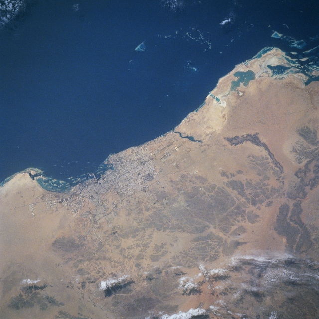
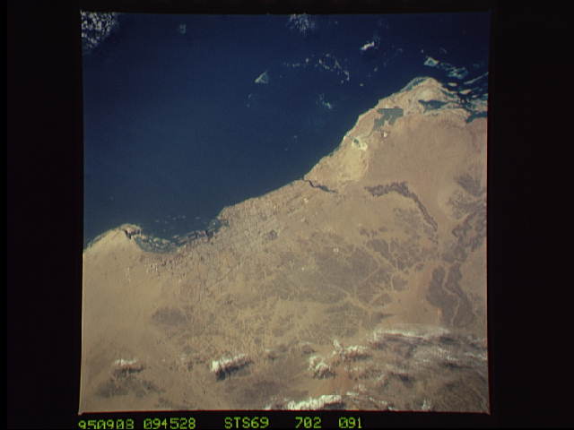
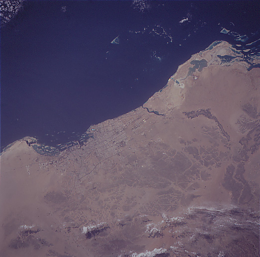
Image Caption: STS069-702-091 Jiddah (Jeddah) Area, Saudi Arabia September 1995
The modern port city of Jiddah, located along the central west coast of Saudi Arabia, is considered to be the most cosmopolitan city in the country. Jiddah has experienced rapid growth and modern development since the early 1970's. The city is Saudi Arabia's principal seaport and transportation hub because of its industrial growth but also because of the city's dramatic increase in Islamic pilgrims who enter the country through Jiddah's worldwide connections via ships or airplanes, as the travelers trek to Mecca (Islam's holiest city), which is located 45 miles (70 km) east of Jiddah. Some of the city's infrastructure, including streets, harbor facilities, and the runways of King Abdul Aziz International Airport (immediately north of the urban area) can be seen. The darker region east of the city (bottom center) is an area of low hills, while the uniform-looking tan landscape show large areas of sand that contrasts with the dark colored waters of the Red Sea.
The modern port city of Jiddah, located along the central west coast of Saudi Arabia, is considered to be the most cosmopolitan city in the country. Jiddah has experienced rapid growth and modern development since the early 1970's. The city is Saudi Arabia's principal seaport and transportation hub because of its industrial growth but also because of the city's dramatic increase in Islamic pilgrims who enter the country through Jiddah's worldwide connections via ships or airplanes, as the travelers trek to Mecca (Islam's holiest city), which is located 45 miles (70 km) east of Jiddah. Some of the city's infrastructure, including streets, harbor facilities, and the runways of King Abdul Aziz International Airport (immediately north of the urban area) can be seen. The darker region east of the city (bottom center) is an area of low hills, while the uniform-looking tan landscape show large areas of sand that contrasts with the dark colored waters of the Red Sea.
