STS068-273-56
| NASA Photo ID | STS068-273-56 |
| Focal Length | 250mm |
| Date taken | 1994.10.03 |
| Time taken | 21:15:03 GMT |
Resolutions offered for this image:
4054 x 4054 pixels 640 x 640 pixels 5700 x 5900 pixels 500 x 518 pixels 640 x 480 pixels
4054 x 4054 pixels 640 x 640 pixels 5700 x 5900 pixels 500 x 518 pixels 640 x 480 pixels
Cloud masks available for this image:
Spacecraft nadir point: 26.8° N, 108.4° W
Photo center point: 28.0° N, 110.0° W
Photo center point by machine learning:
Photo center point: 28.0° N, 110.0° W
Photo center point by machine learning:
Nadir to Photo Center: Northwest
Spacecraft Altitude: 118 nautical miles (219km)
Country or Geographic Name: | MEXICO |
Features: | ALVARA OBRAGON RES. |
| Features Found Using Machine Learning: | |
Cloud Cover Percentage: | 10 (1-10)% |
Sun Elevation Angle: | 46° |
Sun Azimuth: | 231° |
Camera: | Hasselblad |
Focal Length: | 250mm |
Camera Tilt: | 45 degrees |
Format: | 5046: Kodak, natural color positive, Lumiere 100/5046, ASA 100, standard base |
Film Exposure: | Normal |
| Additional Information | |
| Width | Height | Annotated | Cropped | Purpose | Links |
|---|---|---|---|---|---|
| 4054 pixels | 4054 pixels | No | No | Earth From Space collection | Download Image |
| 640 pixels | 640 pixels | No | No | Earth From Space collection | Download Image |
| 5700 pixels | 5900 pixels | No | No | Download Image | |
| 500 pixels | 518 pixels | No | No | Download Image | |
| 640 pixels | 480 pixels | No | No | Download Image |
Download Packaged File
Download a Google Earth KML for this Image
View photo footprint information
Download a GeoTIFF for this photo
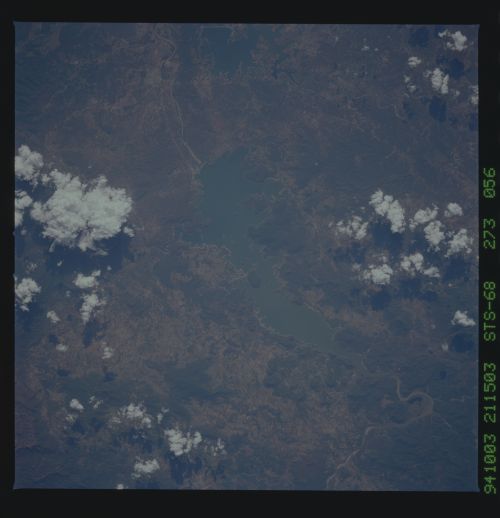
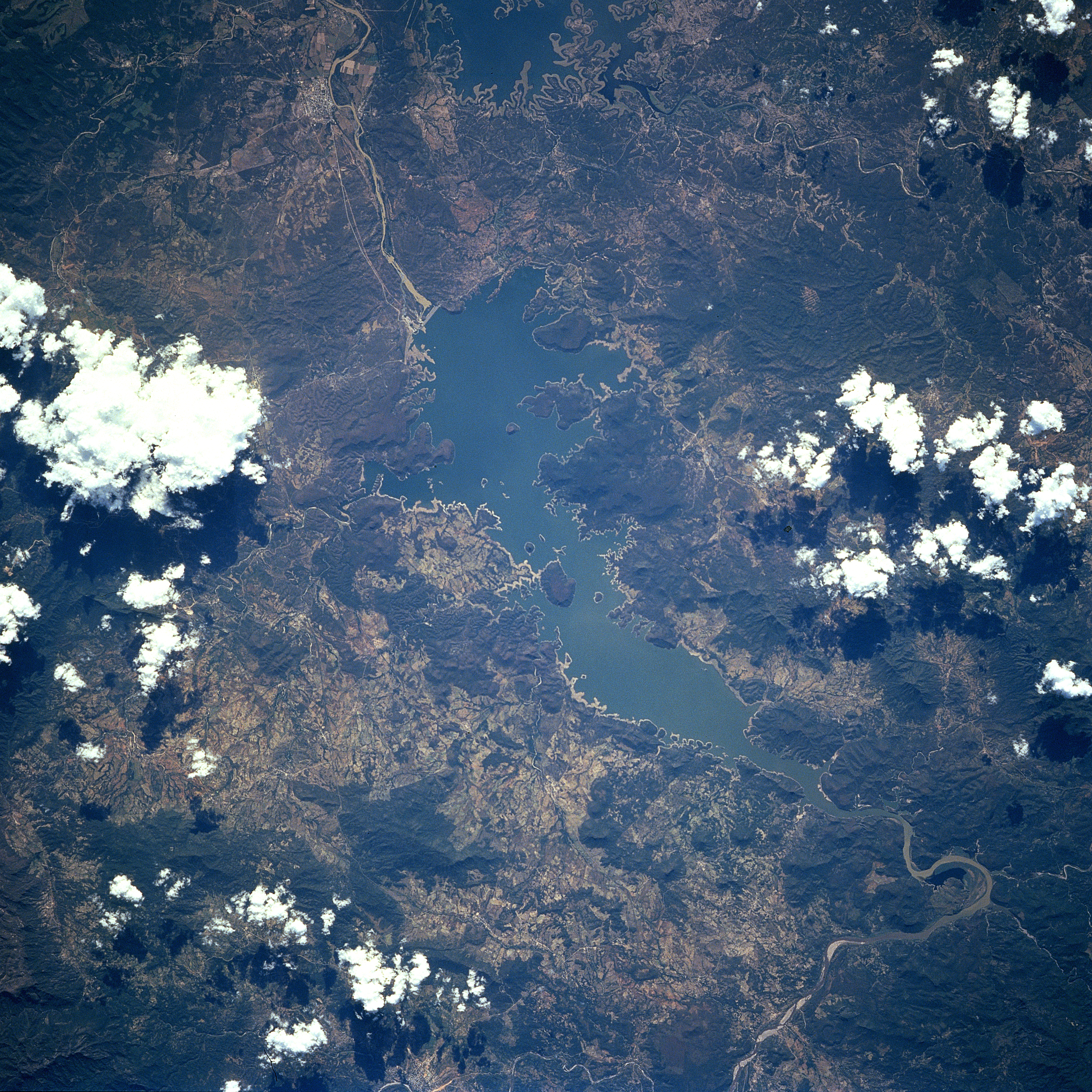
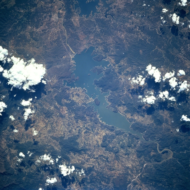
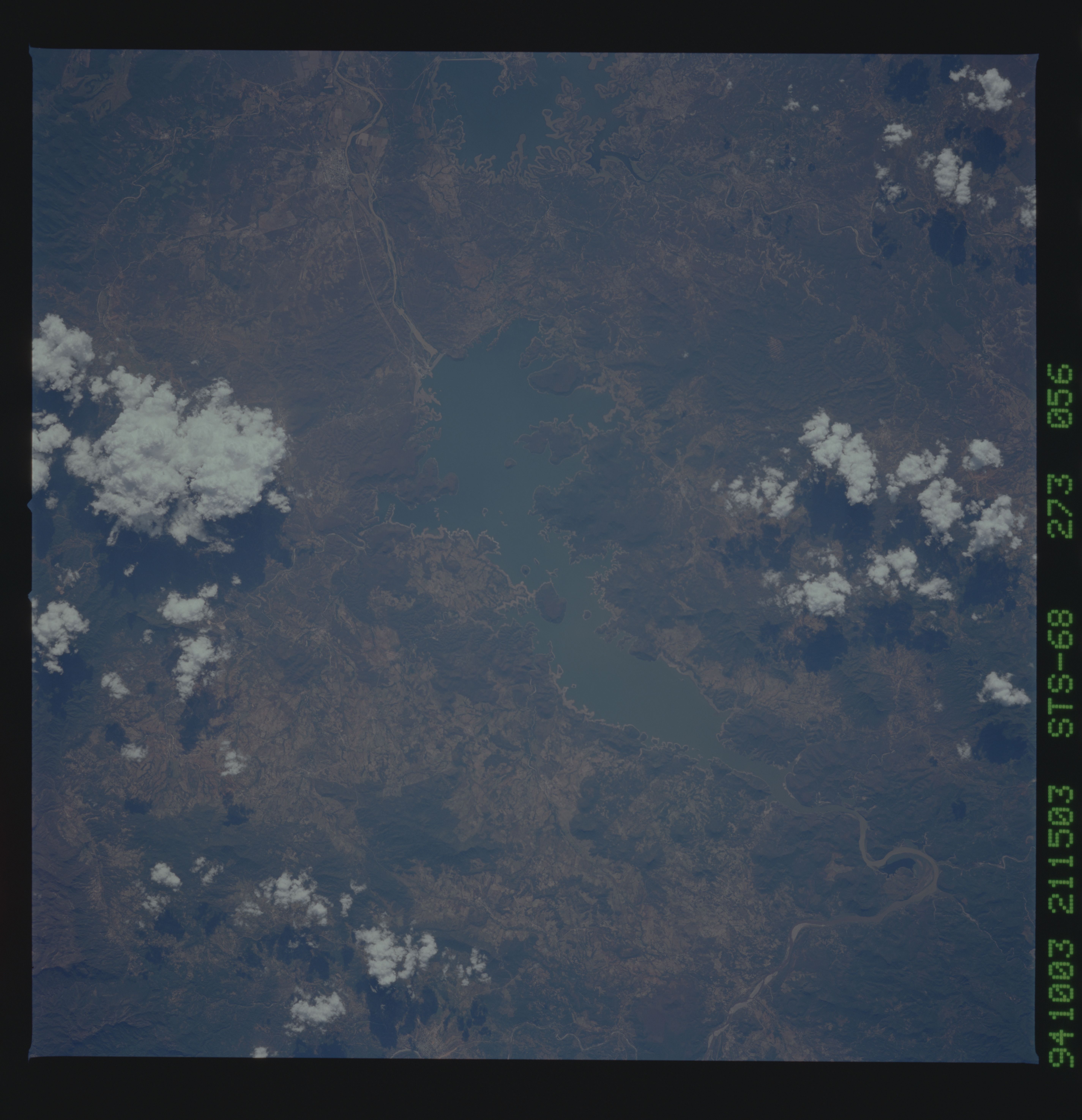
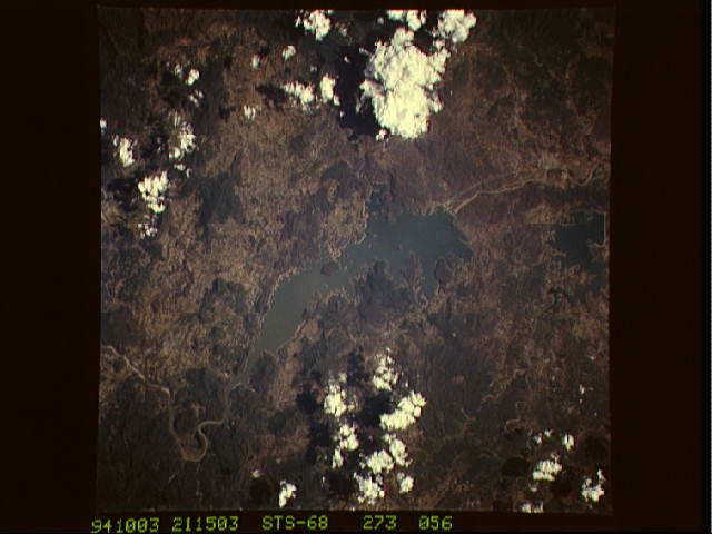
Image Caption: STS068-273-056 Lake Ouiachic, Mexico October 1994
Located in the foothills of the Sierra Madre Occidental, Lake Ouiachic (also referred to as the Lever Obregon Reservoir) can be seen in this south-southwest looking view. Lake Ouiachic is fed by and drained by the Yaqui River. The dam was completed in 1952 with the purpose to regulate water flow of the Yaqui River, prevent floods, and generate electricity. Lake Ouiachic is also an expanding tourist and resort area specializing in fishing, boating, and water skiing.
Located in the foothills of the Sierra Madre Occidental, Lake Ouiachic (also referred to as the Lever Obregon Reservoir) can be seen in this south-southwest looking view. Lake Ouiachic is fed by and drained by the Yaqui River. The dam was completed in 1952 with the purpose to regulate water flow of the Yaqui River, prevent floods, and generate electricity. Lake Ouiachic is also an expanding tourist and resort area specializing in fishing, boating, and water skiing.
