STS068-273-40
| NASA Photo ID | STS068-273-40 |
| Focal Length | 250mm |
| Date taken | 1994.10.03 |
| Time taken | 21:10:03 GMT |
Resolutions offered for this image:
3904 x 3904 pixels 639 x 639 pixels 5700 x 5900 pixels 500 x 518 pixels 640 x 480 pixels
3904 x 3904 pixels 639 x 639 pixels 5700 x 5900 pixels 500 x 518 pixels 640 x 480 pixels
Cloud masks available for this image:
Spacecraft nadir point: 41.9° N, 123.6° W
Photo center point: 41.5° N, 122.5° W
Photo center point by machine learning:
Photo center point: 41.5° N, 122.5° W
Photo center point by machine learning:
Nadir to Photo Center: East
Spacecraft Altitude: 117 nautical miles (217km)
Country or Geographic Name: | USA-CALIFORNIA |
Features: | MOUNT SHASTA VOLCANO |
| Features Found Using Machine Learning: | |
Cloud Cover Percentage: | 0 (no clouds present) |
Sun Elevation Angle: | 42° |
Sun Azimuth: | 203° |
Camera: | Hasselblad |
Focal Length: | 250mm |
Camera Tilt: | Near Vertical |
Format: | 5046: Kodak, natural color positive, Lumiere 100/5046, ASA 100, standard base |
Film Exposure: | Normal |
| Additional Information | |
| Width | Height | Annotated | Cropped | Purpose | Links |
|---|---|---|---|---|---|
| 3904 pixels | 3904 pixels | No | No | Earth From Space collection | Download Image |
| 639 pixels | 639 pixels | No | No | Earth From Space collection | Download Image |
| 5700 pixels | 5900 pixels | No | No | Download Image | |
| 500 pixels | 518 pixels | No | No | Download Image | |
| 640 pixels | 480 pixels | No | No | Download Image |
Download Packaged File
Download a Google Earth KML for this Image
View photo footprint information
Download a GeoTIFF for this photo
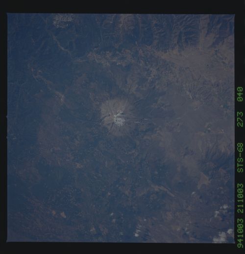
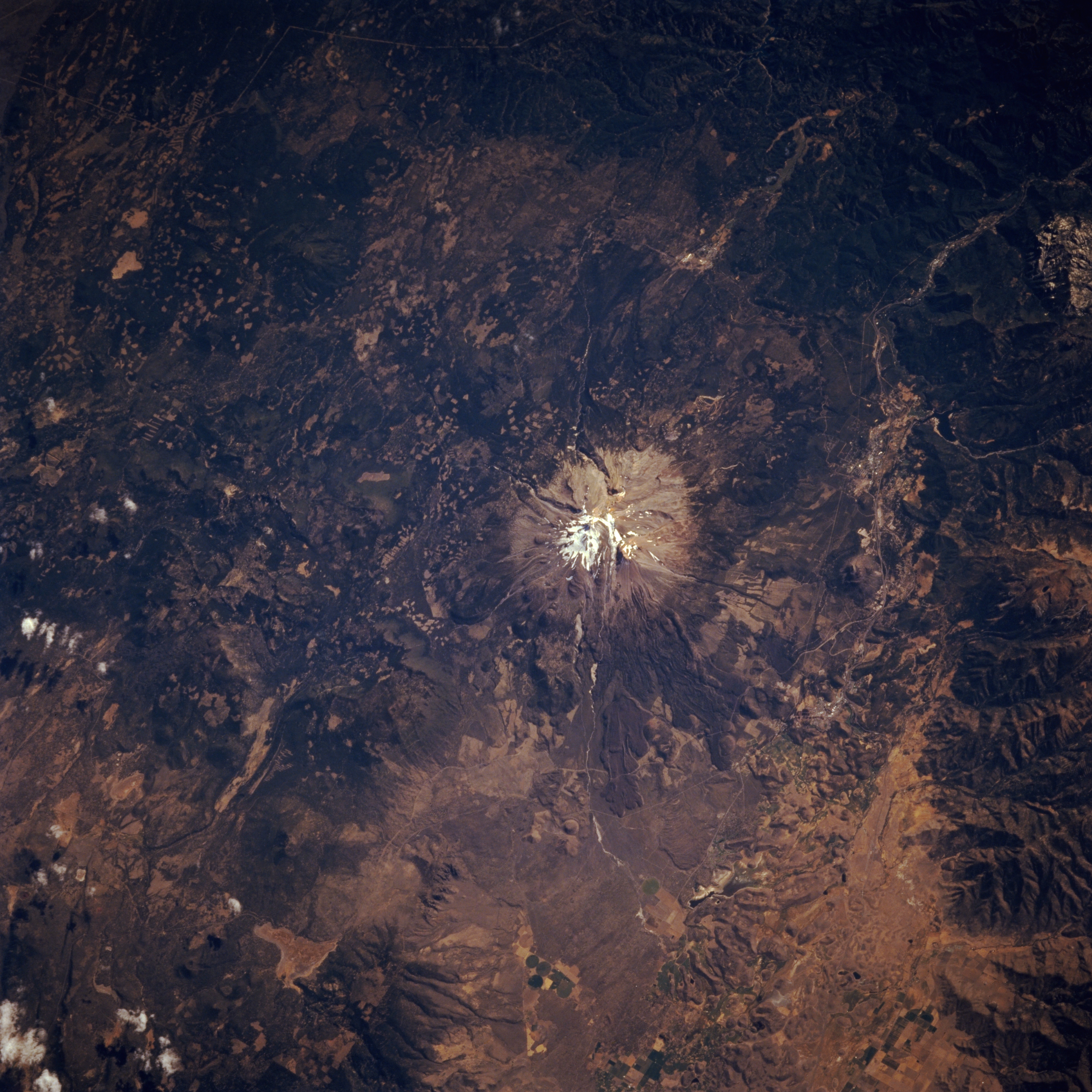
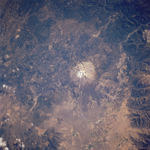
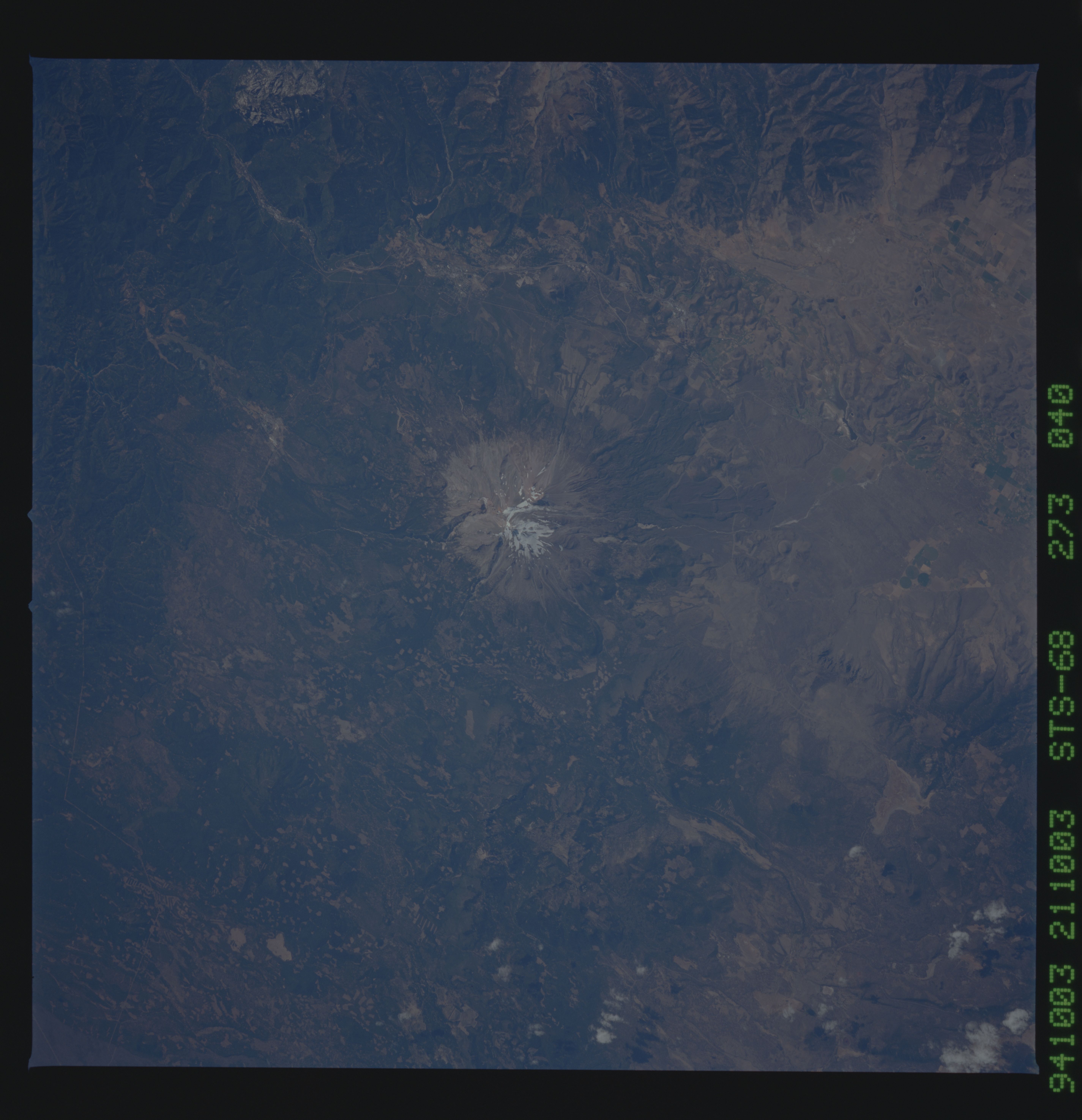
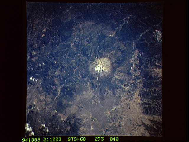
Image Caption: STS068-273-040 Mount Shasta, California, U.S.A. October 1994
Mount Shasta, a stratovolcano located in the southern Cascade Mountains, is featured in this low-oblique, east-southeast-looking photograph. Glaciers are visible near the top of this 14 162-foot (4319-meter) dormant volcano that last erupted in 1768. Small rectangular patterns of clear-cutting in Shasta-Trinity National Forest are visible to the east and southeast.
Mount Shasta, a stratovolcano located in the southern Cascade Mountains, is featured in this low-oblique, east-southeast-looking photograph. Glaciers are visible near the top of this 14 162-foot (4319-meter) dormant volcano that last erupted in 1768. Small rectangular patterns of clear-cutting in Shasta-Trinity National Forest are visible to the east and southeast.
