STS068-273-12
| NASA Photo ID | STS068-273-12 |
| Focal Length | 250mm |
| Date taken | 1994.10.03 |
| Time taken | 19:50:52 GMT |
Resolutions offered for this image:
5285 x 5285 pixels 639 x 639 pixels 5700 x 5900 pixels 500 x 518 pixels 640 x 480 pixels
5285 x 5285 pixels 639 x 639 pixels 5700 x 5900 pixels 500 x 518 pixels 640 x 480 pixels

Cloud masks available for this image:
Spacecraft nadir point: 11.4° N, 75.5° W
Photo center point: 11.0° N, 75.0° W
Photo center point by machine learning:
Photo center point: 11.0° N, 75.0° W
Photo center point by machine learning:
Nadir to Photo Center: Southeast
Spacecraft Altitude: 118 nautical miles (219km)
Country or Geographic Name: | COLOMBIA |
Features: | CITY OF BARRANQUILLA |
| Features Found Using Machine Learning: | |
Cloud Cover Percentage: | 10 (1-10)% |
Sun Elevation Angle: | 43° |
Sun Azimuth: | 253° |
Camera: | Hasselblad |
Focal Length: | 250mm |
Camera Tilt: | 18 degrees |
Format: | 5046: Kodak, natural color positive, Lumiere 100/5046, ASA 100, standard base |
Film Exposure: | Normal |
| Additional Information | |
| Width | Height | Annotated | Cropped | Purpose | Links |
|---|---|---|---|---|---|
| 5285 pixels | 5285 pixels | No | No | Earth From Space collection | Download Image |
| 639 pixels | 639 pixels | No | No | Earth From Space collection | Download Image |
| 5700 pixels | 5900 pixels | No | No | Download Image | |
| 500 pixels | 518 pixels | No | No | Download Image | |
| 640 pixels | 480 pixels | No | No | Download Image |
Download Packaged File
Download a Google Earth KML for this Image
View photo footprint information
Download a GeoTIFF for this photo
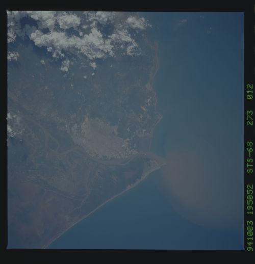
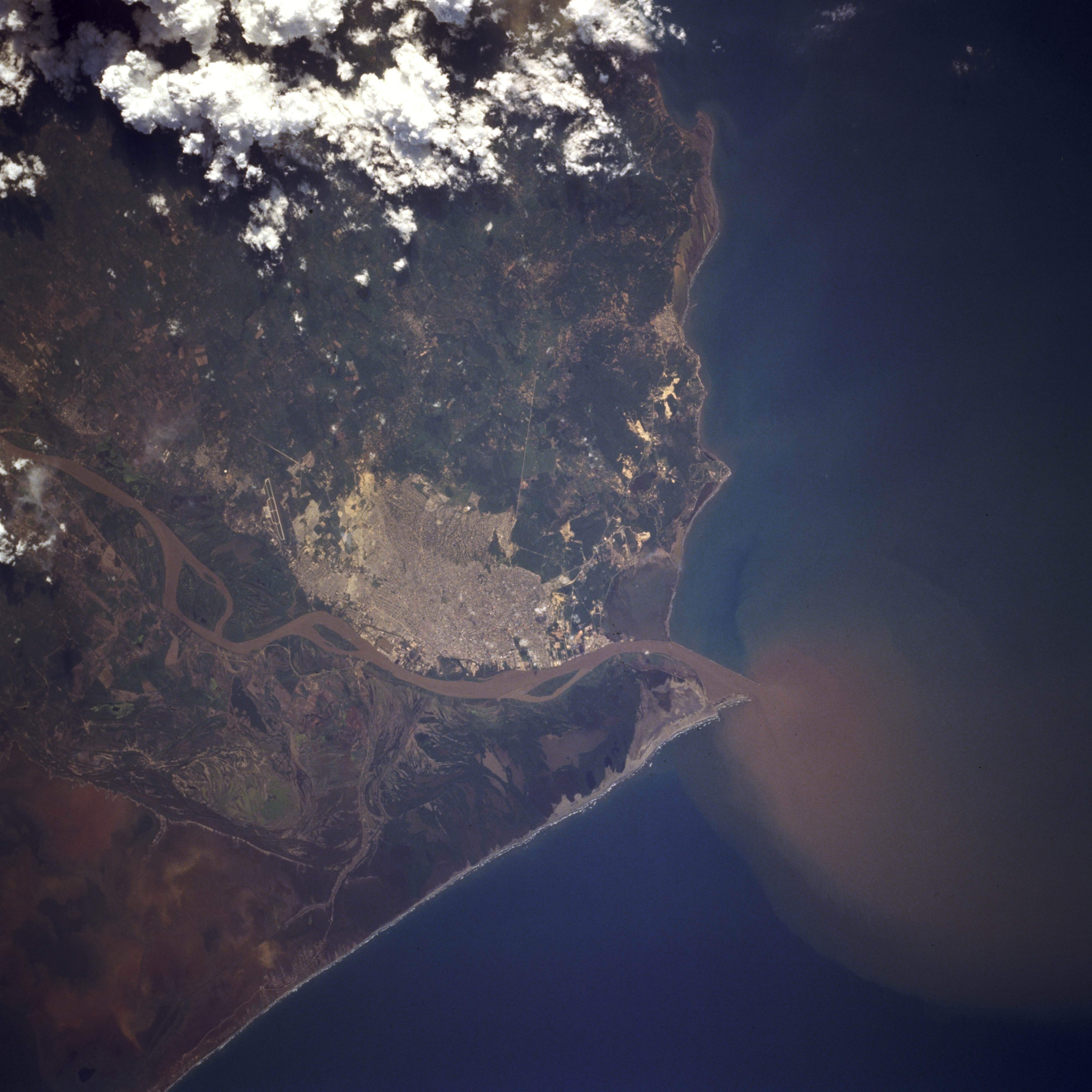
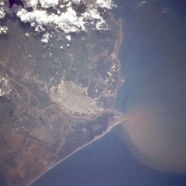
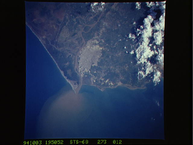
Image Caption: STS068-273-012 Barranquilla, Colombia October 1994
Barranquilla, a city of more than 1 million, is located near the mouth of the Magdalena River. Barranquilla and Cartagena (not shown), with a population of approximately 655 000, are Columbia's two most important seaports with access to the Caribbean Sea. Because of large quantities of sediment, indicated by the extensive sediment plume at its mouth and the brownish color of its water, the Magdalena requires frequent dredging of the main channel to permit access to Barranquilla's port for oceangoing vessels. The urban area, with airport runways visible south of the city, presents a dramatic comparison to the almost uninhabited swamplands east of the city through which a single road traverses. In addition to its position as an important seaport, Barranquilla is a leading industrial city, producing textiles, sugar, beer, cement, and flour.
Barranquilla, a city of more than 1 million, is located near the mouth of the Magdalena River. Barranquilla and Cartagena (not shown), with a population of approximately 655 000, are Columbia's two most important seaports with access to the Caribbean Sea. Because of large quantities of sediment, indicated by the extensive sediment plume at its mouth and the brownish color of its water, the Magdalena requires frequent dredging of the main channel to permit access to Barranquilla's port for oceangoing vessels. The urban area, with airport runways visible south of the city, presents a dramatic comparison to the almost uninhabited swamplands east of the city through which a single road traverses. In addition to its position as an important seaport, Barranquilla is a leading industrial city, producing textiles, sugar, beer, cement, and flour.
