STS068-271-60
| NASA Photo ID | STS068-271-60 |
| Focal Length | 250mm |
| Date taken | 1994.10.04 |
| Time taken | 19:25:41 GMT |
Resolutions offered for this image:
5700 x 5900 pixels 500 x 518 pixels 640 x 480 pixels 850 x 864 pixels 750 x 762 pixels
5700 x 5900 pixels 500 x 518 pixels 640 x 480 pixels 850 x 864 pixels 750 x 762 pixels

Cloud masks available for this image:
Spacecraft nadir point: 30.8° N, 90.1° W
Photo center point: 30.0° N, 91.5° W
Photo center point by machine learning:
Photo center point: 30.0° N, 91.5° W
Photo center point by machine learning:
Nadir to Photo Center: Southwest
Spacecraft Altitude: 117 nautical miles (217km)
Country or Geographic Name: | USA-LOUISIANA |
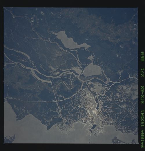
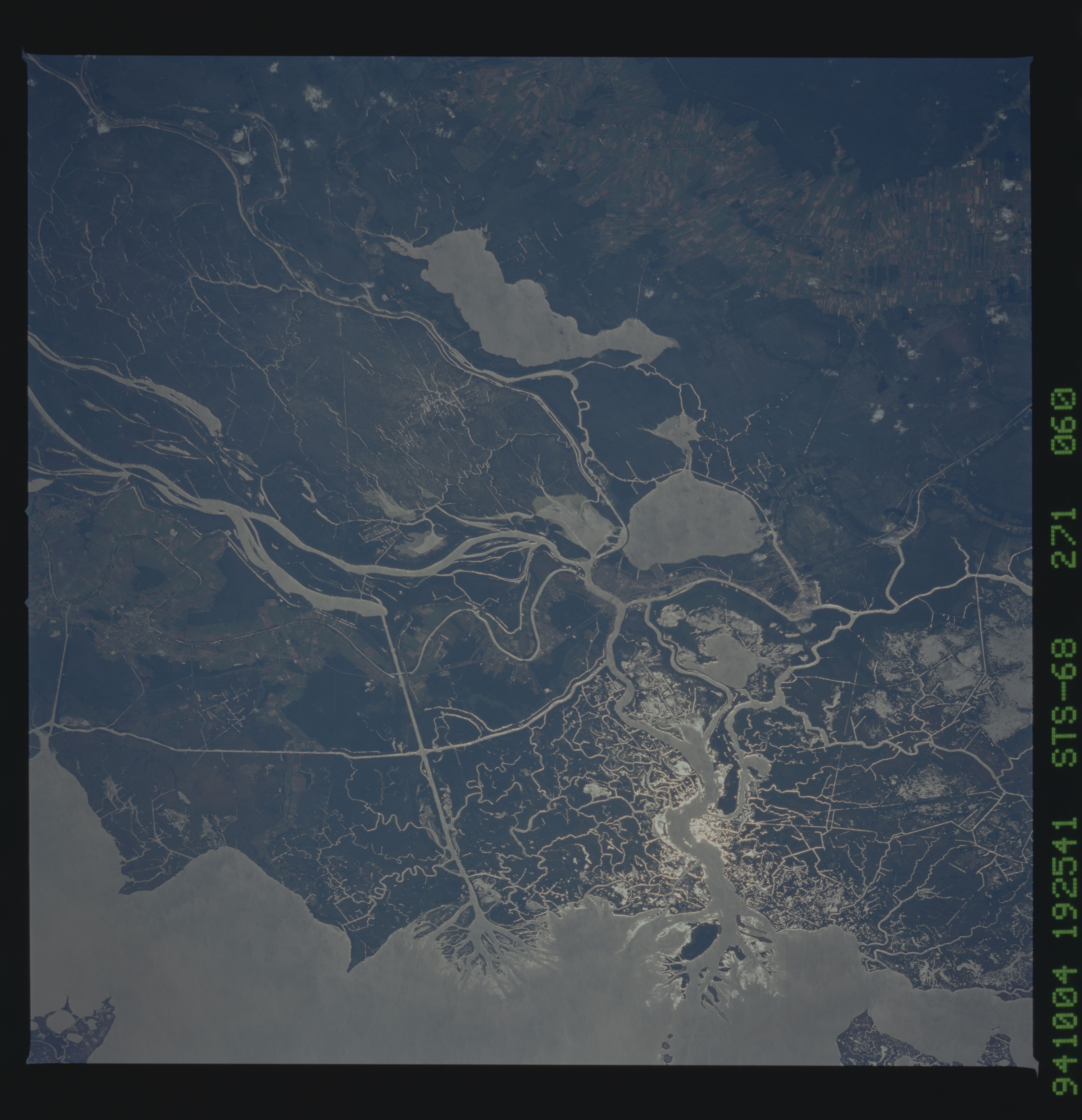
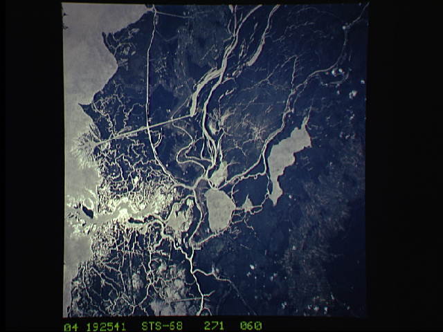
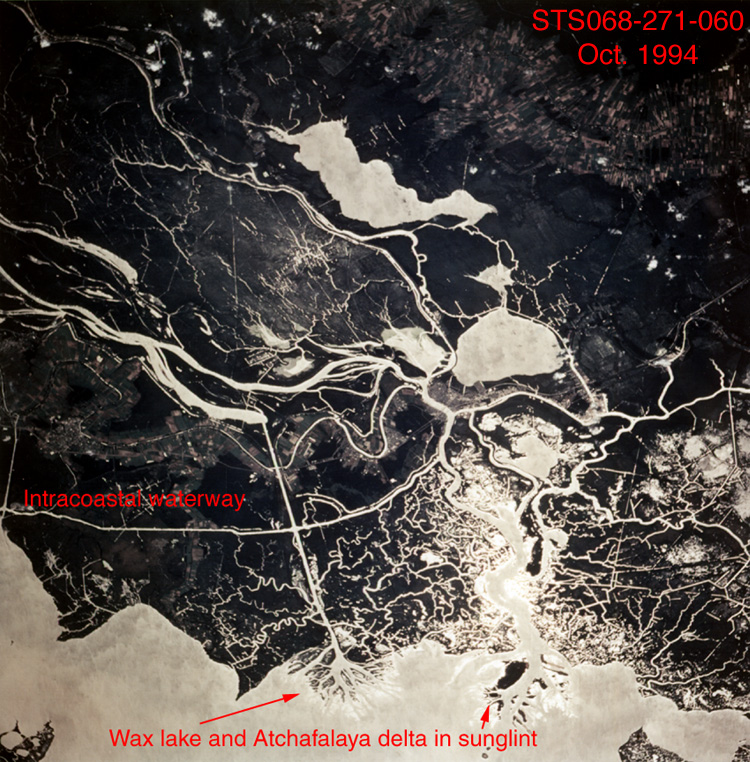
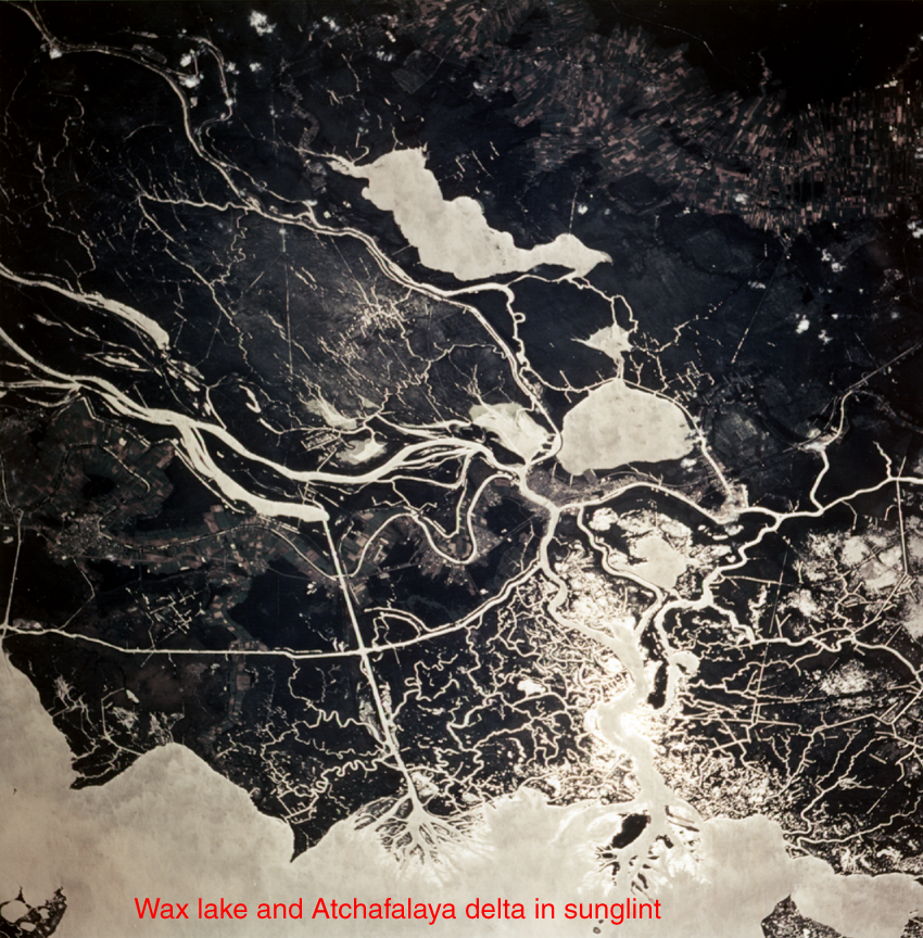
Features: | ATCHAFALAYA DELTA, SNGLNT |
| Features Found Using Machine Learning: | |
Cloud Cover Percentage: | 0 (no clouds present) |
Sun Elevation Angle: | 48° |
Sun Azimuth: | 218° |
Camera: | Hasselblad |
Focal Length: | 250mm |
Camera Tilt: | 40 degrees |
Format: | 5046: Kodak, natural color positive, Lumiere 100/5046, ASA 100, standard base |
Film Exposure: | Normal |
| Additional Information | |
| Width | Height | Annotated | Cropped | Purpose | Links |
|---|---|---|---|---|---|
| 5700 pixels | 5900 pixels | No | No | Download Image | |
| 500 pixels | 518 pixels | No | No | Download Image | |
| 640 pixels | 480 pixels | No | No | Download Image | |
| 850 pixels | 864 pixels | Yes | No | Download Image | |
| 750 pixels | 762 pixels | Download Image |
Download Packaged File
Download a Google Earth KML for this Image
View photo footprint information
Download a GeoTIFF for this photo
Image Caption: Atchafalaya River Basin in sunglint. Much of this area
was water, tens of meters deep, in 1957. Flow of the Mississippi River
during the past 35 years has filled in the former basin and begun a
delta south of Morgan City, Louisiana (on the large, braided channel).
A small birds-foot delta is forming at the mouth of a canal to the
west.
was water, tens of meters deep, in 1957. Flow of the Mississippi River
during the past 35 years has filled in the former basin and begun a
delta south of Morgan City, Louisiana (on the large, braided channel).
A small birds-foot delta is forming at the mouth of a canal to the
west.
