STS068-253-72
| NASA Photo ID | STS068-253-72 |
| Focal Length | 250mm |
| Date taken | 1994.10.05 |
| Time taken | 07:19:45 GMT |
Resolutions offered for this image:
4096 x 4096 pixels 640 x 640 pixels 5700 x 5900 pixels 500 x 518 pixels 640 x 480 pixels 524 x 519 pixels
4096 x 4096 pixels 640 x 640 pixels 5700 x 5900 pixels 500 x 518 pixels 640 x 480 pixels 524 x 519 pixels

Cloud masks available for this image:
Spacecraft nadir point: 18.3° N, 98.8° E
Photo center point: 16.5° N, 97.5° E
Photo center point by machine learning:
Photo center point: 16.5° N, 97.5° E
Photo center point by machine learning:
Nadir to Photo Center: Southwest
Spacecraft Altitude: 118 nautical miles (219km)
Country or Geographic Name: | MYANMAR (BURMA) |
Features: | SALWEEN RIVER DELTA |
| Features Found Using Machine Learning: | |
Cloud Cover Percentage: | 10 (1-10)% |
Sun Elevation Angle: | 51° |
Sun Azimuth: | 237° |
Camera: | Hasselblad |
Focal Length: | 250mm |
Camera Tilt: | 48 degrees |
Format: | 5046: Kodak, natural color positive, Lumiere 100/5046, ASA 100, standard base |
Film Exposure: | Normal |
| Additional Information | |
| Width | Height | Annotated | Cropped | Purpose | Links |
|---|---|---|---|---|---|
| 4096 pixels | 4096 pixels | No | No | Earth From Space collection | Download Image |
| 640 pixels | 640 pixels | No | No | Earth From Space collection | Download Image |
| 5700 pixels | 5900 pixels | No | No | Download Image | |
| 500 pixels | 518 pixels | No | No | Download Image | |
| 640 pixels | 480 pixels | No | No | Download Image | |
| 524 pixels | 519 pixels | Download Image |
Download Packaged File
Download a Google Earth KML for this Image
View photo footprint information
Download a GeoTIFF for this photo
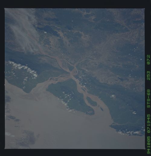
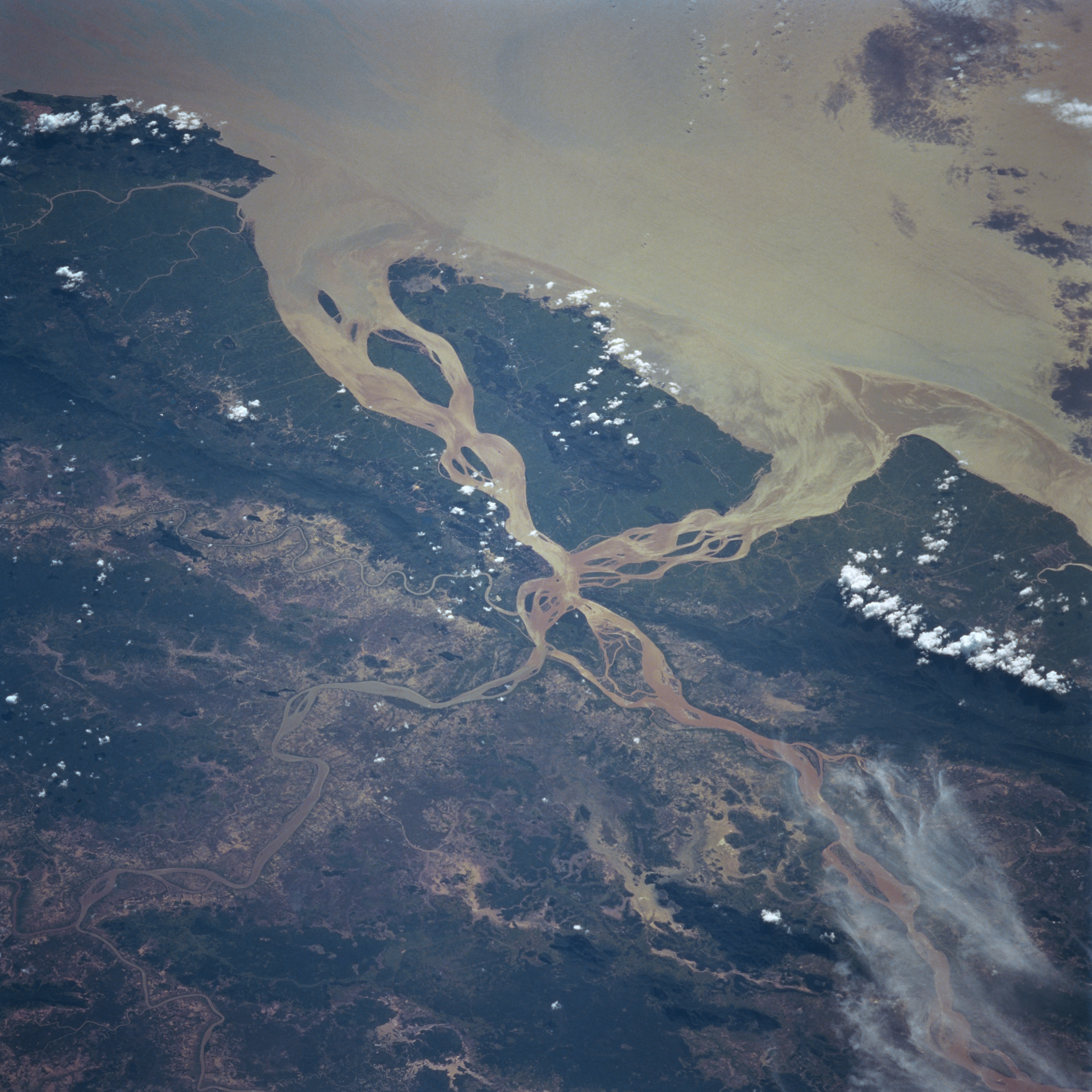
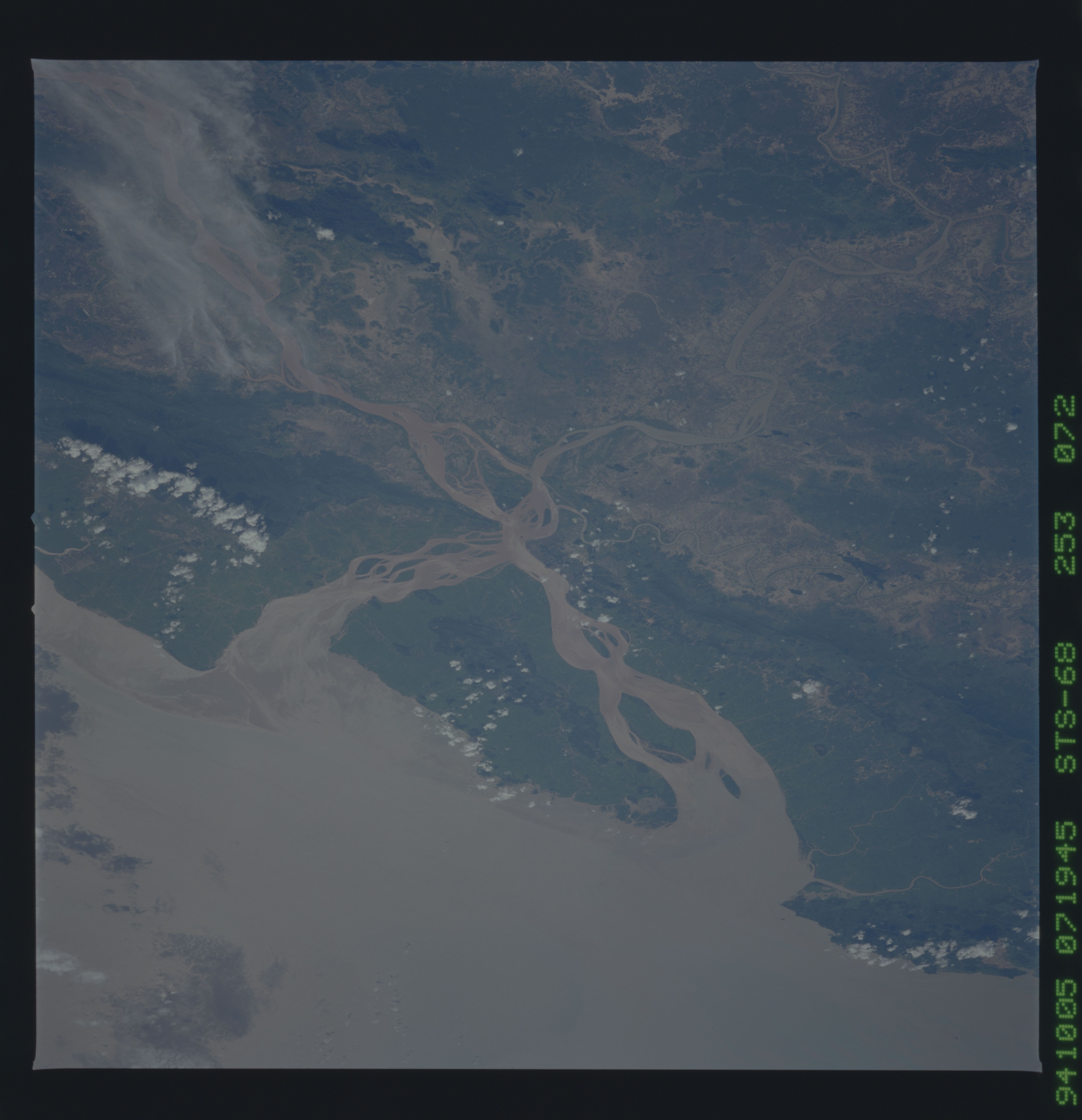
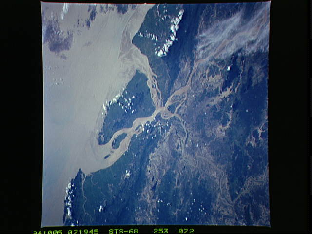
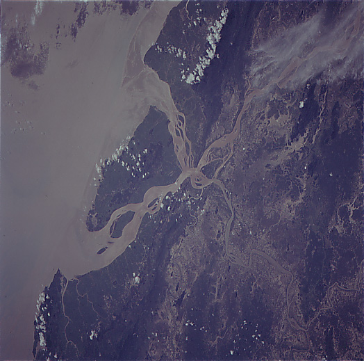
Image Caption: STS068-253-072 Salween River Delta, Burma October 1994
The silt-laden mouth of the Salween River is visible in this west-looking view. The Salween River rises in the Tibet Plateau of western China just to the south of the Kunlun Mountains. The river flows generally in a southeast direction for 1750 miles (2815 km) through deep, narrow gorges from China into Burma to its mouth. In Burma, the river cuts through the Shan Plateau and Karenni Hills before emptying into the Gulf of Martaban near the port city of Moulmein. The Salween River has few tributaries and because of the river's numerous rapids, is navigable for only 75 miles (120 km) upstream. The small river entering the scene at the bottom left of the image is the Hlaingbwe.
The silt-laden mouth of the Salween River is visible in this west-looking view. The Salween River rises in the Tibet Plateau of western China just to the south of the Kunlun Mountains. The river flows generally in a southeast direction for 1750 miles (2815 km) through deep, narrow gorges from China into Burma to its mouth. In Burma, the river cuts through the Shan Plateau and Karenni Hills before emptying into the Gulf of Martaban near the port city of Moulmein. The Salween River has few tributaries and because of the river's numerous rapids, is navigable for only 75 miles (120 km) upstream. The small river entering the scene at the bottom left of the image is the Hlaingbwe.
