STS068-253-7
| NASA Photo ID | STS068-253-7 |
| Focal Length | 250mm |
| Date taken | 1994.10.05 |
| Time taken | 04:17:19 GMT |
Resolutions offered for this image:
4061 x 4061 pixels 639 x 639 pixels 5700 x 5900 pixels 500 x 518 pixels 640 x 480 pixels
4061 x 4061 pixels 639 x 639 pixels 5700 x 5900 pixels 500 x 518 pixels 640 x 480 pixels
Cloud masks available for this image:
Spacecraft nadir point: 34.0° N, 131.6° E
Photo center point: 33.5° N, 131.5° E
Photo center point by machine learning:
Photo center point: 33.5° N, 131.5° E
Photo center point by machine learning:
Nadir to Photo Center: South
Spacecraft Altitude: 117 nautical miles (217km)
Country or Geographic Name: | JAPAN |
Features: | KYUSHU, RADIAL DRAINAGE |
| Features Found Using Machine Learning: | |
Cloud Cover Percentage: | 0 (no clouds present) |
Sun Elevation Angle: | 48° |
Sun Azimuth: | 208° |
Camera: | Hasselblad |
Focal Length: | 250mm |
Camera Tilt: | 15 degrees |
Format: | 5046: Kodak, natural color positive, Lumiere 100/5046, ASA 100, standard base |
Film Exposure: | Normal |
| Additional Information | |
| Width | Height | Annotated | Cropped | Purpose | Links |
|---|---|---|---|---|---|
| 4061 pixels | 4061 pixels | No | No | Earth From Space collection | Download Image |
| 639 pixels | 639 pixels | No | No | Earth From Space collection | Download Image |
| 5700 pixels | 5900 pixels | No | No | Download Image | |
| 500 pixels | 518 pixels | No | No | Download Image | |
| 640 pixels | 480 pixels | No | No | Download Image |
Download Packaged File
Download a Google Earth KML for this Image
View photo footprint information
Download a GeoTIFF for this photo
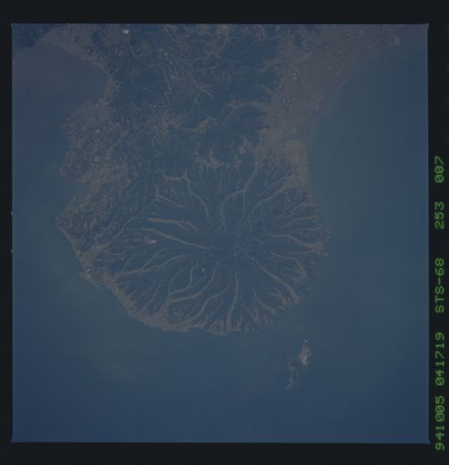
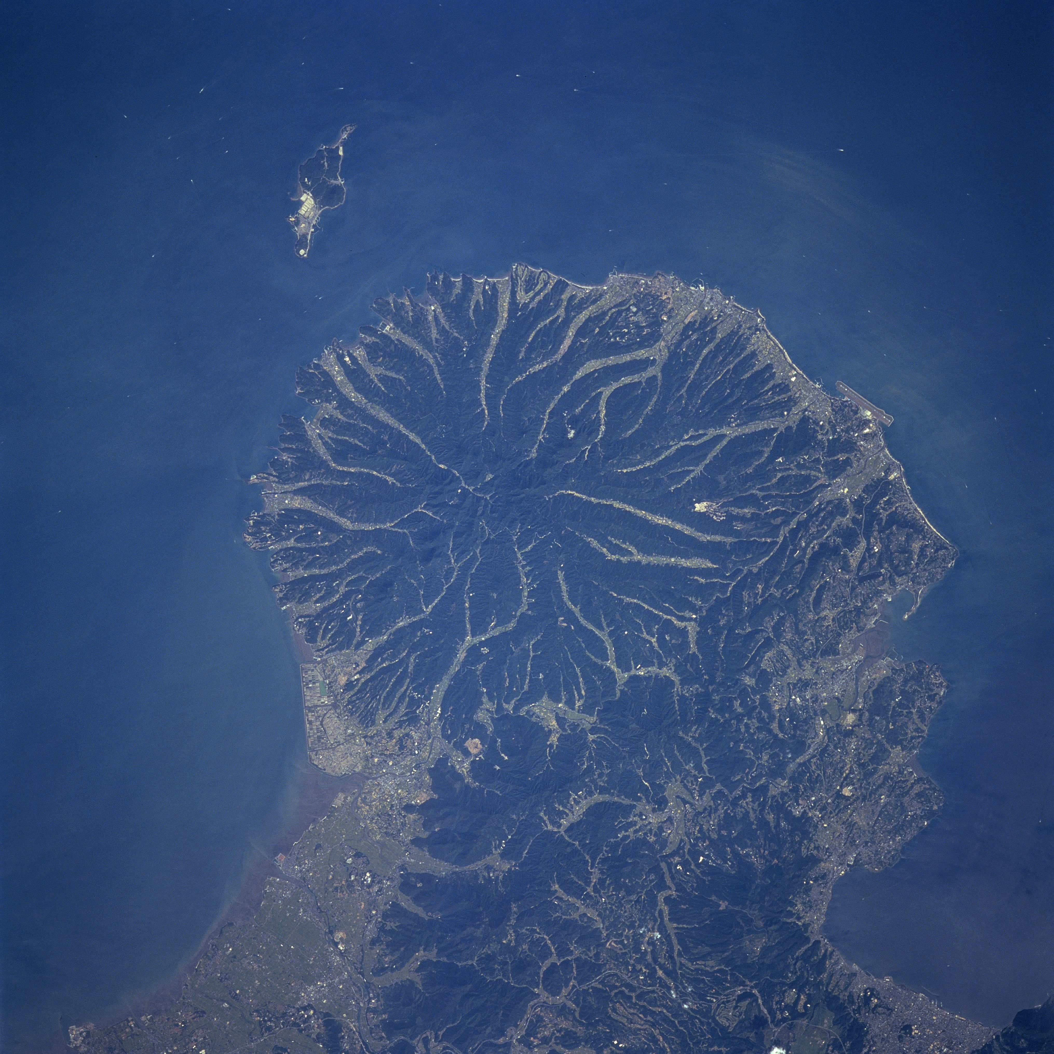
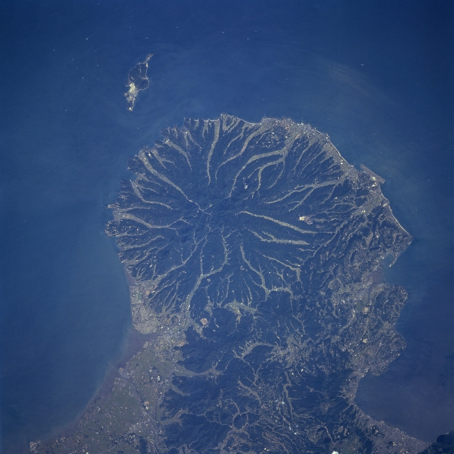
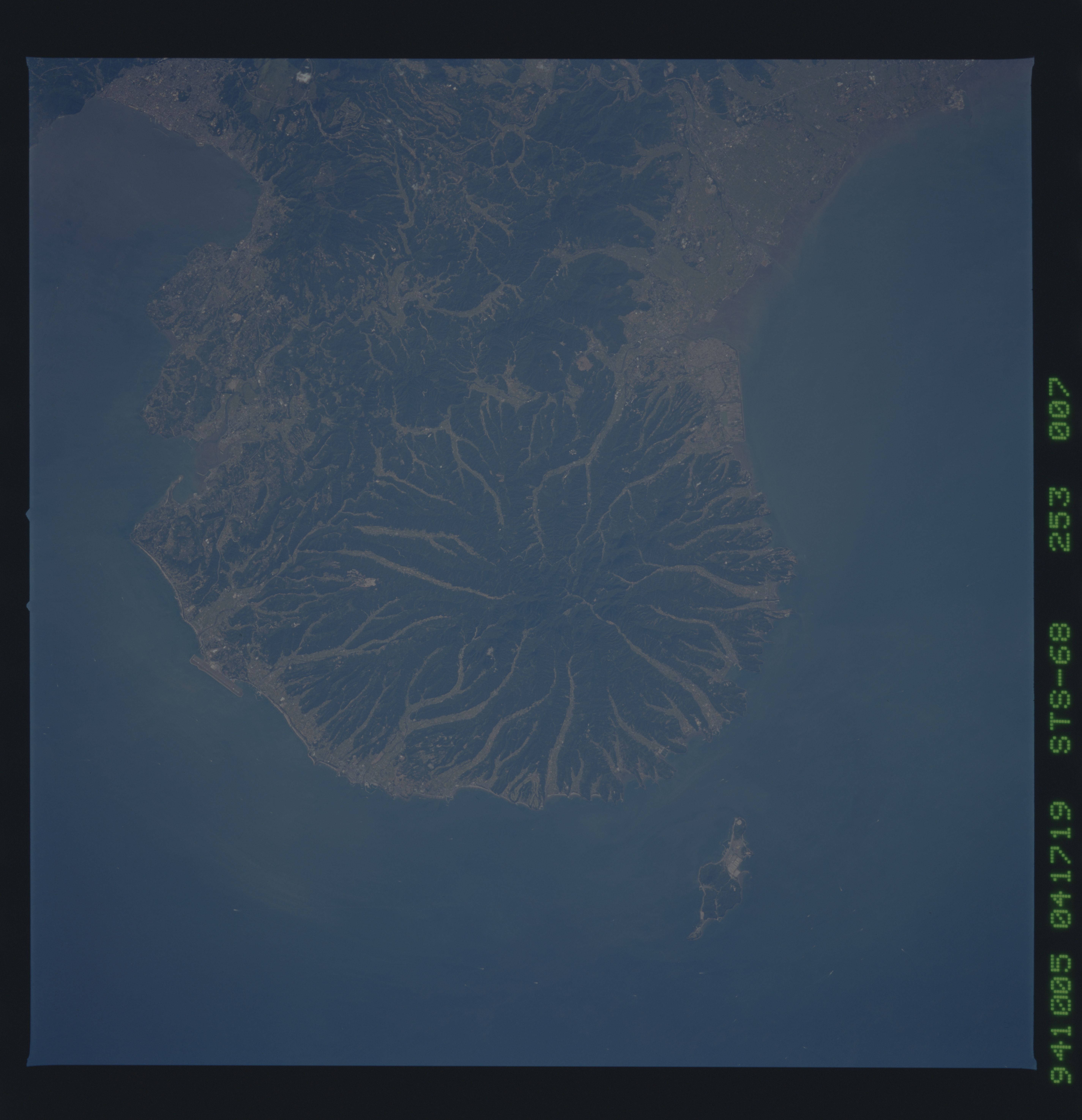
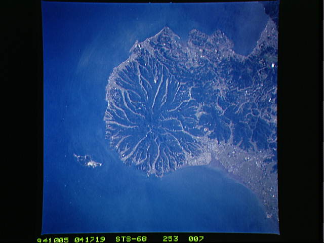
Image Caption: STS068-253-007 Futago Mountain, Kyushu, Japan October, 1994
This detailed view of Futago Mountain (center of image), highest elevation 2365 feet (721 meters), shows a classic radial drainage pattern that is usually associated with volcanoes. The darker landscape maps the steep sloped, densely forested mountain ridgelines, while the lighter colored, linear areas show the eroded valleys that are being used for intensive agriculture. The limited areas of coastal plains are used either for urban development or intensive agriculture. Hime Island is visible off the north coast of this mountainous peninsula that juts northeasterly into the Inland Sea of Japan.
This detailed view of Futago Mountain (center of image), highest elevation 2365 feet (721 meters), shows a classic radial drainage pattern that is usually associated with volcanoes. The darker landscape maps the steep sloped, densely forested mountain ridgelines, while the lighter colored, linear areas show the eroded valleys that are being used for intensive agriculture. The limited areas of coastal plains are used either for urban development or intensive agriculture. Hime Island is visible off the north coast of this mountainous peninsula that juts northeasterly into the Inland Sea of Japan.
