STS068-249-51
| NASA Photo ID | STS068-249-51 |
| Focal Length | 100mm |
| Date taken | 1994.10.09 |
| Time taken | 19:06:16 GMT |
Resolutions offered for this image:
3904 x 3907 pixels 639 x 640 pixels 5700 x 5900 pixels 500 x 518 pixels 640 x 480 pixels
3904 x 3907 pixels 639 x 640 pixels 5700 x 5900 pixels 500 x 518 pixels 640 x 480 pixels

Cloud masks available for this image:
Spacecraft nadir point: 36.3° N, 119.9° W
Photo center point: 34.0° N, 119.5° W
Photo center point by machine learning:
Photo center point: 34.0° N, 119.5° W
Photo center point by machine learning:
Nadir to Photo Center: South
Spacecraft Altitude: 111 nautical miles (206km)
Country or Geographic Name: | USA-CALIFORNIA |
Features: | COASTAL MTS, SUNGLINT |
| Features Found Using Machine Learning: | |
Cloud Cover Percentage: | 5 (1-10)% |
Sun Elevation Angle: | 46° |
Sun Azimuth: | 165° |
Camera: | Hasselblad |
Focal Length: | 100mm |
Camera Tilt: | 52 degrees |
Format: | 5046: Kodak, natural color positive, Lumiere 100/5046, ASA 100, standard base |
Film Exposure: | Normal |
| Additional Information | |
| Width | Height | Annotated | Cropped | Purpose | Links |
|---|---|---|---|---|---|
| 3904 pixels | 3907 pixels | No | No | Earth From Space collection | Download Image |
| 639 pixels | 640 pixels | No | No | Earth From Space collection | Download Image |
| 5700 pixels | 5900 pixels | No | No | Download Image | |
| 500 pixels | 518 pixels | No | No | Download Image | |
| 640 pixels | 480 pixels | No | No | Download Image |
Download Packaged File
Download a Google Earth KML for this Image
View photo footprint information
Download a GeoTIFF for this photo
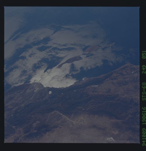
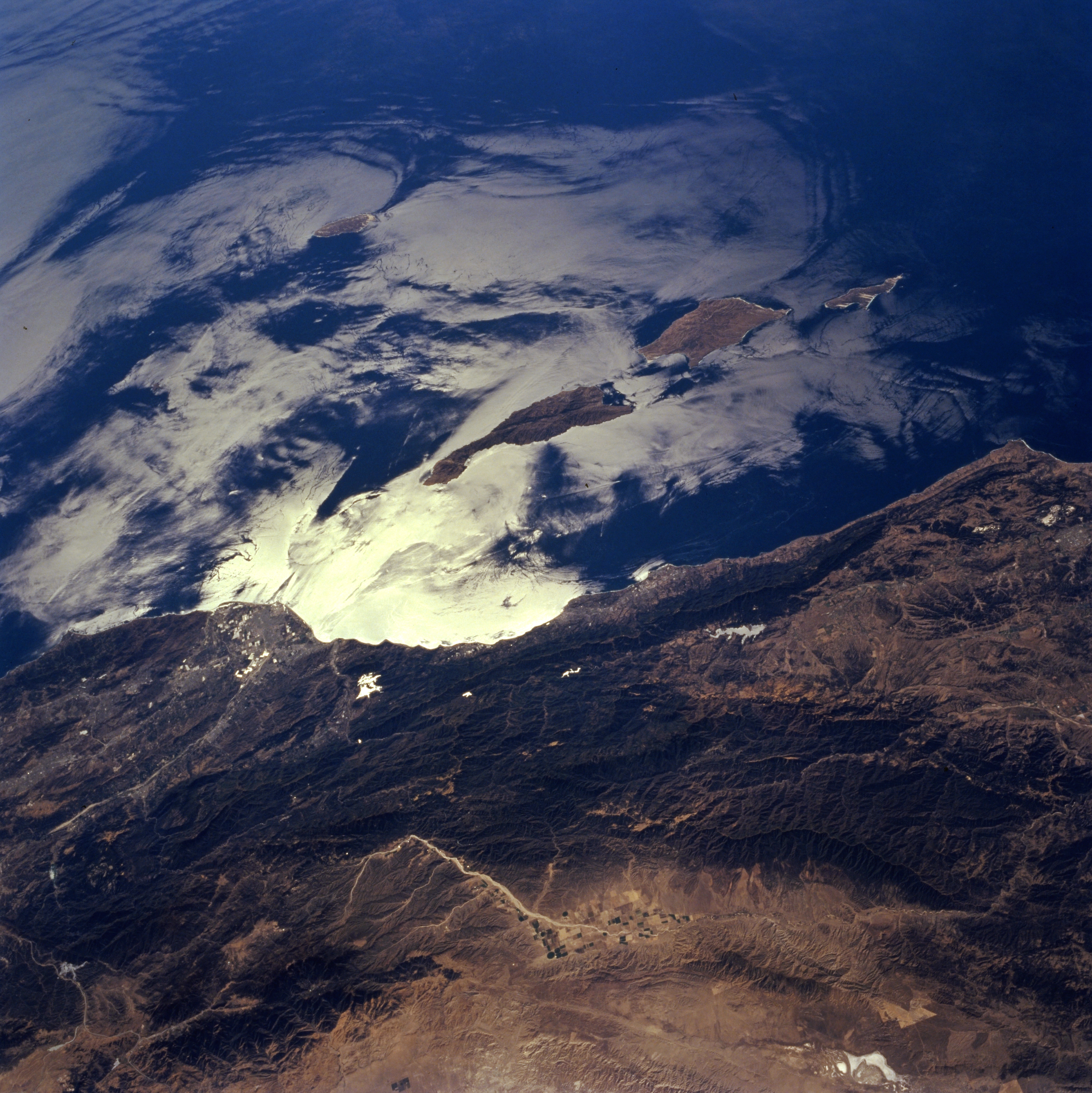
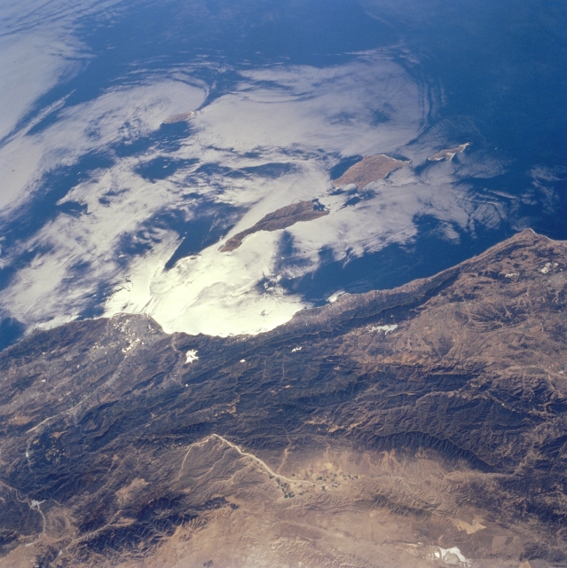
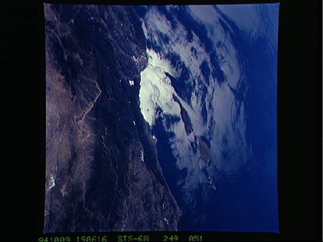
Image Caption: STS068-249-051 Channel Islands and Santa Ynez Mountains, California, U.S.A. October 1994
The northern Channel Islands are captured in sunglint in this south-southwest-looking, low-oblique photograph. Near the center of the photograph is Santa Cruz, the largest of the islands. Visible are the Santa Ynez Mountains paralleling the coastline from near Point Conception to Ventura; the forested, rugged Sierra Madre Range farther inland; and the Santa Monica Mountains to the south. In the sunglint, island wakes, waves, and ship wakes are discernible. The Sierra Madre Range and Santa Monica Mountains are subject to devastating forest fires when grass and timber growth is enhanced by good winter and early spring rains. Recent fires in the Santa Monica Mountains destroyed homes and businesses westward to the beach.
The northern Channel Islands are captured in sunglint in this south-southwest-looking, low-oblique photograph. Near the center of the photograph is Santa Cruz, the largest of the islands. Visible are the Santa Ynez Mountains paralleling the coastline from near Point Conception to Ventura; the forested, rugged Sierra Madre Range farther inland; and the Santa Monica Mountains to the south. In the sunglint, island wakes, waves, and ship wakes are discernible. The Sierra Madre Range and Santa Monica Mountains are subject to devastating forest fires when grass and timber growth is enhanced by good winter and early spring rains. Recent fires in the Santa Monica Mountains destroyed homes and businesses westward to the beach.
