STS068-249-49
| NASA Photo ID | STS068-249-49 |
| Focal Length | 100mm |
| Date taken | 1994.10.09 |
| Time taken | 19:05:54 GMT |
Resolutions offered for this image:
3904 x 3904 pixels 639 x 639 pixels 5700 x 5900 pixels 5985 x 5985 pixels 500 x 518 pixels 640 x 480 pixels
3904 x 3904 pixels 639 x 639 pixels 5700 x 5900 pixels 5985 x 5985 pixels 500 x 518 pixels 640 x 480 pixels

Cloud masks available for this image:
Spacecraft nadir point: 37.4° N, 121.1° W
Photo center point: 35.5° N, 121.0° W
Photo center point by machine learning:
Photo center point: 35.5° N, 121.0° W
Photo center point by machine learning:
Nadir to Photo Center: South
Spacecraft Altitude: 111 nautical miles (206km)
Country or Geographic Name: | USA-CALIFORNIA |
Features: | COASTAL MTS, SUNGLINT |
| Features Found Using Machine Learning: | |
Cloud Cover Percentage: | 20 (11-25)% |
Sun Elevation Angle: | 45° |
Sun Azimuth: | 164° |
Camera: | Hasselblad |
Focal Length: | 100mm |
Camera Tilt: | 46 degrees |
Format: | 5046: Kodak, natural color positive, Lumiere 100/5046, ASA 100, standard base |
Film Exposure: | Normal |
| Additional Information | |
| Width | Height | Annotated | Cropped | Purpose | Links |
|---|---|---|---|---|---|
| 3904 pixels | 3904 pixels | No | No | Earth From Space collection | Download Image |
| 639 pixels | 639 pixels | No | No | Earth From Space collection | Download Image |
| 5700 pixels | 5900 pixels | No | No | Download Image | |
| 5985 pixels | 5985 pixels | No | No | Scientist Request | Download Image |
| 500 pixels | 518 pixels | No | No | Download Image | |
| 640 pixels | 480 pixels | No | No | Download Image |
Download Packaged File
Download a Google Earth KML for this Image
View photo footprint information
Download a GeoTIFF for this photo
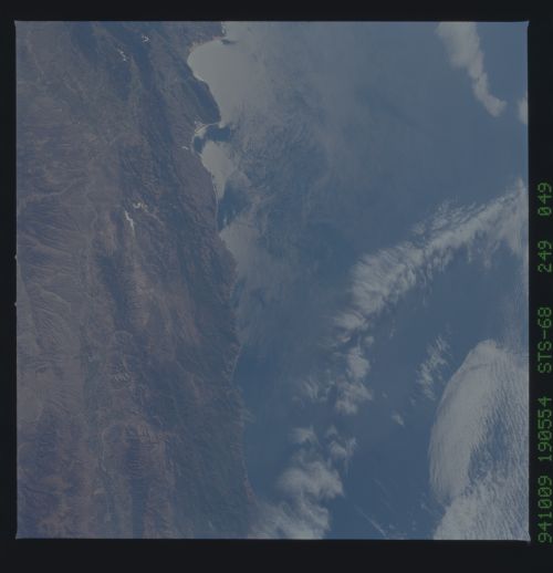
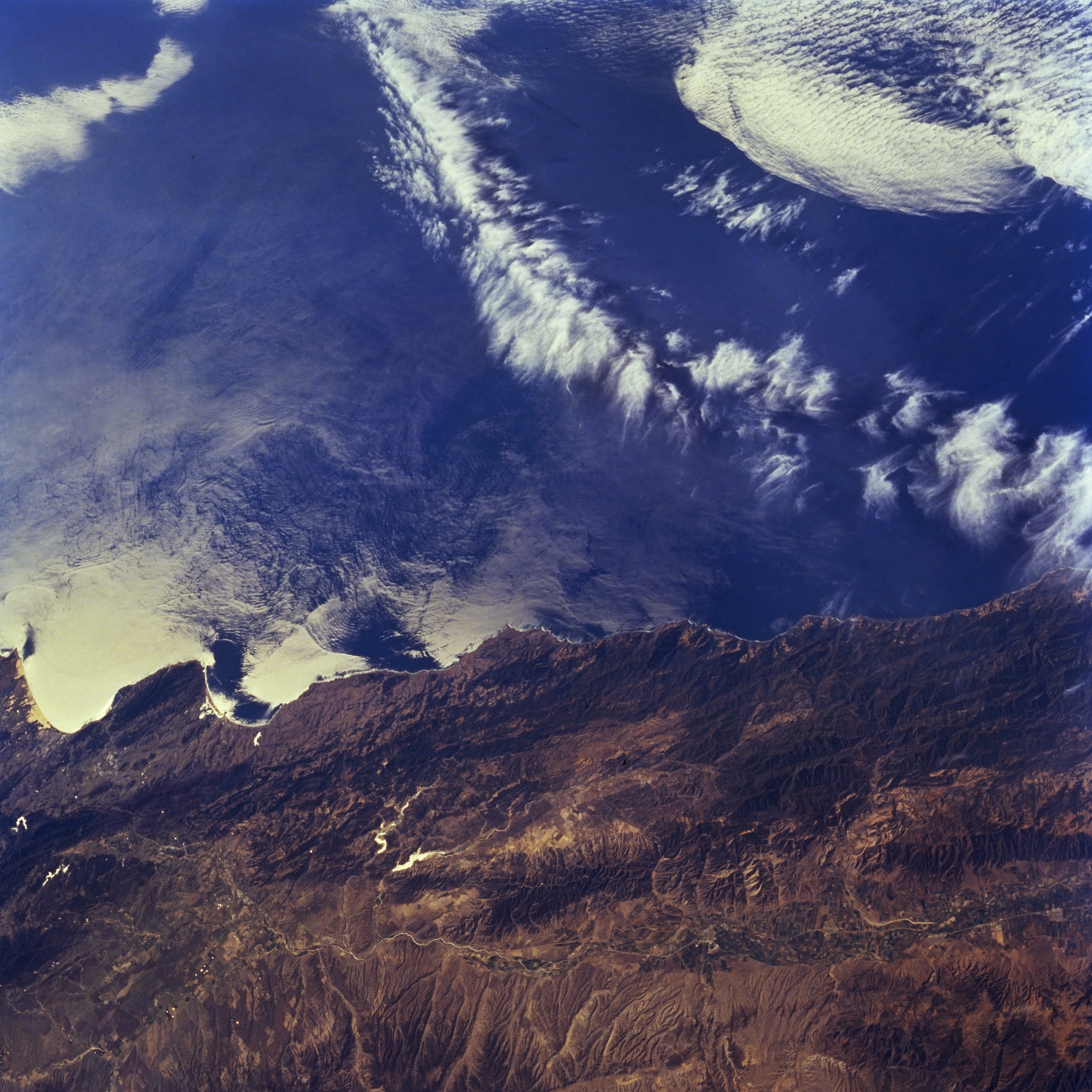
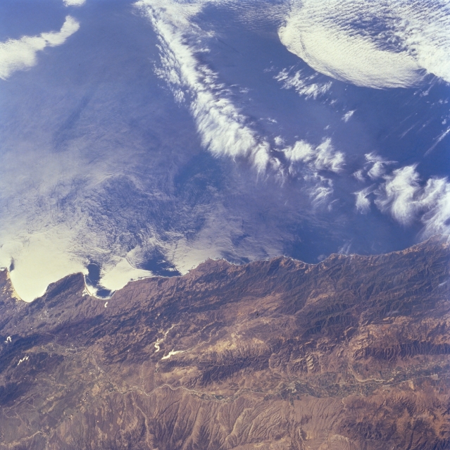
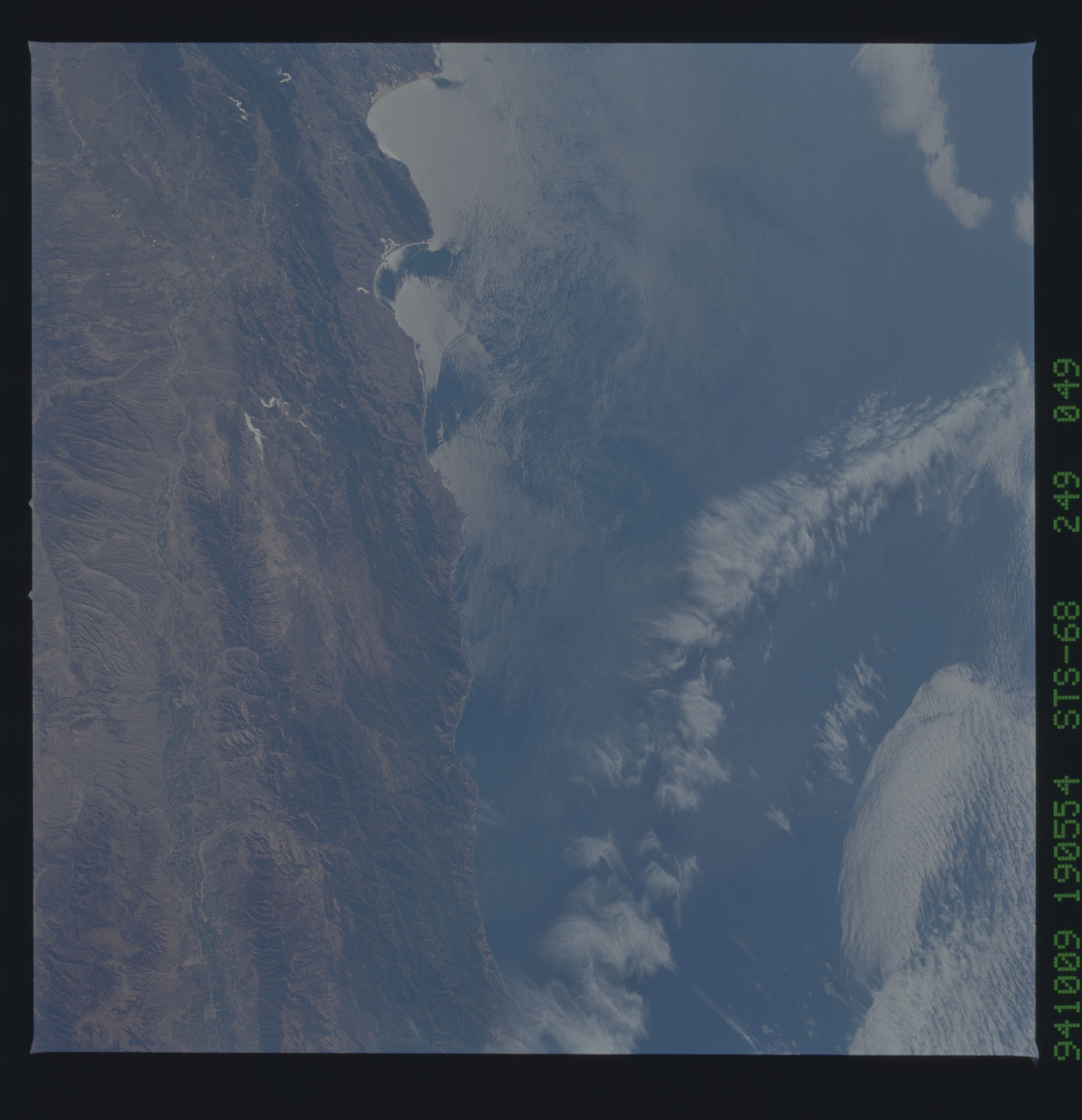
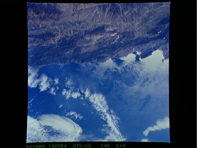
Image Caption: STS068-249-049 Santa Lucia Range and Salinas River Valley, California, U.S.A. October 1994
The tree-covered Santa Lucia Range and the central coast of California are captured in this low-oblique, west-southwest-looking photograph. Wave patterns off the Pacific Ocean and San Luis Obispo Bay are reflected in sunglint. Estero Bay lies just north of San Luis Obispo Bay. East of the Santa Lucia Range lie the irrigated agricultural fields of the Salinas River Valley and the western Diablo Range. The numerous coves and headlands of this part of the coast provide refuge to sea otters and seals.
The tree-covered Santa Lucia Range and the central coast of California are captured in this low-oblique, west-southwest-looking photograph. Wave patterns off the Pacific Ocean and San Luis Obispo Bay are reflected in sunglint. Estero Bay lies just north of San Luis Obispo Bay. East of the Santa Lucia Range lie the irrigated agricultural fields of the Salinas River Valley and the western Diablo Range. The numerous coves and headlands of this part of the coast provide refuge to sea otters and seals.
