STS068-248-68
| NASA Photo ID | STS068-248-68 |
| Focal Length | 250mm |
| Date taken | 1994.10.08 |
| Time taken | 16:30:54 GMT |
Resolutions offered for this image:
3872 x 3872 pixels 639 x 639 pixels 5700 x 5900 pixels 500 x 518 pixels 640 x 480 pixels
3872 x 3872 pixels 639 x 639 pixels 5700 x 5900 pixels 500 x 518 pixels 640 x 480 pixels
Cloud masks available for this image:
Spacecraft nadir point: 39.4° N, 78.4° W
Photo center point: 39.0° N, 78.0° W
Photo center point by machine learning:
Photo center point: 39.0° N, 78.0° W
Photo center point by machine learning:
Nadir to Photo Center: Southeast
Spacecraft Altitude: 111 nautical miles (206km)
Country or Geographic Name: | USA-VIRGINIA |
Features: | WINCHESTER AREA |
| Features Found Using Machine Learning: | |
Cloud Cover Percentage: | 10 (1-10)% |
Sun Elevation Angle: | 44° |
Sun Azimuth: | 169° |
Camera: | Hasselblad |
Focal Length: | 250mm |
Camera Tilt: | 17 degrees |
Format: | 5046: Kodak, natural color positive, Lumiere 100/5046, ASA 100, standard base |
Film Exposure: | Normal |
| Additional Information | |
| Width | Height | Annotated | Cropped | Purpose | Links |
|---|---|---|---|---|---|
| 3872 pixels | 3872 pixels | No | No | Earth From Space collection | Download Image |
| 639 pixels | 639 pixels | No | No | Earth From Space collection | Download Image |
| 5700 pixels | 5900 pixels | No | No | Download Image | |
| 500 pixels | 518 pixels | No | No | Download Image | |
| 640 pixels | 480 pixels | No | No | Download Image |
Download Packaged File
Download a Google Earth KML for this Image
View photo footprint information
Download a GeoTIFF for this photo
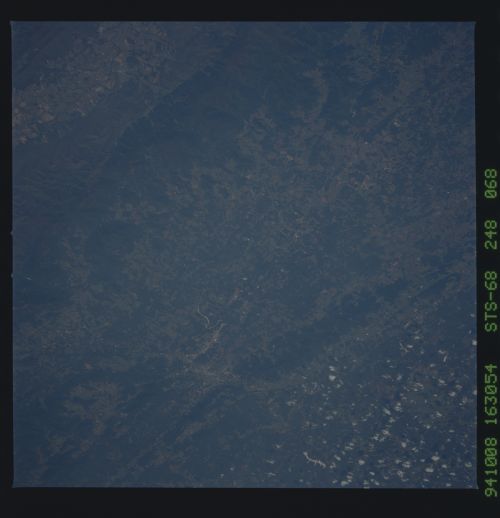
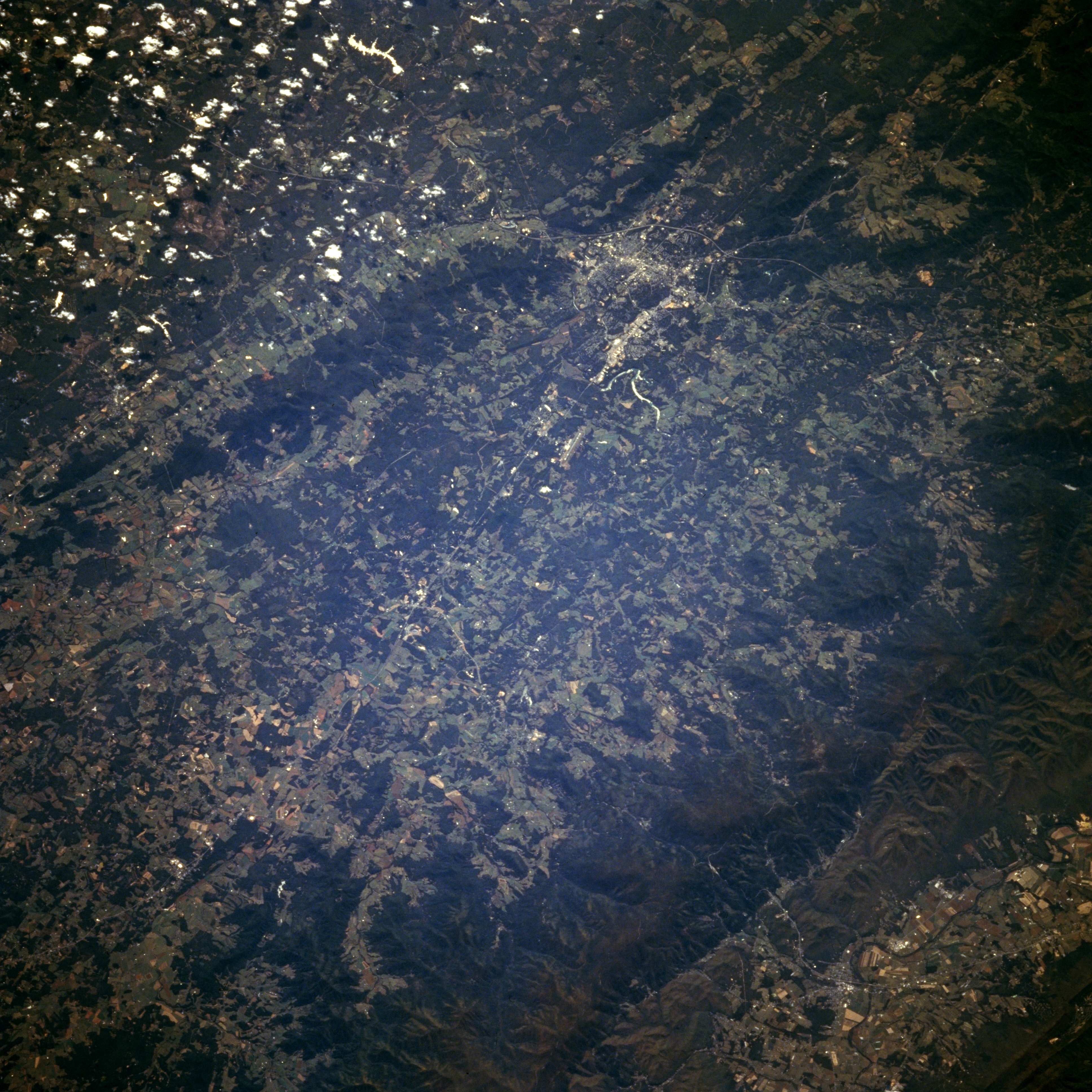
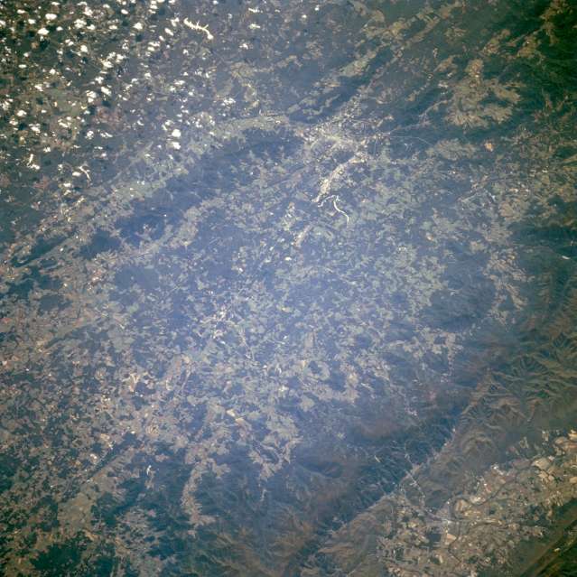
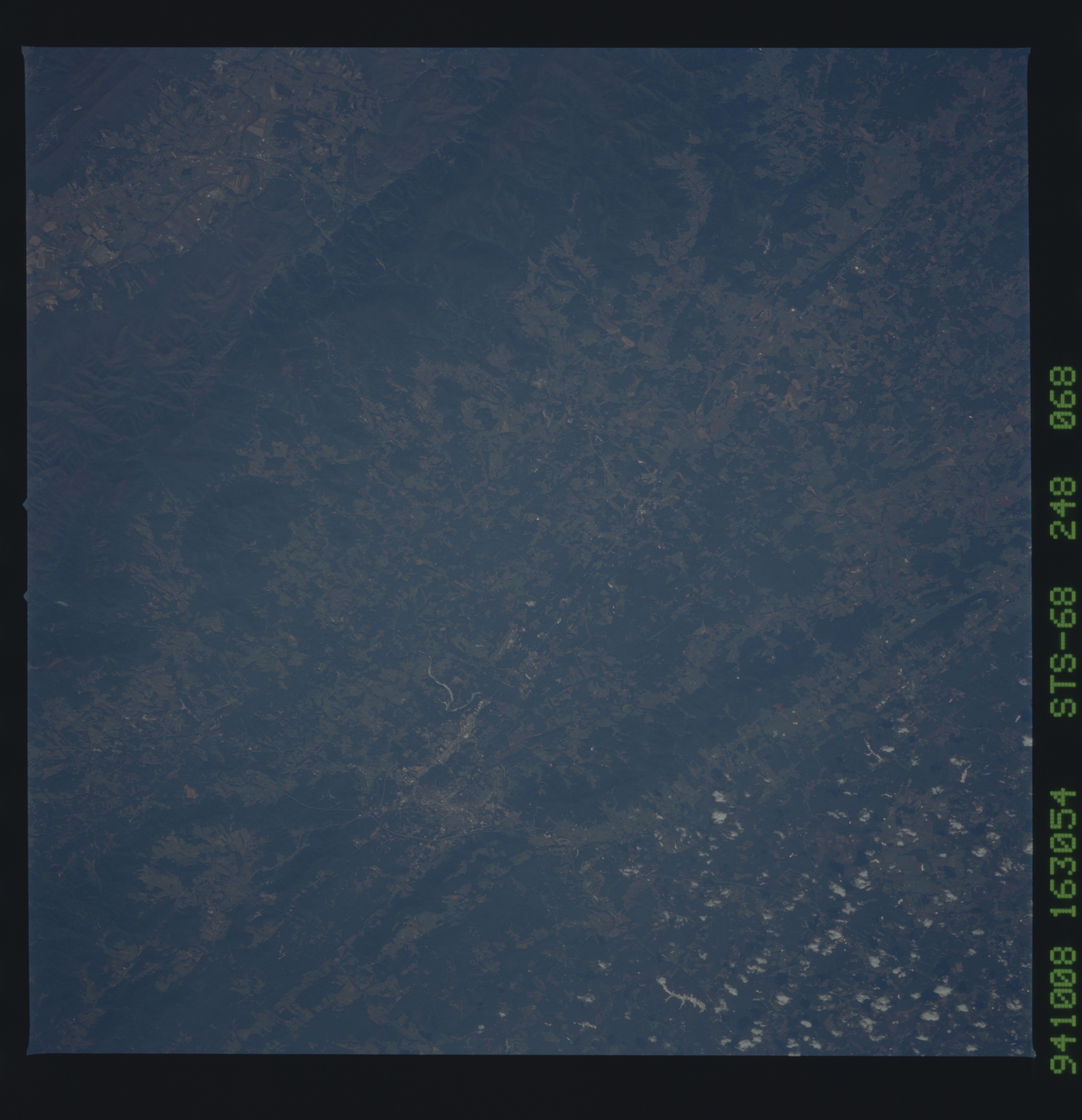
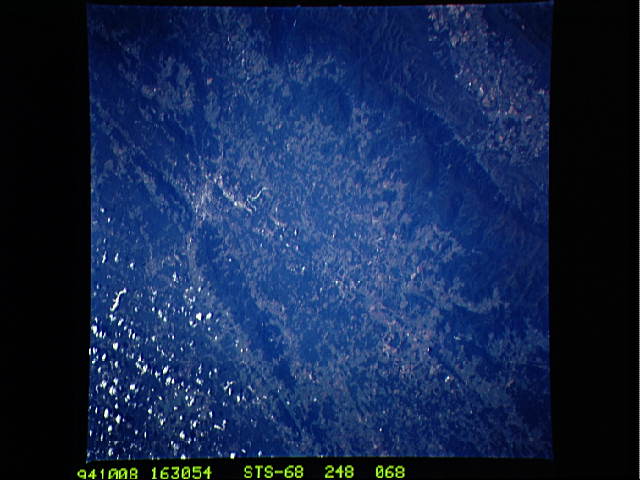
Image Caption: STS068-248-068 Shenandoah Valley, Winchester, Virginia, U.S.A. October 1994
The agricultural fields of the Shenandoah Valley in northwestern Virginia are visible in this northwest-looking low-oblique view. The Shenandoah Valley is part of the Great Appalachian Valley and is over 150 miles (240 km) long. It is located between the Blue Ridge Mountains to the east (lower right) and the Allegheny Mountains to the west (upper left under clouds). The valley is a rich agricultural area with fertile farm land, orchards, and pastures. During the American Civil War, the valley served as one of the Confederates' principal storehouses. The Confederate Forces of General Robert E. Lee retreated through the valley after being checked in the Antietam and Gettysburg campaigns. The city of Winchester is discernible midway between the center and the upper center of the image. Located in the northern Shenandoah Valley, Winchester is a trade, processing, and shipping center for an orchard district noted worldwide for its apples.
The agricultural fields of the Shenandoah Valley in northwestern Virginia are visible in this northwest-looking low-oblique view. The Shenandoah Valley is part of the Great Appalachian Valley and is over 150 miles (240 km) long. It is located between the Blue Ridge Mountains to the east (lower right) and the Allegheny Mountains to the west (upper left under clouds). The valley is a rich agricultural area with fertile farm land, orchards, and pastures. During the American Civil War, the valley served as one of the Confederates' principal storehouses. The Confederate Forces of General Robert E. Lee retreated through the valley after being checked in the Antietam and Gettysburg campaigns. The city of Winchester is discernible midway between the center and the upper center of the image. Located in the northern Shenandoah Valley, Winchester is a trade, processing, and shipping center for an orchard district noted worldwide for its apples.
