STS068-246-61
| NASA Photo ID | STS068-246-61 |
| Focal Length | 250mm |
| Date taken | 1994.10.06 |
| Time taken | 09:45:59 GMT |
Resolutions offered for this image:
4079 x 4084 pixels 639 x 639 pixels 5700 x 5900 pixels 500 x 518 pixels 640 x 480 pixels 524 x 503 pixels
4079 x 4084 pixels 639 x 639 pixels 5700 x 5900 pixels 500 x 518 pixels 640 x 480 pixels 524 x 503 pixels

Cloud masks available for this image:
Spacecraft nadir point: 51.1° N, 14.9° E
Photo center point: 51.5° N, 14.0° E
Photo center point by machine learning:
Photo center point: 51.5° N, 14.0° E
Photo center point by machine learning:
Nadir to Photo Center: West
Spacecraft Altitude: 115 nautical miles (213km)
Country or Geographic Name: | GERMANY |
Features: | STRIP MINES, AGR., FOREST |
| Features Found Using Machine Learning: | |
Cloud Cover Percentage: | 5 (1-10)% |
Sun Elevation Angle: | 32° |
Sun Azimuth: | 161° |
Camera: | Hasselblad |
Focal Length: | 250mm |
Camera Tilt: | 27 degrees |
Format: | 5046: Kodak, natural color positive, Lumiere 100/5046, ASA 100, standard base |
Film Exposure: | Normal |
| Additional Information | |
| Width | Height | Annotated | Cropped | Purpose | Links |
|---|---|---|---|---|---|
| 4079 pixels | 4084 pixels | No | No | Earth From Space collection | Download Image |
| 639 pixels | 639 pixels | No | No | Earth From Space collection | Download Image |
| 5700 pixels | 5900 pixels | No | No | Download Image | |
| 500 pixels | 518 pixels | No | No | Download Image | |
| 640 pixels | 480 pixels | No | No | Download Image | |
| 524 pixels | 503 pixels | No | No | Download Image |
Download Packaged File
Download a Google Earth KML for this Image
View photo footprint information
Download a GeoTIFF for this photo
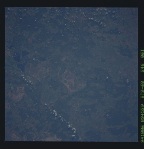
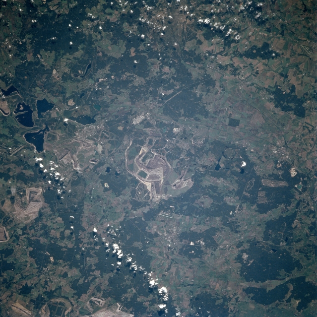
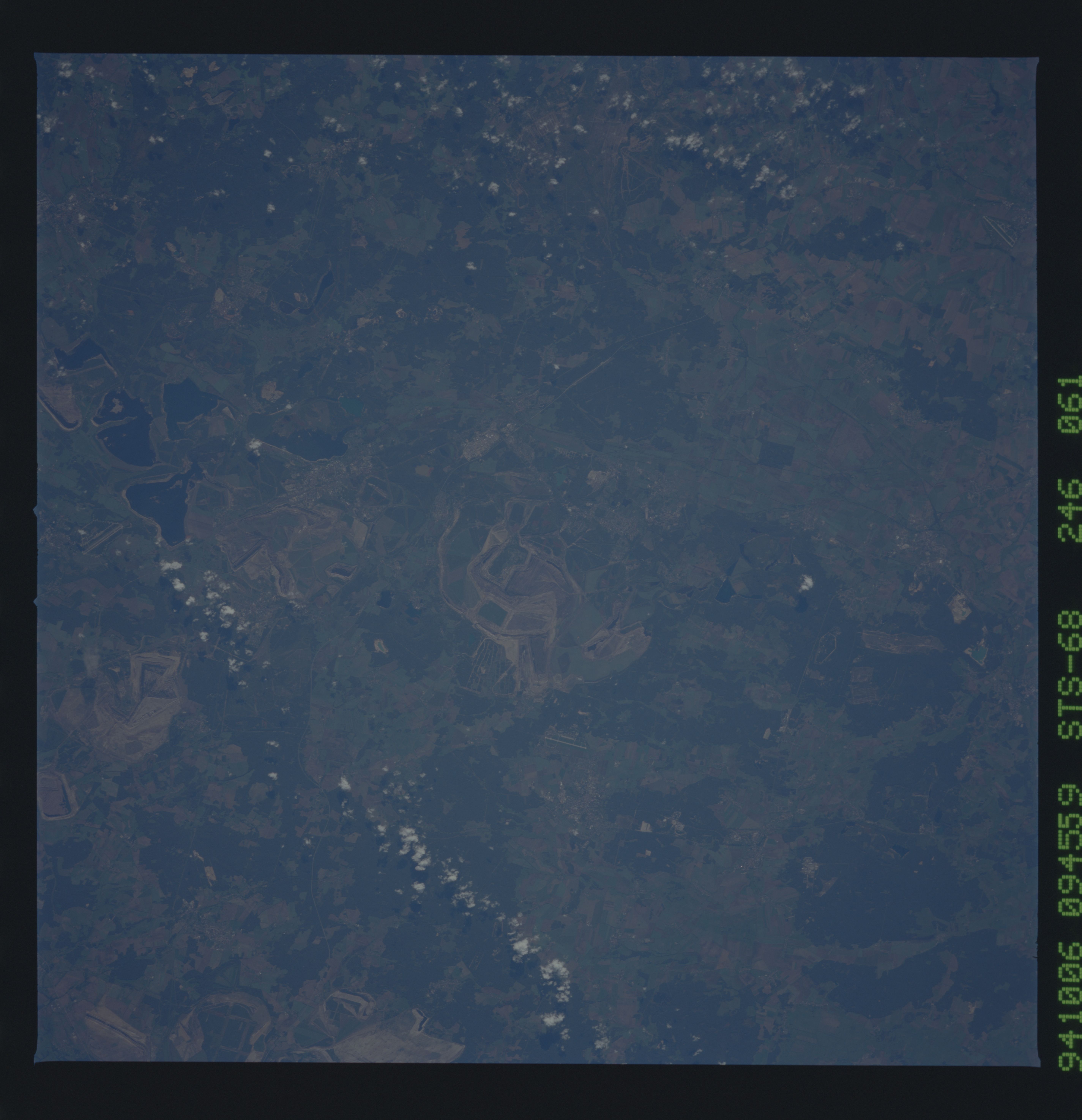
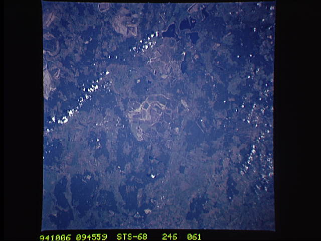
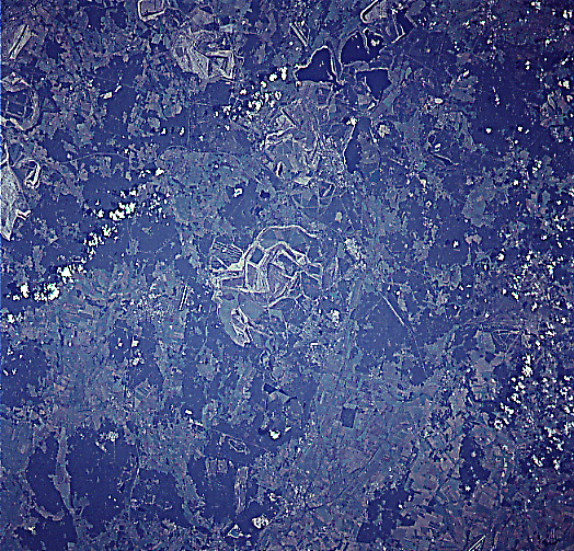
Image Caption: STS068-246-061 Strip Mining Near Ruhland, Germany October, 1994
Lignite coal strip mines can be seen scattered throughout the image in this southeast-looking view. This part of eastern Germany some 70 miles (113 km) southeast of Berlin has numerous seams or outcrops of lignite, a low-grade brownish-black coal. The seams or outcrops of the Lignite are very close to the surface of the ground and can be mined by the removal of topsoil and vegetation. Near the left center of the image, water has filled older strip mines now depleted of lignite coal. Forests (darker greenish color) and agricultural field patterns (lighter colored landscape) are also seen scattered throughout the image.
Lignite coal strip mines can be seen scattered throughout the image in this southeast-looking view. This part of eastern Germany some 70 miles (113 km) southeast of Berlin has numerous seams or outcrops of lignite, a low-grade brownish-black coal. The seams or outcrops of the Lignite are very close to the surface of the ground and can be mined by the removal of topsoil and vegetation. Near the left center of the image, water has filled older strip mines now depleted of lignite coal. Forests (darker greenish color) and agricultural field patterns (lighter colored landscape) are also seen scattered throughout the image.
