STS068-244-93
| NASA Photo ID | STS068-244-93 |
| Focal Length | 250mm |
| Date taken | 1994.10.07 |
| Time taken | 03:46:49 GMT |
Resolutions offered for this image:
5285 x 5285 pixels 639 x 639 pixels 5700 x 5900 pixels 500 x 518 pixels 640 x 480 pixels
5285 x 5285 pixels 639 x 639 pixels 5700 x 5900 pixels 500 x 518 pixels 640 x 480 pixels

Cloud masks available for this image:
Spacecraft nadir point: 2.5° N, 152.0° E
Photo center point:
Photo center point by machine learning:
Photo center point:
Photo center point by machine learning:
Nadir to Photo Center:
Spacecraft Altitude: 117 nautical miles (217km)
Country or Geographic Name: | PACIFIC OCEAN |
Features: | CLOUD FORMATIONS, SUNGLINT |
| Features Found Using Machine Learning: | |
Cloud Cover Percentage: | 20 (11-25)% |
Sun Elevation Angle: | 57° |
Sun Azimuth: | 256° |
Camera: | Hasselblad |
Focal Length: | 250mm |
Camera Tilt: | Low Oblique |
Format: | 5046: Kodak, natural color positive, Lumiere 100/5046, ASA 100, standard base |
Film Exposure: | Normal |
| Additional Information | |
| Width | Height | Annotated | Cropped | Purpose | Links |
|---|---|---|---|---|---|
| 5285 pixels | 5285 pixels | No | No | Earth From Space collection | Download Image |
| 639 pixels | 639 pixels | No | No | Earth From Space collection | Download Image |
| 5700 pixels | 5900 pixels | No | No | Download Image | |
| 500 pixels | 518 pixels | No | No | Download Image | |
| 640 pixels | 480 pixels | No | No | Download Image |
Download Packaged File
Download a Google Earth KML for this Image
View photo footprint information
Download a GeoTIFF for this photo
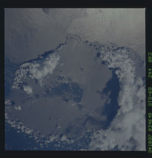
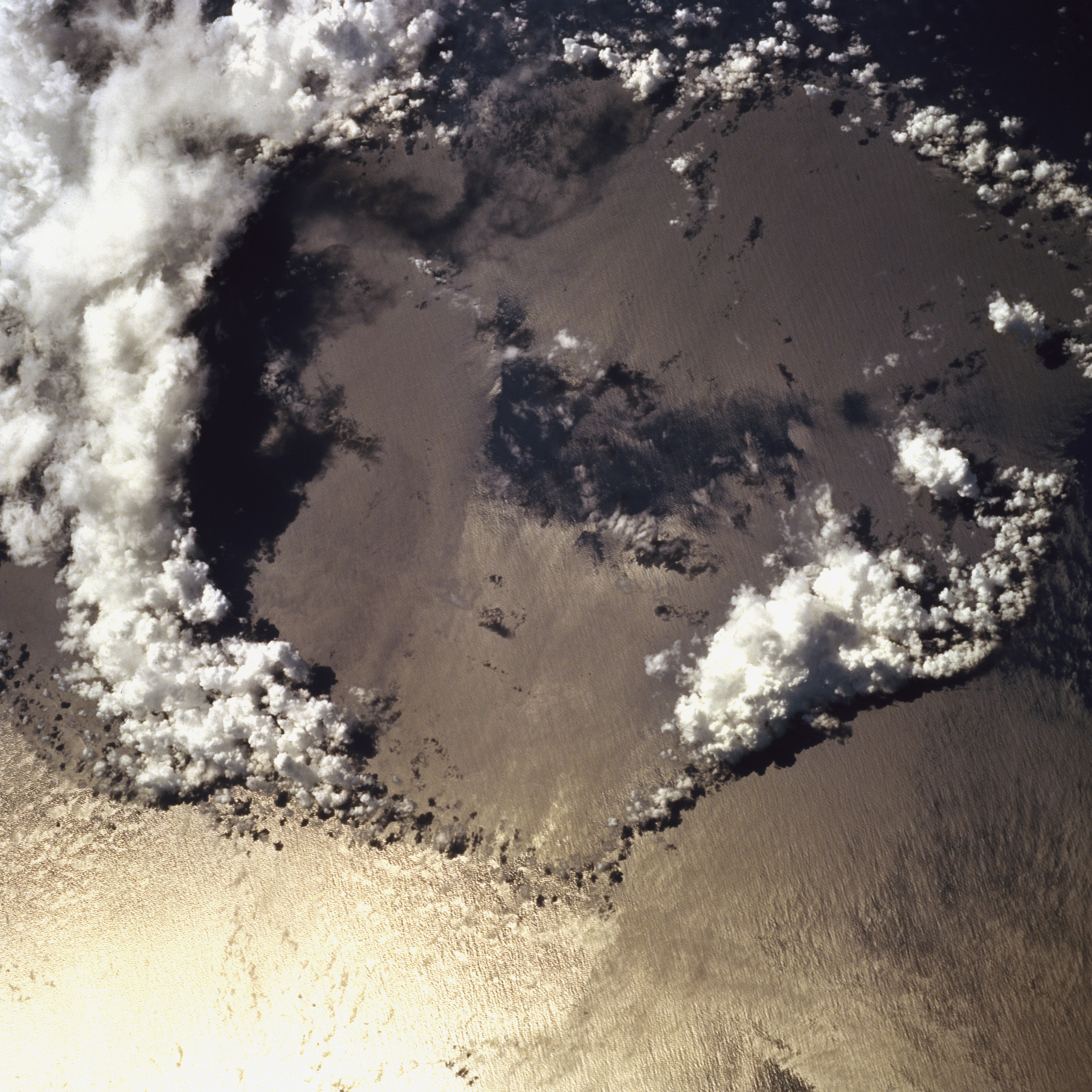
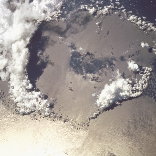
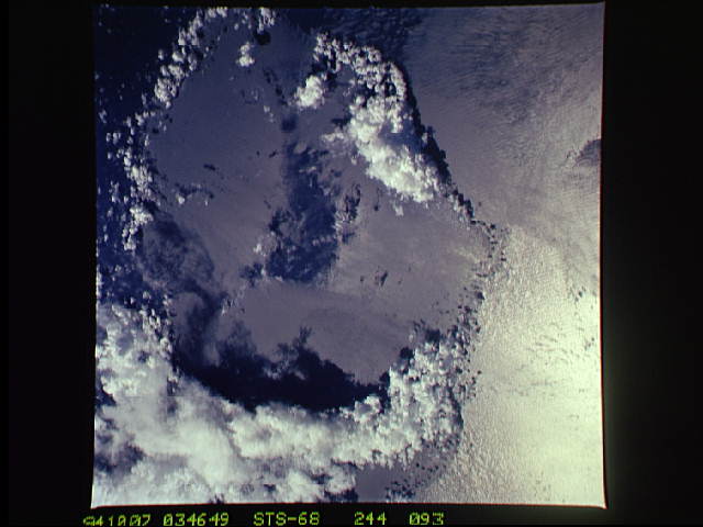
Image Caption: STS068-244-93 Collapsed Thunderstorm, Pacific Ocean October 1994
The large circular area of a recently collapsed thunderstorm is seen in this photograph. It is located just north of the equator near the island and atolls of the Federated States of Micronesia in the Pacific Ocean. Thunderstorms form when the atmosphere is unstable and moist warm air near the surface rises. If the differential air temperature is great enough, thunderstorms can form. The moist air can penetrate into the stratosphere to altitudes of more than 12.5 miles (20 km). These types of storms can produce violent updrafts and downdrafts. At the onset of precipitation, strong downdrafts develop. Falling precipitation reverses rising air columns by frictional drag, and eventually the thunderstorm will begin to dissipate. The strong cool downdrafts will eventually clear the region. New clouds can be seen forming in the upper left of the photograph.
The large circular area of a recently collapsed thunderstorm is seen in this photograph. It is located just north of the equator near the island and atolls of the Federated States of Micronesia in the Pacific Ocean. Thunderstorms form when the atmosphere is unstable and moist warm air near the surface rises. If the differential air temperature is great enough, thunderstorms can form. The moist air can penetrate into the stratosphere to altitudes of more than 12.5 miles (20 km). These types of storms can produce violent updrafts and downdrafts. At the onset of precipitation, strong downdrafts develop. Falling precipitation reverses rising air columns by frictional drag, and eventually the thunderstorm will begin to dissipate. The strong cool downdrafts will eventually clear the region. New clouds can be seen forming in the upper left of the photograph.
