STS068-231-36
| NASA Photo ID | STS068-231-36 |
| Focal Length | 100mm |
| Date taken | 1994.10.04 |
| Time taken | 20:55:16 GMT |

Cloud masks available for this image:
Spacecraft nadir point: 28.3° N, 110.6° W
Photo center point: 27.0° N, 111.5° W
Photo center point by machine learning:
Photo center point: 27.0° N, 111.5° W
Photo center point by machine learning:
Nadir to Photo Center: Southwest
Spacecraft Altitude: 117 nautical miles (217km)
Country or Geographic Name: | MEXICO |
Features: | PT. CHIVATO, SUNGLINT, MTS |
| Features Found Using Machine Learning: | |
Cloud Cover Percentage: | 0 (no clouds present) |
Sun Elevation Angle: | 49° |
Sun Azimuth: | 222° |
Camera: | Hasselblad |
Focal Length: | 100mm |
Camera Tilt: | 39 degrees |
Format: | 5046: Kodak, natural color positive, Lumiere 100/5046, ASA 100, standard base |
Film Exposure: | Normal |
| Additional Information | |
| Width | Height | Annotated | Cropped | Purpose | Links |
|---|---|---|---|---|---|
| 5700 pixels | 5900 pixels | No | No | Download Image | |
| 500 pixels | 518 pixels | No | No | Download Image | |
| 640 pixels | 480 pixels | No | No | Download Image |
Download Packaged File
Download a Google Earth KML for this Image
View photo footprint information
Download a GeoTIFF for this photo
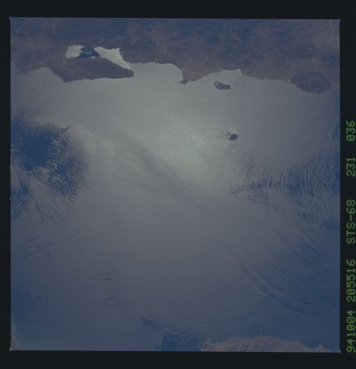
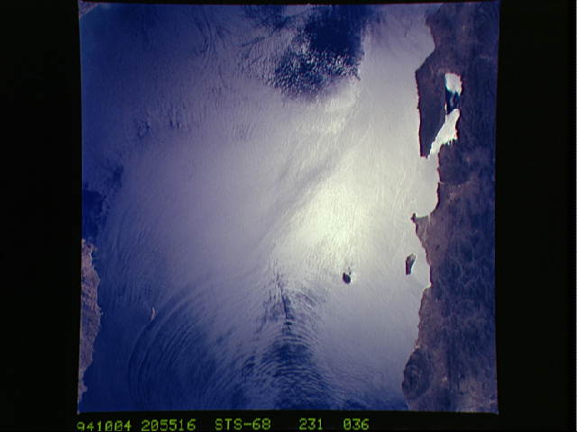
Image Caption: Internal waves heading south toward Bahia Conception
in the Gulf of California Internal waves are generated by tides
generated and travel along the density discontinuity at the bottom of
the mixed layer depth. There is very little evidence of the internal
waves at the surface; about a 1.5 inch change in sea surface height.
We can see them in the Space Shuttle photos because of sunglint which
reflects off the water. The internal waves smooth out some of the
capillary waves at the surface in bands. The sun reflects more
brightly from these smooth areas showing us the pattern of the
underwater waves. Underneath the surface these waves have been
measured to have amplitudes of 50 to 200 feet, and are approx. 100 to
150 feet below the surface or at the depth of the density interface,
which can be 1000 feet deep in some oceans.
