STS068-230-85
| NASA Photo ID | STS068-230-85 |
| Focal Length | 250mm |
| Date taken | 1994.10.01 |
| Time taken | 18:48:07 GMT |
Resolutions offered for this image:
3840 x 3907 pixels 629 x 640 pixels 5700 x 5900 pixels 500 x 518 pixels 640 x 480 pixels
3840 x 3907 pixels 629 x 640 pixels 5700 x 5900 pixels 500 x 518 pixels 640 x 480 pixels


Cloud masks available for this image:
Spacecraft nadir point: 46.9° N, 84.1° W
Photo center point: 46.0° N, 84.5° W
Photo center point by machine learning:
Photo center point: 46.0° N, 84.5° W
Photo center point by machine learning:
Nadir to Photo Center: South
Spacecraft Altitude: 118 nautical miles (219km)
Country or Geographic Name: | USA-MICHIGAN |
Features: | STRAITS OF MACKINAC, BRIDGE |
| Features Found Using Machine Learning: | |
Cloud Cover Percentage: | 0 (no clouds present) |
Sun Elevation Angle: | 37° |
Sun Azimuth: | 206° |
Camera: | Hasselblad |
Focal Length: | 250mm |
Camera Tilt: | 27 degrees |
Format: | 5046: Kodak, natural color positive, Lumiere 100/5046, ASA 100, standard base |
Film Exposure: | Normal |
| Additional Information | |
| Width | Height | Annotated | Cropped | Purpose | Links |
|---|---|---|---|---|---|
| 3840 pixels | 3907 pixels | No | No | Earth From Space collection | Download Image |
| 629 pixels | 640 pixels | No | No | Earth From Space collection | Download Image |
| 5700 pixels | 5900 pixels | No | No | Download Image | |
| 500 pixels | 518 pixels | No | No | Download Image | |
| 640 pixels | 480 pixels | No | No | Download Image |
Download Packaged File
Download a Google Earth KML for this Image
View photo footprint information
Download a GeoTIFF for this photo
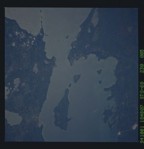
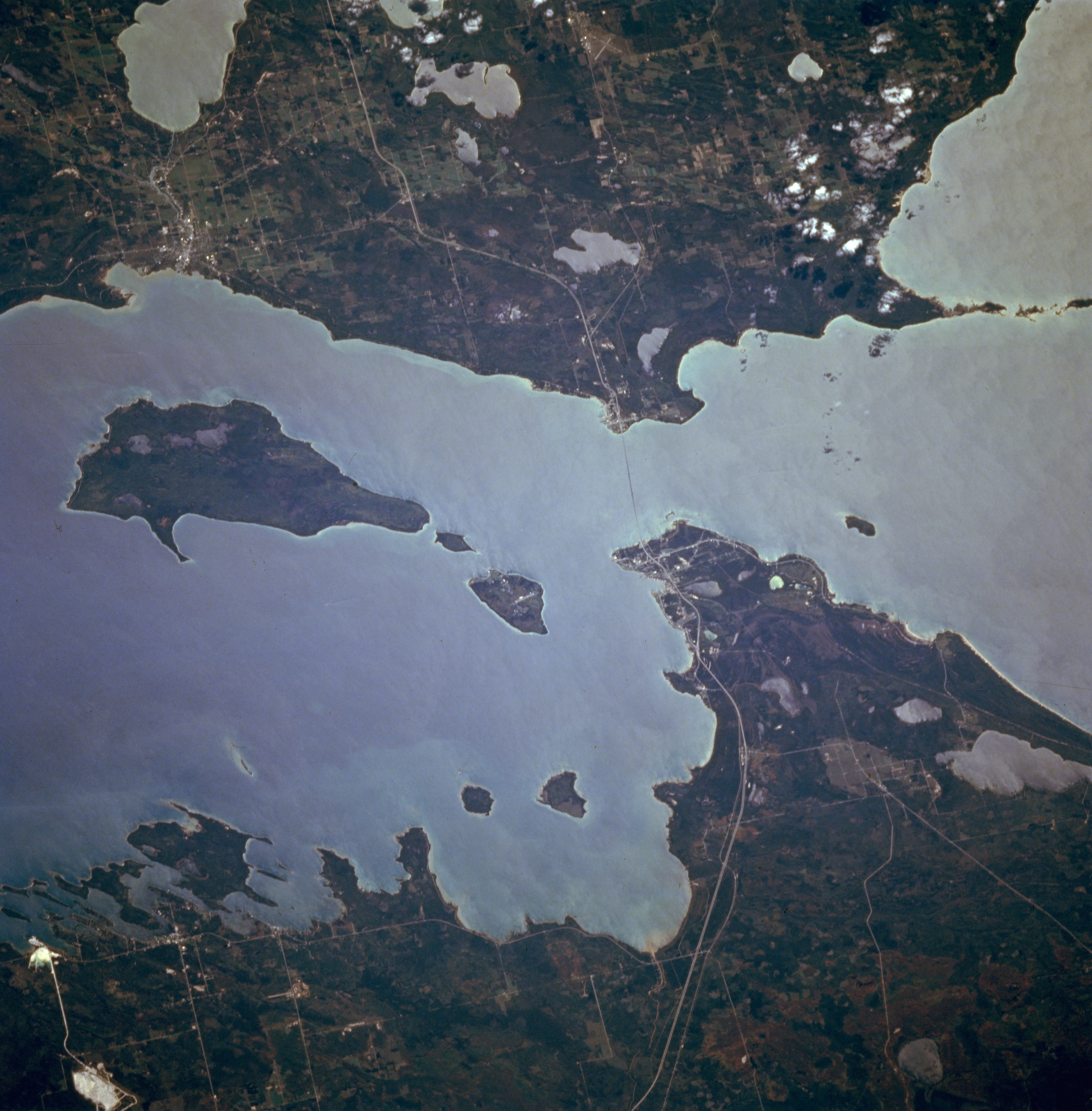
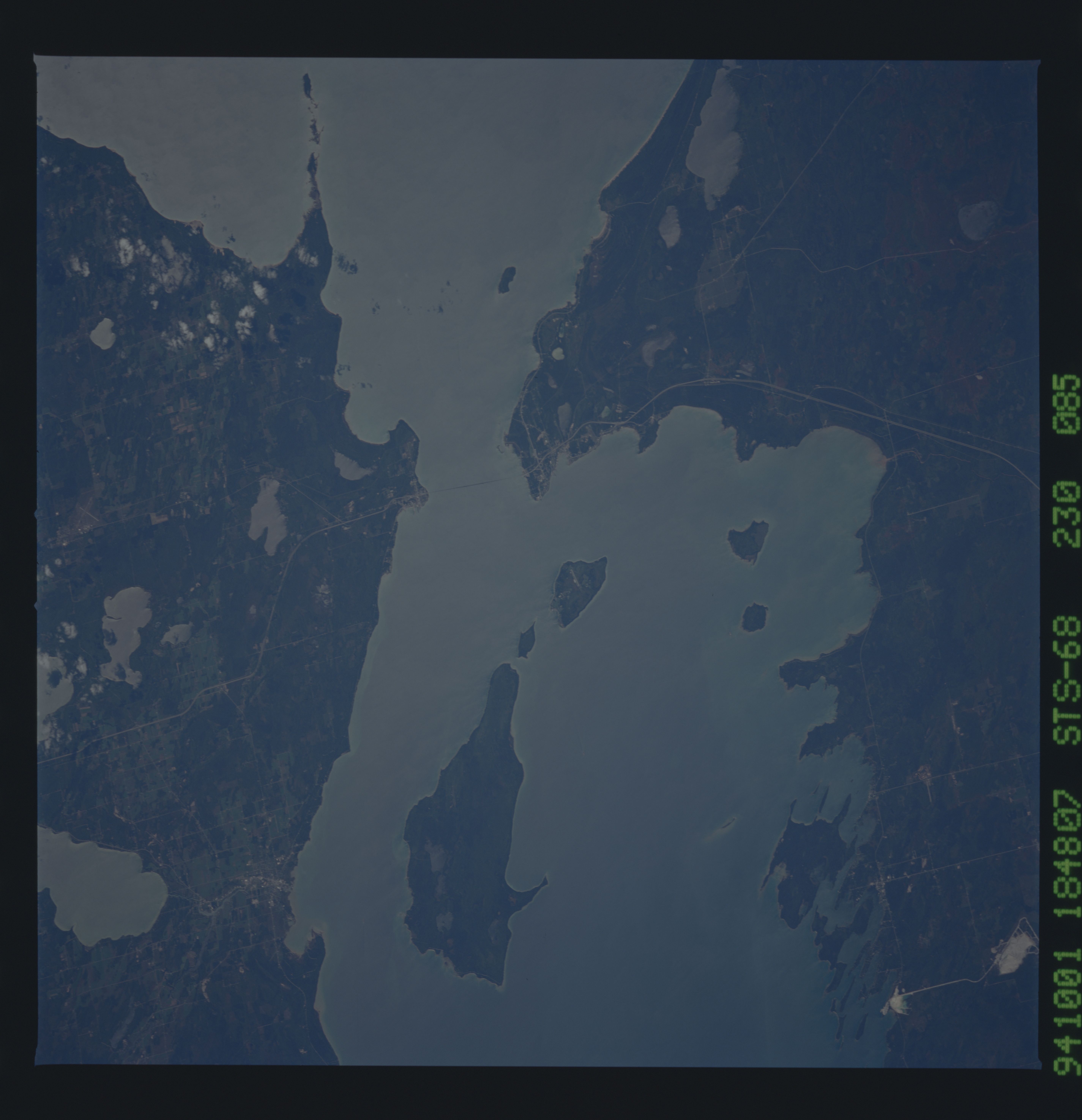
Image Caption: STS068-230-085 Straits of Mackinac, Michigan, U.S.A. October 1994
An important link in the Saint Lawrence Seaway, the Straits of Mackinac, 4 miles (6 kilometers) wide at their narrowest point, are apparent in this south-looking, low-oblique, sunglint-reflected photograph. The Mackinac Straits Bridge (barely discernible), third longest suspension bridge [3800 feet (1159 meters) long] in the world, opened in 1957. Three islands are readily visible--Round Island, the smallest; Mackinac; and Boise Blanc, the largest of the three, south of which lies the city of Cheboygan. Interstate Highway 75 traverses north-south.
An important link in the Saint Lawrence Seaway, the Straits of Mackinac, 4 miles (6 kilometers) wide at their narrowest point, are apparent in this south-looking, low-oblique, sunglint-reflected photograph. The Mackinac Straits Bridge (barely discernible), third longest suspension bridge [3800 feet (1159 meters) long] in the world, opened in 1957. Three islands are readily visible--Round Island, the smallest; Mackinac; and Boise Blanc, the largest of the three, south of which lies the city of Cheboygan. Interstate Highway 75 traverses north-south.
