STS068-229-7
| NASA Photo ID | STS068-229-7 |
| Focal Length | 40mm |
| Date taken | 1994.__.__ |
| Time taken | GMT |
Resolutions offered for this image:
3904 x 3904 pixels 639 x 639 pixels 5700 x 5900 pixels 500 x 518 pixels 640 x 480 pixels
3904 x 3904 pixels 639 x 639 pixels 5700 x 5900 pixels 500 x 518 pixels 640 x 480 pixels


Cloud masks available for this image:
Spacecraft nadir point:
Photo center point: 59.0° N, 137.0° W
Photo center point by machine learning:
Photo center point: 59.0° N, 137.0° W
Photo center point by machine learning:
Nadir to Photo Center:
Spacecraft Altitude: nautical miles (0km)
Country or Geographic Name: | USA-ALASKA |
Features: | BRADY GLACIER, GLACIER BAY |
| Features Found Using Machine Learning: | |
Cloud Cover Percentage: | 5 (1-10)% |
Sun Elevation Angle: | ° |
Sun Azimuth: | ° |
Camera: | Hasselblad |
Focal Length: | 40mm |
Camera Tilt: | Low Oblique |
Format: | 5046: Kodak, natural color positive, Lumiere 100/5046, ASA 100, standard base |
Film Exposure: | Normal |
| Additional Information | |
| Width | Height | Annotated | Cropped | Purpose | Links |
|---|---|---|---|---|---|
| 3904 pixels | 3904 pixels | No | No | Earth From Space collection | Download Image |
| 639 pixels | 639 pixels | No | No | Earth From Space collection | Download Image |
| 5700 pixels | 5900 pixels | No | No | Download Image | |
| 500 pixels | 518 pixels | No | No | Download Image | |
| 640 pixels | 480 pixels | No | No | Download Image |
Download Packaged File
Download a Google Earth KML for this Image
View photo footprint information
Download a GeoTIFF for this photo
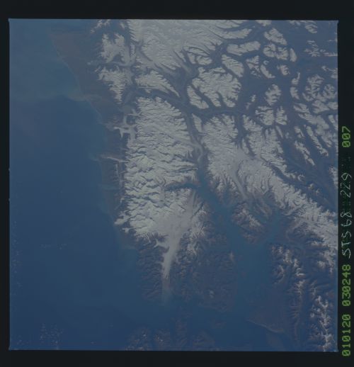
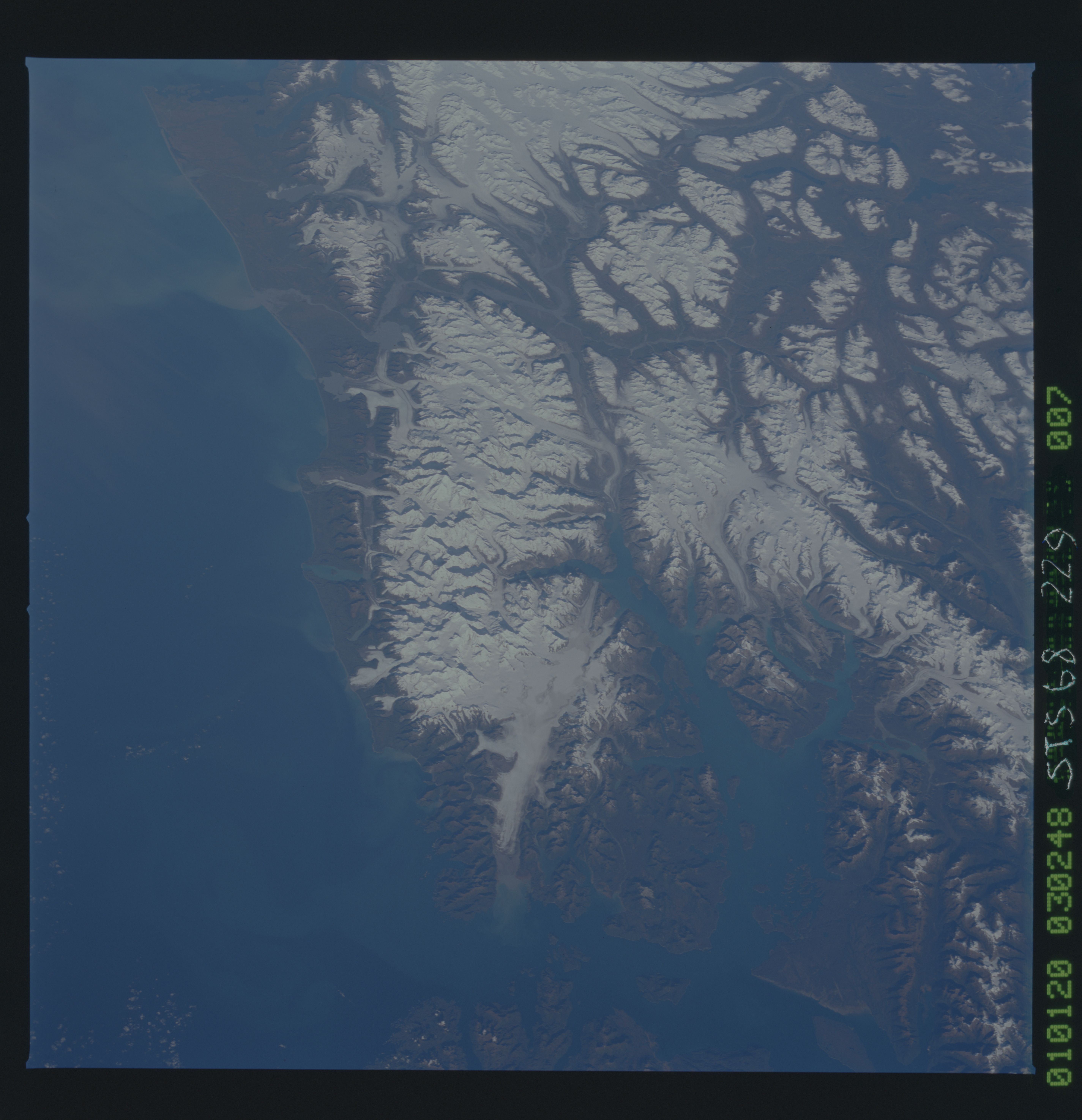
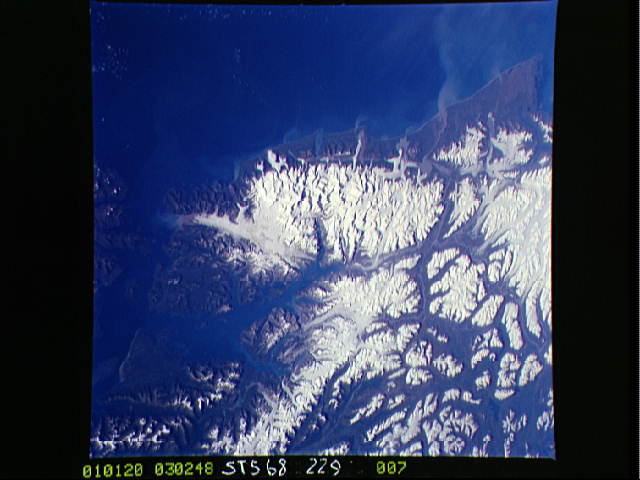
Image Caption: STS068-229-007 Brady Glacier and Glacier Bay, Alaska, U.S.A. October 1994
Several valley glaciers are apparent throughout Glacier Bay National Park and Preserve, named for Glacier Bay, the water inlet that parallels the eastern coast of the peninsula. This national park has approximately 16 tidewater glaciers and is accessible by plane or boat from Juneau, 50 miles (81 kilometers) away. Brady Glacier, the most prominent glacier, extends in a generally north-south orientation to the southern end of the peninsula. Visible are numerous sediment plumes carrying fine-grained silt to the Gulf of Alaska to the west; Cross Sound, shown at the bottom of the photograph, that connects the Gulf of Alaska with Glacier Bay; and the snow-covered Fairweather Range along the coast that includes Mount Fairweather [elevation 15 300 feet (4663 meters) above sea level].
Several valley glaciers are apparent throughout Glacier Bay National Park and Preserve, named for Glacier Bay, the water inlet that parallels the eastern coast of the peninsula. This national park has approximately 16 tidewater glaciers and is accessible by plane or boat from Juneau, 50 miles (81 kilometers) away. Brady Glacier, the most prominent glacier, extends in a generally north-south orientation to the southern end of the peninsula. Visible are numerous sediment plumes carrying fine-grained silt to the Gulf of Alaska to the west; Cross Sound, shown at the bottom of the photograph, that connects the Gulf of Alaska with Glacier Bay; and the snow-covered Fairweather Range along the coast that includes Mount Fairweather [elevation 15 300 feet (4663 meters) above sea level].
