STS068-227-9
| NASA Photo ID | STS068-227-9 |
| Focal Length | 250mm |
| Date taken | 1994.10.01 |
| Time taken | 20:19:59 GMT |
Resolutions offered for this image:
3904 x 3904 pixels 639 x 639 pixels 5700 x 5900 pixels 500 x 518 pixels 640 x 480 pixels 3282 x 3406 pixels
3904 x 3904 pixels 639 x 639 pixels 5700 x 5900 pixels 500 x 518 pixels 640 x 480 pixels 3282 x 3406 pixels

Cloud masks available for this image:
Spacecraft nadir point: 38.8° N, 95.0° W
Photo center point: 39.0° N, 94.5° W
Photo center point by machine learning:
Photo center point: 39.0° N, 94.5° W
Photo center point by machine learning:
Nadir to Photo Center: East
Spacecraft Altitude: 118 nautical miles (219km)
Country or Geographic Name: | USA-KANSAS |
Features: | KANSAS CITY, MISSOURI R. |
| Features Found Using Machine Learning: | |
Cloud Cover Percentage: | 0 (no clouds present) |
Sun Elevation Angle: | 38° |
Sun Azimuth: | 223° |
Camera: | Hasselblad |
Focal Length: | 250mm |
Camera Tilt: | 15 degrees |
Format: | 5046: Kodak, natural color positive, Lumiere 100/5046, ASA 100, standard base |
Film Exposure: | Normal |
| Additional Information | |
| Width | Height | Annotated | Cropped | Purpose | Links |
|---|---|---|---|---|---|
| 3904 pixels | 3904 pixels | No | No | Earth From Space collection | Download Image |
| 639 pixels | 639 pixels | No | No | Earth From Space collection | Download Image |
| 5700 pixels | 5900 pixels | No | No | Download Image | |
| 500 pixels | 518 pixels | No | No | Download Image | |
| 640 pixels | 480 pixels | No | No | Download Image | |
| 3282 pixels | 3406 pixels | Download Image |
Download Packaged File
Download a Google Earth KML for this Image
View photo footprint information
Download a GeoTIFF for this photo
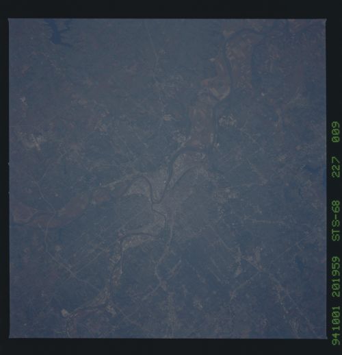
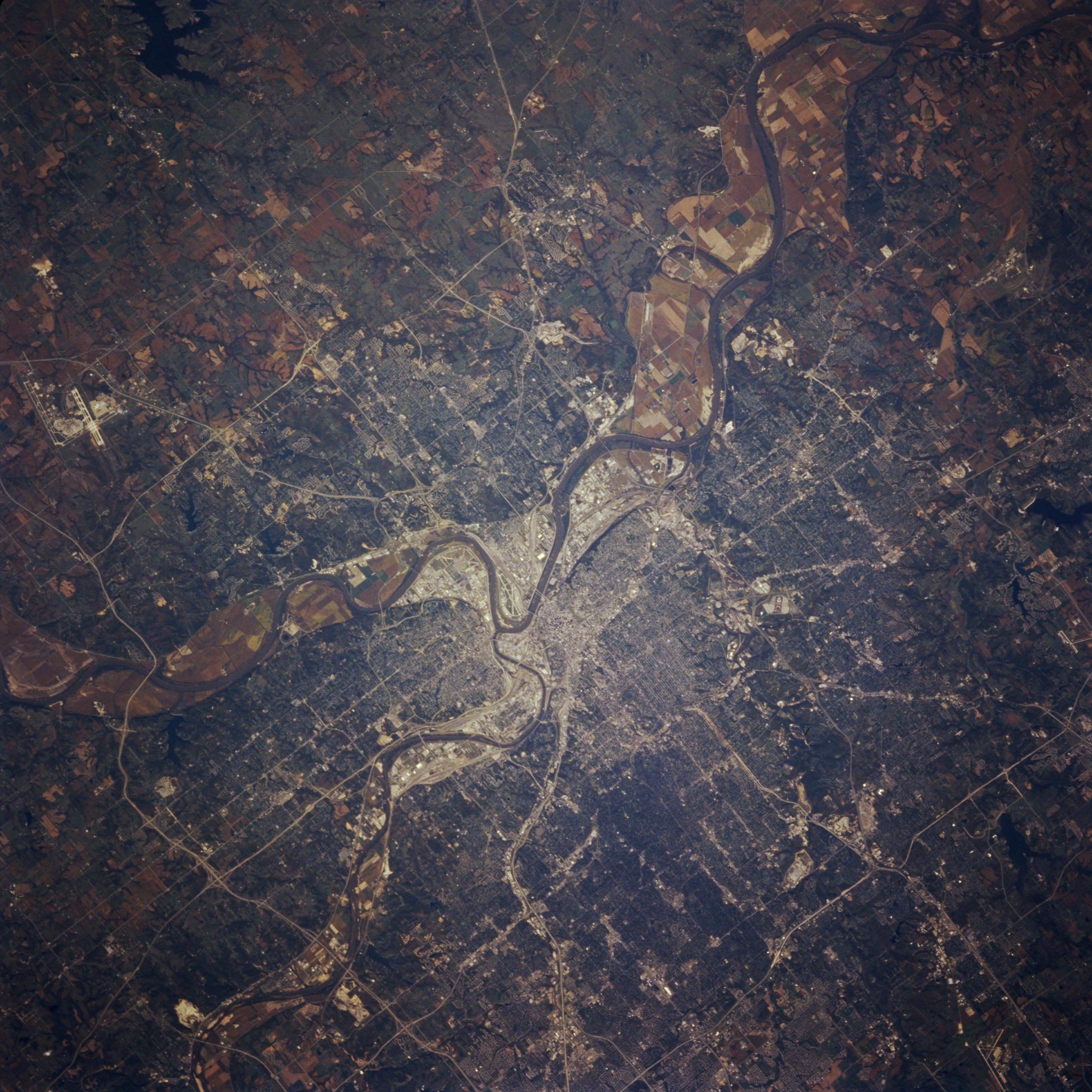
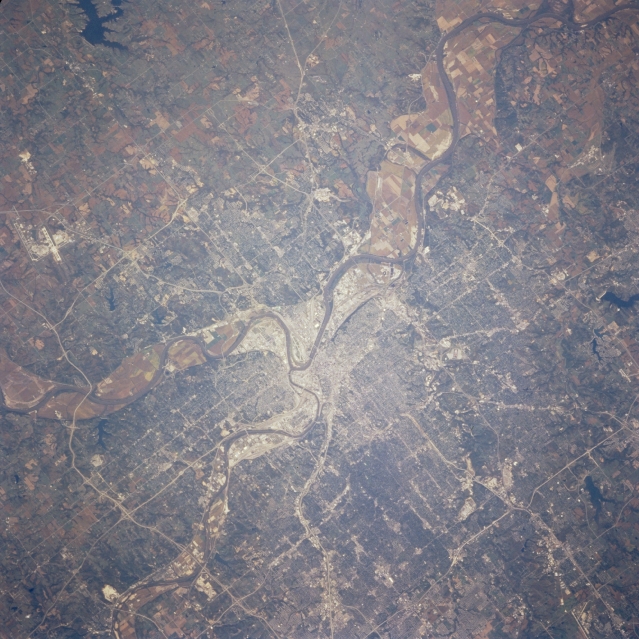
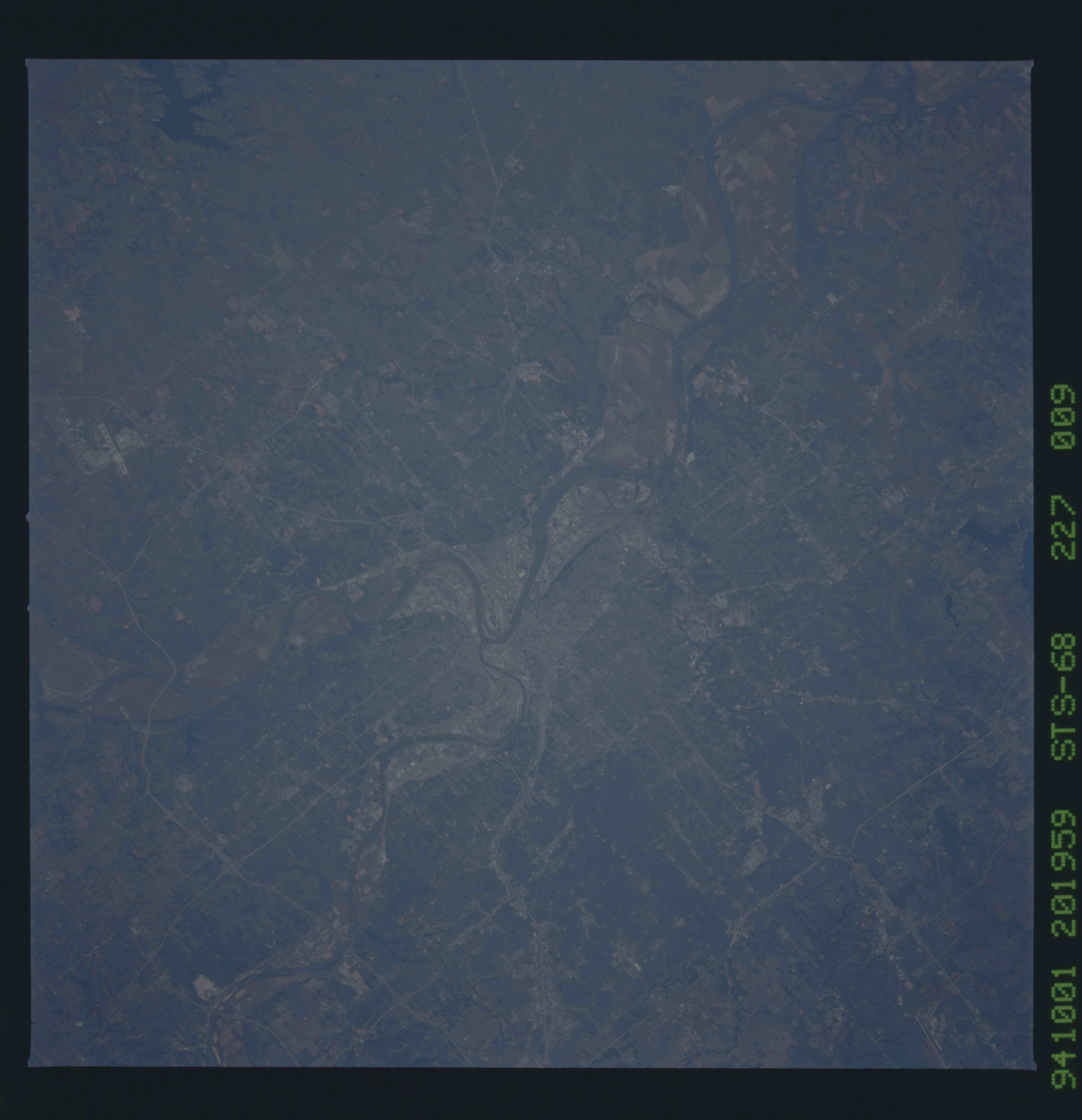
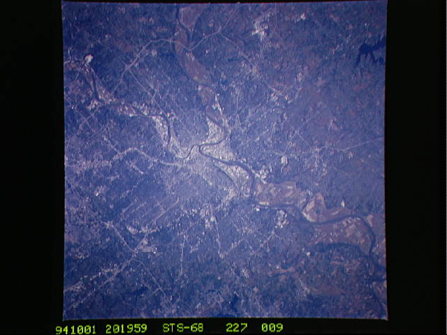
Image Caption: STS068-227-009 Missouri River and Kansas City, Missouri, U.S.A. October 1994
Featured in this northeast-looking, low-oblique photograph are metropolitan Kansas City, the second largest city in the state and a major industrial, commercial, and transportation center, and the Missouri River making a turn to the east where it is joined by the Kansas River. The floodplain has begun to recover from the devastating floods of the spring and early summer of 1993 as evidenced by agricultural field patterns. Both Kansas City, Missouri, and Kansas City, Kansas, located in a rich grain and livestock producing region, have numerous stockyards, packing houses, and food processing plants. The Smithville Reservoir and the runways of Kansas City International Airport are apparent north of the city.
Featured in this northeast-looking, low-oblique photograph are metropolitan Kansas City, the second largest city in the state and a major industrial, commercial, and transportation center, and the Missouri River making a turn to the east where it is joined by the Kansas River. The floodplain has begun to recover from the devastating floods of the spring and early summer of 1993 as evidenced by agricultural field patterns. Both Kansas City, Missouri, and Kansas City, Kansas, located in a rich grain and livestock producing region, have numerous stockyards, packing houses, and food processing plants. The Smithville Reservoir and the runways of Kansas City International Airport are apparent north of the city.
