STS068-227-1
| NASA Photo ID | STS068-227-1 |
| Focal Length | 250mm |
| Date taken | 1994.10.01 |
| Time taken | 20:11:29 GMT |
Resolutions offered for this image:
3904 x 3904 pixels 639 x 639 pixels 5700 x 5900 pixels 500 x 518 pixels 640 x 480 pixels
3904 x 3904 pixels 639 x 639 pixels 5700 x 5900 pixels 500 x 518 pixels 640 x 480 pixels


Cloud masks available for this image:
Spacecraft nadir point: 56.4° N, 138.1° W
Photo center point: 59.5° N, 140.5° W
Photo center point by machine learning:
Photo center point: 59.5° N, 140.5° W
Photo center point by machine learning:
Nadir to Photo Center: Northwest
Spacecraft Altitude: 117 nautical miles (217km)
Country or Geographic Name: | USA-ALASKA |
Features: | MALASPINA GLACIER, BANDS |
| Features Found Using Machine Learning: | |
Cloud Cover Percentage: | 20 (11-25)% |
Sun Elevation Angle: | 30° |
Sun Azimuth: | 165° |
Camera: | Hasselblad |
Focal Length: | 250mm |
Camera Tilt: | Low Oblique |
Format: | 5046: Kodak, natural color positive, Lumiere 100/5046, ASA 100, standard base |
Film Exposure: | Normal |
| Additional Information | |
| Width | Height | Annotated | Cropped | Purpose | Links |
|---|---|---|---|---|---|
| 3904 pixels | 3904 pixels | No | No | Earth From Space collection | Download Image |
| 639 pixels | 639 pixels | No | No | Earth From Space collection | Download Image |
| 5700 pixels | 5900 pixels | No | No | Download Image | |
| 500 pixels | 518 pixels | No | No | Download Image | |
| 640 pixels | 480 pixels | No | No | Download Image |
Download Packaged File
Download a Google Earth KML for this Image
View photo footprint information
Download a GeoTIFF for this photo
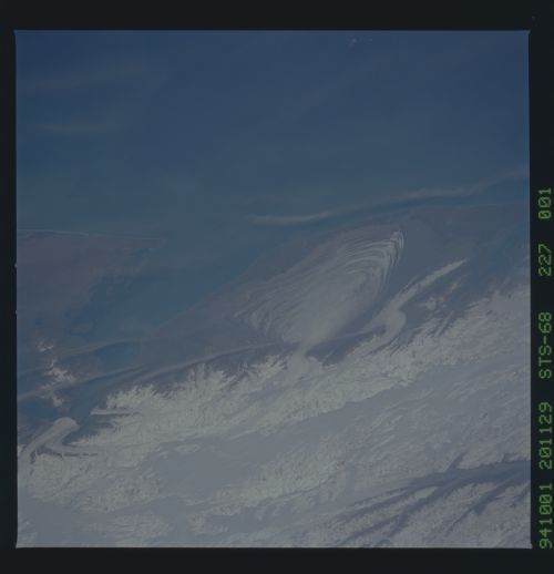
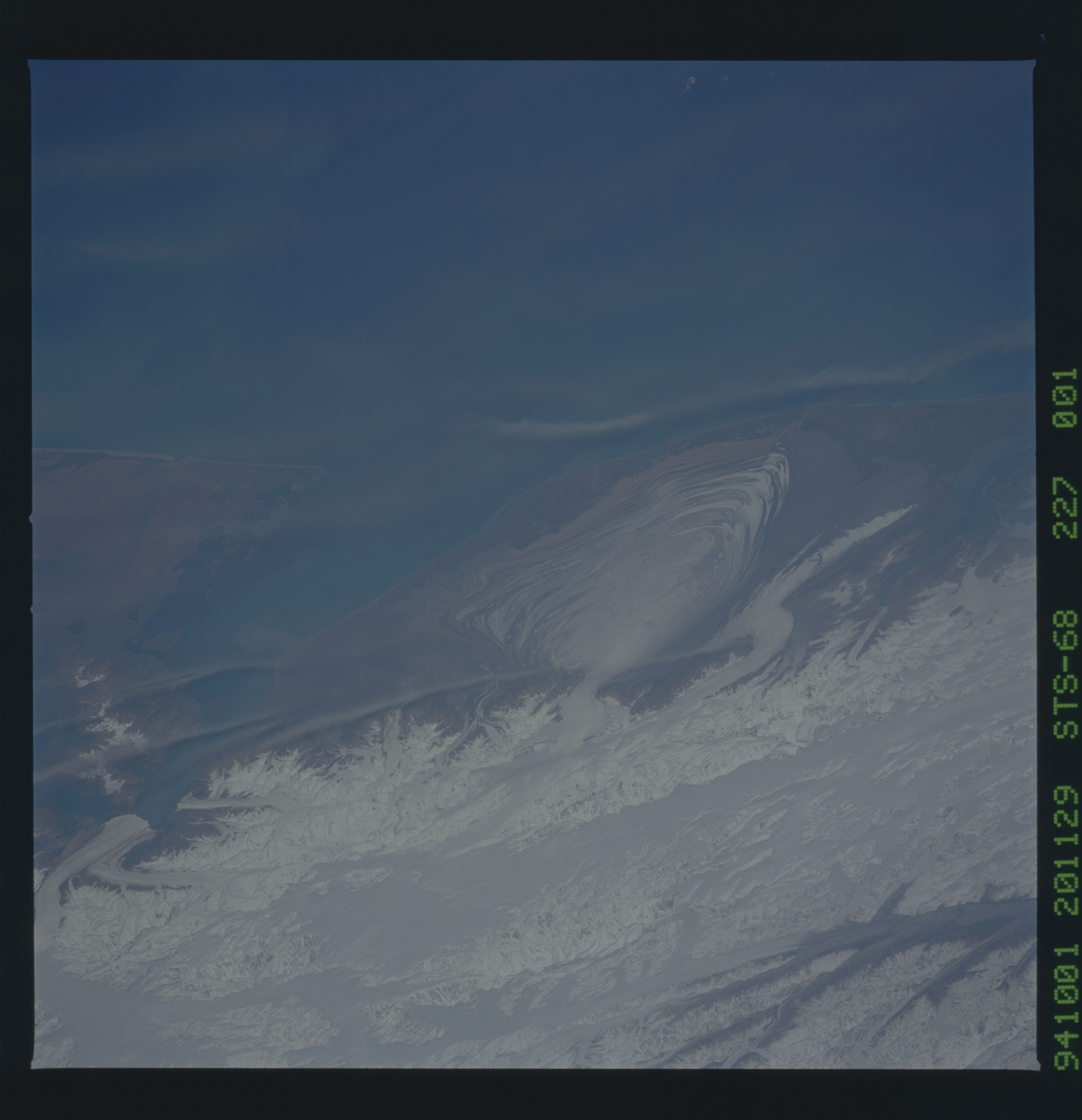
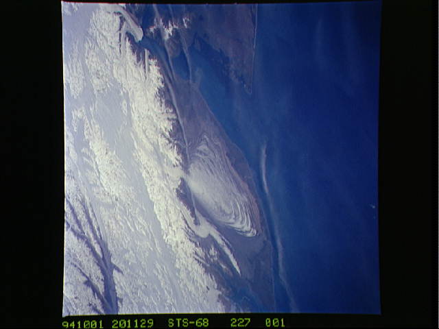
Image Caption: STS068-227-001 Malaspina Glacier, Alaska, U.S.A. October 1994
Several alpine glaciers and Malaspina Glacier, with its lobate, concentric banks of terminal, ground, and recessional moraines, are easily discernible in this photograph. Malaspina is a classic example of a piedmont glacier that forms when valley glaciers coalesce over relatively flat land at the base of a mountain range. Immediately west of Malaspina Glacier, Agassiz Glacier curves toward Icy Bay, and to the east Hubbard Glacier flows into the northern end of Yakutat Bay. In the upper-left corner of the photograph, Logan Glacier is visible flowing westward into the Chitina River Valley. The Saint Elias Mountains north of Malaspina Glacier contain Mount Saint Elias [elevation 18 008 feet (5489 meters) above sea level] and Mount Logan [19 550 feet (5959 meters) above sea level]. The large ice field between these two peaks is Seward Glacier, which is located in the Yukon Territory of Canada.
Several alpine glaciers and Malaspina Glacier, with its lobate, concentric banks of terminal, ground, and recessional moraines, are easily discernible in this photograph. Malaspina is a classic example of a piedmont glacier that forms when valley glaciers coalesce over relatively flat land at the base of a mountain range. Immediately west of Malaspina Glacier, Agassiz Glacier curves toward Icy Bay, and to the east Hubbard Glacier flows into the northern end of Yakutat Bay. In the upper-left corner of the photograph, Logan Glacier is visible flowing westward into the Chitina River Valley. The Saint Elias Mountains north of Malaspina Glacier contain Mount Saint Elias [elevation 18 008 feet (5489 meters) above sea level] and Mount Logan [19 550 feet (5959 meters) above sea level]. The large ice field between these two peaks is Seward Glacier, which is located in the Yukon Territory of Canada.
